


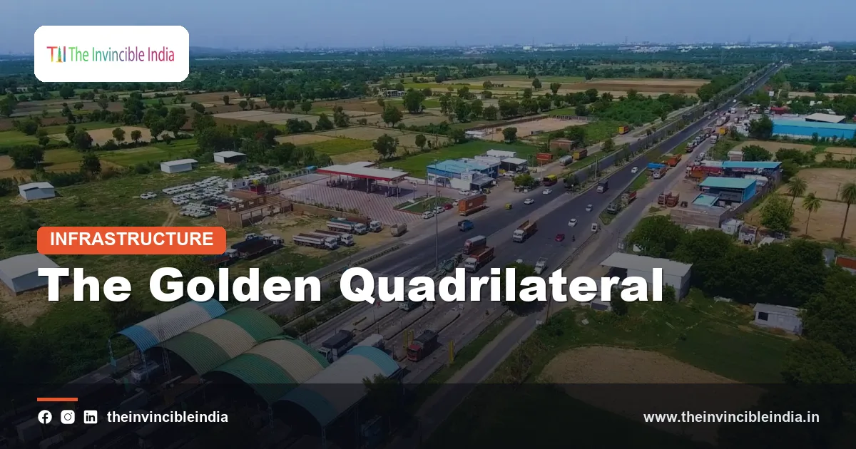
The Golden Quadrilateral is the ribbon of four- and six-lane highway that links India’s four largest metropolitan cities, Delhi, Mumbai, Chennai and Kolkata, into a giant four-sided loop of roughly 5,800 km. When it was planned at the turn of the century, it was described as the most ambitious road project the country had ever attempted, and in many ways it changed how Indians, and Indian goods, move across the map.
The Golden Quadrilateral was the first and largest component of the National Highways Development Project (NHDP), a programme conceived under Prime Minister Atal Bihari Vajpayee and launched in 2001. This explainer walks through how the project came about, who built and paid for it, how it connects with other national corridors, and how India’s highway story has since moved on to modern expressways, Bharatmala and digital tolling. Figures are given as approximate and dated because road lengths and traffic keep changing.
Quick Facts: The Golden Quadrilateral at a Glance
| Item | Details |
|---|---|
| Full name | Golden Quadrilateral (GQ), part of the National Highways Development Project |
| Cities linked | Delhi, Mumbai, Chennai and Kolkata |
| Approximate length | About 5,800 km of four- and six-lane highway |
| Launched | 2001, under Prime Minister Atal Bihari Vajpayee |
| Largely completed | Around 2012 (upgrading and widening continued afterwards) |
| Implementing agency | National Highways Authority of India (NHAI), set up in 1988 |
| Main funding | Fuel cess (Central Road Fund), government budget, and public-private partnerships such as BOT |
| Companion corridors | North-South Corridor (Srinagar to Kanyakumari) and East-West Corridor (Silchar to Porbandar) |
| Successor umbrella programme | Bharatmala Pariyojana, announced in 2017 |
What Is the Golden Quadrilateral?
Draw a rough square on a map of India with Delhi at the top, Kolkata to the east, Chennai in the south-east and Mumbai on the west coast. The Golden Quadrilateral traces the four sides of that shape. Each side is a long-distance national highway that was widened, strengthened and, in many stretches, made access-controlled so that fast-moving traffic is not slowed by cross-junctions, village lanes and roadside markets.
The name is a nod to the idea that the four metros are the economic hubs of the country. Together they anchor manufacturing, finance, ports, information technology and consumer markets. By putting a good highway between them, planners hoped to shorten travel times, cut vehicle operating costs and open up the towns that lay in between.
Not just four cities
Although the project is named after four metros, the highway passes through or near dozens of other important cities. Along the way you find places such as Jaipur, Ahmedabad, Vadodara, Pune, Bengaluru, Visakhapatnam, Bhubaneswar, Kanpur, Prayagraj, Varanasi, Asansol and Dhanbad, which made the corridor a backbone for regional trade rather than a metro-only link.
Origins and Route: Why India Needed a Highway Overhaul
By the 1990s, India’s main highways were often narrow, two-lane roads shared by trucks, buses, tractors, bullock carts and pedestrians. A truck travelling between the major cities could spend days in transit, with long delays at level crossings, town bottlenecks and state borders. As the economy opened up after the reforms of 1991, freight and passenger traffic grew much faster than the roads could handle.
The idea of a dedicated national programme to upgrade the trunk routes gained momentum in the late 1990s. The government approved the National Highways Development Project, with the Golden Quadrilateral as its centrepiece, and work on the ground picked up from 2001. The ambition was to treat highways as a single national system rather than a patchwork of stretches maintained differently by different agencies.
Key milestones
- 1988: The National Highways Authority of India (NHAI) is established by an Act of Parliament.
- Late 1990s: The National Highways Development Project is conceived and approved.
- 2001: Construction of the Golden Quadrilateral begins in earnest under the Vajpayee government.
- 2000s: Most of the GQ stretches are four-laned and opened to traffic in phases.
- Around 2012: The GQ is largely complete, with later work focusing on six-laning and upgrades.
The Four Legs of the Quadrilateral
The route is easiest to understand as four sides, each linking a pair of metros. The distances below are approximate, rounded values and can differ slightly depending on how a stretch is measured.
| Leg | Approximate length | Notable places along the way |
|---|---|---|
| Delhi to Kolkata | About 1,450 km | Agra region, Kanpur, Prayagraj, Varanasi, Dhanbad, Asansol |
| Kolkata to Chennai | About 1,650 km | Kharagpur, Bhubaneswar, Visakhapatnam, Vijayawada, Nellore |
| Chennai to Mumbai | About 1,300 km | Vellore, Bengaluru, Belagavi region, Kolhapur, Pune |
| Mumbai to Delhi | About 1,400 km | Vadodara, Ahmedabad, Udaipur region, Jaipur |
The numbering of the highways along these legs was changed in a national renumbering exercise around 2010, so older books may refer to routes such as NH 2, NH 4, NH 5 and NH 8 while newer maps show different numbers for the same roads. The alignment, rather than the number, is what defines the Golden Quadrilateral.
Who Built and Funded the Golden Quadrilateral
The agency responsible for the project is the National Highways Authority of India, usually called NHAI. It was created in 1988 under an Act of Parliament and functions under the Ministry of Road Transport and Highways. For its first years NHAI was small, but the Golden Quadrilateral turned it into the country’s largest highway developer.
NHAI’s role includes planning and surveys, acquiring land, awarding contracts to private builders, supervising quality and, once roads are complete, arranging tolling and maintenance. It works with state governments, forest and environment authorities, railways and utility agencies, all of which have to sign off on parts of any large road project.
How the work was carried out
- The corridor was split into hundreds of packages so that many contractors could work at the same time.
- Existing two-lane roads were widened to four lanes, with bypasses added around congested towns.
- Bridges, flyovers, underpasses and rail over-bridges were built to remove level crossings.
- Service roads and toll plazas were added along stretches where tolling was planned.
How the Golden Quadrilateral Was Funded
A project of this scale needed a reliable and large source of money. India’s answer combined a dedicated tax with private investment.
Fuel cess and the Central Road Fund
A key source of funds was a cess on petrol and diesel. The proceeds went into a dedicated road fund, so that money collected from road users was channelled back into road building. This gave the programme a steadier budget than annual allocations alone could offer.
Public-private partnerships and BOT
The government also invited private companies to participate through public-private partnership models. Under the Build-Operate-Transfer (BOT) approach, a private developer builds a highway, collects tolls for a fixed concession period and then hands the road back to the public authority. Variants included annuity models, in which the government pays the developer fixed instalments instead of the developer collecting tolls. In addition, multilateral lenders and the government’s own borrowing supported some parts.
The mix of models has evolved over time, and later programmes introduced other structures to share risk between the public and private sectors more evenly.
The NHDP and Its North-South and East-West Corridors
The Golden Quadrilateral was only the first phase of the wider National Highways Development Project. The NHDP was planned in phases, each with its own target of lane widening, new construction or specialised roads.
- Phase I and II: The Golden Quadrilateral together with the North-South and East-West Corridors.
- Phase III: Upgrading high-density national highway stretches, often through BOT projects.
- Phase IV: Widening other national highways to two lanes with paved shoulders.
- Phase V: Six-laning of the busiest sections, including large parts of the GQ.
- Phase VI: Development of expressways.
- Phase VII: Ring roads, bypasses, flyovers and similar bottleneck-removing works.
Phase details were revised several times as the programme changed shape, and eventually the successor programme, Bharatmala, took over the broader vision.
The North-South and East-West Corridors
Two long spines cross the country and intersect near Jhansi in Uttar Pradesh. Together they are often described as the “cross” that completes the picture begun by the Golden Quadrilateral.
| Corridor | Runs between | Approximate length | Purpose |
|---|---|---|---|
| North-South Corridor | Srinagar to Kanyakumari | About 4,000 km | Links the Himalayan north with the southern tip, passing through Delhi region, Agra, Jhansi, Nagpur, Hyderabad and Bengaluru |
| East-West Corridor | Silchar to Porbandar | About 3,300 km | Links Assam in the north-east with the Gujarat coast, passing through Gorakhpur, Jhansi and Kota |
Combined, the two corridors were planned at roughly 7,000 km or more. Their importance lies in connecting regions that the Golden Quadrilateral does not touch, including the north-east, Jammu and Kashmir, central India and the far south. Some sections of these corridors overlap with the GQ itself.
India’s Road Network: A Hierarchy
To see where the Golden Quadrilateral fits, it helps to understand how India classifies its roads. The country has one of the largest road networks in the world, running to several million kilometres, and it is organised into tiers by function and responsibility.
The main categories
- National Highways: The principal arteries that connect states, major cities and ports. They form a small share of total road length but carry a disproportionately large share of traffic. The Centre is responsible for them, mostly through NHAI and the Ministry of Road Transport and Highways.
- State Highways: Roads that link district headquarters and important towns within a state, plus connections to national highways. They are the responsibility of state public works departments.
- Major District Roads and Other District Roads: Roads that link production areas, markets and smaller towns within a district.
- Rural roads: Village roads that connect habitations to markets, schools and health services.
PMGSY and rural connectivity
Rural roads received a major push with the Pradhan Mantri Gram Sadak Yojana (PMGSY), launched in December 2000 to provide all-weather connectivity to unconnected villages. While the Golden Quadrilateral improved the main trunk routes, PMGSY worked at the other end of the hierarchy, helping farmers, students and workers reach the highway network in the first place.
From Highways to Expressways
A national highway is not necessarily an expressway. An expressway is a fully access-controlled road: entry and exit are only through designated interchanges, there are no level crossings or pedestrian crossings, and slow vehicles are usually kept off. The design allows higher speeds and considerably better safety per kilometre travelled.
Notable expressways
- Mumbai-Pune Expressway: Opened in the early 2000s, it is widely regarded as India’s first six-lane, concrete, access-controlled expressway. It cut travel time between the two cities dramatically.
- Yamuna Expressway: A roughly 165 km route between the Noida region and Agra, opened in 2012, reducing the journey between Delhi’s neighbourhood and Agra.
- Delhi-Mumbai Expressway: A very long greenfield corridor, of the order of 1,300 km or more, being opened in sections. It is designed to run through several states and to shorten the Delhi-Mumbai journey substantially.
- Other expressways: Several state and national expressways have come up in the past decade, including Agra-Lucknow, Purvanchal, Bundelkhand and Ganga corridors in Uttar Pradesh, among others.
Expressways do not replace the Golden Quadrilateral. Rather, they represent the next generation, building on the same logic of connecting large markets with fast, safe and predictable travel.
Bharatmala Pariyojana: The Successor Programme
In 2017 the Government of India announced Bharatmala Pariyojana as an umbrella road and highways programme. Where the NHDP was largely about widening and upgrading existing trunk routes, Bharatmala took a more corridor-based approach, aiming to fill gaps in the network and improve efficiency.
Themes of Bharatmala
- Economic corridors: Identifying major freight-carrying routes and upgrading them in a coordinated way.
- Inter-corridor and feeder routes: Connecting corridors with one another and with production centres.
- National corridor efficiency: Removing bottlenecks, adding bypasses and improving multi-lane capacity.
- Border and coastal roads: Strengthening connectivity to frontier areas and ports.
- Expressways and greenfield highways: Building new, access-controlled roads.
The programme was designed to be revised as projects were scoped, so specific length targets and costs have changed over time.
Economic Impact of the Golden Quadrilateral
Studies of highway upgrades in India and elsewhere generally find that better roads help economies in several ways, and the Golden Quadrilateral is widely credited with contributing to them.
- Faster freight movement: Trucks can cover longer distances in a day, improving delivery times and reducing the inventory that firms have to hold.
- Lower logistics costs: Improved roads reduce fuel use, breakdowns and wear on vehicles, helping cut the cost of moving goods.
- Port and industry links: The corridors connect major ports such as those near Mumbai, Chennai and Kolkata to industrial clusters in the interior.
- Growth along the corridor: Warehousing hubs, logistics parks, factories and small businesses have grown up along the route, and research suggests that towns close to the GQ saw more industrial activity than similar places farther away.
- Passenger mobility: Inter-city buses, taxis and private vehicles gained shorter, more reliable journeys.
Gati Shakti and the National Logistics Policy
Roads work best when they are linked with railways, ports, airports and warehouses. The PM Gati Shakti National Master Plan, launched in October 2021, is a digital platform meant to coordinate the planning of such infrastructure across ministries. The National Logistics Policy, announced in September 2022, sets out goals to reduce logistics costs and improve efficiency across modes. The highway network, with the Golden Quadrilateral at its core, is a key part of this larger picture.
Technology on the Highways: FASTag and Beyond
Toll collection used to mean queues at plazas, cash exchanges and slow-moving lanes. India’s answer has been electronic tolling through FASTag, which uses radio frequency identification (RFID). A small tag on a vehicle’s windscreen is linked to a prepaid or bank account, and the toll is deducted as the vehicle passes through the plaza, usually without stopping.
FASTag became mandatory for four-wheelers and larger vehicles in 2021, after a phased rollout that started earlier in the decade. It is intended to reduce waiting times, limit cash handling and give authorities better data on traffic flows.
Other tools in use
- Highway traffic management systems, cameras and emergency call boxes on selected stretches.
- Route and toll information through mobile applications run by the authorities.
- Ongoing experiments with satellite-based and barrier-free tolling, which are being discussed and piloted as the technology matures.
Challenges: Land, Safety and Maintenance
Building highways in a densely populated country is not simple, and the Golden Quadrilateral programme met its share of difficulties.
Land acquisition
Acquiring land for a corridor means dealing with thousands of owners, compensation questions and, sometimes, protracted legal disputes. Delays in handing over land are among the most common reasons why highway projects run late.
Road safety
India has a high number of road accidents relative to the size of its vehicle fleet, and highways are especially affected because of high speeds and mixed traffic. Measures such as better lane discipline, signage, crash barriers, speed enforcement, trauma-care facilities and awareness campaigns are needed to bring fatalities down. Reducing accidents has been a stated national goal for years, and the design of modern expressways places a strong emphasis on it.
Maintenance and capacity
Roads deteriorate with heavy trucks, monsoon rains and ageing, so regular maintenance and periodic strengthening are essential. As traffic has grown, several GQ stretches have needed further widening to six or more lanes to keep congestion in check. Environmental clearances, tree felling and wildlife crossings are additional considerations for new alignments.
Conclusion
The Golden Quadrilateral is more than a road; it is a statement about how India wants to connect its people and markets. From its launch in 2001 to its broad completion around 2012, it showed that a large, centrally coordinated programme could deliver modern highways at scale. The North-South and East-West Corridors extended the idea across the country, expressways and Bharatmala pushed it further, and FASTag and Gati Shakti added digital efficiency.
Challenges of land, safety and upkeep remain, but the highway network today looks very different from that of the 1990s. For travellers, truckers and businesses alike, the Golden Quadrilateral remains the foundation on which India’s modern road story was built.
Frequently Asked Questions
What is the Golden Quadrilateral in India?
The Golden Quadrilateral is a network of four- and six-lane highways of about 5,800 km that connects Delhi, Mumbai, Chennai and Kolkata. It was the first and largest phase of the National Highways Development Project and was launched in 2001.
Who built the Golden Quadrilateral?
It was built by the National Highways Authority of India (NHAI), which was established in 1988. The work was carried out through many contractors, with funding from a cess on fuel, government budgets and public-private partnership models such as Build-Operate-Transfer.
Which cities does the Golden Quadrilateral connect?
Its four corners are Delhi, Mumbai, Chennai and Kolkata. Along the way it passes through or near many other cities, such as Jaipur, Ahmedabad, Pune, Bengaluru, Visakhapatnam, Bhubaneswar, Varanasi and Kanpur.
What are the North-South and East-West Corridors?
They are two other major components of the NHDP. The North-South Corridor runs from Srinagar to Kanyakumari, and the East-West Corridor runs from Silchar to Porbandar; the two cross near Jhansi.
How is Bharatmala different from the NHDP?
The NHDP focused mostly on upgrading and widening major existing highways in phases. Bharatmala Pariyojana, announced in 2017, is a broader umbrella programme built around economic corridors, feeder routes, border and coastal roads and expressways.
What is FASTag and how does it help on highways?
FASTag is an electronic toll collection system that uses RFID tags on vehicle windscreens. Tolls are deducted automatically from a linked account, which reduces waiting time at toll plazas and cash handling.
{“@context”:”https://schema.org”,”@graph”:[{“@type”:”FAQPage”,”mainEntity”:[{“@type”:”Question”,”name”:”What is the Golden Quadrilateral in India?”,”acceptedAnswer”:{“@type”:”Answer”,”text”:”The Golden Quadrilateral is a network of four- and six-lane highways of about 5,800 km that connects Delhi, Mumbai, Chennai and Kolkata. It was the first and largest phase of the National Highways Development Project and was launched in 2001.”}},{“@type”:”Question”,”name”:”Who built the Golden Quadrilateral?”,”acceptedAnswer”:{“@type”:”Answer”,”text”:”It was built by the National Highways Authority of India (NHAI), which was established in 1988. The work was carried out through many contractors, with funding from a cess on fuel, government budgets and public-private partnership models such as Build-Operate-Transfer.”}},{“@type”:”Question”,”name”:”Which cities does the Golden Quadrilateral connect?”,”acceptedAnswer”:{“@type”:”Answer”,”text”:”Its four corners are Delhi, Mumbai, Chennai and Kolkata. Along the way it passes through or near many other cities, such as Jaipur, Ahmedabad, Pune, Bengaluru, Visakhapatnam, Bhubaneswar, Varanasi and Kanpur.”}},{“@type”:”Question”,”name”:”What are the North-South and East-West Corridors?”,”acceptedAnswer”:{“@type”:”Answer”,”text”:”They are two other major components of the NHDP. The North-South Corridor runs from Srinagar to Kanyakumari, and the East-West Corridor runs from Silchar to Porbandar; the two cross near Jhansi.”}},{“@type”:”Question”,”name”:”How is Bharatmala different from the NHDP?”,”acceptedAnswer”:{“@type”:”Answer”,”text”:”The NHDP focused mostly on upgrading and widening major existing highways in phases. Bharatmala Pariyojana, announced in 2017, is a broader umbrella programme built around economic corridors, feeder routes, border and coastal roads and expressways.”}},{“@type”:”Question”,”name”:”What is FASTag and how does it help on highways?”,”acceptedAnswer”:{“@type”:”Answer”,”text”:”FASTag is an electronic toll collection system that uses RFID tags on vehicle windscreens. Tolls are deducted automatically from a linked account, which reduces waiting time at toll plazas and cash handling.”}}]}]}