

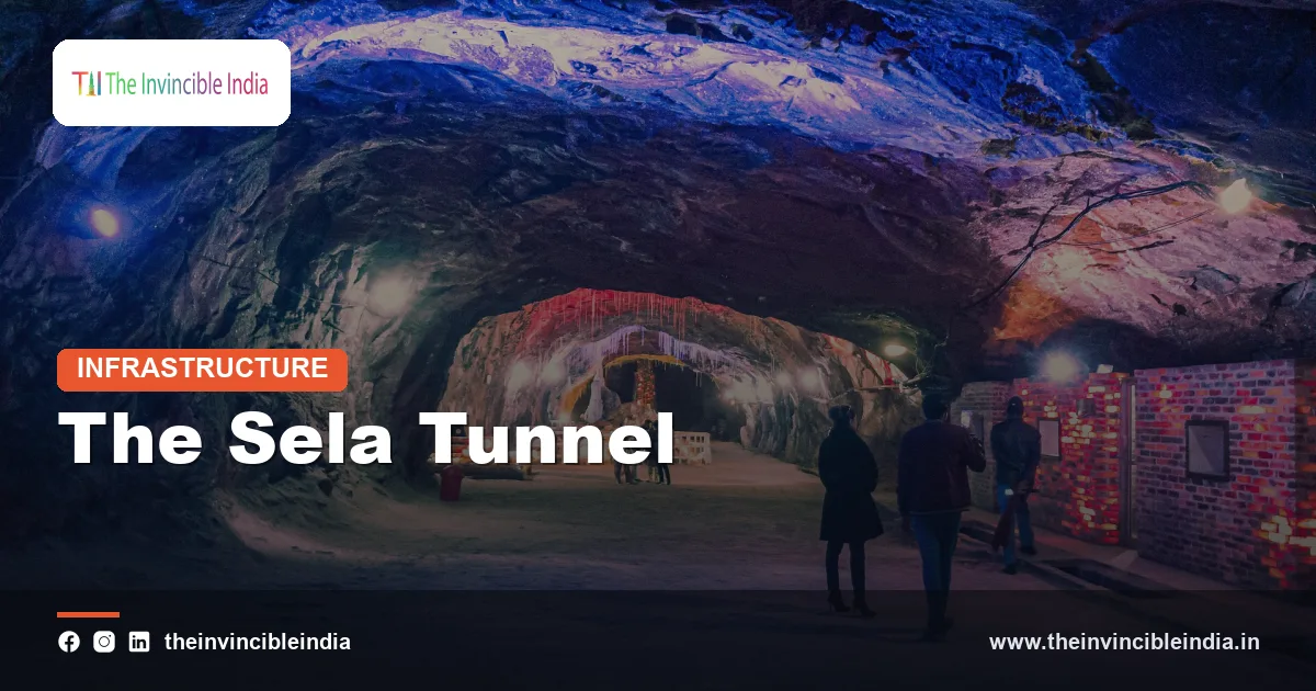
The Sela Tunnel is a strategic twin-tube road tunnel in West Kameng district of Arunachal Pradesh, opened in March 2024, that gives all-weather road access to Tawang near the India-China border and is described as one of the world’s longest twin-lane tunnels at an altitude above 13,000 feet. It was built by the Border Roads Organisation (BRO) under the Ministry of Defence on the Balipara-Chariduar-Tawang road, bypassing the snow-prone Sela Pass.
The Sela Tunnel project is really a pair of tunnels linked by an approach road, excavated mainly using the New Austrian Tunnelling Method (NATM) in difficult Himalayan rock. This explainer covers where the tunnel is, why it was built, how it was constructed, what it contains and why it matters for both the military and civilians in Tawang. Details were last reviewed on 15 October 2026; engineering figures are quoted in rounded terms.
Quick Facts
| Attribute | Detail |
|---|---|
| Official name | Sela Tunnel (the Sela Tunnel project) |
| Location | Sela Pass area, West Kameng district, Arunachal Pradesh, on the road to Tawang |
| Road | Balipara-Chariduar-Tawang (BCT) Road, part of National Highway 13 |
| Built by | Border Roads Organisation (BRO), Ministry of Defence |
| Structure | Two tunnels (a single-tube tunnel and a twin-tube tunnel) joined by an approach road |
| Altitude | Above 13,000 feet, near the Sela Pass at about 13,700 feet |
| Construction method | New Austrian Tunnelling Method (NATM) |
| Foundation and opening | Foundation stone in 2019; inaugurated by the Prime Minister in March 2024 |
| Main purpose | All-weather road access to Tawang and the forward areas near the Line of Actual Control (LAC) |
Key Takeaways
- The Sela Tunnel is a twin-tube road tunnel system in West Kameng district, Arunachal Pradesh, built to give year-round road access to Tawang near the China border.
- The Border Roads Organisation (BRO) built the Sela Tunnel for the Ministry of Defence, and the project was opened in March 2024.
- The Sela Tunnel is billed as among the world’s longest bi-lane (two-lane) tunnels at an altitude above 13,000 feet.
- The project has two tunnels, one a single tube and the other a twin tube with a parallel escape tube, joined by an approach road.
- The New Austrian Tunnelling Method (NATM) was used to excavate the tunnels through weak, fractured Himalayan rock.
- The Sela Tunnel avoids the Sela Pass, which is blocked by snow and landslides in winter, and shortens travel on the road to Tawang.
What is the Sela Tunnel?
The Sela Tunnel is a road tunnel project in Arunachal Pradesh that lets vehicles travel under the high mountain barrier at the Sela Pass instead of climbing over it. It consists of two tunnels connected by an approach road, together with link roads, and the whole project is often described as around 12 kilometres long including approaches.
The tunnels are located on the Balipara-Chariduar-Tawang (BCT) Road, the main route from the Assam plains to Tawang. Because the Sela Pass lies at an altitude of roughly 13,700 feet and receives heavy snowfall, the road over the pass used to be closed or hazardous for long stretches in winter.
The name comes from the Sela Pass, a historic mountain pass linking Dirang with Tawang. The tunnel carries traffic beneath the pass at a slightly lower altitude, though still above 13,000 feet.
Where is the Sela Tunnel located?
The Sela Tunnel is located near the Sela Pass in West Kameng district, in the western part of Arunachal Pradesh, between the towns of Dirang and Tawang. It sits in the Eastern Himalaya, close to the borders with Bhutan and with the Tibet Autonomous Region of China.
Tawang is the district headquarters of Tawang district and is known for the Tawang Monastery, one of the largest Buddhist monasteries in India. The town lies close to the Line of Actual Control (LAC), the de facto boundary between India and China, so reliable road access is of strategic value.
Before the tunnel, the route climbed over the Sela Pass through steep curves and areas prone to avalanches, landslides and white-out conditions. The new tunnels bypass the highest part of that climb.
Why was the Sela Tunnel built?
The Sela Tunnel was built to provide all-weather connectivity to Tawang and to the forward areas of the Indian Army and other forces, and to improve everyday life for civilians in the region. The Sela Pass road was exposed to heavy snow, avalanches and landslides, which meant that traffic could be cut off during winter and monsoon months.
The main reasons were:
- Defence logistics: troops, vehicles and supplies must reach the border region quickly in all seasons.
- Civilian access: residents of Tawang and nearby villages need dependable access to markets, hospitals and schools.
- Tourism: Tawang is a major pilgrim and tourist destination, and year-round road access supports local livelihoods.
- Safety: the tunnel reduces the dangers of crossing the high pass in bad weather.
- Strategic infrastructure: India has expanded border roads, tunnels and bridges across the Himalaya in recent decades to improve the Army’s mobility.
The tunnel is also associated with the memory of the 1962 India-China conflict, when the Tawang and Sela areas saw heavy fighting, and the wider effort to strengthen infrastructure in the border region.
Who built the Sela Tunnel?
The Sela Tunnel was built by the Border Roads Organisation (BRO), a body under the Ministry of Defence that constructs and maintains roads, bridges and tunnels in border areas. The project was executed under the BRO’s Project Vartak, which operates in Arunachal Pradesh.
The BRO was established in 1960 and has built some of the world’s highest motorable roads and several important tunnels in Jammu and Kashmir, Himachal Pradesh, Uttarakhand, Sikkim and the North East. Private contractors usually carry out detailed tunnel excavation under BRO supervision, and the Sela Tunnel was built with the participation of an experienced tunnelling contractor.
The foundation stone was laid in 2019, work progressed despite weather, remote terrain and the COVID-19 pandemic, and the tunnel was inaugurated in March 2024. The cost was in the region of several hundred crore rupees for the main tunnel works.
How is the Sela Tunnel designed?
The Sela Tunnel is designed as two tunnels with an approach road between them: Tunnel 1, a single-tube tunnel of under a kilometre, and Tunnel 2, a twin-tube tunnel of roughly one and a half kilometres. The twin-tube design in Tunnel 2 gives one tube for traffic and a parallel tube for emergency escape and maintenance.
The table below summarises the main elements in rounded terms.
| Component | Description |
|---|---|
| Tunnel 1 | Single-tube, bi-lane tunnel of a little under one kilometre |
| Tunnel 2 | Twin-tube tunnel of roughly one and a half kilometres, with a main traffic tube and a parallel escape tube |
| Approach road | Roughly one kilometre or more connecting the two tunnels |
| Link roads | New alignments on both sides, bringing the project to roughly 12 kilometres in total |
| Ventilation | Mechanical ventilation systems that remove vehicle fumes and supply fresh air |
| Safety systems | Fire-fighting, lighting, communication, monitoring and emergency cross-passages |
The tunnel is designed for speeds suitable for military vehicles and civilian traffic, and it can carry heavy vehicles such as military trucks and artillery tractors.
What is the New Austrian Tunnelling Method used at Sela?
The New Austrian Tunnelling Method (NATM) is a tunnel construction technique in which the surrounding rock is treated as part of the support structure, and it is the method used to build the Sela Tunnel. NATM uses sequential excavation, immediate application of sprayed concrete (shotcrete), rock bolts and steel ribs, and careful monitoring of how the rock moves.
The method suits the geology of the Eastern Himalaya, where rock is often weak, fractured and variable. Tunnelling crews excavate a short section, install support at once, and measure deformation to adjust the support design as needed. This flexibility helps in unpredictable ground.
The key steps in NATM include:
- Excavating in small stages by drilling and blasting or mechanical means.
- Spraying shotcrete on the freshly exposed rock to form an initial lining.
- Installing rock bolts and steel supports to stabilise the rock mass.
- Monitoring convergence and deformation with instruments.
- Building a final concrete lining and waterproofing after the initial support has stabilised.
NATM differs from tunnel boring machine (TBM) methods, which are less suited to remote, high-altitude sites where moving large machinery is hard.
What construction challenges did the Sela Tunnel face?
The Sela Tunnel faced challenges from extreme altitude, harsh weather, difficult geology and a remote location. The high altitude means thin air and low temperatures, which reduce worker efficiency and affect machines and concrete curing.
Major difficulties included:
- Weather: heavy snowfall and a short working season at the site.
- Geology: fractured rock, water seepage and shear zones that required stronger support.
- Logistics: bringing equipment, cement and fuel up narrow mountain roads.
- Health and safety: altitude sickness and cold exposure for workers.
- Delays: disruptions from the pandemic and from the narrow working window each year.
Engineers handled these problems with careful planning, winterised equipment, on-site material production and continuous monitoring of the rock.
Why is the Sela Tunnel strategically important?
The Sela Tunnel is strategically important because it keeps the road to Tawang open in all seasons, which improves the Indian Army’s ability to move troops and supplies near the Line of Actual Control. Tawang district borders both Bhutan and Tibet, and it has been a sensitive area since the 1962 conflict.
The tunnel reduces travel time over the route, with estimates of roughly an hour saved, and it provides a safer way to cross the high pass. For the military, the benefit is not only speed but reliability, since closures due to snow can leave forward posts hard to supply.
The tunnel is part of a larger national push to improve border infrastructure. Other examples include the Atal Tunnel in Himachal Pradesh and roads in Ladakh and Sikkim, and the Sela project is an important case in India’s North East.
What does the Sela Tunnel mean for civilians and tourism?
The Sela Tunnel means safer, more reliable travel for civilians, including residents, pilgrims, traders and tourists heading to Tawang and nearby villages. Year-round access supports healthcare, education, trade and the movement of goods.
Tawang attracts visitors for the Tawang Monastery, high-altitude lakes, scenic passes and Monpa culture. A road that does not close in winter can extend the tourist season and support homestays, guides, drivers and small businesses.
Development brings concerns as well. Rising traffic can put pressure on the fragile Himalayan environment, so waste management, sustainable tourism and careful road maintenance are important.
How does the Sela Tunnel compare with other Indian tunnels?
The Sela Tunnel is one of several major high-altitude road tunnels built in India, and it stands out for its altitude and its location on a sensitive border route in the North East. Each of the major tunnels serves a different Himalayan route and faces its own geological and weather conditions.
- Atal Tunnel (Rohtang), Himachal Pradesh: a long highway tunnel under the Rohtang Pass that keeps the Manali-Lahaul-Spiti route open in winter, and one of the longest highway tunnels in India.
- Jawahar Tunnel, Jammu and Kashmir: an older road tunnel under the Pir Panjal range on the Jammu-Srinagar highway.
- Chenani-Nashri Tunnel, Jammu and Kashmir: a long modern highway tunnel on the same national highway, with an integrated escape tube.
- Sela Tunnel, Arunachal Pradesh: notable for its altitude above 13,000 feet and its role in reaching Tawang near the LAC.
The common aim of these projects is to make mountain routes usable throughout the year. In each case, tunnels replace exposed pass roads that are vulnerable to snow, avalanches and landslides, and they shorten travel times for both military and civilian users.
Bottom Line
The Sela Tunnel in Arunachal Pradesh is a Border Roads Organisation project of twin tunnels and approach roads that provides all-weather access to Tawang beneath the snow-prone Sela Pass. Built using the New Austrian Tunnelling Method at over 13,000 feet, it serves both strategic and civilian needs and stands as a notable example of high-altitude engineering in India.
Frequently Asked Questions
What is the Sela Tunnel?
The Sela Tunnel is a twin-tube road tunnel project in West Kameng district, Arunachal Pradesh, built by the Border Roads Organisation. It lets vehicles bypass the snow-prone Sela Pass on the road to Tawang. It was inaugurated in March 2024.
Where is the Sela Tunnel located?
The Sela Tunnel is located near the Sela Pass in West Kameng district of Arunachal Pradesh, between Dirang and Tawang. It is on the Balipara-Chariduar-Tawang road. The area lies close to the borders with Bhutan and Tibet.
How high is the Sela Tunnel?
The Sela Tunnel is located above 13,000 feet, slightly below the Sela Pass, which is at roughly 13,700 feet. This altitude is why the project is described as one of the highest tunnels of its kind. The cold and thin air made construction challenging.
Who built the Sela Tunnel?
The Sela Tunnel was built by the Border Roads Organisation (BRO) under the Ministry of Defence. The work was done under Project Vartak with the help of an experienced tunnelling contractor. The foundation stone was laid in 2019 and the tunnel opened in March 2024.
Which method was used to build the Sela Tunnel?
The New Austrian Tunnelling Method (NATM) was used to build the Sela Tunnel. NATM uses staged excavation, sprayed concrete, rock bolts and continuous monitoring of the rock. It suits the weak and fractured rock of the Himalaya.
Why is the Sela Tunnel important?
The Sela Tunnel is important because it gives all-weather access to Tawang, which is near the Line of Actual Control with China. It helps the armed forces move troops and supplies throughout the year. It also benefits civilians, pilgrims and tourists by making travel safer and more reliable.
{“@context”:”https://schema.org”,”@graph”:[{“@type”:”FAQPage”,”mainEntity”:[{“@type”:”Question”,”name”:”What is the Sela Tunnel?”,”acceptedAnswer”:{“@type”:”Answer”,”text”:”The Sela Tunnel is a twin-tube road tunnel project in West Kameng district, Arunachal Pradesh, built by the Border Roads Organisation. It lets vehicles bypass the snow-prone Sela Pass on the road to Tawang. It was inaugurated in March 2024.”}},{“@type”:”Question”,”name”:”Where is the Sela Tunnel located?”,”acceptedAnswer”:{“@type”:”Answer”,”text”:”The Sela Tunnel is located near the Sela Pass in West Kameng district of Arunachal Pradesh, between Dirang and Tawang. It is on the Balipara-Chariduar-Tawang road. The area lies close to the borders with Bhutan and Tibet.”}},{“@type”:”Question”,”name”:”How high is the Sela Tunnel?”,”acceptedAnswer”:{“@type”:”Answer”,”text”:”The Sela Tunnel is located above 13,000 feet, slightly below the Sela Pass, which is at roughly 13,700 feet. This altitude is why the project is described as one of the highest tunnels of its kind. The cold and thin air made construction challenging.”}},{“@type”:”Question”,”name”:”Who built the Sela Tunnel?”,”acceptedAnswer”:{“@type”:”Answer”,”text”:”The Sela Tunnel was built by the Border Roads Organisation (BRO) under the Ministry of Defence. The work was done under Project Vartak with the help of an experienced tunnelling contractor. The foundation stone was laid in 2019 and the tunnel opened in March 2024.”}},{“@type”:”Question”,”name”:”Which method was used to build the Sela Tunnel?”,”acceptedAnswer”:{“@type”:”Answer”,”text”:”The New Austrian Tunnelling Method (NATM) was used to build the Sela Tunnel. NATM uses staged excavation, sprayed concrete, rock bolts and continuous monitoring of the rock. It suits the weak and fractured rock of the Himalaya.”}},{“@type”:”Question”,”name”:”Why is the Sela Tunnel important?”,”acceptedAnswer”:{“@type”:”Answer”,”text”:”The Sela Tunnel is important because it gives all-weather access to Tawang, which is near the Line of Actual Control with China. It helps the armed forces move troops and supplies throughout the year. It also benefits civilians, pilgrims and tourists by making travel safer and more reliable.”}}]}]}


