

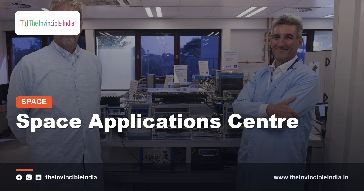
The Space Applications Centre (SAC) is the Indian Space Research Organisation (ISRO) centre at Ahmedabad, Gujarat, that designs and builds the communication, navigation, earth-observation and meteorological payloads flown on Indian satellites and develops practical applications of space data for society. SAC is the place where an ISRO satellite’s mission instruments, such as transponders, cameras, radars and sensors, are conceived, fabricated and tested, while other ISRO centres build the satellite bus and the launch vehicles.
The Space Applications Centre grew out of the vision of Dr Vikram Sarabhai, who wanted space technology to serve development needs such as education, weather forecasting and resource management. This explainer covers its origins, laboratories, payload work, applications and its role across ISRO missions, including planetary instruments.
| Attribute | Detail |
|---|---|
| Name | Space Applications Centre (SAC) |
| Parent organisation | Indian Space Research Organisation (ISRO), under the Department of Space |
| Headquarters | Ahmedabad, Gujarat |
| Formed | 1972, from earlier Ahmedabad-based space units |
| Founding inspiration | Dr Vikram Sarabhai, the founder of the Indian space programme |
| Core mandate | Payloads for communication, navigation, earth observation and meteorology, plus space applications |
| Well-known experiments | Satellite Instructional Television Experiment (SITE), INSAT meteorology, remote sensing applications |
| Associated data centre | MOSDAC, the Meteorological and Oceanographic Satellite Data Archival Centre |
Key Takeaways
- The Space Applications Centre (SAC) is an ISRO centre in Ahmedabad that develops satellite payloads and the applications of space data.
- SAC was formed in 1972 at Ahmedabad and carries forward the development-oriented vision of Dr Vikram Sarabhai.
- The Space Applications Centre designs communication transponders, earth-observation cameras, microwave radars, navigation payloads and meteorological instruments.
- SAC played a central role in India’s pioneering Satellite Instructional Television Experiment (SITE) of the mid-1970s.
- The Space Applications Centre hosts the data and application systems that support weather forecasting, disaster management, resource mapping and tele-education.
- SAC has contributed scientific instruments to planetary and lunar missions such as Chandrayaan and the Mars Orbiter Mission.
What is the Space Applications Centre (SAC)?
The Space Applications Centre is a research and development centre of ISRO in Ahmedabad whose job is to turn space technology into usable services and instruments. While other ISRO centres focus on rockets, satellite buses and launch operations, SAC concentrates on the payloads, which are the parts of a satellite that actually do the work.
A payload can be a communication transponder that relays television and data, a camera that photographs the Earth, a radar that images through clouds, a sounder that measures atmospheric temperature, or a clock and signal generator for satellite navigation. SAC designs these systems, builds and tests them in its laboratories and then hands them over for integration with a satellite.
The centre also works on the other end of the chain, namely what to do with the data. Teams develop algorithms, products and services that turn raw satellite signals into maps, forecasts and decision support for ministries, state governments and the public.
How did the Space Applications Centre begin?
The Space Applications Centre began as a set of space-related units in Ahmedabad founded under the leadership of Vikram Sarabhai, and it was formally constituted as SAC in 1972. Sarabhai had earlier established the Physical Research Laboratory (PRL) in Ahmedabad and led the Indian National Committee for Space Research (INCOSPAR), the forerunner of ISRO, set up in 1962.
The early Ahmedabad programmes included an experimental satellite communication earth station and various facilities for rocket, atmospheric and space applications research. These groups were brought together in the early 1970s, giving rise to a centre whose purpose was to put space data and communication to work for development.
The philosophy that Sarabhai articulated was that a developing country need not compete with advanced nations in exploration for its own sake, but should apply space tools to national problems. SAC is the most direct institutional expression of that idea.
What does the Space Applications Centre do?
The Space Applications Centre designs, develops, tests and delivers satellite payloads and builds applications for communication, navigation, earth observation and meteorology. Its work spans the full cycle from scientific concept and electronics design to environmental testing and data utilisation.
The main areas of activity are:
- Satellite communication payloads: Transponders and antennas for the INSAT and GSAT families that carry television, telephony, VSAT, radio and data services.
- Earth-observation payloads: Optical and microwave sensors for the Indian Remote Sensing (IRS) series and other missions.
- Meteorological payloads: Imagers and sounders for weather and climate observation from geostationary and polar orbits.
- Navigation payloads: Systems for the Indian Regional Navigation Satellite System (IRNSS), known as NavIC, including precise timing hardware.
- Applications development: Techniques for agriculture, forestry, water, oceans, urban planning and disaster management.
- Technology development: Microwave components, antenna systems, electronics and sensor technology.
Which facilities and laboratories does SAC operate?
The Space Applications Centre operates specialised laboratories for microwave and optical payload development, antenna testing, environmental simulation and data processing, together with satellite earth stations. These facilities allow SAC to build and verify complex instruments before they fly.
Laboratories and test facilities
- Antenna and microwave labs: Facilities such as compact antenna test ranges measure how antennas radiate before they are fitted to a satellite.
- Optical and sensor labs: Clean areas where cameras, spectrometers and detectors are assembled and calibrated.
- Environmental test facilities: Thermal vacuum chambers, vibration tables and electromagnetic compatibility chambers simulate launch and orbital conditions.
- Electronics and component labs: Spaces for hybrid microcircuits, microwave components and space-qualified electronics.
Earth stations and data systems
SAC is linked with satellite earth stations used for experiments and operations, including the Delhi Earth Station associated with the centre’s communication work. It also runs data centres and web-based archives, most notably MOSDAC, which distributes meteorological and oceanographic data from Indian satellites.
What payloads has SAC developed?
The Space Applications Centre has developed payloads for a wide range of Indian missions, covering communication, earth observation, oceanography, weather and navigation. The table below lists representative examples, and it is not an exhaustive catalogue.
| Domain | Representative SAC contribution |
|---|---|
| Communication | Transponders and antennas for the INSAT and GSAT satellite series, including EDUSAT for education |
| Meteorology | Very High Resolution Radiometer and CCD cameras on INSAT, and imagers and sounders on later weather satellites |
| Optical earth observation | Cameras such as LISS, AWiFS and the panchromatic cameras on the Cartosat series, in collaboration with other ISRO teams |
| Microwave remote sensing | Radar imaging payloads on the RISAT satellites and scatterometers such as that on SCATSAT-1 |
| Ocean observation | Ocean colour monitors and scatterometers for the Oceansat series and related ocean-observing missions |
| Navigation | Payload elements and atomic clock work for the NavIC satellites |
| Planetary science | Instruments on Chandrayaan lunar orbiters and the Mars Orbiter Mission |
Many of these payloads are the product of long development programmes in which SAC engineers work with other ISRO centres, national laboratories, universities and industry partners.
How does SAC support weather forecasting through INSAT?
The Space Applications Centre supports weather forecasting by building the meteorological instruments on the INSAT series and by developing the products that forecasters use. INSAT, short for Indian National Satellite System, is a multipurpose geostationary system that combines communication and weather observation.
From a fixed position over the equator, an INSAT meteorological payload can scan the Indian region repeatedly during the day. It records cloud patterns, water vapour, sea-surface temperature and other variables, which help the India Meteorological Department (IMD) track monsoon systems, cyclones and western disturbances.
SAC also develops retrieval algorithms for rainfall estimation, fog and cloud-top information, wind vectors from moving clouds, and sounding profiles of temperature and humidity. Data are archived and shared through MOSDAC for operational and research users. For coastal states, early cyclone tracking from geostationary satellites has been valuable for evacuation planning.
What was SITE and how did SAC contribute to tele-education?
The Satellite Instructional Television Experiment (SITE) was a large-scale experiment in 1975-76 that used a satellite to broadcast educational television directly to community sets in thousands of Indian villages, and the Space Applications Centre played a leading role in organising it. SITE used the ATS-6 satellite, lent by the United States, and it demonstrated that satellite broadcasting could reach remote areas.
SITE covered programmes on health, hygiene, agriculture and family planning, along with school-level content. It also trained Indian engineers and broadcasters in the operation of a satellite-based system, which prepared the ground for the later INSAT era.
The lessons from SITE inspired later initiatives, including educational channels, the dedicated EDUSAT satellite for tele-education and distance learning in the 2000s, and village resource centres that combined satellite connectivity with local services. Tele-medicine links, in which remote clinics connect to specialist hospitals through satellite networks, also draw on the same communication payload expertise.
How does SAC help with disaster management and resource mapping?
The Space Applications Centre helps disaster management and resource mapping by turning satellite imagery and radar data into maps of floods, cyclones, droughts, forest fires and land use. Microwave radars are especially useful in flood mapping because they can see through cloud cover during the monsoon.
Typical application areas include:
- Flood and cyclone monitoring: Mapping inundated areas and tracking storm systems to assist relief agencies.
- Agriculture: Estimating crop area and condition, and assessing drought stress.
- Water resources: Mapping snow cover, glaciers, lakes and reservoirs.
- Forestry and ecology: Monitoring forest cover, mangroves and wetlands.
- Urban and land use planning: Producing land-cover maps and tracking urban expansion.
- Oceans and fisheries: Estimating chlorophyll and temperature patterns to identify potential fishing zones.
These applications are often delivered in partnership with other ISRO units, such as the National Remote Sensing Centre in Hyderabad, and with central and state government departments.
What role does SAC play in navigation?
The Space Applications Centre contributes to Indian satellite navigation by developing key payload elements for NavIC, India’s regional navigation system, and by working on timing technology. Accurate time is the heart of satellite navigation, because a receiver calculates its position by comparing signals from several satellites, and a tiny timing error translates into a large position error.
NavIC provides positioning and timing services over India and a surrounding region. SAC engineers have worked on the navigation signal generation and on the onboard atomic clock technology that keeps each satellite’s time precise. Indigenous capability in this area reduces dependence on foreign systems for strategic uses.
How has SAC contributed to planetary and space science missions?
The Space Applications Centre has contributed scientific instruments to Indian planetary missions, applying its remote-sensing expertise to the Moon and Mars. The techniques that look at Earth from orbit work equally well on other bodies, with different calibration and design constraints.
- Chandrayaan-1 (2008): SAC supplied cameras and a mini synthetic aperture radar used in lunar mapping and in the search for polar ice, along with other spectrometers.
- Mars Orbiter Mission (2013): SAC built instruments such as the Mars Colour Camera and the Methane Sensor for Mars, as well as a thermal infrared imaging spectrometer.
- Chandrayaan-2 (2019): SAC contributed instruments such as the dual-frequency synthetic aperture radar and other imaging payloads on the orbiter.
- NISAR collaboration: SAC developed the S-band synthetic aperture radar for the NASA-ISRO Synthetic Aperture Radar mission that images Earth’s changing surface.
These involvements show how SAC’s role extends from Earth applications to space science, with a common foundation in imaging, radar and spectroscopy.
How does SAC work with other ISRO centres?
The Space Applications Centre works with other ISRO centres through a division of labour in which each centre handles a part of the space mission chain. SAC provides the payloads and applications, while the U R Rao Satellite Centre (URSC) in Bengaluru builds many satellite platforms and the Vikram Sarabhai Space Centre (VSSC) in Thiruvananthapuram develops launch vehicles.
| ISRO centre | Primary focus |
|---|---|
| Space Applications Centre (SAC), Ahmedabad | Payloads, applications, communication and remote-sensing technology |
| U R Rao Satellite Centre (URSC), Bengaluru | Satellite design, build and integration |
| Vikram Sarabhai Space Centre (VSSC), Thiruvananthapuram | Launch vehicle development |
| Satish Dhawan Space Centre (SDSC SHAR), Sriharikota | Launch operations and range facilities |
| National Remote Sensing Centre (NRSC), Hyderabad | Remote sensing data acquisition, processing and distribution |
| ISRO Telemetry, Tracking and Command Network (ISTRAC), Bengaluru | Satellite tracking and control |
This arrangement lets each centre specialise while the overall system benefits from shared standards and testing.
Why does the Space Applications Centre matter for India?
The Space Applications Centre matters because it connects India’s space capability to everyday public benefits, such as weather warnings, television reach, education, disaster response and resource planning. A launch or a satellite is only valuable if the payload does a useful job, and SAC is where that usefulness is designed.
Its work also supports technological self-reliance. By building transponders, sensors, radars and clocks in-house, India reduces its dependence on imported components and gains export-quality expertise. Over the decades the centre has trained generations of engineers and scientists in microwave engineering, optics, electronics and data science.
In the coming years, SAC is expected to continue work on higher-resolution imaging, advanced communication satellites, hyperspectral sensing, and applications that use artificial intelligence on satellite data. Many of these themes appear in ISRO’s public statements, though specific project schedules change.
Bottom Line
The Space Applications Centre in Ahmedabad is the part of ISRO that builds the payloads and applications that make Indian satellites useful. From the SITE experiment to weather satellites, radar missions and planetary instruments, SAC has linked space technology to development. It remains central to India’s communication, navigation and earth-observation capabilities.
Frequently Asked Questions
What is the Space Applications Centre?
The Space Applications Centre (SAC) is an ISRO centre in Ahmedabad that designs and builds satellite payloads for communication, navigation, earth observation and meteorology. It also develops applications that use space data for weather, education, disaster management and resource mapping.
Where is SAC located?
SAC is located in Ahmedabad, Gujarat. The city was the base of Dr Vikram Sarabhai, who founded the Physical Research Laboratory there and led the early Indian space programme.
Who founded the Space Applications Centre?
The Space Applications Centre grew from the vision of Dr Vikram Sarabhai, the father of the Indian space programme. It was formally constituted as SAC in 1972 by bringing together earlier space-related units in Ahmedabad.
What is the difference between SAC and NRSC?
SAC develops satellite payloads and applications, while the National Remote Sensing Centre (NRSC) in Hyderabad acquires, processes and distributes remote-sensing data. The two centres cooperate closely, because SAC designs many of the sensors whose data NRSC delivers to users.
What is MOSDAC?
MOSDAC is the Meteorological and Oceanographic Satellite Data Archival Centre, which is run by SAC. It archives and distributes weather and ocean data from Indian satellites for forecasting, research and operational use.
Did SAC contribute to Chandrayaan and the Mars mission?
Yes, SAC contributed scientific instruments to Chandrayaan-1, Chandrayaan-2 and the Mars Orbiter Mission. Examples include lunar mapping cameras and radar, the Mars Colour Camera and the Methane Sensor for Mars.
{“@context”:”https://schema.org”,”@graph”:[{“@type”:”FAQPage”,”mainEntity”:[{“@type”:”Question”,”name”:”What is the Space Applications Centre?”,”acceptedAnswer”:{“@type”:”Answer”,”text”:”The Space Applications Centre (SAC) is an ISRO centre in Ahmedabad that designs and builds satellite payloads for communication, navigation, earth observation and meteorology. It also develops applications that use space data for weather, education, disaster management and resource mapping.”}},{“@type”:”Question”,”name”:”Where is SAC located?”,”acceptedAnswer”:{“@type”:”Answer”,”text”:”SAC is located in Ahmedabad, Gujarat. The city was the base of Dr Vikram Sarabhai, who founded the Physical Research Laboratory there and led the early Indian space programme.”}},{“@type”:”Question”,”name”:”Who founded the Space Applications Centre?”,”acceptedAnswer”:{“@type”:”Answer”,”text”:”The Space Applications Centre grew from the vision of Dr Vikram Sarabhai, the father of the Indian space programme. It was formally constituted as SAC in 1972 by bringing together earlier space-related units in Ahmedabad.”}},{“@type”:”Question”,”name”:”What is the difference between SAC and NRSC?”,”acceptedAnswer”:{“@type”:”Answer”,”text”:”SAC develops satellite payloads and applications, while the National Remote Sensing Centre (NRSC) in Hyderabad acquires, processes and distributes remote-sensing data. The two centres cooperate closely, because SAC designs many of the sensors whose data NRSC delivers to users.”}},{“@type”:”Question”,”name”:”What is MOSDAC?”,”acceptedAnswer”:{“@type”:”Answer”,”text”:”MOSDAC is the Meteorological and Oceanographic Satellite Data Archival Centre, which is run by SAC. It archives and distributes weather and ocean data from Indian satellites for forecasting, research and operational use.”}},{“@type”:”Question”,”name”:”Did SAC contribute to Chandrayaan and the Mars mission?”,”acceptedAnswer”:{“@type”:”Answer”,”text”:”Yes, SAC contributed scientific instruments to Chandrayaan-1, Chandrayaan-2 and the Mars Orbiter Mission. Examples include lunar mapping cameras and radar, the Mars Colour Camera and the Methane Sensor for Mars.”}}]}]}


