

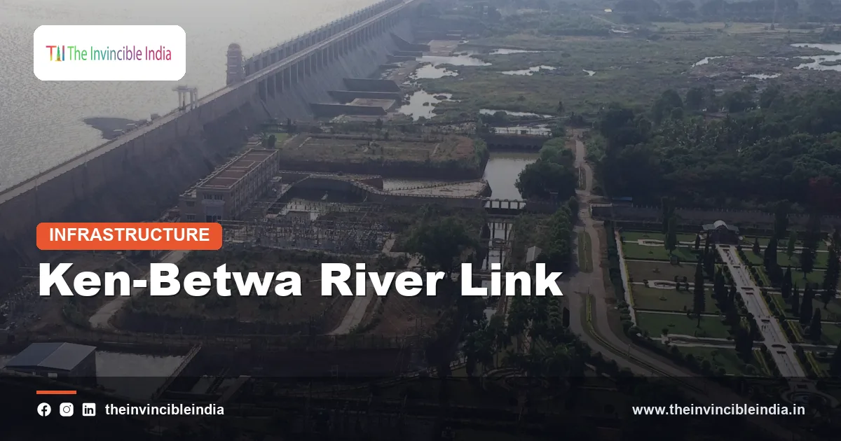
The Ken-Betwa river linking project is India’s first major inter-basin water transfer scheme under the National Perspective Plan for interlinking rivers, designed to carry surplus water from the Ken river to the water-scarce Betwa basin across Madhya Pradesh and Uttar Pradesh in the drought-prone Bundelkhand region. The scheme centres on a high dam at Daudhan on the Ken and a long link canal that joins the Ken basin with the Betwa basin, both of which are tributaries of the Yamuna.
The Ken-Betwa Link Project (KBLP) promises irrigation, drinking water and hydropower to a region that has suffered repeated droughts, but it is also among the most debated river projects in the country because part of the Panna Tiger Reserve will be submerged. This explainer sets out what the project is, how it works, who benefits, and why environmentalists, engineers and officials continue to disagree about it.
Quick Facts
| Attribute | Details |
|---|---|
| Project name | Ken-Betwa Link Project (KBLP) |
| Parent programme | National Perspective Plan (NPP) for interlinking of rivers, formulated in 1980 |
| Type | Peninsular-component inter-basin water transfer: dam, link canal, barrages and power houses |
| Rivers involved | Ken (donor) and Betwa (recipient), both tributaries of the Yamuna |
| Main structure | Daudhan dam on the Ken river, Chhatarpur district, Madhya Pradesh |
| States | Madhya Pradesh and Uttar Pradesh (Bundelkhand region) |
| Nodal ministry | Ministry of Jal Shakti, Government of India |
| Implementing bodies | National Water Development Agency (NWDA) and the Ken-Betwa Link Project Authority |
| Key concern | Submergence of part of the Panna Tiger Reserve and its forests |
Key Takeaways
- The Ken-Betwa river linking project is the first scheme to be taken up for implementation under India’s National Perspective Plan for interlinking rivers.
- The Ken-Betwa Link Project connects two Yamuna tributaries, the Ken and the Betwa, through the Daudhan dam and a link canal running through Bundelkhand.
- Bundelkhand, spread over Madhya Pradesh and Uttar Pradesh, is the principal beneficiary region because it faces chronic drought, erratic rainfall and acute drinking-water stress.
- The reservoir behind the Daudhan dam will submerge a significant portion of the Panna Tiger Reserve, which is the central environmental objection to the Ken-Betwa project.
- Critics question whether the Ken basin really has surplus water to give, while supporters argue that the transfer is essential for Bundelkhand’s survival.
- The Ken-Betwa project involves displacement of villagers in the submergence zone, so rehabilitation and resettlement form a major part of its costs and challenges.
What is the Ken-Betwa river linking project?
The Ken-Betwa river linking project is a plan to move water from the Ken river basin to the Betwa river basin through a storage dam, a link canal and supporting structures. It is the first link of the Peninsular Rivers Component of the National Perspective Plan to move from paper to construction.
The idea behind the Ken-Betwa Link Project is simple. The Ken is believed to have more water than its own basin currently needs, while the upper Betwa basin and the adjoining districts are chronically short. The scheme stores monsoon flows of the Ken at Daudhan, sends a share through a link canal into the Betwa, and uses the water for farm irrigation, town and village water supply and electricity generation.
The project is a joint venture between the Government of India and the two state governments. The Union Ministry of Jal Shakti coordinates the policy, the National Water Development Agency (NWDA) prepared the technical studies, and a dedicated special purpose vehicle, the Ken-Betwa Link Project Authority, was set up to build and run it.
What is the National Perspective Plan for river interlinking?
The National Perspective Plan (NPP) is a long-term plan, prepared in 1980 by the then Ministry of Irrigation, to transfer water from surplus river basins to deficit basins through a network of canals and storages. The plan was meant to reduce the damage from floods in some regions and the severity of drought in others.
The NPP identified a set of links grouped into two broad components. The Himalayan Rivers Component covers links involving the Ganga, Brahmaputra and their tributaries, together with Nepal and Bhutan storages. The Peninsular Rivers Component covers links among rivers such as the Mahanadi, Godavari, Krishna, Pennar, Cauvery, Ken, Betwa and Parbati. In all, roughly thirty links were identified at the pre-feasibility stage.
The National Water Development Agency (NWDA) was set up in 1982 as a society under the Ministry of Water Resources, now the Ministry of Jal Shakti, to study these links. For decades most links stayed at the study stage because of cost, inter-state disagreement and environmental questions. The Ken-Betwa link advanced first because both rivers lie largely within two states and the case for water relief in Bundelkhand is widely accepted.
Where is the Ken-Betwa link located?
The Ken-Betwa link is located in the Bundelkhand region of central India, with the Daudhan dam site on the Ken river in Chhatarpur district of Madhya Pradesh and the canal running north-west toward the Betwa basin. The Ken rises in the Kaimur range of Madhya Pradesh and flows north-east into Uttar Pradesh, where it joins the Yamuna near Chilla in Banda district. The Betwa rises near Bhopal and flows north to join the Yamuna near Hamirpur.
The Ken flows through the Panna district, where the Ken Gharial Sanctuary and the Panna Tiger Reserve are located. This geography explains why the project is entangled with wildlife conservation: the proposed reservoir sits inside a forested stretch of the river that is rich in biodiversity.
Districts expected to gain from the project lie in both states. In Madhya Pradesh they include Chhatarpur, Tikamgarh, Panna, and parts of districts such as Sagar, Damoh, Datia, Vidisha, Shivpuri and Raisen. In Uttar Pradesh they include Banda, Mahoba, Lalitpur and Jhansi.
How does the Ken-Betwa link work?
The Ken-Betwa link works by storing surplus monsoon water behind the Daudhan dam on the Ken and releasing a part of it through a link canal that crosses the watershed into the Betwa basin. Gravity carries the water along the canal, which includes tunnel sections and several cross-drainage works to pass under or over smaller streams.
The main components of the project can be summarised as follows.
- Daudhan dam and reservoir: a large concrete and earthen dam on the Ken that creates the main storage and holds the water to be transferred.
- Link canal: a canal of well over two hundred kilometres that carries water from the Ken reservoir toward the Betwa basin, including a tunnel section through intervening high ground.
- Lower Orr dam and Bina complex: additional storages and diversion structures on tributaries and on the Betwa side, designed to hold and distribute the transferred water.
- Kotha barrage: a barrage in the Betwa system that helps regulate and distribute flows to command areas.
- Power houses: hydropower units attached to the Daudhan dam and canal system, intended to generate electricity from the released water.
Water allocation between Madhya Pradesh and Uttar Pradesh is a negotiated matter. The two states agreed on sharing arrangements for the monsoon and non-monsoon seasons, and these arrangements are central to the project’s agreement documents.
Why is Bundelkhand called a water-scarce region?
Bundelkhand is called water-scarce because it combines low and highly variable rainfall, hard rocky terrain with limited groundwater recharge, shallow soils and a long record of dry spells. The region straddles the border between Madhya Pradesh and Uttar Pradesh and includes about thirteen districts, depending on how the boundaries are defined.
Despite having several rivers, including the Ken, Betwa, Dhasan and Pahuj, Bundelkhand struggles to hold monsoon water. The rivers are seasonal, the terrain drains quickly, and the granite and gneiss geology stores little groundwater. Traditional systems such as tanks and ponds built by the Chandela and Bundela rulers once supported the region, but many have silted up or fallen into disuse.
Repeated droughts have driven farm distress, seasonal migration of workers, and drinking-water crises in towns and villages. Supporters of the Ken-Betwa link argue that these conditions justify a bold intervention, while critics respond that local water conservation can address part of the problem at lower cost and lower ecological risk.
What are the benefits of the Ken-Betwa project?
The Ken-Betwa project is expected to deliver irrigation, drinking water, hydropower and some flood moderation. These are the claims made in the official project descriptions, and their realisation depends on how the system is built and operated.
Irrigation
The most prominent benefit is irrigation of farmland in the Bundelkhand districts of both states. The scheme is planned to serve several lakh hectares annually, covering both the monsoon crop and the winter crop, which would help farmers who currently rely on erratic rain and falling groundwater.
Drinking water
The project includes provision for drinking and domestic water supply for a population running into the millions, covering many villages and towns that face summer shortages. Water supply is treated as a first priority in the allocation of any stored water.
Hydropower
The dam and canal system includes hydropower units, which add a modest amount of electricity to the grid. The power component is generally regarded as secondary to irrigation and water supply.
Wider economic effects
Supporters also expect more stable farm incomes, reduced seasonal migration and growth in allied activities such as dairy and horticulture once reliable water is available. These economic effects are projections and depend on canal reliability, farm practices and distribution of water to the tail end of the system.
What are the environmental concerns about the Ken-Betwa link?
The principal environmental concern about the Ken-Betwa link is that the Daudhan reservoir would submerge a significant portion of the core area of the Panna Tiger Reserve, along with forests, grasslands and river habitat. Panna lies in the Vindhyan landscape and is home to tigers, leopards, sloth bears, hyenas, many deer species, and large numbers of birds, including threatened vultures.
The Panna Tiger Reserve has a particular history. Tigers disappeared from the reserve by the late 2000s, and a reintroduction programme from 2009 helped rebuild the population. Conservationists describe Panna as one of India’s notable recovery stories, and they argue that losing core habitat could undo years of work and affect tiger movement in the wider central Indian landscape.
The main environmental objections can be listed as follows.
- Loss of forest and tree cover: a large number of trees would be felled or inundated, and compensatory afforestation elsewhere is not a like-for-like replacement for old forest.
- Impact on tigers and other wildlife: submergence reduces core habitat, and construction brings roads, labour camps and disturbance.
- Effect on the Ken Gharial Sanctuary and the river: lower downstream flow and changed sediment patterns could affect gharial and other aquatic species.
- Vulture habitat: cliff nesting habitat in the area is important to several vulture species that are already threatened.
- Cumulative impact: critics say that assessments considered the dam in isolation rather than as part of a wider landscape already under pressure.
The Central Empowered Committee appointed by the Supreme Court examined the project and recorded concerns about its ecological costs. The National Board for Wildlife, through its standing committee, considered the proposal and cleared it with conditions, including a set of compensatory and mitigation measures. The sequence of clearances and the strength of the conditions remain a point of dispute.
Is there really surplus water in the Ken basin?
Whether the Ken basin has genuine surplus water is one of the most contested technical questions about the project. The official position is that the Ken has a surplus in the monsoon and in average years that can be transferred without harming its own users.
Critics, including some hydrologists and water-policy researchers, argue that this claim rests on older data and optimistic assumptions. They point out that the Ken itself flows through areas with growing water demand, that climate change is altering rainfall patterns, and that a river that gives water to another basin in a poor year may leave its own users short. They also note that the Betwa basin may be a fuller candidate for local conservation measures.
The project’s supporters reply that water-balance studies by the NWDA and subsequent technical reviews support the transfer, and that the design includes provisions to protect the Ken’s own command area and ecological flow. This disagreement is partly technical and partly about trust in the underlying data, which is why independent review is a frequent demand.
What are the social impacts and displacement issues?
The social impact of the Ken-Betwa link is mainly the displacement of people living in the villages that will be submerged by the Daudhan reservoir and affected by the canal alignment. Families lose homes, farmland and in some cases forest-based livelihoods, and many belong to tribal or other vulnerable communities.
Under Indian law, land acquisition, rehabilitation and resettlement are governed by the Right to Fair Compensation and Transparency in Land Acquisition, Rehabilitation and Resettlement Act, 2013, along with the project’s own resettlement policy and state packages. These typically include cash compensation, a rehabilitation package, house plots and support for livelihoods.
Local groups and civil-society organisations have raised questions about the adequacy of compensation, the pace of resettlement and the quality of resettlement sites. Government agencies state that packages exceed statutory minimums. As with most large dams, the experience of resettled families over the long term is the real test and is monitored by courts, local administrations and non-governmental organisations.
What is the history and current status of the project?
The history of the Ken-Betwa link stretches over several decades, from early studies in the 1980s to a formal agreement between the Centre and the two states in the 2020s. The project advanced through feasibility reports, detailed project reports, inter-state negotiations and a series of statutory clearances.
| Stage | Milestone |
|---|---|
| 1980 | National Perspective Plan for river interlinking is formulated |
| 1982 | National Water Development Agency is set up to study the links |
| 1990s to 2000s | Feasibility studies and detailed project report prepared for the Ken-Betwa link |
| 2005 | Madhya Pradesh and Uttar Pradesh sign an early memorandum on the link |
| 2010s | Environmental, forest and wildlife clearances are examined; the Central Empowered Committee reviews the project |
| 2021 | Tripartite agreement signed among the Ministry of Jal Shakti and the governments of Madhya Pradesh and Uttar Pradesh |
| 2021 to 2024 | Union Cabinet approval, creation of the project authority and formal launch of construction |
The tripartite agreement signed in March 2021 is widely treated as the turning point, because it settled the roles and funding arrangements among the Centre and the states. The foundation stone for the project was laid in December 2024. As of the latest information, construction is at an early stage, and timelines for completion run over several years. Readers should consult official Ministry of Jal Shakti releases for the latest status.
Funding is shared between the Government of India and the two states, with the Centre bearing the larger part. The overall cost runs into tens of thousands of crore rupees, and the figure has been revised upward over time because of price escalation, design changes and added safeguards. A large share goes to the Daudhan dam and link canal, and a smaller portion to rehabilitation, afforestation and environmental mitigation.
What are the main arguments for and against the project?
The arguments for and against the Ken-Betwa project reflect a broader national debate about whether large inter-basin transfers are the best way to manage water. Both sides raise points that deserve attention.
| Theme | Case in favour | Case against |
|---|---|---|
| Water need | Bundelkhand faces repeated drought and needs reliable supply | Local conservation and groundwater recharge could address part of the need |
| Surplus claim | Technical studies show a transferable monsoon surplus | Data may be dated; climate change could erase the surplus |
| Environment | Compensatory afforestation and mitigation will offset losses | Old forest and tiger habitat cannot be replaced by new plantations |
| People | Packages meet or exceed legal norms | Displacement and livelihood loss remain heavy |
| Cost | Long-term gains justify upfront investment | High cost and risk of delay and overrun |
| Precedent | Success would unlock other river links | Problems here could repeat across the interlinking programme |
The honest summary is that the Ken-Betwa link addresses a genuine human need while imposing real ecological costs, and informed observers disagree about the balance. Monitoring, transparency about data, and strict implementation of mitigation measures are likely to determine how the project is judged over time.
Bottom Line
The Ken-Betwa river linking project is India’s first large step toward interlinking rivers, aimed at bringing irrigation and drinking water to Bundelkhand by connecting the Ken and Betwa basins. It offers real benefits to a thirsty region, but the loss of part of the Panna Tiger Reserve, the displacement of villagers and doubts about the Ken’s surplus keep it contested. Its results over the coming years will matter well beyond central India, because the project is the test case for whether other river links in the National Perspective Plan are pursued, modified or shelved, and it brings together drought resilience, tiger habitat, Centre-state water relations and the rights of displaced communities.
Frequently Asked Questions
What is the Ken-Betwa river linking project?
The Ken-Betwa river linking project is a plan to transfer surplus water from the Ken river to the Betwa river through the Daudhan dam and a link canal. It is meant to supply irrigation, drinking water and hydropower to Bundelkhand in Madhya Pradesh and Uttar Pradesh. It is the first link to be implemented under the National Perspective Plan for interlinking rivers.
Where is the Daudhan dam located?
The Daudhan dam is located on the Ken river in Chhatarpur district of Madhya Pradesh, close to the Panna Tiger Reserve. It is the main storage structure of the Ken-Betwa Link Project. Its reservoir will submerge villages and part of the forests in the Ken valley.
Which states benefit from the Ken-Betwa link?
Madhya Pradesh and Uttar Pradesh are the two states that benefit from the Ken-Betwa link, mainly through their Bundelkhand districts. Madhya Pradesh districts such as Chhatarpur, Tikamgarh and Panna are covered, as are Uttar Pradesh districts such as Banda, Mahoba, Lalitpur and Jhansi. The states share the water under agreed monsoon and non-monsoon arrangements.
Why is the Ken-Betwa project controversial?
The Ken-Betwa project is controversial mainly because its reservoir will submerge a significant part of the Panna Tiger Reserve and displace villagers. Critics also question whether the Ken basin has enough surplus water to transfer. Supporters argue that the benefits to drought-hit Bundelkhand outweigh the costs and that mitigation measures will reduce the harm.
How does the Ken-Betwa link affect the Panna Tiger Reserve?
The Ken-Betwa link affects the Panna Tiger Reserve by flooding a portion of its core habitat behind the Daudhan dam. The loss of forest, grassland and river habitat could affect tigers, vultures and other wildlife that have recovered in the reserve over the past decade and a half. Compensatory afforestation and wildlife-management measures have been set as conditions, but their adequacy is debated.
Is the Ken-Betwa link under construction?
The Ken-Betwa link has moved from planning to construction after the tripartite agreement of 2021 and the laying of the foundation stone in December 2024. Work on the dam, canal and associated structures is expected to take several years. Current progress and completion targets should be checked against official announcements from the Ministry of Jal Shakti.
{“@context”:”https://schema.org”,”@graph”:[{“@type”:”FAQPage”,”mainEntity”:[{“@type”:”Question”,”name”:”What is the Ken-Betwa river linking project?”,”acceptedAnswer”:{“@type”:”Answer”,”text”:”The Ken-Betwa river linking project is a plan to transfer surplus water from the Ken river to the Betwa river through the Daudhan dam and a link canal. It is meant to supply irrigation, drinking water and hydropower to Bundelkhand in Madhya Pradesh and Uttar Pradesh. It is the first link to be implemented under the National Perspective Plan for interlinking rivers.”}},{“@type”:”Question”,”name”:”Where is the Daudhan dam located?”,”acceptedAnswer”:{“@type”:”Answer”,”text”:”The Daudhan dam is located on the Ken river in Chhatarpur district of Madhya Pradesh, close to the Panna Tiger Reserve. It is the main storage structure of the Ken-Betwa Link Project. Its reservoir will submerge villages and part of the forests in the Ken valley.”}},{“@type”:”Question”,”name”:”Which states benefit from the Ken-Betwa link?”,”acceptedAnswer”:{“@type”:”Answer”,”text”:”Madhya Pradesh and Uttar Pradesh are the two states that benefit from the Ken-Betwa link, mainly through their Bundelkhand districts. Madhya Pradesh districts such as Chhatarpur, Tikamgarh and Panna are covered, as are Uttar Pradesh districts such as Banda, Mahoba, Lalitpur and Jhansi. The states share the water under agreed monsoon and non-monsoon arrangements.”}},{“@type”:”Question”,”name”:”Why is the Ken-Betwa project controversial?”,”acceptedAnswer”:{“@type”:”Answer”,”text”:”The Ken-Betwa project is controversial mainly because its reservoir will submerge a significant part of the Panna Tiger Reserve and displace villagers. Critics also question whether the Ken basin has enough surplus water to transfer. Supporters argue that the benefits to drought-hit Bundelkhand outweigh the costs and that mitigation measures will reduce the harm.”}},{“@type”:”Question”,”name”:”How does the Ken-Betwa link affect the Panna Tiger Reserve?”,”acceptedAnswer”:{“@type”:”Answer”,”text”:”The Ken-Betwa link affects the Panna Tiger Reserve by flooding a portion of its core habitat behind the Daudhan dam. The loss of forest, grassland and river habitat could affect tigers, vultures and other wildlife that have recovered in the reserve over the past decade and a half. Compensatory afforestation and wildlife-management measures have been set as conditions, but their adequacy is debated.”}},{“@type”:”Question”,”name”:”Is the Ken-Betwa link under construction?”,”acceptedAnswer”:{“@type”:”Answer”,”text”:”The Ken-Betwa link has moved from planning to construction after the tripartite agreement of 2021 and the laying of the foundation stone in December 2024. Work on the dam, canal and associated structures is expected to take several years. Current progress and completion targets should be checked against official announcements from the Ministry of Jal Shakti.”}}]}]}


