

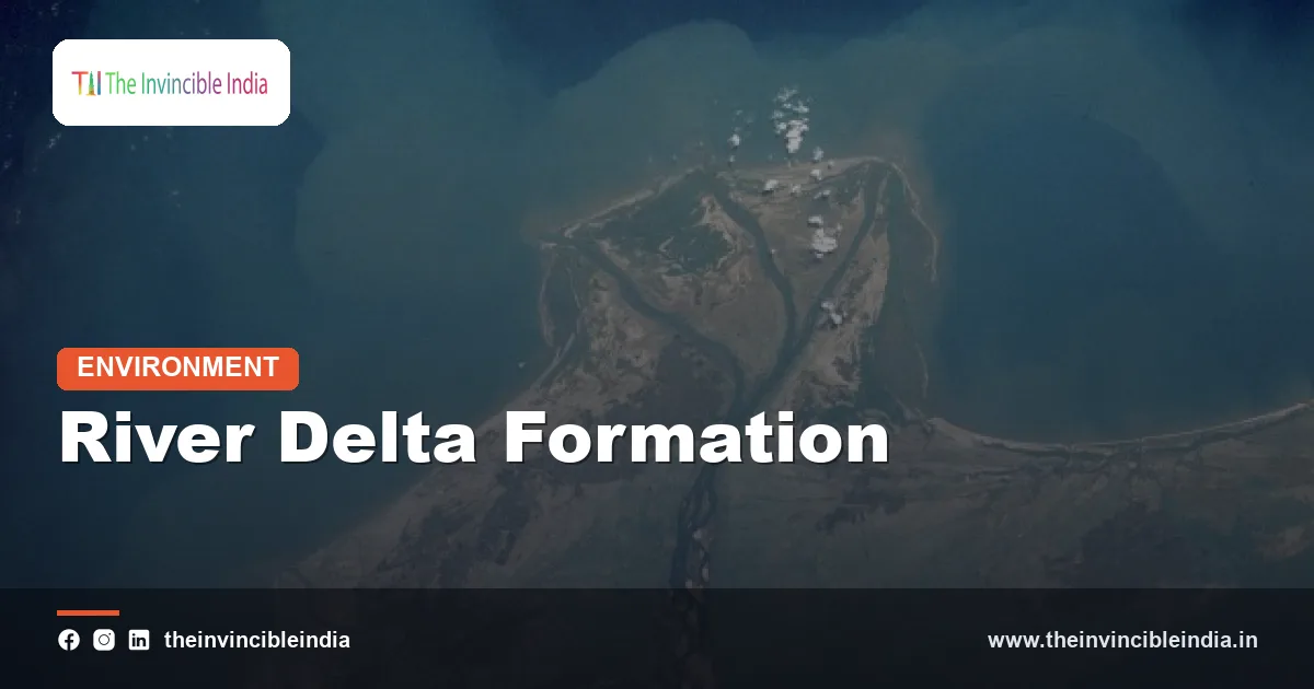
A river delta is a fan-shaped or irregular plain of silt, sand and clay that builds up where a river slows down and drops its load on meeting the sea, a lake or another large body of water. India has some of the most productive and densely populated deltas on Earth, and they shape food, trade, culture and disaster risk along almost the whole of the east coast. This guide explains how a river delta forms, why the Ganga-Brahmaputra, Mahanadi, Godavari, Krishna and Kaveri deltas look so different from one another, and why these low, fertile lands are now among the most fragile landscapes in the country. (Last updated 3 November 2026.)
The word “delta” comes from the Greek letter that looks like a triangle, a name given to the Nile’s mouth by ancient Greek writers. The triangle is only one of many shapes, and Indian deltas show several. Understanding them means understanding a simple tug of war between a river that brings sediment, waves that tear it away, and tides that push it around.
| Feature | Quick fact |
|---|---|
| What it is | A low plain built from river-borne sediment at a river mouth |
| Core process | Deposition when river flow slows on entering still or slow water |
| Main channels | The river splits into many distributaries that spread sediment |
| Common shapes | Arcuate (fan), bird’s-foot, estuarine and tide-dominated |
| India’s largest | Ganga-Brahmaputra delta, shared with Bangladesh, home of the Sundarbans |
| Other major deltas | Mahanadi, Godavari, Krishna and Kaveri, all on the east coast |
| West coast contrast | Narmada and Tapi form estuaries, not true deltas |
| Main threats | Dams trapping silt, sinking land, rising seas, cyclones, salinity |
Key Takeaways
- A river delta forms when a river loses speed at its mouth and deposits its sediment faster than waves and tides can carry it away.
- Most Indian deltas lie on the east coast because the large peninsular rivers flow eastward across gentle slopes into the Bay of Bengal.
- The Ganga-Brahmaputra delta is one of the largest in the world and holds the Sundarbans, the biggest mangrove forest on the planet.
- The Godavari, Krishna and Kaveri deltas are intensely cultivated rice bowls, helped by irrigation canals that date back well over a century.
- West-flowing rivers such as the Narmada and Tapi build estuaries rather than deltas because of strong tides and steep, narrow coastal plains.
- Dams, sand mining, groundwater pumping and sea-level rise are starving and sinking many deltas, so their long-term safety depends on sediment management.
What exactly is a river delta?
A river delta is a depositional landform, a place where land is being added to the coast rather than taken away from it. Rivers carry a mix of coarse sand, fine silt and clay eroded from their catchments, and the load can be very large in a country with young mountains and heavy monsoon rain. As long as the water is fast, the load stays in suspension or rolls along the bed. Once the river reaches the sea, the channel widens, the current drops, and the sediment begins to settle.
Geographers describe three parts of a mature delta. The upper delta is the older, higher, mostly freshwater plain nearest the river, often crowded with farms and towns. The lower delta is the active zone where tides reach, soils are salty in places and mangroves or marshes may grow. The delta front and prodelta lie underwater, where sand and silt keep building seaward. Together they form a wedge of sediment that can be hundreds of metres thick under the biggest deltas.
Deltas are not the same as estuaries. An estuary is a drowned river mouth where fresh and salt water mix, and sediment tends to be carried out to sea or trapped only in mudflats. A delta pushes out into the sea and builds new land. Some mouths are a mixture, and the Hooghly and the lower Ganga show that mixed character.
How does a river delta form step by step?
A river delta forms through a repeating cycle of deposition, channel splitting and shifting that can run for thousands of years. The process works roughly like this:
First, the river arrives at the coast with its sediment load. Because the water spreads out and meets the resistance of the sea, its speed falls sharply, and its carrying power falls even faster. The heaviest sand grains drop out first, forming a mouth bar at the channel exit. Finer silt and clay drift farther out before settling.
Second, the mouth bar blocks the main channel. The river cannot flow straight through the obstacle, so it splits and goes around it. The new channels are called distributaries, and each one carries part of the flow and repeats the same process. Over time the river fans out into a network of branches, a pattern that is the opposite of a normal river system where small streams join into larger ones.
Third, the banks of each distributary build up into natural levees. When floods overtop the levees, they spill silt across the low ground behind, raising the surface and creating marshes, ponds and fertile fields. This is why the best farmland in a delta often lies in the gentle hollows between old channels.
Fourth, the river shifts. A channel that grows long and sluggish loses its slope advantage, and during a big flood the river may break through and take a shorter route to the sea. This is called avulsion. The abandoned channel slowly silts up or becomes a dead river, and a new lobe of the delta starts to build elsewhere. The Ganga delta is full of such dead and dying channels, which is why the active mouth has moved over the centuries.
Fifth, the land sinks under its own weight. Fresh sediment is soft and full of water, so it compacts and settles. A delta therefore needs a steady supply of new sediment just to hold its height. Where the supply stops, the surface drops and the sea creeps in.
What decides the shape of a delta?
The shape of a delta is decided by the balance between three forces: the sediment brought by the river, the energy of waves, and the strength of tides. Geologists often sort deltas into river-dominated, wave-dominated and tide-dominated types, though most real deltas show a blend.
In a river-dominated delta, a strong sediment supply and weak waves let the channels push far out to sea. When the distributaries are long and narrow, with each one building its own levees into the water, the outline looks like the toes of a bird’s foot. The Mississippi is the classic example, and it has no true match in India, although parts of the Mahanadi and Godavari lobes carry some of that finger-like growth.
In a wave-dominated delta, strong waves on an open coast push the sediment back and spread it sideways along the shore. The result is a smooth, curved, arc-shaped coastline with beach ridges. This is called an arcuate delta, and it is the typical form for the Godavari and Krishna deltas, whose gentle bulges into the Bay of Bengal are visible on any map.
In a tide-dominated delta, strong tides run in and out through wide, funnel-shaped channels, shaping the sediment into long sand bars and tidal islands separated by creeks. The Sundarbans, with its maze of tidal creeks, mudflats and mangrove islands, is the best-known example in the world. The sea moves so much water through the system twice a day that the land is constantly being reshaped.
A fourth category worth knowing is the estuarine delta, where a delta forms inside a drowned valley mouth. This is the situation in many West Coast rivers, where the sediment is largely trapped inside the estuary and little spills out onto the open coast.
Why are India’s biggest deltas on the east coast?
India’s biggest deltas lie on the east coast because the great peninsular rivers rise in the Western Ghats and flow eastward for long distances over gentle slopes, picking up silt all the way to the Bay of Bengal. The east coast plain is wide and low, and the continental shelf is broad enough to hold large volumes of sediment.
The west coast tells a different story. The Western Ghats rise close to the Arabian Sea, so west-flowing rivers are short, steep and fast. They reach the coast with limited sediment and a high tidal range, which flushes silt away. The Narmada and Tapi flow westward through ancient rift valleys and enter the sea through wide estuaries rather than deltas. The same pattern holds for the Mandovi and Zuari in Goa, which are classic estuaries.
The Himalayan rivers feed the largest sediment supply of all. Young, steep and still rising, the Himalaya shed vast amounts of material to the Ganga and Brahmaputra, and the monsoon rain provides the water to move it. This combination of fast uplift, heavy rain and a long flat run to the sea is the recipe for the largest delta in the region.
How did the Ganga-Brahmaputra delta and the Sundarbans form?
The Ganga-Brahmaputra delta formed over thousands of years as two of the world’s most sediment-laden river systems, joined by the Meghna, built a vast plain at the head of the Bay of Bengal. It spreads across West Bengal in India and much of Bangladesh, and it is usually described as the largest delta in the world.
The Himalayan source matters. The Ganga carries sediment from the central Himalaya and its Gangetic plain tributaries, while the Brahmaputra brings an enormous load from Tibet and Assam. After they merge in Bangladesh, the combined flow drops a huge quantity of silt into the Bay of Bengal, and the river system continues to shift its channels across a very flat landscape. In the Indian part, the Hooghly is the main active distributary, and Kolkata sits on its bank.
The seaward fringe is the Sundarbans, a tide-dominated expanse of mangrove forest, creeks and mudflats shared between India and Bangladesh. The Indian portion is a UNESCO World Heritage Site and a tiger reserve. Its mangroves act as a living shield against cyclones and tidal surges, and its channels shelter fish, crabs and the Bengal tiger, a species known for swimming between islands. The Sundarbans’ tides, salinity and sediment supply together hold up the forest, which is why changes upstream matter so much to it.
How were the Mahanadi, Godavari, Krishna and Kaveri deltas built?
The Mahanadi, Godavari, Krishna and Kaveri deltas were built by peninsular rivers that drop their silt on the east coast plain, and each has its own character shaped by river size, wave action and human engineering.
The Mahanadi delta in Odisha is built by a river that splits into several distributaries near Cuttack, such as the Kathajodi and the Devi. It is a wave- and river-influenced delta that sits near Chilika lagoon in the south and merges northward with the neighbouring Brahmani-Baitarani delta, and it is regularly hit by floods and cyclones. The Hirakud dam upstream controls part of the flow, which has changed the way sediment and floodwater arrive.
The Godavari delta in Andhra Pradesh is a textbook arcuate delta. The river divides near Dowleswaram into branches, and the delta runs into the Bay of Bengal along a rounded coast. The nineteenth-century irrigation works at Dowleswaram turned this area into a famed rice and coconut belt. The Coringa mangrove forest and wetlands on its eastern edge are among the better-known mangroves of the east coast.
The Krishna delta lies just to the south, close enough that the Godavari and Krishna deltas almost join. It was also developed through nineteenth-century irrigation works at Vijayawada. The two deltas together are sometimes called the “rice bowl” of Andhra Pradesh, and the offshore basin beneath them is known for oil and gas exploration.
The Kaveri delta in Tamil Nadu is a fan-shaped plain fed by a network of branches that split off near the island of Srirangam. It is often called the “granary of South India”. The Kallanai, or Grand Anicut, an irrigation structure built in the Chola period on the Kaveri, is famous as one of the oldest water-regulation structures still in use. Because the Kaveri depends heavily on both monsoons, the delta’s water supply can be uncertain in dry years.
| Delta | State(s) | Dominant character | Known for |
|---|---|---|---|
| Ganga-Brahmaputra | West Bengal (and Bangladesh) | Tide-dominated, very large | Sundarbans mangroves, tigers, Hooghly |
| Mahanadi | Odisha | River and wave influenced | Cuttack distributaries, floods, cyclone exposure |
| Godavari | Andhra Pradesh | Arcuate, wave influenced | Rice and coconut, Coringa mangroves |
| Krishna | Andhra Pradesh | Arcuate | Irrigated farmland, offshore hydrocarbons |
| Kaveri | Tamil Nadu | Fan-shaped | Ancient irrigation, “granary of the south” |
Why are delta soils so fertile?
Delta soils are fertile because they are made of fresh alluvium, a fine mixture of silt, clay and organic matter that rivers wash down from rich upland soils and renew with every flood. Alluvium holds water well, contains plant nutrients, and is easy to plough, which is why deltas support some of the highest rural population densities in the world.
The flat surface helps as well. A delta has very little slope, so water can be spread easily across large fields by canals, and farmers can raise paddy in flooded plots through the monsoon. Many Indian deltas support two or even three crops a year where irrigation is reliable. Rice is the staple, but coconut, banana, sugarcane, pulses and aquaculture ponds for fish and prawns are all common.
Fertility also needs balance. Too much salt, which seeps in when freshwater flow is low or when seawater floods land after a cyclone, can damage soils for years. Waterlogging in the lowest parts can limit what can be grown. This is why delta farming has always depended on managing water, from the old Chola and Kakatiya tank systems to modern barrages and drains.
How do deltas protect coasts and support wildlife?
Deltas protect coasts by acting as a soft buffer, a wide, low, vegetated zone that absorbs the energy of storm surges before it reaches inland towns. Mangroves are the most visible part of that buffer. Their dense roots slow water, trap sediment and hold the shore together, and studies of cyclones in the Bay of Bengal suggest that mangrove belts reduce damage behind them, though they cannot stop a very large surge.
Deltas are also hotspots for wildlife. The Sundarbans shelters tigers, estuarine crocodiles, fishing cats, dolphins and countless birds. Bhitarkanika, in the adjoining Brahmani-Baitarani delta, is known for its estuarine crocodiles and its nearby sea turtle nesting beaches. The Godavari and Krishna wetlands host migratory waterbirds in winter. Fish such as hilsa, which migrates from the sea into delta rivers to spawn, depend on healthy river mouths. Fishing communities in the delta region rely on this productivity for their livelihoods.
What are the biggest threats to India’s deltas?
The biggest threat to India’s deltas is the combination of falling sediment supply and a rising sea, which together make the land sink relative to the water around it. Because a delta must keep gaining sediment to stay above sea level, anything that starves it of silt puts the whole system at risk.
Dams and barrages trap sediment in their reservoirs, so far less reaches the coast than in the past. Sand mining in riverbeds removes yet more. Pumping of groundwater, and in some deltas gas and oil, can speed up the sinking of the ground. Embankments built to protect fields keep floods out but also keep fresh silt from reaching the land inside them, which can leave fields lower each year while the river bed between the embankments rises.
Sea-level rise adds pressure from the other side. Research on the Ganga-Brahmaputra delta in particular suggests that parts of it are sinking at a pace that may exceed the global average sea-level rise, though estimates vary by place and method. Cyclones such as those that have struck Odisha and the Sundarbans push saltwater far inland, ruin farmland and displace people. Salt intrusion into rivers and groundwater is already a daily problem in the Sundarbans, where shrimp farming and salty drinking water affect villages. Islands such as Ghoramara have lost land to the sea over recent decades.
Human pressure on mangroves, from clearing for aquaculture and settlement, removes the natural defence at exactly the time it is needed most.
Can India’s deltas be protected?
India’s deltas can be protected, but only by treating sediment as a resource to be managed and not as a nuisance to be blocked. Experts discuss a range of measures. Controlled sediment release from dams and careful management of floodplains can help silt reach the coast. Strict regulation of sand mining can reduce the damage to riverbeds. Restoring and protecting mangroves can rebuild natural defences, and community-based planting has been tried widely in the Sundarbans and in Odisha.
Better early warning has already saved many lives from cyclones, with Odisha often cited as a model for evacuation planning. Controlling groundwater withdrawal, shifting to salt-tolerant rice varieties and diversifying livelihoods can help farmers adapt. Some planners also discuss tidal river management, an approach tested in parts of Bangladesh, where tidal flow is deliberately let into diked areas so that silt can raise the land. None of these measures is a complete fix, and long-term safety depends on coordinated action across the whole river basin, from the mountain headwaters to the mangrove edge.
Bottom Line
A river delta is a land built by sediment, and it survives only as long as sediment keeps arriving. India’s deltas, from the tidal Sundarbans to the irrigated Godavari, Krishna and Kaveri plains, are among its most fertile and crowded regions, but also among its most exposed to cyclones, salt and sinking ground. Protecting them means looking upstream as much as at the coast.
Frequently Asked Questions
What is a river delta in simple words?
A river delta is a plain of silt and sand that forms where a river meets the sea and slows down, dropping the sediment it carries. The river usually splits into many smaller channels called distributaries across the new land.
Which is the largest river delta in India?
The Ganga-Brahmaputra delta is the largest, spreading across West Bengal and Bangladesh and holding the Sundarbans mangrove forest. It is generally regarded as the largest delta in the world.
Why do the Narmada and Tapi not form deltas?
These west-flowing rivers enter the Arabian Sea through wide estuaries where strong tides sweep sediment away. Their coastal plain is also narrow and steep, leaving little room for a delta to build out.
What is the difference between a delta and an estuary?
A delta is land built outward by deposited sediment at a river mouth, while an estuary is a drowned river mouth where fresh and salt water mix. Deltas add new land, whereas estuaries mostly carry sediment out to sea.
Why are delta regions so fertile?
They are made of alluvium, a nutrient-rich mix of silt and clay renewed by river floods. The flat ground also makes irrigation easy, supporting rice and other crops.
Are India’s deltas in danger?
Yes, many face trouble because dams and sand mining reduce the silt reaching them while sea levels rise and cyclones bring salt water inland. Protecting mangroves and managing sediment are among the main responses.
{“@context”:”https://schema.org”,”@graph”:[{“@type”:”FAQPage”,”mainEntity”:[{“@type”:”Question”,”name”:”What is a river delta in simple words?”,”acceptedAnswer”:{“@type”:”Answer”,”text”:”A river delta is a plain of silt and sand that forms where a river meets the sea and slows down, dropping the sediment it carries. The river usually splits into many smaller channels called distributaries across the new land.”}},{“@type”:”Question”,”name”:”Which is the largest river delta in India?”,”acceptedAnswer”:{“@type”:”Answer”,”text”:”The Ganga-Brahmaputra delta is the largest, spreading across West Bengal and Bangladesh and holding the Sundarbans mangrove forest. It is generally regarded as the largest delta in the world.”}},{“@type”:”Question”,”name”:”Why do the Narmada and Tapi not form deltas?”,”acceptedAnswer”:{“@type”:”Answer”,”text”:”These west-flowing rivers enter the Arabian Sea through wide estuaries where strong tides sweep sediment away. Their coastal plain is also narrow and steep, leaving little room for a delta to build out.”}},{“@type”:”Question”,”name”:”What is the difference between a delta and an estuary?”,”acceptedAnswer”:{“@type”:”Answer”,”text”:”A delta is land built outward by deposited sediment at a river mouth, while an estuary is a drowned river mouth where fresh and salt water mix. Deltas add new land, whereas estuaries mostly carry sediment out to sea.”}},{“@type”:”Question”,”name”:”Why are delta regions so fertile?”,”acceptedAnswer”:{“@type”:”Answer”,”text”:”They are made of alluvium, a nutrient-rich mix of silt and clay renewed by river floods. The flat ground also makes irrigation easy, supporting rice and other crops.”}},{“@type”:”Question”,”name”:”Are India’s deltas in danger?”,”acceptedAnswer”:{“@type”:”Answer”,”text”:”Yes, many face trouble because dams and sand mining reduce the silt reaching them while sea levels rise and cyclones bring salt water inland. Protecting mangroves and managing sediment are among the main responses.”}}]}]}


