

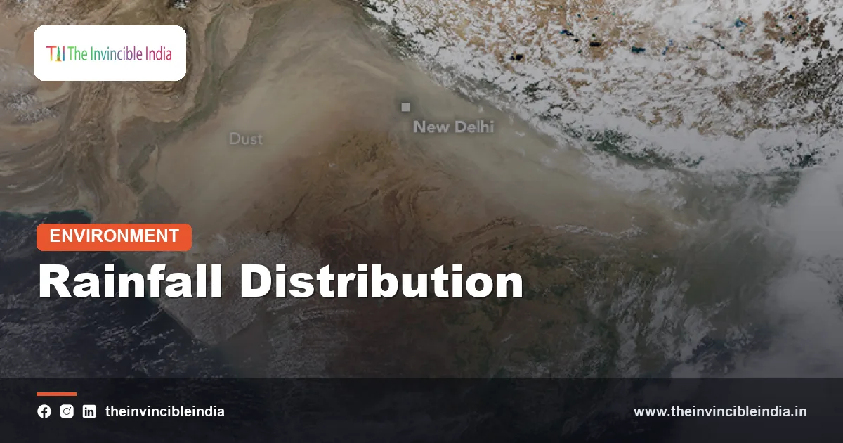
Rainfall distribution is the way rain is spread across a country in space and time, and in India it is startlingly uneven: the hills of Meghalaya record several metres of rain a year while the Thar Desert, a few thousand kilometres to the west, may see only a few centimetres, and most of it falls in just four months. Understanding this pattern is the key to understanding India’s farms, floods, droughts, rivers and water politics.
This explainer, last reviewed 4 November 2026, describes how rainfall is distributed across India geographically and through the year, what shapes the pattern, how variable and extreme it is, and why it matters for people who live with it.
Quick Facts
| All-India average | Roughly 1,100 to 1,200 mm a year, a long-term national mean |
|---|---|
| Monsoon share | About three-quarters of annual rain falls from June to September |
| Wettest places | Mawsynram and Cherrapunji in Meghalaya, with well over 10,000 mm in a typical year |
| Driest regions | Western Rajasthan (Thar), Kutch and Ladakh, often under 250 mm and sometimes under 100 mm |
| Wet windward belt | Western Ghats west slopes, commonly 2,500 to over 5,000 mm |
| Rain-shadow zone | Interior Deccan plateau, often only 400 to 700 mm |
| Other rain seasons | Northeast monsoon (October to December) for Tamil Nadu; western disturbances (winter) for the northwest |
| Monitoring agency | India Meteorological Department (IMD), with rain gauges, radars and satellites |
Key Takeaways
- India’s rainfall distribution is highly uneven: the northeast and Western Ghats are among the wettest places on Earth, while western Rajasthan and Ladakh are arid or near-desert.
- Around three-quarters of India’s annual rain falls in the four monsoon months from June to September, so a single weak season can strain agriculture and water supply.
- Mountains shape the pattern: they force moist winds upward to drop rain on windward slopes and leave rain-shadow regions such as the interior Deccan dry.
- Variability is greatest where rainfall is lowest, so desert and semi-arid districts face the biggest swings from year to year.
- Heavy-rain events have become more frequent in many regions, even as the number of light-rain days has fallen, raising flood and drought risk together.
- Different regions rely on different rain seasons, including the northeast monsoon for southeast India and western disturbances for the northwest in winter.
What is the overall pattern of rainfall across India?
The overall pattern is a country-wide average of roughly 1,100 to 1,200 millimetres of rain a year that hides enormous local differences, from over 10,000 millimetres in parts of Meghalaya to under 200 millimetres in parts of the Thar. A national average therefore describes almost nowhere in particular. The wettest zones are narrow strips along mountains, while the driest cover large areas of the interior and northwest.
Textbooks often group India into four broad rainfall zones. Areas receiving more than about 200 centimetres a year include the western slopes of the Western Ghats, the northeast hills, Meghalaya and the sub-Himalayan parts of West Bengal. Areas with about 100 to 200 centimetres include parts of south Gujarat, eastern Maharashtra, Odisha, Chhattisgarh, Bihar, eastern Uttar Pradesh and the Tamil Nadu coast. Areas with about 50 to 100 centimetres cover much of the northern plains, east Rajasthan and the plateau interior, and those with under 50 centimetres include western Rajasthan, parts of Gujarat, Ladakh and the rain-shadow Deccan.
The result is a country in which farming systems, housing, food habits and even folk traditions follow the rain. Paddy and coconut thrive in the wet south and east; millets, pulses and groundnut dominate drier tracts; and the desert people of Rajasthan built an elaborate culture of stored water because rain is rare and unpredictable.
Why is the Western Ghats so wet and the Deccan so dry?
The Western Ghats are wet and the interior Deccan is dry because mountains force moist monsoon winds to rise and shed their rain on the windward side, leaving descending, drier air behind. From June, the southwest monsoon winds carry moisture from the Arabian Sea toward the coast. When they meet the Ghats, which run parallel to the coast, the air is pushed upward, cools and condenses, and heavy rain falls on the western slopes and the coastal strip. Some stations, such as Agumbe in Karnataka, are known as the “Cherrapunji of the south” for their very heavy totals.
Once the air crosses the crest, it descends on the leeward side, warming and drying as it sinks. This creates a rain shadow over parts of the Deccan plateau, including interior Maharashtra, Karnataka and Rayalaseema, where yearly totals can be less than a third of those on the windward side only a few dozen kilometres away. Cities such as Pune and Solapur lie in this drier belt and depend on reservoirs fed by the Ghats.
The effect, called orographic rainfall, is not limited to the west. The Himalaya forces air to rise over the Brahmaputra valley and northeast hills. Understanding this mountain control is the first step in explaining nearly every large contrast in the rainfall map of India.
Why does Mawsynram get so much rain?
Mawsynram gets so much rain because of its location on the Meghalaya plateau, where moisture-laden air from the Bay of Bengal is funnelled and forced upward, creating some of the heaviest rainfall on Earth. Mawsynram and nearby Cherrapunji have long competed for the title of the wettest place in the world, with annual totals well above 10,000 millimetres in typical years.
The geography is a perfect funnel. Southwest monsoon winds sweep north over the low, flat plains of Bangladesh, picking up moisture from the Bay of Bengal. They then meet the steep southern face of the Khasi Hills, which rise abruptly from the plains. The air is forced to climb quickly, and the funnel-like shape of the terrain concentrates the flow, producing intense and prolonged rain from May to September.
The same slopes are, ironically, dry in winter, and water can be scarce in the dry months because rain washes quickly down steep ground and erodes the thin soils. Local people respond with umbrellas made of bamboo and banana leaf and with living root bridges. The extreme rain here also illustrates how the monsoon’s moisture is concentrated into a few favoured places rather than spread evenly.
Why are Rajasthan, Kutch and Ladakh so dry?
Rajasthan, Kutch and Ladakh are dry for different reasons: the first two because the monsoon arrives late, weakly and is not forced to rise, and Ladakh because the Himalaya blocks the moisture. In the Thar region, the Aravalli Range runs parallel to the monsoon winds from the Arabian Sea, so it does not trigger rain and the air passes over. High surface heat also keeps the air dry and descending, which discourages cloud formation, and the monsoon withdraws early from the northwest.
Ladakh is a cold desert in the rain shadow of the Himalaya. Monsoon clouds from the south lose most of their moisture on the southern slopes, and little reaches the high plateau behind them, where annual precipitation can be below 100 millimetres, mostly as winter snow. Kutch shares aridity with the Thar, with erratic, scanty rain.
These dry regions are not lifeless. Western Rajasthan supports desert-adapted wildlife, such as the great Indian bustard and the chinkara, and people who have long used methods such as tankas, khadins and johads to capture rain. But a year of very low rain can quickly mean fodder and water crises, which is why variability matters as much as the average.
How is rainfall distributed through the year?
Rainfall is distributed through the year in a strongly seasonal pattern, with the great majority falling during the southwest monsoon from June to September. The monsoon usually reaches Kerala around the start of June, advances up both coasts, and covers the whole country by early to mid July, then withdraws from the northwest from September. Nationally it contributes about three-quarters of annual rainfall, and in many regions the share is higher.
India has other rain seasons that matter regionally. The northeast monsoon, or retreating monsoon, brings the main rain to Tamil Nadu, coastal Andhra Pradesh and parts of Kerala and Karnataka from October to December, and drives much of Chennai’s yearly total. Western disturbances, storm systems that travel from the Mediterranean region, bring winter and early-spring rain and snow to Jammu and Kashmir, Himachal, Punjab and Haryana, which is vital for the wheat crop. Pre-monsoon thunderstorms, known as Kalbaishakhi in Bengal and Nor’westers in the east, add rain in April and May.
The table below summarises the main seasons and who depends on them.
| Season | Months | Main regions served | Share or importance |
|---|---|---|---|
| Southwest monsoon | June to September | Almost the whole country | About three-quarters of annual rain |
| Northeast (retreating) monsoon | October to December | Tamil Nadu, coastal Andhra, south Karnataka | Main rain for the southeast coast |
| Western disturbances | December to March | Northwest India and the western Himalaya | Crucial for wheat and snow |
| Pre-monsoon showers | March to May | Northeast, Kerala, eastern India | Relief from heat; tea and mango |
How variable is India’s rainfall from year to year?
India’s rainfall is highly variable from year to year, and the variability is greatest in the driest regions. The India Meteorological Department compares each monsoon with a long-period average of about 87 centimetres for the June to September season, calling it “normal” when it lies close to that figure and “deficient” or “excess” when it strays far above or below. The national total usually stays within roughly 10 per cent of average, but individual regions can swing much further.
The coefficient of variation, a measure of relative swing, is low in the rainy northeast and Western Ghats and high in western Rajasthan and Gujarat, where one year’s rain can be double or half the average. This explains why desert districts experience repeated droughts and occasional surprise floods. Moreover, a good national total can hide local failures, because rain can pile up in one belt while another stays dry.
Several natural rhythms drive the swings. The El Nino and La Nina cycle in the Pacific often, but not always, links a warm El Nino year to weaker monsoon rain, and the Indian Ocean Dipole, a similar seesaw in the Indian Ocean, can offset or reinforce it. Within a season, the monsoon alternates between active spells and breaks of a week or more, and a long break in July or August can be as damaging to crops as a poor total.
Are India’s rainfall extremes getting worse?
Studies suggest that India’s rainfall extremes are becoming more frequent and intense, even as moderate rain days become fewer, though regional patterns differ. Analyses of daily station data report a marked increase in heavy and very heavy rain events over central India since the mid-twentieth century, with some research describing roughly a threefold rise in widespread extreme events. Warmer air can hold more moisture, and warming of the Arabian Sea has been linked to stronger, more clustered storms.
Memorable cases include the Mumbai deluge of July 2005, when about 94 centimetres fell at one station in a single day, the Uttarakhand disaster of 2013, the Chennai floods of 2015 and the Kerala floods of 2018. At the other end, drought years such as 2002, 2009, 2014 and 2015 hit farm output and water supply hard.
The emerging picture is of a more erratic monsoon: longer dry gaps punctuated by short, violent downpours. This pattern is hard on both flood control and farming, because rain that falls in a burst runs off instead of soaking in. Rapid urbanisation, which paves surfaces and chokes drains, and construction on floodplains and hill slopes, magnify the damage. Forecasts and early warnings are improving, but adaptation lags.
How do scientists measure and forecast the rain?
Scientists measure rainfall with a network of rain gauges, radars and satellites, and forecast it with computer models run by the India Meteorological Department. The IMD maintains thousands of rain gauge stations, including automatic weather stations that report in near real time, and a growing grid of Doppler weather radars that track storms. Satellites such as the INSAT series and international missions supply cloud and rainfall estimates over oceans and remote mountains. Records are combined into gridded datasets that let researchers study long-term trends.
Forecasts span several time scales. IMD issues a long-range forecast for the monsoon in April, updated in late May, along with seasonal and monthly outlooks and extended-range forecasts for two to four weeks. Short-range forecasts and now-casts warn of heavy rain, cyclones and cloudbursts in the coming hours or days, and are issued with colour-coded alerts. Improving high-resolution models and data assimilation have raised accuracy, particularly for large-scale systems.
Local convective downpours and cloudbursts in mountains remain hardest to predict. That is why community rain gauges, citizen reporting and village-level advisories are increasingly valuable, and why research on the monsoon is a national priority.
Why does rainfall distribution matter for farming and water?
Rainfall distribution matters for farming and water because roughly half of India’s cropped area is still rainfed, and the timing and place of rain decide what can grow and how much water is stored. A well-timed monsoon sows the kharif crops of rice, cotton, soybean, pulses and millets, while failure at a critical stage cuts yields and farm incomes. Rainfall also recharges groundwater, which supplies most of the country’s irrigation and a large share of drinking water.
The concentration of rain in a few months creates a need for storage. Dams, tanks, ponds, step-wells and recharge structures capture the monsoon surplus for use in the dry months. Because rain is so uneven in space, water-rich basins such as the Brahmaputra contrast with water-short ones such as the Luni and the upper Krishna, which fuels interstate river disputes and proposals for interlinking rivers.
Planning therefore follows the rain. Watershed development, rainwater harvesting, drought-proofing, crop insurance and climate-smart farming practices are all responses to a landscape of feast and famine. Matching crops to local rainfall, rather than forcing thirsty crops into dry regions, is among the most effective long-term strategies.
Bottom Line
India’s rain is distributed with extraordinary inequality across both space and season, shaped by mountains, monsoon winds and the oceans. Wet and dry extremes sit side by side, and a changing climate seems to be sharpening them. Knowing where, when and how reliably rain falls is the starting point for every decision about crops, dams, cities and disaster preparedness.
Frequently Asked Questions
What is the average annual rainfall in India?
India’s long-term average is roughly 1,100 to 1,200 millimetres a year, with about three-quarters falling during the June to September monsoon. Local totals range from under 100 mm to over 10,000 mm.
Which place in India receives the most rainfall?
Mawsynram and nearby Cherrapunji in Meghalaya receive the most, with annual totals well over 10,000 millimetres. The Khasi Hills funnel and lift monsoon winds from the Bay of Bengal.
Which region of India receives the least rainfall?
Western Rajasthan, including the Thar Desert, and cold desert Ladakh receive the least, often under 250 mm a year. Parts of Kutch are also very dry.
Why is rainfall in India so uneven?
The pattern is shaped by monsoon winds, mountains such as the Western Ghats and Himalaya, and the position of the rain-shadow regions. The monsoon also brings most of the rain in only four months.
What is a rain shadow?
A rain shadow is a dry area on the leeward side of mountains, where descending air has already lost its moisture. The interior Deccan plateau behind the Western Ghats is a classic example.
Are extreme rain events increasing in India?
Studies indicate that heavy and very heavy rain events have risen in many regions, especially in central India, while light rain days have declined. This makes floods and dry spells both more likely.
{“@context”:”https://schema.org”,”@graph”:[{“@type”:”FAQPage”,”mainEntity”:[{“@type”:”Question”,”name”:”What is the average annual rainfall in India?”,”acceptedAnswer”:{“@type”:”Answer”,”text”:”India’s long-term average is roughly 1,100 to 1,200 millimetres a year, with about three-quarters falling during the June to September monsoon. Local totals range from under 100 mm to over 10,000 mm.”}},{“@type”:”Question”,”name”:”Which place in India receives the most rainfall?”,”acceptedAnswer”:{“@type”:”Answer”,”text”:”Mawsynram and nearby Cherrapunji in Meghalaya receive the most, with annual totals well over 10,000 millimetres. The Khasi Hills funnel and lift monsoon winds from the Bay of Bengal.”}},{“@type”:”Question”,”name”:”Which region of India receives the least rainfall?”,”acceptedAnswer”:{“@type”:”Answer”,”text”:”Western Rajasthan, including the Thar Desert, and cold desert Ladakh receive the least, often under 250 mm a year. Parts of Kutch are also very dry.”}},{“@type”:”Question”,”name”:”Why is rainfall in India so uneven?”,”acceptedAnswer”:{“@type”:”Answer”,”text”:”The pattern is shaped by monsoon winds, mountains such as the Western Ghats and Himalaya, and the position of the rain-shadow regions. The monsoon also brings most of the rain in only four months.”}},{“@type”:”Question”,”name”:”What is a rain shadow?”,”acceptedAnswer”:{“@type”:”Answer”,”text”:”A rain shadow is a dry area on the leeward side of mountains, where descending air has already lost its moisture. The interior Deccan plateau behind the Western Ghats is a classic example.”}},{“@type”:”Question”,”name”:”Are extreme rain events increasing in India?”,”acceptedAnswer”:{“@type”:”Answer”,”text”:”Studies indicate that heavy and very heavy rain events have risen in many regions, especially in central India, while light rain days have declined. This makes floods and dry spells both more likely.”}}]}]}


