

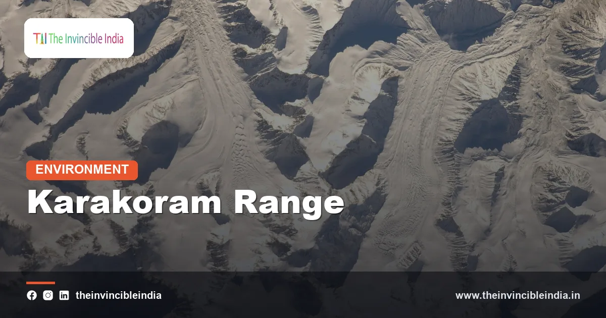
The Karakoram Range is the great glaciated mountain system lying north of the main Himalaya, a savage wall of rock and ice that holds K2, the second-highest mountain on Earth, and some of the longest glaciers found anywhere outside the polar regions. It stretches for roughly 500 kilometres in a north-west to south-east sweep across the borders of Pakistan, India and China, and its eastern flank forms the northern rim of Ladakh, the high cold-desert region at the top of the Indian map. Where the Himalaya is a green, monsoon-fed barrier, the Karakoram is a stark, dry, ice-clad fortress, and that contrast makes it one of the most fascinating landscapes in physical geography.
For Indian readers the Karakoram matters for several reasons at once: it feeds the Nubra and Shyok rivers and through them the Indus, it contains the Siachen Glacier, and it is the home of an unusual scientific puzzle in which many of its glaciers have held steady while ice elsewhere has shrunk. This explainer, last reviewed on 4 November 2026, unpacks how the range formed, what it contains, why its glaciers behave oddly, and how it differs from the better-known Himalaya.
Karakoram Range at a Glance: Quick Facts
| Feature | Great glaciated mountain system north of the Himalaya and the Indus-Shyok valleys |
|---|---|
| Length | Roughly 500 km, trending north-west to south-east |
| Countries | Pakistan, India and China (a small portion extends toward Afghanistan and Tajikistan, depending on how the range is defined) |
| Highest peak | K2, about 8,611 m, the second-highest mountain in the world |
| Peaks above 8,000 m | Four: K2, Gasherbrum I, Broad Peak and Gasherbrum II |
| Highest peak in Indian-administered territory | Saser Kangri, about 7,670 m, in the Saser Muztagh of Ladakh |
| Famous glaciers | Siachen, Baltoro, Biafo, Hispar and Rimo |
| Climate | High-altitude cold desert with very low precipitation, fed mainly by winter westerlies |
| Name | From Turkic words usually translated as black gravel or black rock |
Key Takeaways
- The Karakoram Range is a roughly 500 km glaciated mountain system north of the Himalaya, shared among Pakistan, India and China, and it contains K2, the world’s second-highest peak.
- It holds four of the world’s fourteen peaks above 8,000 metres and several glaciers, including Siachen, that rank among the longest outside the polar regions.
- The range was uplifted by the same India-Eurasia collision that built the Himalaya, but it sits further north on older, harder crystalline rock including granite.
- The Karakoram anomaly is the observation that many of its glaciers were stable or even slightly gaining mass in the early twenty-first century, while most Himalayan glaciers were retreating; the cause and the future of this behaviour are still debated.
- Its location in the rain shadow of the Himalaya makes it a cold desert, where snow comes mostly from winter westerly storms rather than the summer monsoon.
- Meltwater from the Karakoram flows into the Indus system, supporting agriculture, hydropower and drinking water for millions of people downstream in Ladakh and Pakistan.
Where exactly is the Karakoram Range?
The Karakoram lies in the far north-west of the Indian subcontinent, in the angle where the borders of Pakistan, India and China meet, and it runs roughly parallel to the Himalaya on its northern side. To the south it is separated from the Ladakh and Zanskar ranges by the long trough of the Indus and Shyok valleys. To the north it is bounded by the Shaksgam and Yarkand drainage and by the vast Kunlun mountains beyond. To the east it merges with the edge of the Tibetan plateau, and in the west it approaches the Hindu Kush and the Pamirs, forming part of the great knot of mountains often called the roof of the world.
Most of the range, including K2, Broad Peak and the Gasherbrum group, lies in Gilgit-Baltistan, an area administered by Pakistan but claimed by India as part of Jammu and Kashmir and Ladakh. A smaller but significant eastern part lies in the Indian-administered Union Territory of Ladakh, where it includes the Saser Muztagh, the Siachen Glacier, the Nubra valley and the Karakoram Pass. A further section, including the Shaksgam valley and the northern slopes, is under Chinese administration. Because of these overlapping claims, sources sometimes differ on exactly what share of the Karakoram belongs to each country, so this article describes the range as a physical system rather than a political one.
The Karakoram Pass, at roughly 5,500 metres, was historically one of the highest caravan crossings in the world. For centuries traders carried goods between Leh and Yarkand across it, along a route so high and cold that the path was said to be marked by the bones of fallen pack animals. The pass is no longer in regular use, but it remains an important marker of the range’s eastern end in Indian geography.
How was the Karakoram formed?
The Karakoram was formed by the collision of the Indian plate with the Eurasian plate, which began roughly 50 million years ago and is still going on today. As the Indian plate pushed north, the crust at the plate edge crumpled, thickened and rose, producing the whole Himalayan-Tibetan mountain complex. The Karakoram represents the northern, more deeply buried and more intensely heated part of this collision zone, which is why its core is made mostly of crystalline rocks such as granite and metamorphic gneiss rather than the folded sedimentary layers that dominate parts of the lower Himalaya.
A central feature is the Karakoram Batholith, a huge mass of granite that cooled from molten rock deep underground and was later lifted to the surface. Granite is hard and resists weathering, which helps explain the steep, jagged, tower-like peaks that characterise the range, as well as the huge cliffs and spires seen around Baltoro. The range is also cut by the Karakoram Fault, a major strike-slip fault that runs for many hundreds of kilometres through the region and along which the crust on either side is thought to slide horizontally. The speed of movement along this fault is an active topic of research, and scientists disagree on exactly how it fits into the larger tectonic picture.
Uplift continues today. The region is seismically active, and its steep slopes, loose debris and glacial ice combine to make landslides, avalanches and rock falls frequent events. The same forces that keep the mountains high also keep them unstable.
Which are the highest peaks of the Karakoram?
The highest peak of the Karakoram is K2, at about 8,611 metres, making it the second-highest mountain on Earth after Mount Everest. The name K2 comes from the 19th-century Great Trigonometrical Survey, in which surveyors labelled the Karakoram peaks K1, K2 and so on in order of survey; K2 simply kept its survey label. It is known locally as Chogori, and it is famed among mountaineers for its steep pyramidal shape and extreme difficulty, with a reputation for weather and avalanche risks that is considered harsher than that of Everest.
Besides K2, three more Karakoram peaks rise above 8,000 metres: Gasherbrum I, Broad Peak and Gasherbrum II. In total the range holds a remarkable number of summits above 7,000 metres, far more per unit of area than most mountain regions. Among them are Masherbrum, Gasherbrum IV, the Muztagh Tower and the Trango Towers, which are celebrated among climbers for some of the largest granite walls on the planet.
In Indian-administered territory the highest peak is Saser Kangri, at roughly 7,670 metres, in the Saser Muztagh north of Leh. It is part of the Karakoram system, and the Siachen Muztagh and Rimo Muztagh sub-ranges lie close by. Rimo, a cluster of peaks above 7,000 metres, feeds the Rimo glacier, which is regarded as the source area of the Shyok river system. In general, the Indian portion is less famous with the climbing world than the Pakistani Baltoro region, partly because access has been restricted for security reasons.
How big are the glaciers of the Karakoram?
The Karakoram contains some of the largest and longest mountain glaciers in the world, and roughly a third of the high range is thought to be covered by ice, according to widely cited estimates. Because the mountains are so high, many of these glaciers begin at altitudes above 5,000 metres, where snow rarely melts, and flow down for tens of kilometres. The famous glaciers include Siachen, Baltoro, Biafo, Hispar, Batura and Rimo. Together with the glaciers of the Himalaya, Hindu Kush and Tibetan plateau, they make up what is often described as the Third Pole, the largest store of ice outside the Arctic and Antarctic.
The Baltoro and Biafo glaciers are each around 60 kilometres long, and the Biafo and Hispar glaciers meet at a high pass to form one of the longest continuous glacier systems outside the polar regions, a route of well over a hundred kilometres that trekkers can walk. Many Karakoram glaciers are covered in a thick blanket of rock debris in their lower reaches. This debris, which falls from the steep valley walls, insulates the ice beneath it and slows melting, which is one reason the glacier tongues can stretch far down into warm valleys.
Some Karakoram glaciers are of a special type called surge-type glaciers. For years they move slowly, then suddenly accelerate to many times their normal speed over a few months, advancing sharply down the valley before settling again. Such surges can dam rivers and create temporary lakes that later burst, causing floods. Lake outburst floods from ice-dammed lakes have affected valleys such as Hunza and Shyok in the past, which is why monitoring of these glaciers is considered important for downstream safety.
What is the Siachen Glacier and why does it matter?
The Siachen Glacier is the longest glacier in the Karakoram and one of the longest outside the polar regions, running for roughly 70 kilometres or more in the eastern Karakoram of Indian-administered Ladakh. It begins near Indira Col at an altitude of about 5,700 metres and descends to a snout at around 3,600 metres, where it gives rise to the Nubra river. The name Siachen is generally explained as meaning the place of wild roses in the Balti language, an ironic label for a landscape of ice and rock.
Siachen is best known as the highest battlefield in the world. Military forces of India and Pakistan have been stationed on or around the glacier since 1984, and the area is notorious for extreme cold, avalanches, crevasses and altitude sickness, which cause far more casualties than combat. A ceasefire along the line has held since 2003, though the troop presence continues. From an environmental point of view, the long military presence has left waste and pollution on a fragile high-altitude glacier, and scientists and conservationists have repeatedly raised the idea of treating the region as a demilitarised zone or a peace park, though such proposals have not been adopted.
Siachen is also a key hydrological resource. Its meltwater feeds the Nubra river, which joins the Shyok and then the Indus, and so contributes to the water supply of Ladakh and the wider Indus basin. Studies using satellite data have tried to measure whether Siachen is shrinking, and several have reported a slow overall thinning and retreat in recent decades, even as other Karakoram glaciers behave differently. The picture is therefore not uniform across the range.
What is the Karakoram anomaly?
The Karakoram anomaly is the finding that many glaciers in the central Karakoram were stable, or even gaining mass, in the early 2000s, while most glaciers across the Himalaya and the rest of the world were losing ice. The idea was highlighted by the glaciologist Kenneth Hewitt in the mid-2000s, after he noticed that Karakoram glaciers were thickening and advancing in some places when satellite and field studies showed the opposite elsewhere. Later satellite measurements broadly supported the idea, though the exact size of the mass gain varied from study to study.
Scientists have proposed several explanations, and none is considered settled. One idea is that more snow falls on the high Karakoram in winter, delivered by westerly weather systems, which offsets melting. Another is that summers are relatively cool and cloudy at altitude. A third hypothesis suggests that expanded irrigation in the Indus plains may have cooled the summer air and strengthened the cloud cover. The thick debris cover and the high elevation of the ice also play a role. Because these ideas are still being tested, it is best to treat them as hypotheses rather than established causes.
The anomaly is not permanent protection. Several recent studies suggest that the anomaly is weakening or that glaciers in the region are starting to thin as warming continues, and the situation varies from sub-range to sub-range. Scientists generally caution that the Karakoram is not immune to climate change, and the stability seen in some glaciers should not be read as a sign that the water future of the Indus is secure.
Why is the Karakoram a cold desert?
The Karakoram is a cold desert because the Himalaya to its south block most of the summer monsoon, leaving the range in a rain shadow with very little rain but a great deal of cold. Moist air from the Bay of Bengal and the Arabian Sea loses most of its water on the southern slopes of the Himalaya, and what reaches Ladakh and the Karakoram is thin and dry. As a result, the valleys of Leh and Nubra receive only on the order of a hundred millimetres of precipitation a year, comparable to many true deserts, and much of it falls as snow.
Most of the snow that feeds the high Karakoram glaciers arrives in winter and spring through western disturbances, which are storm systems that travel eastwards from the Mediterranean region. This is a major difference from the Eastern Himalaya, where the summer monsoon is the principal source of snowfall. At great heights, snow also arrives in summer, but the dominant pattern is winter accumulation.
Temperatures swing widely between day and night and between seasons. Winter lows in Ladakh’s valleys fall far below freezing, and on the high glaciers the air is thin and bitterly cold throughout the year. Vegetation in the lower valleys is sparse, confined to irrigated oases along the river terraces where villages grow barley, wheat, apricot and other crops using glacier-fed channels. Above these oases the landscape is bare rock, scree and ice.
Which rivers rise in the Karakoram?
The Karakoram feeds the upper Indus system, including the Shyok, Nubra, Hunza, Shigar and Gilgit rivers, which together carry a large share of the Indus’s flow. The Shyok, whose name is often translated as river of death, rises from the glaciers of the eastern Karakoram, flows through Ladakh, and meets the Indus in Gilgit-Baltistan. The Nubra river, fed by the Siachen Glacier, joins the Shyok in the Nubra valley. Further west, the Shigar, fed by the Baltoro glacier, and the Hunza flow into the Indus.
The Indus itself does not rise in the Karakoram; its source lies on the Tibetan plateau near Mount Kailash. But the Karakoram supplies a very large share of the ice and snow melt that sustains the river during the dry months. This glacier-fed flow is particularly valuable for downstream farming in the Indus plains in the late spring and summer, before the monsoon rains arrive. Because the Indus system is shared among India, Pakistan and China, the health of Karakoram glaciers is a matter of regional water security, not just local geography.
What wildlife lives in the Karakoram?
The Karakoram supports a hardy cold-desert community that includes the snow leopard, Himalayan ibex, Ladakh urial, blue sheep, Tibetan wolf and many high-altitude birds. In Indian territory, much of this area is covered by the Karakoram (Nubra-Shyok) Wildlife Sanctuary in Ladakh, which protects a large high-altitude landscape of glaciers, rock and arid valleys. Snow leopards, the apex predators of the region, hunt wild sheep and goats on the steep slopes, and the area is regarded as important for the species.
Birdlife includes the lammergeier, golden eagle, snow cock and chukar partridge, along with migrants that cross the passes. In the Nubra valley, a small population of double-humped Bactrian camels, descended from animals once used on the Silk Route caravans, is a well-known sight on the sand dunes near Hunder. These animals are a reminder that the Karakoram was once a living highway between India and Central Asia.
Plant life is sparse and adapted to the cold and dryness: low shrubs, cushion plants, willow and sea buckthorn along stream beds, and hardy grasses on the slopes. Sea buckthorn, which grows in the Nubra and other Ladakh valleys, is valued locally for its berries and for stabilising sandy soil.
How is the Karakoram different from the Himalaya?
The Karakoram differs from the Himalaya in being higher on average, more heavily glaciated, drier and made of harder crystalline rock, while the Himalaya is wetter and greener on its southern side. The table below sets out the main contrasts.
| Aspect | Karakoram | Himalaya |
|---|---|---|
| Position | North-west, beyond the Indus-Shyok trough | South of the Indus-Tsangpo line, forming the main arc |
| Highest peak | K2, about 8,611 m | Mount Everest, about 8,849 m |
| Glaciation | Very heavy; many of the longest glaciers outside the poles | Substantial but mostly shorter glaciers; generally retreating |
| Main precipitation source | Winter western disturbances | Summer monsoon in the east and centre |
| Dominant rock | Granite and other crystalline rock | A mix of crystalline, metamorphic and sedimentary rocks |
| Landscape character | Dry, stark, snow and rock | Forested and green on southern slopes |
| Glacier behaviour | Anomalous stability in the central part, with surge-type glaciers | Widespread retreat and thinning |
One simple way to remember the difference is that the Himalaya is a monsoon mountain and the Karakoram is a westerlies mountain. The two ranges share a common origin, but their positions relative to moisture-bearing winds have given them very different faces.
What threatens the Karakoram?
The main threats to the Karakoram are climate change, glacier-related hazards, human pressure from tourism and military activity, and the geopolitical difficulty of managing a shared, contested landscape. Even though some glaciers have resisted warming so far, the long-term outlook is uncertain, and meltwater timing and quantity could change in ways that affect the Indus basin.
Glacial lake outburst floods and glacier surges are particular risks. When a surging glacier blocks a valley or a moraine-dammed lake bursts, the resulting flood can destroy fields, roads and bridges far downstream. Landslides and avalanches add to the hazards, especially in a region with frequent earthquakes. Black carbon and dust that settle on the ice can darken the surface and speed melt, though the importance of this effect in the Karakoram compared to elsewhere is still being measured.
Human pressures include mountaineering and trekking waste, particularly on the Baltoro route, and the environmental footprint of long-term military deployment on glaciers like Siachen. Heavy-lift infrastructure, road building and tourism growth in Ladakh also add stress to a fragile high-altitude ecosystem. Careful waste management, better monitoring and regional scientific cooperation across borders are widely seen as the most practical responses.
Bottom Line
The Karakoram Range is the Himalaya’s cold, dry and ice-heavy northern neighbour: a 500 km wall of granite that holds K2, four peaks above 8,000 metres, the Siachen Glacier and a famous glacier puzzle known as the Karakoram anomaly. It is a cold desert watered by winter storms, a source of the Indus system, and a fragile, shared landscape whose future depends on a changing climate and on cooperation across borders. For India, it is both the frontier of Ladakh and a vital water tower.
Frequently Asked Questions
Is K2 in India?
No. K2 stands in the Karakoram on the border between Pakistan-administered Gilgit-Baltistan and China, though India claims Gilgit-Baltistan as part of its territory. The highest Karakoram peak in Indian-administered Ladakh is Saser Kangri.
What does Karakoram mean?
The name comes from Turkic words usually translated as black gravel or black rock. It is thought to refer to the dark scree and rock of the Karakoram Pass.
What is the difference between the Karakoram and the Himalaya?
The Karakoram lies north of the Himalaya, is more heavily glaciated, receives most of its snow from winter western disturbances and is made largely of hard crystalline rock. The Himalaya is fed by the summer monsoon and is greener on its southern slopes.
How long is the Siachen Glacier?
Siachen is roughly 70 kilometres long or more, depending on how it is measured, making it one of the longest glaciers outside the polar regions. It feeds the Nubra river in Ladakh.
What is the Karakoram anomaly?
It is the observation that many glaciers in the central Karakoram were stable or slightly gaining mass in the early 2000s while most other glaciers were retreating. The causes are still debated, and recent studies suggest the effect may be weakening.
Which Indian states or regions include the Karakoram?
The Indian-administered part of the Karakoram lies in the Union Territory of Ladakh, including the Saser Muztagh, the Nubra valley, the Siachen Glacier and the Karakoram Pass. It does not extend into any Indian state.
{“@context”:”https://schema.org”,”@graph”:[{“@type”:”FAQPage”,”mainEntity”:[{“@type”:”Question”,”name”:”Is K2 in India?”,”acceptedAnswer”:{“@type”:”Answer”,”text”:”No. K2 stands in the Karakoram on the border between Pakistan-administered Gilgit-Baltistan and China, though India claims Gilgit-Baltistan as part of its territory. The highest Karakoram peak in Indian-administered Ladakh is Saser Kangri.”}},{“@type”:”Question”,”name”:”What does Karakoram mean?”,”acceptedAnswer”:{“@type”:”Answer”,”text”:”The name comes from Turkic words usually translated as black gravel or black rock. It is thought to refer to the dark scree and rock of the Karakoram Pass.”}},{“@type”:”Question”,”name”:”What is the difference between the Karakoram and the Himalaya?”,”acceptedAnswer”:{“@type”:”Answer”,”text”:”The Karakoram lies north of the Himalaya, is more heavily glaciated, receives most of its snow from winter western disturbances and is made largely of hard crystalline rock. The Himalaya is fed by the summer monsoon and is greener on its southern slopes.”}},{“@type”:”Question”,”name”:”How long is the Siachen Glacier?”,”acceptedAnswer”:{“@type”:”Answer”,”text”:”Siachen is roughly 70 kilometres long or more, depending on how it is measured, making it one of the longest glaciers outside the polar regions. It feeds the Nubra river in Ladakh.”}},{“@type”:”Question”,”name”:”What is the Karakoram anomaly?”,”acceptedAnswer”:{“@type”:”Answer”,”text”:”It is the observation that many glaciers in the central Karakoram were stable or slightly gaining mass in the early 2000s while most other glaciers were retreating. The causes are still debated, and recent studies suggest the effect may be weakening.”}},{“@type”:”Question”,”name”:”Which Indian states or regions include the Karakoram?”,”acceptedAnswer”:{“@type”:”Answer”,”text”:”The Indian-administered part of the Karakoram lies in the Union Territory of Ladakh, including the Saser Muztagh, the Nubra valley, the Siachen Glacier and the Karakoram Pass. It does not extend into any Indian state.”}}]}]}


