

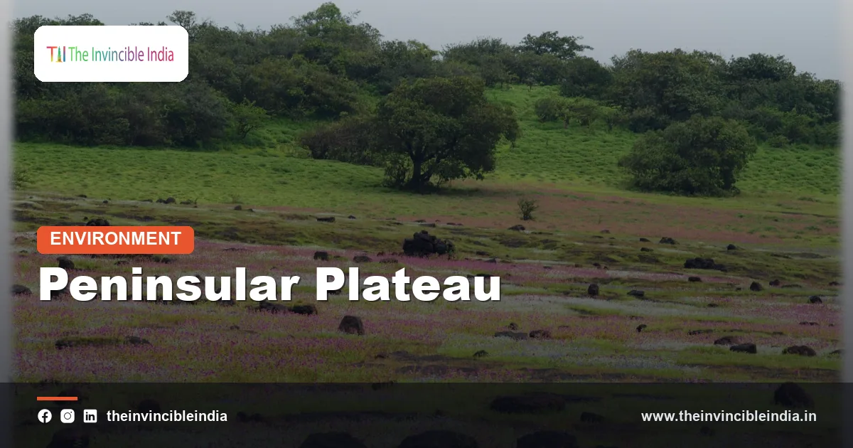
The peninsular plateau is India’s vast, ancient tableland of hard crystalline and volcanic rock, a triangular block that makes up the southern and central heart of the country and is the oldest and most stable part of the Indian landmass. Stretching from the Aravalli hills and the Gangetic plain in the north down to the southern tip at Kanyakumari, it is bordered on the west by the Western Ghats and on the east by the Eastern Ghats, and it holds many of the country’s richest minerals, its black cotton soils and a large share of its dry forests and wildlife. Last reviewed: 4 November 2026.
For most Indians the plateau is simply “the Deccan” or “central India”, yet it is one of the most geologically important regions in South Asia. Its rocks were part of the ancient southern supercontinent Gondwana, and they have been weathering, eroding and quietly rising and falling for hundreds of millions of years. This explainer sets out what the peninsular plateau is, how it formed, how it divides into regions, and why it matters for water, farming, minerals and conservation.
Quick Facts: The Peninsular Plateau at a Glance
| Feature | Triangular tableland of ancient crystalline rock and later lava, south of the Indo-Gangetic plain |
|---|---|
| Approximate area | Roughly 1.6 million square kilometres, about half of India’s land |
| Typical elevation | Mostly 300 to 900 metres above sea level, with higher ranges on the edges |
| Main divisions | Central Highlands (north) and the Deccan Plateau (south), plus the Chotanagpur and north-eastern extensions |
| Western boundary | Western Ghats, close to the Arabian Sea |
| Eastern boundary | Eastern Ghats, a broken chain facing the Bay of Bengal |
| Rock types | Granite, gneiss, schist, sandstone and the basalt of the Deccan Traps |
| Characteristic soils | Black (regur), red, yellow and laterite soils |
| Major rivers | Godavari, Krishna, Kaveri and Mahanadi flow east; Narmada and Tapi flow west |
Key Takeaways
- The peninsular plateau is India’s oldest and most stable landmass, made largely of Precambrian rock that has not been folded by mountain-building for a very long time.
- It is divided into the Central Highlands in the north and the Deccan Plateau in the south, separated broadly by the Narmada and Satpura belt.
- Its rock is rich in iron ore, coal, manganese, bauxite and mica, which is why India’s heavy industry grew up around its edges.
- The Deccan Traps, a huge sheet of lava erupted about 66 million years ago, gave the plateau its black cotton soil and flat-topped hills.
- Most large peninsular rivers flow east into the Bay of Bengal, while only the Narmada and Tapi drain west through rift valleys.
- The plateau’s dry forests, hill ranges and tiger reserves make it a major refuge for Indian wildlife, even as mining and farming press in.
What Is the Peninsular Plateau of India?
The peninsular plateau is the largest of India’s physiographic divisions, an irregular triangle of upland that rises gently above the coastal plains and slopes broadly from west to east. Unlike the young, folded Himalaya or the soft sediments of the northern plains, it is built of old, hard rock that has been exposed at the surface for a very long time.
Geographers describe it as a “tableland” because much of its surface is a gently rolling upland cut into steps by rivers, with occasional flat-topped hills and low ranges standing above it. The word “plateau” can mislead, since the region is not a single flat sheet. It contains dry basins, river valleys, rocky ridges, ravines and forested hills, and its altitude varies from a few hundred metres in the east to well over a thousand along parts of the western edge.
The plateau covers all or part of many states, including Madhya Pradesh, Maharashtra, Karnataka, Telangana, Andhra Pradesh, Chhattisgarh, Jharkhand, Odisha, Tamil Nadu, Kerala, Rajasthan and Gujarat. Its apex roughly points to the south, and the high ranges of the Western and Eastern Ghats meet near the Nilgiri hills.
How Did the Peninsular Plateau Form?
The peninsular plateau began as part of the ancient supercontinent Gondwana, and its core rocks date back billions of years to the Precambrian era. Over those immense stretches of time, these rocks were pressed, heated and recrystallised into granite, gneiss and schist that form the stable foundations geologists call cratons.
Around 100 to 150 million years ago Gondwana began to break apart, and the Indian plate separated and drifted northward, eventually colliding with Asia and raising the Himalaya. During that long journey the plateau stayed relatively rigid. It was tilted, faulted and uplifted along its edges, but not crumpled into folded mountains the way the northern margin of the plate was.
Two later events shaped its look. First, as the plate moved over a hot region of the mantle roughly 66 million years ago, enormous eruptions poured basaltic lava across the west and centre, building the Deccan Traps. Second, the western edge was uplifted and tilted, producing the steep escarpment of the Western Ghats and giving the plateau its general eastward slope, which explains why most major peninsular rivers run toward the Bay of Bengal.
How Is the Peninsular Plateau Divided?
The peninsular plateau is usually divided into two main parts, the Central Highlands in the north and the Deccan Plateau in the south, with several smaller extensions around them. The dividing zone runs roughly along the Narmada rift valley and the Satpura Range, which stand between the northern and southern halves.
The Central Highlands lie north of the Narmada and include the Malwa Plateau, the Bundelkhand upland, the Baghelkhand plateau and the rugged Aravalli remnants on the north-west flank. Their rivers, such as the Chambal, Betwa and Ken, drain northward and eastward to join the Yamuna and Ganga, which shows how the northern part of the plateau tilts toward the plains.
The Deccan Plateau lies south of the Satpura and Mahadeo hills and is bounded by the two Ghats. Locally it is known by names such as the Maharashtra plateau, the Karnataka plateau and the Telangana plateau. Further north-east, the Chotanagpur Plateau in Jharkhand and the Meghalaya (Shillong) Plateau are extensions of the same ancient block, the latter separated from the main mass by the Garo-Rajmahal gap, a break in the upland filled with river sediment.
What Are the Main Regions of the Peninsular Plateau?
The main regions are the Malwa, Bundelkhand, Baghelkhand, Chotanagpur, Maharashtra, Karnataka and Telangana plateaus, each with its own rocks and character. Seeing them together shows how varied the “flat” interior really is.
| Region | Where it lies | Defining features |
|---|---|---|
| Malwa Plateau | Western Madhya Pradesh and south-east Rajasthan | Basalt-based black soil, cotton and soybean farming, gentle rolling land |
| Bundelkhand | Between Madhya Pradesh and Uttar Pradesh | Old granite and gneiss, rocky ridges, scant rainfall and recurrent water stress |
| Chotanagpur Plateau | Jharkhand and neighbouring states | Mineral-rich uplands with coal, iron ore and mica; source of several rivers |
| Maharashtra Plateau | Western Deccan | Deccan Trap lava, flat-topped hills, deep black soil |
| Karnataka Plateau | Southern interior | Granite hills, red soils, coffee-growing hill belt in the west |
| Telangana Plateau | Central Deccan | Ancient granite, rocky outcrops, tanks for irrigation |
What Are the Western and Eastern Ghats?
The Western and Eastern Ghats are the two mountain-like edges of the peninsular plateau, and they differ sharply in height, continuity and character. Together they frame the plateau like the sides of a triangle and control how rain reaches its interior.
The Western Ghats run for roughly 1,600 kilometres along the Arabian Sea coast, from near the Tapi valley down to the southern tip. They are high, continuous and steep on their western face, with peaks such as Anamudi in Kerala, the highest in peninsular India at over 2,600 metres, and Doddabetta in the Nilgiris. They are a recognised global biodiversity hotspot and a UNESCO World Heritage property, home to evergreen forests, rare amphibians and many endemic species.
The Eastern Ghats are lower, more broken and more discontinuous, cut through by the Mahanadi, Godavari, Krishna and Kaveri on their way to the sea. They run along the Bay of Bengal side from Odisha through Andhra Pradesh into Tamil Nadu, reaching about 1,500 metres at points such as Mahendragiri. The two Ghats converge in the Nilgiri and Biligirirangan hills, which are a crossroads of habitats for elephants, tigers and other large wildlife.
What Are the Deccan Traps and Why Do They Matter?
The Deccan Traps are a thick, widespread sheet of basalt lava that erupted across western and central India roughly 66 million years ago, and they matter because they created the region’s black soil and distinctive stepped hills. The name “trap” comes from a Swedish word for staircase, describing the terraced look that repeated lava flows leave on hillsides.
At their greatest extent the lava flows are believed to have covered a very large area, and the surviving cover is still hundreds of thousands of square kilometres, thickest near the Western Ghats. Scientists link the eruptions in time to a major mass extinction at the end of the Cretaceous period, although how much volcanic activity versus other causes contributed to that extinction remains debated among researchers.
The lava weathered into regur, the black cotton soil that holds moisture exceptionally well and supports cotton, sorghum (jowar), soybean and pulses. Some striking features developed within the traps, including the Lonar crater lake in Maharashtra, a basalt crater formed by a meteorite impact, and the rock-cut caves of Ajanta and Ellora, which were carved into this very basalt.
Which Minerals Does the Peninsular Plateau Hold?
The peninsular plateau holds most of India’s metallic and coal wealth, including iron ore, manganese, bauxite, copper, mica and the bulk of the country’s coal. Its old crystalline rocks and the Gondwana sedimentary basins that lie within them are exactly the kinds of geology that concentrate minerals.
The Chotanagpur region of Jharkhand, together with parts of Odisha and Chhattisgarh, is the core of India’s mining belt, famous for coal, iron ore and mica. This concentration of resources is why steel plants and heavy industry clustered in towns such as Jamshedpur, Bokaro, Rourkela and Bhilai. Further south, Karnataka and Andhra Pradesh contribute iron ore, manganese and, historically, gold from the Kolar fields. The Panna belt in Madhya Pradesh is known for its diamonds, and Rajasthan’s Aravalli belt for copper, zinc and lead.
The same wealth brings pressure. Mining and quarrying have cleared forests, polluted rivers and displaced forest communities in several districts. Balancing extraction against the forests and tribal homelands that sit above these deposits is one of the persistent debates in Indian environmental policy.
Why Do Peninsular Rivers Mostly Flow East?
Peninsular rivers mostly flow east because the plateau tilts gently toward the Bay of Bengal, with the Western Ghats acting as the main watershed close to the western coast. Rain that falls on the western flank, heavy as it is, therefore runs quickly down short, steep west-flowing streams, while the interior drains slowly across the entire plateau to the east.
The Godavari, Krishna, Kaveri and Mahanadi are the great east-flowing rivers, rain-fed and seasonal, with broad deltas on the east coast that are among the country’s most productive farmland. The Narmada and Tapi are the main exceptions. They flow west through narrow rift valleys, or faults, in the rock, and reach the Arabian Sea through estuaries rather than deltas.
Because these rivers depend on monsoon rain rather than Himalayan snowmelt, they swing between floods and low flow, and tank and reservoir systems became vital long ago. Dams such as Nagarjuna Sagar and Sardar Sarovar, and countless small irrigation tanks in the Telangana and Tamil Nadu uplands, are responses to this uneven supply.
What Soils and Climate Does the Plateau Have?
The plateau has a mix of black, red, yellow and laterite soils and a mostly tropical, semi-arid to sub-humid climate shaped by the monsoon and the rain shadow of the Western Ghats. Rainfall is heavy along the western slopes but falls sharply on the interior, so large stretches of the Deccan receive only modest, unreliable rain.
Black soil, from the Deccan lava, is clayey, rich in nutrients and moisture-retentive, and swells and cracks with the seasons. Red and yellow soils, formed on granite and gneiss, are lighter and less fertile, and respond well to irrigation and fertiliser. Laterite soils, found on the high-rainfall edges, are leached and best suited to plantation crops such as cashew, coffee and rubber.
This variety supports a wide range of farming: cotton, sugarcane, millets, pulses and oilseeds on the black soils; groundnut and ragi on the red soils; and coffee, tea, spices and rubber on the wetter hill slopes. Dry-land farming and drought recur as problems, particularly in the rain-shadow districts of Maharashtra, Karnataka and Telangana.
What Wildlife and Forests Live on the Plateau?
The plateau supports mostly tropical dry and moist deciduous forest, scrub and grassland, and it shelters tigers, leopards, sloth bears, elephants, gaur and a huge diversity of birds. Its forests are less lush than those of the Western Ghats or Northeast, but they cover large connected areas that are crucial for big carnivores.
Central India, in particular, is one of the world’s most important tiger landscapes, with the Satpura, Maikal and Vindhya hills linking reserves in Madhya Pradesh, Maharashtra and Chhattisgarh. Sal forests dominate the east, teak and bamboo the centre and west, and thorny scrub the drier interior. The Western Ghats on the plateau’s edge, by contrast, hold evergreen and semi-evergreen forests with many species found nowhere else.
These habitats are fragmented by highways, mines, irrigation canals and expanding farmland. Wildlife corridors between reserves have therefore become a central concern for conservation planners, since tigers and elephants cannot survive in isolated patches alone.
What Threats Does the Peninsular Plateau Face?
The main threats to the peninsular plateau are mining, deforestation, groundwater depletion, soil degradation and the fragmentation of wildlife habitat. Because the plateau is relatively dry and its rock holds limited groundwater, many areas are especially sensitive to overuse.
Hard-rock aquifers recharge slowly, so heavy borewell pumping for sugarcane and other thirsty crops can drain water tables quickly. Overgrazing, heavy fertiliser use and erosion damage the thin red soils, while open-cast mining leaves scars and dust over forested districts. Climate change adds new stress, as warming and more erratic monsoon rainfall raise the risk of drought in the rain-shadow belt and of intense bursts of rain elsewhere.
Responses include watershed management, check dams, drip irrigation, reforestation, compensatory afforestation requirements and tighter rules on mining in sensitive forest areas, although enforcement varies widely from state to state.
Bottom Line
The peninsular plateau is the old, hard-rock core of India, a tilted tableland framed by the Ghats, built from ancient crystalline rock and the Deccan lava, and rich in minerals, black soils and dry forest. Understanding it helps explain why India’s rivers run east, why its interior is dry, where its mines and steel towns sit, and why central India’s forests are so central to tiger and elephant conservation. Its stable crust makes it far less prone to major earthquakes than the Himalaya, and protecting its water, soil and forests matters as much as exploiting its minerals.
Frequently Asked Questions
Why is the peninsular plateau called the oldest part of India?
Its core rocks formed in the Precambrian era, over a billion years ago, and have been stable ever since, unlike the young Himalaya. Parts of it were once joined to other continents in the supercontinent Gondwana.
What is the difference between the Deccan Plateau and the Central Highlands?
The Central Highlands lie north of the Narmada and Satpura belt and drain mainly toward the Ganga system. The Deccan Plateau lies to the south, is bounded by the two Ghats and drains mostly east into the Bay of Bengal.
Why are the peninsular plateau’s rivers rain-fed rather than snow-fed?
The plateau has no large glaciers or permanent snow, so its rivers depend on monsoon rain for their flow. As a result, they swell in the rainy season and shrink or even run dry in summer.
What is black cotton soil and where does it occur?
Black cotton soil, or regur, is a moisture-retaining clay soil formed from weathered Deccan basalt. It is found mainly in Maharashtra, Madhya Pradesh, Gujarat, Karnataka and Telangana and is ideal for cotton.
Is the peninsular plateau prone to earthquakes?
It is much more stable than the Himalaya, so strong earthquakes are rare. Moderate quakes do occur along old faults, as in the 1993 Latur event, but the risk is lower than in the north.
Which minerals are most associated with the peninsular plateau?
The plateau is rich in coal, iron ore, manganese, bauxite, copper and mica, concentrated in Jharkhand, Odisha, Chhattisgarh, Karnataka and Madhya Pradesh. These deposits support India’s steel, power and aluminium industries.
{“@context”:”https://schema.org”,”@graph”:[{“@type”:”FAQPage”,”mainEntity”:[{“@type”:”Question”,”name”:”Why is the peninsular plateau called the oldest part of India?”,”acceptedAnswer”:{“@type”:”Answer”,”text”:”Its core rocks formed in the Precambrian era, over a billion years ago, and have been stable ever since, unlike the young Himalaya. Parts of it were once joined to other continents in the supercontinent Gondwana.”}},{“@type”:”Question”,”name”:”What is the difference between the Deccan Plateau and the Central Highlands?”,”acceptedAnswer”:{“@type”:”Answer”,”text”:”The Central Highlands lie north of the Narmada and Satpura belt and drain mainly toward the Ganga system. The Deccan Plateau lies to the south, is bounded by the two Ghats and drains mostly east into the Bay of Bengal.”}},{“@type”:”Question”,”name”:”Why are the peninsular plateau’s rivers rain-fed rather than snow-fed?”,”acceptedAnswer”:{“@type”:”Answer”,”text”:”The plateau has no large glaciers or permanent snow, so its rivers depend on monsoon rain for their flow. As a result, they swell in the rainy season and shrink or even run dry in summer.”}},{“@type”:”Question”,”name”:”What is black cotton soil and where does it occur?”,”acceptedAnswer”:{“@type”:”Answer”,”text”:”Black cotton soil, or regur, is a moisture-retaining clay soil formed from weathered Deccan basalt. It is found mainly in Maharashtra, Madhya Pradesh, Gujarat, Karnataka and Telangana and is ideal for cotton.”}},{“@type”:”Question”,”name”:”Is the peninsular plateau prone to earthquakes?”,”acceptedAnswer”:{“@type”:”Answer”,”text”:”It is much more stable than the Himalaya, so strong earthquakes are rare. Moderate quakes do occur along old faults, as in the 1993 Latur event, but the risk is lower than in the north.”}},{“@type”:”Question”,”name”:”Which minerals are most associated with the peninsular plateau?”,”acceptedAnswer”:{“@type”:”Answer”,”text”:”The plateau is rich in coal, iron ore, manganese, bauxite, copper and mica, concentrated in Jharkhand, Odisha, Chhattisgarh, Karnataka and Madhya Pradesh. These deposits support India’s steel, power and aluminium industries.”}}]}]}


