

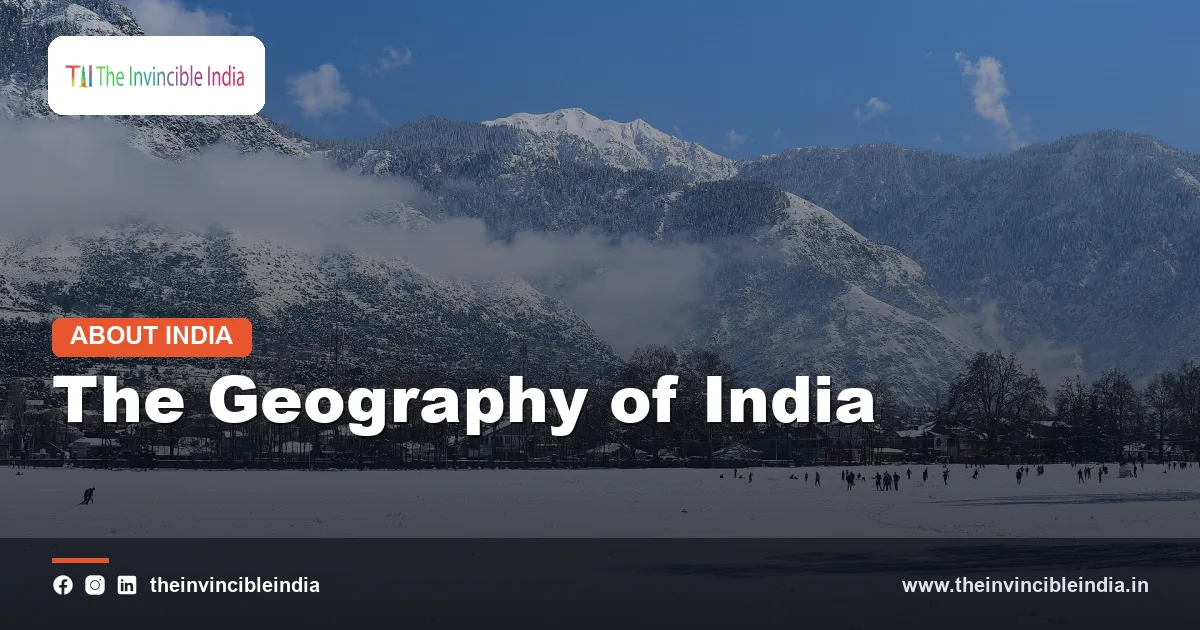
The geography of India is one of the most varied on Earth. Within a single national boundary you can find the world’s highest mountain wall, one of its most fertile river plains, a sun-baked desert, ancient rocky plateaus, rainforest-draped hills, a long palm-fringed coastline and distant island chains. This diversity is why India is often called a subcontinent rather than just a country.
Covering roughly 3.28 million square kilometres, India is the seventh-largest country in the world by area, and its landscapes have shaped everything from where people live to what they grow, eat, believe and trade. This explainer walks through India’s location and extent, its six physical divisions, its rivers, climate, soils and vegetation, its neighbours, and the ways geography has moulded Indian life.
| Feature | Details |
|---|---|
| Area | About 3.28 million sq km (seventh-largest country in the world) |
| Location | South Asia, wholly in the Northern and Eastern Hemispheres |
| Latitudinal extent (mainland) | Roughly 8 degrees N to 37 degrees N |
| Longitudinal extent | Roughly 68 degrees E to 97 degrees E |
| Tropic of Cancer | 23.5 degrees N, passing through eight states and dividing the country almost in half |
| Standard Meridian | 82.5 degrees E, the basis of Indian Standard Time (UTC+5:30) |
| Coastline | About 7,500 km including the island territories |
| Land neighbours | Pakistan, China, Nepal, Bhutan, Bangladesh and Myanmar |
| Maritime neighbours | Sri Lanka and the Maldives |
Location and Extent of India
India lies in the southern part of the Asian continent, jutting into the Indian Ocean as a great triangular peninsula. The Himalayan mountain system closes it off to the north, while the Arabian Sea lies to the west, the Bay of Bengal to the east and the open Indian Ocean to the south. This position gave India its natural separation from the rest of Asia, yet left it open to the sea routes that have linked it with Africa, West Asia and Southeast Asia for thousands of years.
North to south, east to west
The mainland stretches over roughly 29 degrees of latitude and a similar span of longitude, so the distance from the far north to Kanyakumari at the southern tip, and from the western edge of Gujarat to the eastern edge of Arunachal Pradesh, is each close to three thousand kilometres. The southernmost point of the whole country is Indira Point in the Great Nicobar island, further south than Kanyakumari.
The Tropic of Cancer
The Tropic of Cancer runs through the middle of the country, touching eight states: Gujarat, Rajasthan, Madhya Pradesh, Chhattisgarh, Jharkhand, West Bengal, Tripura and Mizoram. This places roughly the southern half in the tropical zone and the northern half in the subtropical belt, though the high Himalayas create alpine conditions well beyond what latitude alone would suggest.
Standard Meridian and time
Because the country spans about 29 degrees of longitude, local sun time differs by nearly two hours between east and west. To keep things simple, the 82.5 degrees E meridian, passing near Mirzapur in Uttar Pradesh, was chosen as the standard meridian. Indian Standard Time is 5 hours 30 minutes ahead of Greenwich Mean Time and is followed across the entire country.
Neighbours and borders
India shares long land boundaries with six countries: Pakistan and China, mainly in the north and north-west, Nepal and Bhutan along the Himalayas, Bangladesh to the east, and Myanmar in the far east. The land frontier runs over many thousands of kilometres, crossing every kind of terrain, from high mountain passes and glaciers to deserts, rivers, forests and plains.
The country also has important maritime neighbours. Sri Lanka lies to the south-east across the shallow Palk Strait and the Gulf of Mannar, a link that has fostered cultural and trade ties for centuries. The Maldives lies to the south-west in the Arabian Sea region of the Indian Ocean. India’s central position along major shipping lanes gives it a strategic maritime role, and the ocean to its south is named after it.
Six Physical Divisions at a Glance
Geographers divide the Indian landmass into six broad physical divisions. Each differs in age, rock type, relief, climate and human use. The table below gives a quick overview before the sections that follow explore each in turn.
| Physical Division | Key Features |
|---|---|
| The Himalayas | Young fold mountains in the north; Greater, Lesser and Shiwalik ranges; highest peaks; source of major rivers; climatic barrier |
| The Northern Plains | Alluvial plains of the Indus, Ganga and Brahmaputra systems; very fertile; densely populated; agricultural heartland |
| The Peninsular Plateau | Ancient, stable Deccan plateau and Central Highlands; flanked by the Western and Eastern Ghats; mineral-rich |
| The Indian (Thar) Desert | Arid sandy region in western Rajasthan; low rainfall; dunes and seasonal streams |
| The Coastal Plains | Narrow western coast and wider eastern coast; deltas, lagoons, backwaters and ports |
| The Islands | Volcanic-origin Andaman and Nicobar Islands in the Bay of Bengal; coral Lakshadweep in the Arabian Sea |
The Himalayas: The Young Mountain Wall
The Himalayas form the northern boundary of India and are among the youngest and highest mountain ranges on Earth. They were raised by the slow collision of the Indian plate with the Eurasian plate, a process that began tens of millions of years ago and still continues, which is why the region is prone to earthquakes and landslides. The name comes from Sanskrit and means the abode of snow.
Three parallel ranges
- Greater Himalaya (Himadri): the northernmost and highest range, with permanent snow and glaciers. Kanchenjunga, the highest peak lying within India, and Nanda Devi are found here.
- Lesser Himalaya (Himachal): a lower, rugged range to the south, home to hill stations such as Shimla, Mussoorie, Nainital and Darjeeling, and known for its meadows and forests.
- Shiwalik range: the outermost and youngest foothills, made of loose sediments, and separated from the Lesser Himalaya by wide valleys known as duns, such as Dehradun.
Why the Himalayas matter
The mountains act as a climatic barrier, blocking the frigid winds of Central Asia from sweeping south and trapping the moisture-laden monsoon winds so that rain falls over the plains. They are the birthplace of the great Himalayan rivers, store vast quantities of water as snow and glacial ice, and shelter exceptional biodiversity. They also hold deep cultural meaning, with pilgrimage sites, monasteries and sacred peaks across the range.
Eastern and western extensions
In the east, the mountains turn southward into the Purvanchal hills, which run through Arunachal Pradesh, Nagaland, Manipur and Mizoram along the border with Myanmar. In the north-west, the Himalayan system links with the Karakoram and other great ranges, and includes the high, cold desert landscapes of Ladakh.
The Northern Plains: India’s Fertile Heartland
South of the Himalayas lies a vast, flat, continuous belt of alluvium laid down by rivers over millions of years. These plains stretch from the Punjab region in the west to the Brahmaputra valley in Assam in the east, forming one of the most productive agricultural regions in the world. The rivers carry silt eroded from the mountains and deposit it across the lowlands, renewing the soil with every flood.
Regional subdivisions
- Punjab Plains: formed by the Indus and its tributaries, and strongly associated with wheat and rice cultivation.
- Ganga Plains: the broad core of the region, stretching across Haryana, Uttar Pradesh, Bihar and West Bengal.
- Brahmaputra Plains: the narrow, high-rainfall valley of Assam, famous for tea.
Old and new alluvium
The older alluvium, called bhangar, forms slightly raised terraces that are less affected by floods, while the newer alluvium, called khadar, lies close to the riverbeds and is replenished each year. The plains are so level that rivers meander freely and sometimes shift their courses, which is why flooding is a recurring feature of life here. The fertility of these lands explains why the plains have hosted some of the oldest settled civilisations and continue to be home to a very large share of the country’s people.
The Peninsular Plateau: An Ancient Landmass
The triangular plateau of peninsular India is one of the oldest and most stable landmasses on Earth. Its hard crystalline and volcanic rocks are much older than the Himalayas, and it was once part of the ancient southern supercontinent Gondwana. Over time the plateau has been worn down by erosion into rolling uplands, and it is a major storehouse of minerals such as iron ore, coal, manganese, bauxite and mica.
Central Highlands and Deccan
The northern part of the plateau is known as the Central Highlands and includes the Malwa plateau, the Bundelkhand uplands and the Aravalli range, one of the oldest fold mountain systems in the world, much worn down by time. The larger southern portion is the Deccan Plateau, which is tilted gently toward the east, and which is why most of the major peninsular rivers flow eastward into the Bay of Bengal. Large parts of the Deccan are covered with lava from ancient volcanic eruptions, giving rise to the Deccan Traps.
Vindhya, Satpura and the rift valleys
The Vindhya and Satpura ranges run east to west across central India. Between them lie the Narmada and Tapi rivers, which flow westward through narrow rift valleys, or fault-created troughs, into the Arabian Sea rather than eastward like most peninsular rivers. The Chota Nagpur plateau in the east is especially rich in coal and other minerals.
The Western and Eastern Ghats
- Western Ghats (Sahyadri): a continuous, steep wall running close to the western coast, catching the monsoon winds and receiving heavy rainfall. Anamudi in Kerala is the highest peak of peninsular India.
- Eastern Ghats: a lower, broken chain of hills along the eastern side, cut through by rivers such as the Godavari, Krishna and Kaveri.
The two ranges meet around the Nilgiri Hills in the south, where the Doddabetta peak is a well-known landmark.
The Indian Desert of Rajasthan
West of the Aravalli range lies the Thar, also called the Great Indian Desert, a dry and sandy expanse covering much of western Rajasthan and extending into neighbouring Pakistan. Rainfall is scanty and uncertain, summers are fiercely hot, and winter nights can be surprisingly cold. The Aravallis block the rain-bearing monsoon branch from reaching this area, which adds to its dryness.
Landscape and life
Much of the Thar is covered with shifting sand dunes, including crescent-shaped barchans, while the eastern margin is more rocky and semi-arid. The Luni is the best-known river of the region, and it is seasonal and salty in its lower reaches. Salt lakes such as Sambhar are a feature of the landscape.
Despite the harsh environment, the desert is far from empty. Hardy crops such as bajra, pulses and guar, livestock including camels and sheep, and traditional water-harvesting systems such as tankas, johads and stepwells have long sustained communities. The Indira Gandhi Canal has brought irrigation to parts of the region, changing agriculture in some districts. The desert also supports a rich cultural landscape of forts, folk music, crafts and tourism, with cities like Jaisalmer and Bikaner as well-known examples.
The Coastal Plains and Islands of India
India has a long coastline of about 7,500 kilometres counting the island territories, and the plateau is bordered on both sides by coastal plains that differ in character.
The western coastal plain
Squeezed between the Western Ghats and the Arabian Sea, the western plain is narrow and dissected by many short, fast rivers. It is traditionally divided into the Konkan coast in the north, the Kanara coast in the middle and the Malabar coast in the south. The coast has natural harbours, lagoons and the famous backwaters of Kerala, a network of interconnected lakes and canals, and it has long been a gateway for the spice trade.
The eastern coastal plain
The eastern plain is wider and flatter, with large deltas built by the Mahanadi, Godavari, Krishna and Kaveri rivers. Its southern part is known as the Coromandel Coast, and the northern parts include the Northern Circars and the Utkal coast. Shallow lagoons such as Chilika in Odisha and Pulicat on the Andhra Pradesh and Tamil Nadu border are important wetlands and bird habitats. In the far east, the Ganga-Brahmaputra delta includes the Sundarbans, the world’s largest mangrove forest region shared with Bangladesh.
The eastern coast is also more exposed to cyclones from the Bay of Bengal, while the long, sheltered western coast is home to several of the country’s major ports.
Island territories: Andaman, Nicobar and Lakshadweep
India’s island territories add another dimension to the physical geography of the country.
Andaman and Nicobar Islands
Scattered across the Bay of Bengal, this archipelago of several hundred islands is really the visible top of an undersea mountain chain, and is of volcanic and tectonic origin. The islands are covered with dense tropical forest, and the Ten Degree Channel separates the Andaman group in the north from the Nicobar group in the south. Barren Island in the Andamans is India’s only confirmed active volcano. The islands are valued for their rich marine life, coral reefs and unique indigenous communities.
Lakshadweep
Lakshadweep is a group of small coral islands in the Arabian Sea off the coast of Kerala. These are atolls and reefs built up by coral polyps, with low elevation, white sandy beaches and shallow lagoons. Their small size makes them especially vulnerable to rising sea levels, and fresh water is a precious resource. Together, the two island groups give India a large maritime presence and a vast Exclusive Economic Zone in the surrounding seas.
Rivers of India in Brief
Rivers are the arteries of Indian geography. They are usually grouped into two broad classes, Himalayan and Peninsular, and this difference follows directly from the physical divisions described above.
- Himalayan rivers: the Indus, Ganga and Brahmaputra systems are fed by both monsoon rain and melting snow and glaciers, so they carry water all year, which is why they are called perennial. They cut deep gorges in the mountains and build wide floodplains and large deltas.
- Peninsular rivers: the Godavari, Krishna, Kaveri and Mahanadi, along with the westward-flowing Narmada and Tapi, depend mainly on monsoon rain and are therefore largely seasonal, with flow that rises and falls through the year. They flow in older, shallower valleys and have fairly stable courses.
The Ganga, which rises in the Himalayas and flows eastward across the plains, is culturally and economically the most important river, while the Brahmaputra, known by other names along its course, is among the largest in terms of water volume. A separate article on the rivers of India covers their origins, tributaries and basins in much greater detail.
Climate: The Monsoon Rhythm
India has a tropical monsoon climate, a pattern in which winds reverse direction with the seasons. The word monsoon comes from an Arabic word meaning season, and the monsoon is the single most important feature of Indian weather. The country is conventionally described as having four seasons.
- Winter (roughly December to February): cool and dry across the north, with western disturbances bringing light winter rain and mountain snow to the north-west.
- Summer (roughly March to May): a period of rising heat, with hot dry winds called loo blowing across the northern plains, and thunderstorms in some regions.
- Southwest monsoon (roughly June to September): moist winds from the Indian Ocean bring the bulk of the year’s rainfall, arriving first on the Kerala coast and spreading across the country.
- Retreating monsoon (roughly October to November): a transition season of clearing skies, often with cyclonic storms along the east coast and a notable rainy season for Tamil Nadu.
Remarkable climatic variety
Though the monsoon unifies the country, regional contrasts are dramatic. Alpine and glacial conditions prevail on the high Himalayas, while Rajasthan is hot and arid. The Western Ghats and the north-east receive extremely heavy rainfall, and Meghalaya is home to places among the wettest on Earth. The coasts have a moderate, humid climate with a small difference between summer and winter. Even within a single day’s journey, one can move from desert to forest or from tropical warmth to mountain cold.
Natural Vegetation and Soils
Vegetation and soil in India closely follow the patterns of rainfall, temperature and the underlying rock.
Natural vegetation
- Tropical evergreen forests: in areas of heavy rain such as the Western Ghats, the north-east and the Andaman and Nicobar Islands.
- Tropical deciduous forests: the most widespread type, found in regions of moderate rainfall, including much of the peninsula, and the home of teak and sal.
- Thorn forests and scrub: in dry regions such as Rajasthan and parts of Gujarat and the Deccan.
- Montane forests: in the Himalayas, changing with altitude from broadleaf trees to conifers to alpine meadows.
- Mangroves: along the coasts and deltas, most famously in the Sundarbans.
Major soil types
- Alluvial soil: the most fertile and widespread, in the northern plains and coastal deltas.
- Black soil (regur): formed from volcanic rock on the Deccan plateau and excellent at holding moisture, ideal for cotton.
- Red and yellow soil: found on older crystalline rocks in the peninsula and the east.
- Laterite soil: in areas of heavy rainfall, suitable for crops like cashew and tea after careful management.
- Desert and mountain soils: sandy and arid in the west, and thin or stony in the high hills.
How Geography Shapes Indian Life
The physical geography of India is not just a backdrop; it influences nearly every dimension of national life.
Agriculture and food
Fertile alluvial plains support wheat, rice, sugarcane and pulses, black soils support cotton, hill slopes support tea, coffee and spices, and the monsoon rhythm decides the cropping calendar. Agriculture in many regions still depends heavily on the timing of the rains, which links farm output to climate in a very direct way.
Population distribution
People have settled most densely where water and fertile land are available: the Ganga plains, the river deltas and the coastal strips. By contrast, the high mountains, the desert and the dense forests of the north-east and islands are far more sparsely populated.
Culture and economy
Rivers and mountains are woven into religion, folklore and festivals. Varied terrains have produced distinct regional cuisines, clothing, housing styles and languages. Economically, mineral wealth in the plateau has supported mining and heavy industry, long coasts have enabled ports and trade, and the Himalayas provide hydropower potential and tourism. At the same time, challenges such as floods, droughts, cyclones, earthquakes and landslides remind us that geography brings risks as well as gifts.
Conclusion
From the snowfields of the Himalayas to the coral atolls of Lakshadweep, the geography of India is a story of contrasts held together by the monsoon, the river systems and a long shared history. Understanding the six physical divisions, the climate and the rivers helps explain why India’s regions look, live and farm so differently, and why the country is so often described as a continent in miniature. Last updated: 1 October 2026.
Frequently Asked Questions
How many physical divisions does India have?
India is usually divided into six physical divisions: the Himalayas, the Northern Plains, the Peninsular Plateau, the Indian (Thar) Desert, the Coastal Plains and the Islands. Each has distinct relief, geology and climate, and together they explain much of the country’s diversity.
Why is India called a subcontinent?
India is called a subcontinent because of its great size and its clear separation from the rest of Asia by the Himalayas and the surrounding seas. It contains a wide range of landforms, climates, languages and cultures, much like a small continent.
Which Indian states does the Tropic of Cancer pass through?
The Tropic of Cancer passes through eight states: Gujarat, Rajasthan, Madhya Pradesh, Chhattisgarh, Jharkhand, West Bengal, Tripura and Mizoram. It divides the country almost into two halves, with the southern part lying in the tropics.
What is the standard meridian of India?
The standard meridian of India is 82.5 degrees East, which passes near Mirzapur in Uttar Pradesh. Indian Standard Time, based on this meridian, is 5 hours and 30 minutes ahead of Greenwich Mean Time and is used across the whole country.
What is the difference between Himalayan and Peninsular rivers?
Himalayan rivers such as the Ganga, Indus and Brahmaputra are perennial because they are fed by both rain and melting snow, and they form wide plains and deltas. Peninsular rivers like the Godavari, Krishna and Kaveri depend mainly on monsoon rain, so their flow is largely seasonal.
Why is the monsoon so important to India?
The southwest monsoon brings most of the country’s annual rainfall between June and September, which supports farming, fills rivers and reservoirs, and affects the economy. Because so much agriculture depends on it, the timing and strength of the monsoon influence food production and rural incomes.
{“@context”:”https://schema.org”,”@graph”:[{“@type”:”FAQPage”,”mainEntity”:[{“@type”:”Question”,”name”:”How many physical divisions does India have?”,”acceptedAnswer”:{“@type”:”Answer”,”text”:”India is usually divided into six physical divisions: the Himalayas, the Northern Plains, the Peninsular Plateau, the Indian (Thar) Desert, the Coastal Plains and the Islands. Each has distinct relief, geology and climate, and together they explain much of the country’s diversity.”}},{“@type”:”Question”,”name”:”Why is India called a subcontinent?”,”acceptedAnswer”:{“@type”:”Answer”,”text”:”India is called a subcontinent because of its great size and its clear separation from the rest of Asia by the Himalayas and the surrounding seas. It contains a wide range of landforms, climates, languages and cultures, much like a small continent.”}},{“@type”:”Question”,”name”:”Which Indian states does the Tropic of Cancer pass through?”,”acceptedAnswer”:{“@type”:”Answer”,”text”:”The Tropic of Cancer passes through eight states: Gujarat, Rajasthan, Madhya Pradesh, Chhattisgarh, Jharkhand, West Bengal, Tripura and Mizoram. It divides the country almost into two halves, with the southern part lying in the tropics.”}},{“@type”:”Question”,”name”:”What is the standard meridian of India?”,”acceptedAnswer”:{“@type”:”Answer”,”text”:”The standard meridian of India is 82.5 degrees East, which passes near Mirzapur in Uttar Pradesh. Indian Standard Time, based on this meridian, is 5 hours and 30 minutes ahead of Greenwich Mean Time and is used across the whole country.”}},{“@type”:”Question”,”name”:”What is the difference between Himalayan and Peninsular rivers?”,”acceptedAnswer”:{“@type”:”Answer”,”text”:”Himalayan rivers such as the Ganga, Indus and Brahmaputra are perennial because they are fed by both rain and melting snow, and they form wide plains and deltas. Peninsular rivers like the Godavari, Krishna and Kaveri depend mainly on monsoon rain, so their flow is largely seasonal.”}},{“@type”:”Question”,”name”:”Why is the monsoon so important to India?”,”acceptedAnswer”:{“@type”:”Answer”,”text”:”The southwest monsoon brings most of the country’s annual rainfall between June and September, which supports farming, fills rivers and reservoirs, and affects the economy. Because so much agriculture depends on it, the timing and strength of the monsoon influence food production and rural incomes.”}}]}]}


