

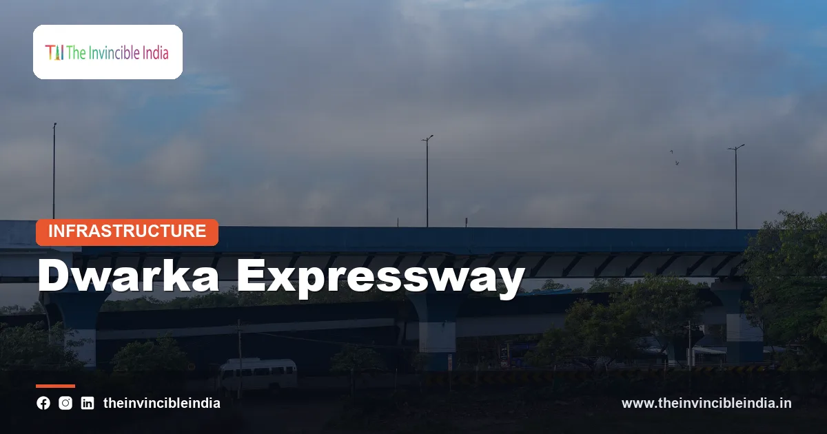
The Dwarka Expressway is a roughly 29 km access-controlled urban expressway, designated National Highway 248BB (NH-248BB), that links Shiv Murti on NH-48 near Mahipalpur in Delhi with Kherki Daula on NH-48 in Gurugram, Haryana. It was built by the National Highways Authority of India (NHAI) as a bypass for the congested Delhi-Gurugram section of NH-48 and is widely described as one of India’s first elevated urban expressways.
The Dwarka Expressway runs through the western edge of Delhi and the northern fringe of Gurugram, serving the Dwarka sub-city, the area around Indira Gandhi International Airport (IGI Airport) and the fast-growing sectors of New Gurugram. Its long single-pillar elevated sections, its tunnel and underpass stretch, and its multi-level interchanges make it a distinctive piece of urban highway engineering in India. This explainer sets out what the road is, how it is built, and why it matters. Figures are given as rounded, widely reported values and are best treated as approximate.
Quick Facts
| Attribute | Details |
|---|---|
| Official name | Dwarka Expressway (also called the Northern Peripheral Road in its Haryana section) |
| Highway number | National Highway 248BB (NH-248BB) |
| Approximate length | About 29 km (roughly 19 km in Delhi and 10 km in Haryana) |
| Start and end points | Shiv Murti (NH-48, near Mahipalpur, Delhi) to Kherki Daula (NH-48, Gurugram) |
| Type | Access-controlled, mostly 8-lane urban expressway with elevated, at-grade and underground stretches |
| Implementing agency | National Highways Authority of India (NHAI), under the Ministry of Road Transport and Highways |
| Opened to traffic | Inaugurated in March 2024 after several years of construction |
| Notable features | Long single-pillar elevated corridor, a road tunnel and underpass section, multi-level interchange at Shiv Murti, intelligent traffic management systems |
Key Takeaways
- The Dwarka Expressway is a roughly 29 km access-controlled urban expressway numbered NH-248BB that connects Shiv Murti in Delhi with Kherki Daula in Gurugram.
- The Dwarka Expressway was built by the National Highways Authority of India (NHAI) to divert traffic away from the heavily congested Delhi-Gurugram stretch of NH-48.
- The Dwarka Expressway is widely described as one of India’s first elevated urban expressways, using a long single-pillar elevated structure to save land and reduce disruption in built-up areas.
- The Dwarka Expressway includes a road tunnel and underpass section in the Delhi stretch, one of the longer urban road tunnels built in India.
- The Dwarka Expressway links the Dwarka sub-city, the IGI Airport area and New Gurugram, and connects with NH-48 at both ends.
- The Dwarka Expressway was inaugurated in March 2024, and its traffic effect depends on how well it connects with the Urban Extension Road, the Kundli-Manesar-Palwal Expressway and other corridors.
What is the Dwarka Expressway?
The Dwarka Expressway is a modern urban expressway, about 29 km long, built to carry high-speed traffic between Delhi and Gurugram without the signals and local access points of an ordinary city road. Officially numbered NH-248BB, it begins at the Shiv Murti interchange on NH-48 in south-west Delhi and ends at the Kherki Daula toll area on NH-48 in Gurugram.
The corridor has two sections of nearly equal importance. The Delhi section, about 19 km long, runs from Shiv Murti through Dwarka to the Delhi-Haryana boundary near Bijwasan. The Haryana section, about 10 km long, continues through the sectors of New Gurugram to Kherki Daula. In Haryana the alignment follows the route earlier planned as the Northern Peripheral Road (NPR), which is why both names are in use.
The expressway is designed for fast, uninterrupted movement. Access is controlled, meaning vehicles can enter and leave only at designated interchanges and slip roads, and slow-moving traffic such as two-wheelers, three-wheelers and pedestrians is kept to service roads and local streets. This is the same principle that governs other expressways in the National Capital Region (NCR).
Where does the Dwarka Expressway run?
The Dwarka Expressway runs along the western side of Delhi and the north-western side of Gurugram, forming an arc that sits between NH-48 and the outer ring of the capital region. Its route passes close to several important localities and transport nodes.
- Shiv Murti, Delhi: the eastern start of the corridor on NH-48, close to Mahipalpur and the IGI Airport approach.
- Dwarka sub-city: the corridor runs alongside Dwarka, one of Asia’s largest planned residential sub-cities, passing near several of its sectors.
- Delhi-Haryana boundary near Bijwasan: the point where the Delhi section hands over to the Haryana section.
- New Gurugram sectors: the Haryana section serves the newer residential and commercial sectors that have grown on Gurugram’s western side.
- Kherki Daula, Gurugram: the western end, where the expressway meets NH-48 again, near the Delhi-Jaipur direction of travel.
Because both ends join NH-48, the Dwarka Expressway works as a parallel relief route rather than a separate road to a new destination. A driver heading from the airport side of Delhi to Manesar, Jaipur or western Gurugram can use the expressway instead of the main NH-48 carriageway.
Why was the Dwarka Expressway built?
The Dwarka Expressway was built mainly to relieve the extreme congestion on NH-48 between Delhi and Gurugram, which carries a very large volume of commuter, freight and airport traffic every day. NH-48 is the main road corridor connecting Delhi with Gurugram, Manesar, Rajasthan and western India, and its Delhi-Gurugram section has long been one of the busiest in the country.
Several planning goals sat behind the project.
- Decongesting NH-48: an alternative route draws away part of the traffic, especially vehicles that only need to pass through the Delhi-Gurugram belt.
- Serving new residential areas: the sectors of New Gurugram and the western parts of Dwarka needed a high-capacity link to the rest of the NCR.
- Improving airport access: a direct route to the IGI Airport area helps travellers coming from Gurugram and Dwarka.
- Better regional connectivity: the expressway connects to other planned or existing corridors around Delhi, helping long-distance and freight movement bypass the city centre.
- Reducing pollution and fuel use: smoother, faster traffic generally means less time spent idling in stop-and-go queues.
Planners also recognised that Delhi and Gurugram are tightly linked economically. Large numbers of people live in one city and work in the other, so a purpose-built commuter-friendly road was seen as essential infrastructure.
Who built and manages the Dwarka Expressway?
The Dwarka Expressway was built by the National Highways Authority of India (NHAI), the statutory body under the Ministry of Road Transport and Highways (MoRTH) responsible for developing and maintaining India’s national highways. NHAI executed the project in packages, each awarded to construction contractors through competitive bidding.
The project was taken up under the Government of India’s programme for developing peripheral and economic corridors around major cities. It was funded as a national highway project, with the Haryana section on land and approvals coordinated with the state government and the Delhi section coordinated with Delhi authorities, including land-owning agencies such as the Delhi Development Authority (DDA). The overall cost is generally reported to run into several thousand crore rupees, with a figure of roughly Rs 9,000 crore or more often quoted; readers should treat this as an approximate number because costs vary with the scope counted.
Once opened, operations and maintenance of the corridor fall to NHAI, which also manages tolling, traffic monitoring and emergency response on its national highways. Day-to-day policing and traffic enforcement involve the Delhi Police and Haryana Police in their respective jurisdictions.
What makes the Dwarka Expressway an engineering first?
The Dwarka Expressway is notable because it combines an elevated urban expressway, a tunnel section and complex multi-level interchanges in a single corridor, features that are rarely seen together on an Indian highway. It is widely described as one of the first elevated urban expressways of this scale in India.
Elevated single-pillar structure
A large part of the Delhi section is carried on an elevated structure supported by a single row of pillars instead of two separate rows. A single-pillar design takes up much less ground space, which matters in a built-up area where land is scarce and expensive. The elevated deck is wide enough to carry many lanes of traffic, while the ground level below remains available for service roads, local traffic and landscaping. The elevated stretch is reported to be several kilometres long and is often described as among the longest of its kind in India.
Tunnel and underpass section
The corridor also includes a road tunnel and underpass stretch, where the carriageways go underground to pass beneath existing roads, rail lines or sensitive areas. A tunnel of roughly 3.6 km is commonly reported, making it one of the longer urban road tunnels built in India. Tunnel sections are designed with ventilation, lighting, fire safety systems and emergency exits, and they allow the expressway to avoid surface obstacles.
Multi-level interchange at Shiv Murti
The Shiv Murti end of the expressway features a multi-level interchange that handles movements between NH-48, the expressway and the roads leading toward the airport. The interchange is often described as having four levels, which lets several traffic streams cross without signals. Further interchanges along the route link the expressway to local roads, sector roads and other highways.
How is the Dwarka Expressway different from an ordinary highway?
The Dwarka Expressway differs from an ordinary highway mainly in its access control, multiple grade-separated levels and technology-driven traffic management. An ordinary national highway often has junctions at ground level, direct property access, local traffic and pedestrians, while an expressway is designed to keep through traffic moving without such interruptions.
| Feature | Ordinary highway | Dwarka Expressway |
|---|---|---|
| Access | Often open, with many local entry points | Controlled, only at designated interchanges |
| Crossings | Frequently at-grade junctions and signals | Grade-separated with flyovers, underpasses and tunnel |
| Lane layout | Commonly 2, 4 or 6 lanes | Mostly 8-lane main carriageway with service roads |
| Land use | Wide ground footprint | Compact footprint where elevated on single pillars |
| Slow traffic | Often mixed with fast traffic | Kept off the main carriageway |
| Technology | Basic signage and patrolling | Intelligent traffic management, cameras and monitoring |
The design also assumes a higher, regulated speed limit than city roads, with signage and enforcement suited to expressway driving. Service roads run alongside the main carriageway so that local movements do not mix with through traffic.
How does the Dwarka Expressway decongest NH-48?
The Dwarka Expressway decongests NH-48 by offering an alternative high-capacity route for traffic that would otherwise crowd the Delhi-Gurugram section of NH-48, so that the same journey is spread across two corridors instead of one. The effect is strongest for vehicles travelling between the airport side of Delhi and the western parts of Gurugram, or between Dwarka and the Manesar-Jaipur direction.
The mechanism is straightforward. Traffic on a highway slows when the number of vehicles approaches the road’s capacity, and the slowdown spreads backward as a queue. Adding a parallel road with its own capacity gives drivers a choice, so each road runs below its saturation point more often. The expressway also removes traffic from the toll plaza area at Kherki Daula and from the junctions near Shiv Murti and Mahipalpur.
Several factors determine how much relief is actually felt.
- Connections at both ends: relief depends on how smoothly traffic can move from the expressway onto NH-48 and other corridors.
- Demand growth: new roads in growing cities can attract additional trips, so the congestion benefit may narrow over time.
- Link roads and feeder networks: access roads from residential sectors and the pace of urban development along the route affect how much traffic uses the expressway.
- Public transport options: metro and bus services in Dwarka and Gurugram reduce the pressure on all roads.
Transport planners generally treat a road like this as one part of a wider network rather than a single solution, which is why it is usually discussed together with the Urban Extension Road and other ring and radial corridors.
How does the Dwarka Expressway connect with other corridors?
The Dwarka Expressway connects with NH-48 at both ends and is designed to link into several other important corridors of the Delhi region. These connections turn it from a local relief road into part of a larger ring-and-radial network.
- NH-48 (Delhi-Gurugram-Jaipur direction): the main corridor, joined at Shiv Murti and again at Kherki Daula.
- Urban Extension Road-II (UER-II): a planned or existing outer ring corridor in Delhi that the expressway links to, improving movement toward the north and west of Delhi.
- Kundli-Manesar-Palwal (KMP) Expressway: the Western Peripheral Expressway ring road that lets through traffic bypass the NCR entirely.
- Airport approach roads: links to IGI Airport help passengers and cargo vehicles.
- Local sector roads in Dwarka and New Gurugram: slip roads and interchanges feed residents onto the expressway.
These links matter because an expressway’s usefulness depends on where it connects. A fast road that ends in a bottleneck simply moves the queue to a new place, so connections at the ends and in the middle are part of the original planning logic.
How was the Dwarka Expressway constructed and what is its timeline?
The Dwarka Expressway was constructed in packages over several years, with approvals and bidding in the late 2010s, major building work through the early 2020s and inauguration in March 2024. The project faced challenges that are typical for large urban infrastructure, including land acquisition, utility shifting, environmental clearances and construction in a busy area.
| Stage | Approximate period | Description |
|---|---|---|
| Planning and approvals | Mid to late 2010s | Corridor alignment, Union Cabinet-level approval, land and clearance processes |
| Foundation and award of work | Around 2018-2019 | Packages awarded to contractors; construction began |
| Main construction | Around 2019-2023 | Elevated structure, tunnel and underpass, interchanges and service roads |
| Opening | March 2024 | Inauguration of the Delhi and Haryana sections |
| Post-opening | Ongoing | Link roads, finishing works, traffic management and refinements |
Dates are approximate and different sources mark stages slightly differently. The construction period overlapped with the COVID-19 pandemic, which slowed labour availability and supply chains across the country.
What technology and safety features does the Dwarka Expressway use?
The Dwarka Expressway uses intelligent traffic management and modern highway safety features, aiming to keep fast traffic safe and to respond quickly to incidents. These systems are now standard on newer Indian expressways, and the Dwarka Expressway was planned to include them.
- Intelligent Transport Systems (ITS): cameras, sensors and variable message signs help operators monitor traffic and warn drivers.
- Control centre: a central facility watches the corridor and coordinates ambulances, tow vehicles and patrols.
- Tunnel safety systems: ventilation, lighting, fire detection and evacuation arrangements for the underground section.
- Crash barriers and signage: engineered barriers, lane markings and clear signboards support high-speed driving.
- Electronic tolling readiness: national highways use FASTag-based electronic toll collection, and the same approach applies where tolls are charged.
- Landscaping and drainage: trees, rainwater management and green strips are part of the design to reduce environmental impact.
Rules on speed limits, permitted vehicles and tolling on the expressway are set by NHAI and the relevant traffic authorities and can change, so travellers should check the latest official notifications before a journey.
What does the Dwarka Expressway mean for the region?
The Dwarka Expressway matters for the region because it improves connectivity between Delhi, the airport area and Gurugram, and shapes how the western NCR is likely to grow in the coming years. Better road access usually raises the attractiveness of nearby residential and commercial areas.
Economic and real estate effects
New Gurugram and western Dwarka have seen strong interest from housing developers and businesses because of the improved connection. Reduced travel time can widen the area from which employers draw workers and make logistics cheaper. At the same time, rising land values can bring affordability pressures for existing residents.
Environmental and social considerations
Large road projects raise legitimate questions about trees felled, noise, air quality and induced traffic, and the project followed environmental clearance and compensatory planting procedures. Analysts differ on how much congestion relief new roads give over the long term, since added capacity can encourage more vehicle use. A balanced view treats the expressway as useful infrastructure whose benefits depend on complementary investment in public transport and land-use planning.
Link to national infrastructure goals
The Dwarka Expressway belongs to a broader push to build modern highways and urban expressways, a priority under the Bharatmala programme and related efforts of the Ministry of Road Transport and Highways. It is frequently cited as an example of how Indian planners are trying to fit high-capacity roads into dense cities.
Bottom Line
The Dwarka Expressway is a roughly 29 km, access-controlled NH-248BB corridor that connects Shiv Murti in Delhi with Kherki Daula in Gurugram, built by NHAI as a relief route for NH-48. Its elevated single-pillar sections, tunnel and underpass stretch, and multi-level interchanges make it a landmark of Indian urban highway engineering, while its long-term benefits depend on connecting roads and public transport. Last reviewed: 17 October 2026.
Frequently Asked Questions
How long is the Dwarka Expressway?
The Dwarka Expressway is roughly 29 km long. About 19 km lies in Delhi, from Shiv Murti to the Delhi-Haryana boundary, and about 10 km lies in Haryana up to Kherki Daula in Gurugram. These are rounded figures, and sources sometimes differ slightly on the exact split.
What is the highway number of the Dwarka Expressway?
The Dwarka Expressway is numbered National Highway 248BB, usually written as NH-248BB. The number identifies the corridor in the national highway system maintained by the National Highways Authority of India. In Haryana, the corridor is also known by its earlier name, the Northern Peripheral Road.
Where does the Dwarka Expressway start and end?
The Dwarka Expressway starts at Shiv Murti on NH-48 near Mahipalpur in Delhi and ends at Kherki Daula on NH-48 in Gurugram, Haryana. In between, it passes along the Dwarka sub-city and the sectors of New Gurugram. Both ends meet the same highway, so it works as a parallel route.
Why is the Dwarka Expressway called an elevated urban expressway?
The Dwarka Expressway is called an elevated urban expressway because a long part of its Delhi section is carried above ground on a single row of pillars. This saves land and keeps the ground level free for service roads and local traffic. It is widely described as one of the first expressways of this kind in India.
Does the Dwarka Expressway have a tunnel?
Yes, the Dwarka Expressway includes a road tunnel and underpass section in its Delhi stretch. A tunnel length of about 3.6 km is commonly reported, and it is regarded as one of the longer urban road tunnels in India. The tunnel is equipped with ventilation, lighting and fire safety systems.
Who built the Dwarka Expressway and when was it opened?
The Dwarka Expressway was built by the National Highways Authority of India (NHAI) under the Ministry of Road Transport and Highways. Construction started around 2018-2019 in several packages, and the corridor was inaugurated in March 2024. Exact dates for individual sections vary slightly between official and media sources.
{“@context”:”https://schema.org”,”@graph”:[{“@type”:”FAQPage”,”mainEntity”:[{“@type”:”Question”,”name”:”How long is the Dwarka Expressway?”,”acceptedAnswer”:{“@type”:”Answer”,”text”:”The Dwarka Expressway is roughly 29 km long. About 19 km lies in Delhi, from Shiv Murti to the Delhi-Haryana boundary, and about 10 km lies in Haryana up to Kherki Daula in Gurugram. These are rounded figures, and sources sometimes differ slightly on the exact split.”}},{“@type”:”Question”,”name”:”What is the highway number of the Dwarka Expressway?”,”acceptedAnswer”:{“@type”:”Answer”,”text”:”The Dwarka Expressway is numbered National Highway 248BB, usually written as NH-248BB. The number identifies the corridor in the national highway system maintained by the National Highways Authority of India. In Haryana, the corridor is also known by its earlier name, the Northern Peripheral Road.”}},{“@type”:”Question”,”name”:”Where does the Dwarka Expressway start and end?”,”acceptedAnswer”:{“@type”:”Answer”,”text”:”The Dwarka Expressway starts at Shiv Murti on NH-48 near Mahipalpur in Delhi and ends at Kherki Daula on NH-48 in Gurugram, Haryana. In between, it passes along the Dwarka sub-city and the sectors of New Gurugram. Both ends meet the same highway, so it works as a parallel route.”}},{“@type”:”Question”,”name”:”Why is the Dwarka Expressway called an elevated urban expressway?”,”acceptedAnswer”:{“@type”:”Answer”,”text”:”The Dwarka Expressway is called an elevated urban expressway because a long part of its Delhi section is carried above ground on a single row of pillars. This saves land and keeps the ground level free for service roads and local traffic. It is widely described as one of the first expressways of this kind in India.”}},{“@type”:”Question”,”name”:”Does the Dwarka Expressway have a tunnel?”,”acceptedAnswer”:{“@type”:”Answer”,”text”:”Yes, the Dwarka Expressway includes a road tunnel and underpass section in its Delhi stretch. A tunnel length of about 3.6 km is commonly reported, and it is regarded as one of the longer urban road tunnels in India. The tunnel is equipped with ventilation, lighting and fire safety systems.”}},{“@type”:”Question”,”name”:”Who built the Dwarka Expressway and when was it opened?”,”acceptedAnswer”:{“@type”:”Answer”,”text”:”The Dwarka Expressway was built by the National Highways Authority of India (NHAI) under the Ministry of Road Transport and Highways. Construction started around 2018-2019 in several packages, and the corridor was inaugurated in March 2024. Exact dates for individual sections vary slightly between official and media sources.”}}]}]}


