

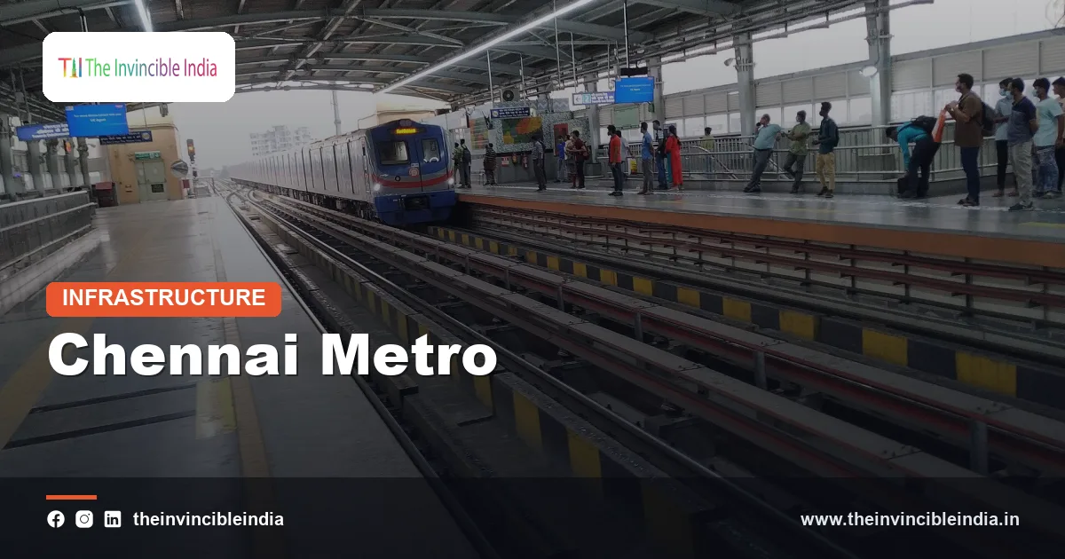
The Chennai Metro is the rapid-transit system of Chennai, Tamil Nadu, built and operated by Chennai Metro Rail Limited (CMRL), and its Phase I network of about 45 km has two lines, the Blue Line and the Green Line, with both underground and elevated sections. The Chennai Metro began commercial operations in June 2015, links Chennai Central, the airport and many parts of the city, and is now being expanded through a much larger Phase II programme.
The Chennai Metro is the main modern, air-conditioned rail alternative to the city’s older suburban and Mass Rapid Transit System (MRTS) railways. This explainer covers the organisation behind it, the Blue and Green Lines, the underground and elevated stretches, airport connectivity, the Phase II expansion, ridership and how the metro eases congestion.
| Attribute | Detail |
|---|---|
| Official name | Chennai Metro (Chennai Metro Rail) |
| Operator | Chennai Metro Rail Limited (CMRL) |
| Ownership | Joint venture of the Government of India and the Government of Tamil Nadu (equal stakes) |
| City and state | Chennai, Tamil Nadu |
| Phase I lines | Blue Line (Wimco Nagar to Chennai Airport) and Green Line (Chennai Central to St. Thomas Mount) |
| Phase I length | About 45 km in the original plan, plus a northern extension of roughly 9 km to Wimco Nagar; underground and elevated sections |
| First operations | June 2015 (elevated section between Koyambedu and Alandur) |
| Phase II | About 119 km across three corridors, under construction in stages |
| Gauge and power | Standard gauge (1,435 mm), 25 kV AC overhead electrification |
Key Takeaways
- The Chennai Metro is the metro rail system of Chennai in Tamil Nadu, run by Chennai Metro Rail Limited (CMRL), a joint venture of the Government of India and the Government of Tamil Nadu.
- The Chennai Metro Phase I has two lines, the Blue Line and the Green Line, with a total length of about 45 km and a mix of underground and elevated stations.
- The Chennai Metro began commercial services in June 2015 with an elevated stretch, and the underground sections opened in the following years.
- The Blue Line of the Chennai Metro connects Wimco Nagar in the north to Chennai International Airport in the south through the city centre.
- The Chennai Metro Phase II covers roughly 119 km across three corridors and is designed to extend the network to the IT corridor, western suburbs and northern Chennai.
- The Chennai Metro interchanges with suburban rail and bus services at Chennai Central, Puratchi Thalaivar Dr. M.G. Ramachandran Central, and at other stations such as Alandur and St. Thomas Mount.
What is the Chennai Metro?
The Chennai Metro is a rapid-transit rail system serving Chennai, the capital of Tamil Nadu and one of India’s largest metropolitan areas. The Chennai Metro offers air-conditioned, electrically powered train services on dedicated tracks, which run above ground on viaducts and below ground in tunnels so that they are not affected by road traffic.
Chennai already had an extensive suburban railway network and a Mass Rapid Transit System (MRTS) running mainly along the coast and the western belt. The Chennai Metro was planned to cover the areas that these older networks do not, and to give residents a faster, more comfortable alternative to cars, two-wheelers and buses on the busiest roads.
The system uses standard gauge track of 1,435 mm and 25 kV AC overhead electrification, in common with most modern Indian metros. Trains are three-car or four-car sets, and the network has ticketing options including smart cards, QR codes and the National Common Mobility Card (NCMC).
Who runs the Chennai Metro?
The Chennai Metro is run by Chennai Metro Rail Limited (CMRL), a special-purpose company jointly owned by the Government of India and the Government of Tamil Nadu in a 50:50 arrangement. CMRL was incorporated in 2007 to plan, build and operate the metro rail system in Chennai.
CMRL handled the construction of Phase I with funding from the two governments and a large loan from the Japan International Cooperation Agency (JICA), which is why the project is often described as being supported by Japanese financing. Phase II is being financed through a mix of government equity, loans from multilateral and bilateral agencies, and other sources.
CMRL also manages property development near stations, advertising, and integration projects such as feeder buses and cycle facilities, which add to the revenue of the system.
What are the Blue Line and Green Line of the Chennai Metro?
The Blue Line and the Green Line are the two corridors of the Chennai Metro Phase I, which together form a Y-shaped or intersecting network that meets at the city centre. The Blue Line runs north-south between Wimco Nagar and Chennai Airport, while the Green Line runs between Chennai Central and St. Thomas Mount via Koyambedu and Alandur.
The two corridors at a glance
| Line | Main route | Approximate length | Nature |
|---|---|---|---|
| Blue Line | Wimco Nagar to Chennai Airport via Washermanpet, Chennai Central, Government Estate, Saidapet and Guindy | About 23 km in the original Phase I, plus a northern extension of roughly 9 km to Wimco Nagar | Mostly underground in the city centre, elevated in the north and south |
| Green Line | Chennai Central to St. Thomas Mount via Egmore, Koyambedu, Vadapalani and Alandur | About 22 km | Underground at the start, then elevated |
The lengths above are approximate and are quoted differently across sources depending on whether extensions are counted. Both lines share track and stations in certain sections near the central area, and passengers can change lines at the main interchange stations.
Blue Line
The Blue Line of the Chennai Metro links north Chennai with the airport, passing Washermanpet, Mannadi, High Court, Chennai Central, Government Estate, LIC, Thousand Lights, AG-DMS, Teynampet, Nandanam, Saidapet, Little Mount, Guindy, Alandur, Nanganallur Road, Meenambakkam and Chennai Airport. The Blue Line was extended northwards from Washermanpet to Wimco Nagar in stages from 2021 onward, which brought it to its current length.
Green Line
The Green Line of the Chennai Metro links Chennai Central with St. Thomas Mount, and it passes Egmore, Nehru Park, Kilpauk, Pachaiyappa’s College, Shenoy Nagar, Anna Nagar East, Anna Nagar Tower, Thirumangalam, Koyambedu, CMBT, Arumbakkam, Vadapalani, Ashok Nagar, Ekkattuthangal, Arignar Anna Alandur and St. Thomas Mount. The Green Line takes passengers to the Koyambedu bus terminus, a major hub for intercity bus travel.
Which parts of the Chennai Metro are underground and which are elevated?
The Chennai Metro has underground stretches mainly through the dense central area of Chennai and elevated stretches in the outer parts, because tunnelling was chosen where road widths and building density made viaducts impractical. The underground portions pass beneath areas such as Egmore, Chennai Central, Government Estate and Teynampet, while the elevated portions run through Koyambedu, Guindy, Alandur and beyond.
Why both underground and elevated sections?
- Underground: Used in congested, historic and low-clearance areas where land for pillars was not available. Tunnelling was done with tunnel boring machines (TBMs), and stations are deep, with escalators and lifts.
- Elevated: Used where road width allowed pillars and a viaduct, which is faster and cheaper to construct than tunnelling.
- At-grade or ramp sections: Used at the depots and near transitions between underground and elevated sections.
Phase I included a number of notable engineering tasks, including tunnelling under busy roads, rivers and existing structures, and crossing the Adyar and Cooum river areas. Phase II also includes elevated and underground stretches, with deeper stations and long tunnels beneath the central business district.
How did the Chennai Metro begin and open in stages?
The Chennai Metro began commercial operations on 29 June 2015, when an elevated stretch between Koyambedu and Alandur was opened to the public. The underground and remaining sections opened in stages over the following years.
Opening sequence
| Year | Milestone (approximate) |
|---|---|
| 2007 | CMRL incorporated as a joint venture company |
| 2009-2011 | Construction starts on Phase I |
| 2015 | First commercial stretch (Koyambedu to Alandur) opened in June |
| 2016-2019 | Extension to St. Thomas Mount, the airport link and the underground central section opened in stages |
| 2021 onward | Northern extension from Washermanpet towards Wimco Nagar opened in stages |
The exact dates of each section are published by CMRL, and the table above should be read as a general sequence rather than a precise calendar.
Does the Chennai Metro connect to the airport?
The Chennai Metro connects to Chennai International Airport through the Blue Line, which has an airport station close to the terminals. The airport link was one of the earliest priorities of the network because Chennai’s airport lies in the south of the city at Meenambakkam, a long drive from the city centre.
At the airport, the Chennai Metro station is connected to the terminals by a walkway, and the airport has direct access to the Tirusulam suburban railway station. A traveller can therefore move between the metro, suburban trains and flights without needing a road vehicle for most of the journey.
The Blue Line also passes Guindy, a hub with an industrial estate, a national park and a suburban rail station, and Alandur, an interchange station between the Blue and Green Lines on the original Phase I plan. Metro stations near the central area offer links to Chennai Central, the long-distance rail terminus.
What is the Chennai Metro Phase II?
The Chennai Metro Phase II is a large expansion of the network by about 119 km across three new corridors, and it is one of the biggest metro programmes in India. Phase II was designed to extend metro service to the IT corridor along Old Mahabalipuram Road, to the western suburbs such as Poonamallee and Porur, and to the northern parts of the city.
The three Phase II corridors
| Corridor | Route (approximate) | Approximate length |
|---|---|---|
| Corridor 3 | Madhavaram to SIPCOT (Siruseri) | About 45 km |
| Corridor 4 | Lighthouse to Poonamallee | About 26 km |
| Corridor 5 | Madhavaram to Sholinganallur | About 47 km |
Corridor 3 and Corridor 5 share the Madhavaram end, and the corridors together serve major residential and IT areas. Phase II uses a mix of underground and elevated sections, and it is expected to feature driverless-ready trains with Communication-Based Train Control (CBTC). The Poonamallee corridor was among the first to be taken up for commissioning, though the overall programme is still under construction and timelines have shifted.
The cost of Phase II has been estimated in the range of tens of thousands of crores of rupees, and the project received central approval after state-level sanction. Figures and dates change with each announcement, so readers should consult official sources for the latest.
How many people use the Chennai Metro?
The Chennai Metro carries lakhs of passengers a day on a busy day, and its daily ridership has risen with each extension and with the introduction of digital ticketing. Ridership was modest in the first years when only a short stretch operated, increased after the underground section and airport link opened, and dipped during the COVID-19 period before recovering.
CMRL has attempted to raise ridership by adding feeder bus services, parking, cycle stands and fare concessions such as smart-card discounts. The introduction of QR-code tickets, mobile app ticketing and ticketing through messaging platforms has made it easier to buy a ticket without queuing.
Factors that influence ridership
- Last-mile connectivity from stations to homes and workplaces.
- Integration with suburban trains, MRTS and the city bus service.
- Fares compared with buses and shared autos.
- Completion of the network so that more journeys can be made end to end.
How does the Chennai Metro reduce congestion?
The Chennai Metro reduces congestion by moving large numbers of commuters on a separate track, so fewer people need to use cars and two-wheelers on busy roads. Metro trains run at fixed times and speeds regardless of road conditions, which gives commuters a reliable travel time on corridors that were previously heavily jammed.
The benefits expected from the Chennai Metro include shorter journey times on key corridors, lower fuel consumption, fewer vehicle emissions and fewer road accidents. Experience in other cities shows that a metro works best when it is combined with good feeder services, pedestrian-friendly stations and policies on parking and road use.
Chennai’s flat terrain, dense population and heavy dependence on two-wheelers make it a suitable city for metro expansion, though the cost and disruption of construction, particularly the underground sections, have drawn complaints from residents and traders in some areas.
Bottom Line
The Chennai Metro has grown from a short elevated stretch in 2015 into a two-line network of about 45 km, and its Phase II expansion aims to take the network to well over 150 km in total. Its success depends on completing the new corridors, improving last-mile links and continuing to grow ridership. For current timings, fares and figures, check CMRL’s official channels (last updated 17 October 2026).
Frequently Asked Questions
Who runs the Chennai Metro?
The Chennai Metro is run by Chennai Metro Rail Limited (CMRL). CMRL is a joint venture of the Government of India and the Government of Tamil Nadu, with equal stakes. It was incorporated in 2007 and handles construction, operation and maintenance.
How many lines does the Chennai Metro have?
The Chennai Metro has two lines in Phase I, the Blue Line and the Green Line. The Blue Line runs between Wimco Nagar and Chennai Airport, and the Green Line runs between Chennai Central and St. Thomas Mount. Phase II is adding three new corridors to the network.
When did the Chennai Metro start?
The Chennai Metro began commercial operations in June 2015. The first stretch was an elevated section between Koyambedu and Alandur. The underground sections and the airport link opened in the following years.
Is Chennai Airport connected to the Chennai Metro?
Chennai Airport is connected to the Chennai Metro through the Blue Line. The airport station is close to the terminals and linked by a walkway, and the airport is also near the Tirusulam suburban railway station. The Blue Line takes passengers from the airport to Guindy, Saidapet, Chennai Central and Washermanpet.
What is the Chennai Metro Phase II?
The Chennai Metro Phase II is a large expansion of about 119 km across three corridors. The corridors run from Madhavaram to SIPCOT, from Lighthouse to Poonamallee and from Madhavaram to Sholinganallur. The programme uses underground and elevated sections and is being built in stages.
Is the Chennai Metro underground or elevated?
The Chennai Metro is both underground and elevated. The central areas, including parts around Egmore, Chennai Central and Teynampet, are underground, while outer areas such as Koyambedu, Guindy and Alandur have elevated tracks. Tunnels were used where road width and building density made viaducts impractical.
{“@context”:”https://schema.org”,”@graph”:[{“@type”:”FAQPage”,”mainEntity”:[{“@type”:”Question”,”name”:”Who runs the Chennai Metro?”,”acceptedAnswer”:{“@type”:”Answer”,”text”:”The Chennai Metro is run by Chennai Metro Rail Limited (CMRL). CMRL is a joint venture of the Government of India and the Government of Tamil Nadu, with equal stakes. It was incorporated in 2007 and handles construction, operation and maintenance.”}},{“@type”:”Question”,”name”:”How many lines does the Chennai Metro have?”,”acceptedAnswer”:{“@type”:”Answer”,”text”:”The Chennai Metro has two lines in Phase I, the Blue Line and the Green Line. The Blue Line runs between Wimco Nagar and Chennai Airport, and the Green Line runs between Chennai Central and St. Thomas Mount. Phase II is adding three new corridors to the network.”}},{“@type”:”Question”,”name”:”When did the Chennai Metro start?”,”acceptedAnswer”:{“@type”:”Answer”,”text”:”The Chennai Metro began commercial operations in June 2015. The first stretch was an elevated section between Koyambedu and Alandur. The underground sections and the airport link opened in the following years.”}},{“@type”:”Question”,”name”:”Is Chennai Airport connected to the Chennai Metro?”,”acceptedAnswer”:{“@type”:”Answer”,”text”:”Chennai Airport is connected to the Chennai Metro through the Blue Line. The airport station is close to the terminals and linked by a walkway, and the airport is also near the Tirusulam suburban railway station. The Blue Line takes passengers from the airport to Guindy, Saidapet, Chennai Central and Washermanpet.”}},{“@type”:”Question”,”name”:”What is the Chennai Metro Phase II?”,”acceptedAnswer”:{“@type”:”Answer”,”text”:”The Chennai Metro Phase II is a large expansion of about 119 km across three corridors. The corridors run from Madhavaram to SIPCOT, from Lighthouse to Poonamallee and from Madhavaram to Sholinganallur. The programme uses underground and elevated sections and is being built in stages.”}},{“@type”:”Question”,”name”:”Is the Chennai Metro underground or elevated?”,”acceptedAnswer”:{“@type”:”Answer”,”text”:”The Chennai Metro is both underground and elevated. The central areas, including parts around Egmore, Chennai Central and Teynampet, are underground, while outer areas such as Koyambedu, Guindy and Alandur have elevated tracks. Tunnels were used where road width and building density made viaducts impractical.”}}]}]}


