

A temperature inversion is a layer of the atmosphere in which air temperature rises with height instead of falling, so a lid of warmer air sits on top of cooler air near the ground. Normally the air closest to the surface is the warmest and it cools as you climb, which lets smoke, dust and moisture drift upward and disperse. When an inversion forms, that upward escape route is shut. Pollutants, fog droplets and vehicle exhaust pile up in a shallow layer just above the streets, and the air at ground level can turn thick, grey and hazardous within a few days. Last reviewed: 3 November 2026.
For India, this is not an abstract textbook idea. Every winter, large parts of the Indo-Gangetic Plain, from Punjab and Haryana through Delhi, Uttar Pradesh and Bihar to West Bengal, wake up to dense fog and a stubborn smoky haze that refuses to lift until late in the day. Temperature inversion is the invisible mechanism behind much of that gloom. This explainer walks through how inversions form, why north India is so vulnerable, how they interact with fog and pollution, and what actually makes them break.
| Term | Temperature inversion (also called thermal inversion) |
|---|---|
| Core idea | Warmer air lies above cooler air, reversing the usual drop in temperature with height |
| Main types relevant to India | Radiation (nocturnal) inversion and subsidence inversion |
| Typical season in India | Strongest from late November to January, especially on clear, calm nights |
| Most affected region | Indo-Gangetic Plain, including the Delhi-NCR region |
| Effect on air | Acts as a lid, trapping pollutants and moisture close to the ground |
| What breaks it | Daytime solar heating, stronger winds, or a change in weather system |
| Health relevance | Raises ground-level concentrations of fine particles (PM2.5) and other pollutants |
Key Takeaways
- A temperature inversion is a layer where air gets warmer with height, which acts like a lid and stops surface air from rising and mixing.
- In winter, clear skies and calm winds over the Indo-Gangetic Plain produce strong overnight radiation inversions that trap fog and pollutants near the ground.
- An inversion does not create pollution; it concentrates the emissions already released by vehicles, industry, construction, stubble and waste burning, and household fuels.
- Radiation inversions are shallow and usually break after sunrise, while subsidence inversions come from sinking air in high-pressure systems and can last for days.
- Delhi’s worst smog episodes typically combine a persistent inversion, very low wind speeds, high humidity and a heavy emissions load.
- Fog, smog and inversion reinforce one another: fog droplets and haze block sunlight, which keeps the surface cold and the inversion alive.
What Is the Normal Temperature Profile of the Atmosphere?
In the lowest layer of the atmosphere, called the troposphere, air temperature normally falls as altitude increases, by roughly six to seven degrees Celsius for every kilometre you climb. The reason is simple. The sun warms the ground, the ground warms the air touching it, and that warm air becomes lighter and rises, cooling as it expands into thinner air above.
This steady decline is what keeps the lower atmosphere well stirred. Warm parcels rise, cooler parcels sink, and everything the surface releases, whether smoke, dust or water vapour, is carried upward and diluted through a deep layer of air. Meteorologists call the depth of this well-mixed layer the mixing height. On a hot summer afternoon over central India it can stretch to a couple of kilometres or more, which is one reason that summer air, for all its dust, often disperses pollution better than winter air does.
An inversion upends this arrangement. At some height, the temperature stops falling and begins to rise, so a layer of relatively warm air floats above cooler, denser air below. Because cold air is heavy and warm air is light, the cold air has nowhere to go. It stays put, and so does everything suspended in it.
Why Does a Temperature Inversion Trap Pollution?
A temperature inversion traps pollution because the warm layer above is more buoyant than anything rising from below, so surface air cannot climb through it. Imagine pouring water into a glass and then covering it with a plate: whatever you add stays inside. Smoke from a chimney or a tailpipe is warmer than the surrounding air only for a short distance. Once it cools to the temperature of the cold surface layer, it stops rising and spreads sideways instead.
The lid is not perfectly sealed, but it sharply reduces vertical mixing. Pollutants emitted at street level are confined to a layer that may be only a few hundred metres deep, sometimes less. If the same emissions were mixed through a layer a kilometre or two deep, concentrations would be several times lower. This is why air quality can worsen dramatically on a night when emissions have not changed at all: the volume of air available to absorb them has shrunk.
Inversions also reduce horizontal ventilation. They tend to form under calm conditions, so there is little wind to carry the polluted air away. Trapped from above and stagnant from the sides, pollutants accumulate day after day, and concentrations of fine particulate matter can build to levels many times higher than health guidelines recommend.
How Does a Radiation Inversion Form on a Winter Night?
A radiation inversion forms when the ground loses heat rapidly to the night sky, chilling the thin layer of air in contact with it while the air higher up stays comparatively warm. It is the most common kind of inversion in India and the main driver of winter fog on the northern plains.
The recipe needs three ingredients. First, a clear sky: with no cloud blanket to send heat back down, the land radiates its warmth to space efficiently. Second, long winter nights, which give that cooling many hours to work. Third, light or calm wind, so that cold air near the surface is not stirred into the warmer air above. When all three are present, the surface can cool several degrees below the temperature of the air a few hundred metres up.
Dry soil and open fields cool faster than wet or built-up surfaces, which is why rural and peri-urban stretches of Punjab, Haryana and Uttar Pradesh often record colder nights than city centres. The result is a ground-based inversion that deepens as the night goes on and usually reaches maximum strength just before sunrise. Radiation inversions are generally shallow, often confined to the lowest few hundred metres, but that is exactly the layer where people live, breathe and drive.
What Is a Subsidence Inversion?
A subsidence inversion is a layer of warm, dry air created when a large mass of air slowly sinks from higher altitudes, compressing and warming as it descends. It sits above the surface layer and caps it, often at a height of a few hundred metres to a kilometre or more.
Subsidence is typical of high-pressure systems. In winter, a strong anticyclone sitting over north India brings settled weather: clear skies, dry upper air and weak surface winds. As air sinks, it warms by compression, and where this warm air meets cooler air near the ground, a distinct inversion layer forms. Unlike a radiation inversion, it does not depend on a cold night alone. It is a feature of the larger weather pattern, so it can persist through the day and for several days at a stretch.
Subsidence inversions are also important elsewhere in the country. Along the west coast, sinking air above the cooler sea surface can create a low-level capping layer in the dry season. In the hills, cold air draining into valleys can combine with sinking air above to form long-lasting valley inversions. What matters for the plains in winter is that a radiation inversion at night can sit beneath a subsidence inversion above, doubling the effect.
| Feature | Radiation inversion | Subsidence inversion |
|---|---|---|
| Cause | Ground cools by losing heat to a clear night sky | Air sinks and warms by compression in a high-pressure system |
| Where it starts | At the surface | Aloft, above the surface layer |
| Typical depth below the lid | Often a few hundred metres or less | Often several hundred metres to over a kilometre |
| Duration | Overnight; usually erodes after sunrise | Can last for several days |
| Key conditions | Clear skies, calm wind, long nights | Stable anticyclone, weak winds, dry upper air |
| Common Indian setting | Winter nights on the Indo-Gangetic Plain | Prolonged winter high-pressure spells; some coastal and valley settings |
Why Is the Indo-Gangetic Plain So Prone to Inversions?
The Indo-Gangetic Plain is prone to inversions because it is a vast, flat basin hemmed in by the Himalaya to the north, which combines winter cold, calm winds and heavy emissions in one place. The geography works against dispersal in several ways.
The plain is almost entirely flat, so there are no hills to help force air upward or channel winds through. The Himalayan wall to the north blocks the flow of air in that direction, and the cold continental winter produces long spells of light winds. Cold air from the mountains also drains slowly southward at night, adding to the pool of dense air near the surface. Meanwhile, the post-monsoon and winter months bring dry soils, clear skies and low sun, a perfect set-up for strong overnight cooling.
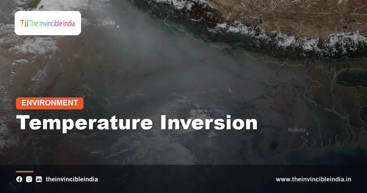
The plain is also one of the most densely populated regions in the world. Millions of vehicles, brick kilns, power plants, factories, construction sites, cooking fires and heating fuels release pollutants into a basin that, for weeks at a time, can barely ventilate. Add the seasonal burning of crop residue in the north-west, which sends smoke across the region in October and November, and the lid captures a heavy load. Satellite images in winter often show a continuous pall of haze stretching across the plain, a sign that the problem is regional, not just local to any one city.
How Do Inversions Create Fog and Smog Together?
Inversions create fog and smog together because the same cold, stagnant surface layer that holds pollutants also lets moisture cool to its dew point and condense into droplets. Winter fog on the northern plains is largely a radiation fog, and the inversion that forms it is the very lid that also traps the pollution.
As the surface chills overnight, the air in contact with it cools until it is saturated. Water vapour then condenses on tiny particles, which serve as condensation nuclei. In a polluted basin there is no shortage of such particles, so even modest moisture can produce a thick, persistent fog. Because pollution provides so many nuclei, the fog droplets tend to be numerous and small, and a fog like that can be slower to clear.
The term smog, a blend of smoke and fog, describes this mix. When fog forms on top of a polluted layer, particles dissolve or become coated with moisture, and chemical reactions inside the droplets can produce additional fine particles, especially secondary aerosols such as sulphates and nitrates. The result is a dense, hazy mixture of water and pollutants that can cut visibility to near zero on roads, railways and runways, and raises health risks well beyond what a clean fog would bring.
There is also a feedback. A thick fog or haze layer blocks sunlight from reaching the ground the next morning, so the surface warms slowly or not at all. That helps the inversion survive through the day, which in turn keeps the fog and smog in place. Meteorologists often describe this as a self-reinforcing loop, and it explains why some winter spells see the sun only faintly for days.
What Role Do Inversions Play in Delhi’s Pollution Episodes?
Inversions play a central supporting role in Delhi’s pollution episodes by compressing the city’s emissions into a shallow layer, though they do not produce the pollution themselves. Studies of winter air quality in Delhi consistently find that the same emissions cause far higher concentrations on nights with a strong inversion and light winds than on nights with better mixing.
Delhi’s air is shaped by a combination of local sources, such as vehicles, dust, construction, industry and waste burning, and regional ones, including smoke from agricultural fires and emissions from neighbouring states. In late autumn and winter, the weather turns against dispersal. Winds from the north-west weaken, the boundary layer shrinks, and clear nights produce strong radiation inversions. The shallow layer fills with particulate matter, and levels of PM2.5 can rise sharply overnight and early morning, often peaking before dawn.
Another factor is that the city’s concentration tends to follow a daily rhythm. Pollution is often lower in the afternoon, when solar heating deepens the mixing layer and brings in cleaner air from above, and higher at night and early morning, when the layer is thin. During the worst episodes, the afternoon improvement is modest or absent, because the haze has kept the surface cool and the inversion lingers. Analysts therefore treat meteorology, not just emissions, as a first-order driver of the numbers on the air-quality index.
This understanding shapes policy. Emergency measures under graded response plans are triggered by forecasts of poor ventilation and calm conditions, since those are the moments when extra emission cuts matter most. It also explains why short-term measures alone cannot deliver clean winter air: the emissions load itself has to fall, so that even in a bad meteorological year the lid has less to trap.
What Is Mixing Height and Why Does It Matter?
Mixing height is the depth of the lower atmosphere through which surface pollutants are actively stirred, and it matters because it sets the volume of air available to dilute emissions. A deep mixing height means more dilution, while a shallow one means concentrated pollution.
An inversion effectively sets the ceiling of the mixing layer. In winter, early morning mixing heights over the Indo-Gangetic Plain can be very low, a few hundred metres or less, and they rise only gradually as the sun warms the ground. By afternoon they can be considerably higher, which is why pollution often eases a little later in the day. When the winter sun is weak or hidden by haze, the layer deepens only slightly, and the effect is a long, grey day.
Together with wind speed, mixing height determines what meteorologists call the ventilation coefficient. When both are low, as they often are during a winter inversion, the atmosphere has little capacity to cleanse itself. Forecasters and air-quality agencies therefore watch these quantities closely when predicting pollution episodes.
How Do Temperature Inversions Break Down?
Temperature inversions break down when something adds heat to the surface layer or stirs the air enough to erase the temperature difference. The most common trigger is simple sunshine.
After sunrise, the ground warms and begins heating the air in contact with it. That warm air rises, eroding the inversion from below. The layer of cool air gets progressively thinner as the morning advances, and when the surface warms enough, the inversion lifts and fog evaporates. On clear winter days over the plains, this usually happens by late morning. Fog, however, can slow the process, since it reflects sunlight and keeps the ground cool.
Stronger winds also help. A change in weather, such as the approach of a western disturbance, can bring wind, cloud and sometimes rain. Light rain washes particles out of the air, while stronger winds mix the layers and push pollution away. This is why a spell of rain or wind in January or February can bring a sudden clear-up, with blue skies appearing after days of grey. The improvement can reverse just as quickly when calm, cold conditions return.
Subsidence inversions are harder to dislodge, because they are tied to larger weather patterns. They typically persist until the high-pressure system moves on or weakens, which can take days.
Do Inversions Occur Elsewhere in India?
Inversions occur across India, not just in the north, though their character and consequences differ by region. Any place with clear nights, light winds and a local source of cold air can develop one.
In Himalayan valleys such as those of Kashmir, Himachal Pradesh and Uttarakhand, cold air drains downhill at night and pools on the valley floor, producing strong valley inversions. Towns like Srinagar and Shimla’s surrounding valleys can see cold, smoky air trapped below, while the ridges above are warmer and clearer. Wood smoke from heating can become a notable pollutant under these conditions.
In the Deccan and central India, winter nights are cooler and drier, and shallow radiation inversions are common, though they are weaker than in the north. Along the coasts, sea breezes and moist air generally weaken nocturnal inversions, but marine inversions linked to cooler sea surfaces can influence haze and low cloud, particularly in the dry season. Kolkata and other eastern cities, near the humid delta, can see inversion-fed winter smog mixed with fog, much like their northern neighbours.
What Can Cities and Citizens Do About Inversion-Driven Smog?
Cities and citizens cannot remove an inversion, but they can reduce what it traps by cutting emissions, especially during the cold months, and by acting on forecasts. The inversion is a feature of weather; the pollution is a feature of human activity, and only the second is within reach.
At the policy level, sustained reductions in emissions from vehicles, industry, power generation, construction dust, open burning and solid fuels matter more than any one-time measure. Regional coordination is essential, since the airshed crosses state boundaries. Forecasting also helps: when meteorologists predict several days of calm, cold, low-mixing-height weather, authorities can bring emergency actions forward and warn vulnerable groups.
For individuals, practical steps include checking local air-quality readings, limiting outdoor exercise during early-morning peaks, wearing a well-fitting respirator when levels are high, avoiding burning leaves, trash or wood, and keeping windows closed during the worst hours while using a clean indoor air strategy where possible. Children, older adults, pregnant women and people with heart or lung conditions are most at risk and should take extra care. Driving with caution in fog, using low-beam lights and reducing speed are essential on foggy roads and highways.
Bottom Line
A temperature inversion is a simple idea with large consequences: warm air above cold air stops the atmosphere from stirring. Over the Indo-Gangetic Plain in winter, strong overnight radiation inversions, often layered under subsidence inversions, squeeze fog, moisture and emissions into a shallow layer. The result is the smog that regularly chokes Delhi and the surrounding region. Understanding the mechanism helps explain why air quality swings with the weather even when emissions barely change, and why lasting improvement depends on cutting emissions rather than waiting for the wind.
Frequently Asked Questions
What is a temperature inversion in simple words?
A temperature inversion is a condition in which warmer air sits above cooler air near the ground, reversing the normal pattern of air cooling with height. The warm layer acts like a lid that stops surface air, smoke and fog from rising and spreading out.
Why do temperature inversions happen more in winter in north India?
Winter brings long, clear nights and light winds, so the ground loses heat quickly and chills the air just above it while higher air stays warmer. The flat Indo-Gangetic Plain, hemmed in by the Himalaya, makes this effect especially strong.
Does a temperature inversion cause air pollution?
No, an inversion does not create pollution; it traps and concentrates the pollutants that vehicles, industry, burning and other sources already release. The same emissions can produce much higher readings on a night with a strong inversion than on a well-mixed day.
What is the difference between radiation and subsidence inversions?
A radiation inversion forms near the ground when the surface cools overnight, and usually fades after sunrise. A subsidence inversion forms higher up when air sinks and warms in a high-pressure system, and it can persist for days.
Why is Delhi’s air worst in the early morning in winter?
In the early morning the inversion is at its strongest and the mixing layer is at its shallowest, so pollutants are squeezed into the smallest volume of air. As the sun warms the surface later in the day, the layer deepens and pollution often eases somewhat.
What ends a winter inversion and smog spell?
Strong sunshine, increased wind or a change of weather system, such as a western disturbance bringing wind or rain, can break an inversion and clear the air. Calm, cold conditions returning can bring the smog back quickly.
{“@context”:”https://schema.org”,”@graph”:[{“@type”:”FAQPage”,”mainEntity”:[{“@type”:”Question”,”name”:”What is a temperature inversion in simple words?”,”acceptedAnswer”:{“@type”:”Answer”,”text”:”A temperature inversion is a condition in which warmer air sits above cooler air near the ground, reversing the normal pattern of air cooling with height. The warm layer acts like a lid that stops surface air, smoke and fog from rising and spreading out.”}},{“@type”:”Question”,”name”:”Why do temperature inversions happen more in winter in north India?”,”acceptedAnswer”:{“@type”:”Answer”,”text”:”Winter brings long, clear nights and light winds, so the ground loses heat quickly and chills the air just above it while higher air stays warmer. The flat Indo-Gangetic Plain, hemmed in by the Himalaya, makes this effect especially strong.”}},{“@type”:”Question”,”name”:”Does a temperature inversion cause air pollution?”,”acceptedAnswer”:{“@type”:”Answer”,”text”:”No, an inversion does not create pollution; it traps and concentrates the pollutants that vehicles, industry, burning and other sources already release. The same emissions can produce much higher readings on a night with a strong inversion than on a well-mixed day.”}},{“@type”:”Question”,”name”:”What is the difference between radiation and subsidence inversions?”,”acceptedAnswer”:{“@type”:”Answer”,”text”:”A radiation inversion forms near the ground when the surface cools overnight, and usually fades after sunrise. A subsidence inversion forms higher up when air sinks and warms in a high-pressure system, and it can persist for days.”}},{“@type”:”Question”,”name”:”Why is Delhi’s air worst in the early morning in winter?”,”acceptedAnswer”:{“@type”:”Answer”,”text”:”In the early morning the inversion is at its strongest and the mixing layer is at its shallowest, so pollutants are squeezed into the smallest volume of air. As the sun warms the surface later in the day, the layer deepens and pollution often eases somewhat.”}},{“@type”:”Question”,”name”:”What ends a winter inversion and smog spell?”,”acceptedAnswer”:{“@type”:”Answer”,”text”:”Strong sunshine, increased wind or a change of weather system, such as a western disturbance bringing wind or rain, can break an inversion and clear the air. Calm, cold conditions returning can bring the smog back quickly.”}}]}]}


