

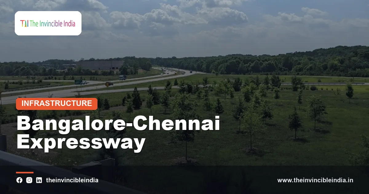
The Bangalore-Chennai Expressway is a roughly 260 km greenfield, access-controlled expressway built by the National Highways Authority of India (NHAI) under the Bharatmala Pariyojana to link Bengaluru in Karnataka with Chennai in Tamil Nadu through a corridor that crosses southern Andhra Pradesh. The route runs from the Hoskote area on the eastern edge of Bengaluru, through Bangarpet and Palamaner, to Sriperumbudur near Chennai, and it is designed to bring the journey between the two cities down to roughly two to three hours.
The Bangalore-Chennai Expressway is more than a faster road. It is also meant to serve as the spine of an industrial and logistics belt between two of south India’s biggest economic centres, connecting manufacturing clusters, inland container depots and ports along the Coromandel coast. This explainer covers what the expressway is, how the route runs, how it differs from the older highway, who built it, and what it is expected to change.
| Attribute | Details |
|---|---|
| Official name | Bangalore-Chennai Expressway (also written Bengaluru-Chennai Expressway) |
| Type | Greenfield, access-controlled, high-speed expressway |
| Approximate length | About 260 km (figures of roughly 258 km are commonly cited) |
| Implementing agency | National Highways Authority of India (NHAI), under the Ministry of Road Transport and Highways |
| Programme | Bharatmala Pariyojana (economic corridor and expressway development) |
| States crossed | Karnataka, Andhra Pradesh and Tamil Nadu |
| Key waypoints | Hoskote, Malur, Bangarpet, Palamaner, Chittoor region, Sriperumbudur |
| Intended travel time | Roughly 2 to 3 hours between the two cities |
| Design speed | Planned for speeds of up to about 120 km/h (subject to rules in force) |
Key Takeaways
- The Bangalore-Chennai Expressway is a roughly 260 km greenfield, access-controlled expressway developed by the National Highways Authority of India (NHAI).
- The Bangalore-Chennai Expressway passes through three states, Karnataka, Andhra Pradesh and Tamil Nadu, between Hoskote near Bengaluru and Sriperumbudur near Chennai.
- The Bangalore-Chennai Expressway is planned to reduce road travel between the two cities from roughly six to seven hours to roughly two to three hours.
- The Bangalore-Chennai Expressway is a greenfield project, which means its alignment was built largely on new land rather than by widening the older National Highway 48 route.
- The Bangalore-Chennai Expressway is part of the Bharatmala Pariyojana and is closely tied to industrial corridor planning between Bengaluru and Chennai.
- Access to the Bangalore-Chennai Expressway is limited to controlled entry and exit points, and slow-moving vehicles such as tractors and two-wheelers are generally restricted.
What Is the Bangalore-Chennai Expressway?
The Bangalore-Chennai Expressway is a four-lane, access-controlled greenfield highway, with provision for later expansion, that connects Bengaluru and Chennai by a largely new alignment. Unlike an ordinary national highway, an expressway has no direct property access, no at-grade junctions and no roadside shops opening onto the carriageway. Vehicles enter and leave only at designated interchanges.
The project is sometimes described as the first high-speed link of its kind in the south of the country, because the older road between the two cities carries a mix of long-haul trucks, local buses, farm vehicles and two-wheelers through many towns. The expressway separates long-distance traffic from that local flow. NHAI built it in packages, with separate contractors responsible for different stretches, a method commonly used for large expressways in India.
The Bangalore-Chennai Expressway is usually discussed alongside other Bharatmala projects such as the Delhi-Mumbai Expressway and the Dwarka Expressway. Its distinguishing feature is its role as an intercity corridor between two metropolitan regions that already generate heavy freight and passenger movement.
How Long Is the Bangalore-Chennai Expressway and Where Does It Run?
The Bangalore-Chennai Expressway is approximately 260 km long, and it runs eastward from the Bengaluru fringe near Hoskote to Sriperumbudur on the western side of the Chennai metropolitan region. Exact lengths vary slightly between official documents because of changes in alignment and how connecting roads are counted, so the figure is best read as an approximation.
The corridor is generally described in three state sections.
- Karnataka section: begins near Hoskote on the Bengaluru side and runs through the Kolar district, passing close to Malur and Bangarpet. This stretch is often given as roughly 70 km.
- Andhra Pradesh section: crosses the southern part of the state through the Chittoor district area, passing near Palamaner and Chittoor. This stretch is often given as roughly 85 km.
- Tamil Nadu section: runs through the districts around Vellore and Kancheepuram before ending at Sriperumbudur. This stretch is often given as roughly 105 km.
Because the Bangalore-Chennai Expressway is built mainly on a fresh alignment, it keeps clear of the dense settlements along the older highway. At its Chennai end it connects to the road network around Sriperumbudur and the outer ring of the Chennai metropolitan region. At its Bengaluru end it ties into the ring-road system on the eastern side of the city.
Why Was the Bangalore-Chennai Expressway Built?
The Bangalore-Chennai Expressway was built because the existing road between the two cities had become congested and slow, even though Bengaluru and Chennai are among the largest economic centres in the south. The older route, the National Highway 48 corridor via Krishnagiri, Vellore and Ranipet, passes through many towns and carries both local and long-distance traffic, so average speeds are low and journey times are unpredictable.
Several reasons are usually cited for the project.
- Congestion relief: a separate expressway moves long-distance traffic off the older road.
- Freight efficiency: faster, more predictable trucking times matter for automobile, electronics and engineering supply chains.
- Industrial development: a high-speed link supports manufacturing clusters and planned industrial nodes along the way.
- Port access: better road links help goods reach the ports around Chennai, including Chennai Port and Kamarajar Port, and the facilities further up the coast.
- Safety: a divided carriageway with controlled access is intended to reduce the conflict points that cause accidents on mixed-traffic roads.
The Bangalore-Chennai Expressway therefore combines transport and economic aims. Planners often present it as an enabler of growth in districts that sit between the two metros but have historically seen less investment.
Which Route Does the Bangalore-Chennai Expressway Follow?
The Bangalore-Chennai Expressway follows a path from Hoskote through Bangarpet and Palamaner to Sriperumbudur, with the middle section lying in southern Andhra Pradesh. A traveller going from Bengaluru to Chennai on the expressway would pass, in broad order, the following zones.
- Hoskote and Malur zone: the Bengaluru end, close to an area with significant industrial and warehousing activity.
- Bangarpet and Kolar belt: an area historically known for the Kolar Gold Fields and now for agriculture and dairying.
- Palamaner and Chittoor region: the Andhra Pradesh stretch, an area known for horticulture, especially mangoes and milk production.
- Vellore and Kancheepuram belt: the Tamil Nadu approach, known for leather, automotive and electronics manufacturing.
- Sriperumbudur: the Chennai end, a major manufacturing hub for cars, electronics and components.
The Bangalore-Chennai Expressway does not pass through the centre of any large city. This is a deliberate feature of greenfield design. Local access to towns such as Kolar, Chittoor and Vellore is expected through interchanges and connecting roads rather than through the expressway itself.
How Does the Bangalore-Chennai Expressway Differ From the Old Highway?
The Bangalore-Chennai Expressway differs from the older National Highway 48 route mainly in being a new, access-controlled road that is shorter in travel time, though not always in distance. The older highway is a widened national highway that serves local towns, while the expressway is intended almost entirely for through traffic.
| Feature | Older highway (NH 48 corridor) | Bangalore-Chennai Expressway |
|---|---|---|
| Alignment | Existing road through towns | Largely new greenfield alignment |
| Access | Open access with many junctions | Controlled entry and exit only |
| Typical traffic | Mixed local and long-distance | Mainly long-distance cars, buses and trucks |
| Approximate distance | About 340 to 350 km | About 260 km |
| Typical travel time | Roughly 6 to 7 hours | Roughly 2 to 3 hours when fully operational |
| Design focus | General mobility | High-speed, safe through traffic |
Travel times on any road depend on traffic and weather, so the two-to-three-hour figure is a design goal rather than a guarantee. Operating speed limits are set by the authorities and can differ by vehicle type.
Who Built and Who Runs the Bangalore-Chennai Expressway?
The Bangalore-Chennai Expressway is built and managed by the National Highways Authority of India (NHAI), a statutory body under the Ministry of Road Transport and Highways. NHAI was constituted under the National Highways Authority of India Act, 1988, and is responsible for developing, maintaining and managing a large part of the national highway network.
The expressway forms part of the Bharatmala Pariyojana, the umbrella programme announced in 2017 to improve road connectivity across the country through economic corridors, feeder routes and expressways. Within that framework, the Bangalore-Chennai project was prioritised because of the economic weight of the two cities.
Construction was divided into packages awarded to contractors, a common arrangement for long expressways. The project was funded largely through central resources, and its cost has been reported in the range of several thousand crore rupees to roughly Rs 17,000 crore. Reported costs vary with the date of the report and with what is counted, so they should be treated as indicative.
Once sections are open, they are generally operated as tolled roads. Tolling is collected electronically in line with national policy, and toll rates are notified by the authorities and can change.
What Are the Main Features and Safety Design of the Expressway?
The Bangalore-Chennai Expressway is designed with a divided carriageway, controlled access and grade-separated crossings to enable steady high-speed travel. These features are typical of modern Indian expressways, though specific details are set in project documents and can be revised.
- Lanes: a four-lane configuration with land acquired to allow later widening to six lanes.
- Interchanges: grade-separated entry and exit points rather than ordinary junctions.
- Underpasses and overpasses: structures for local roads, farm tracks and, in places, animal movement, so that local communities are not cut off.
- Fencing: fencing along the right of way to keep pedestrians and animals off the carriageway.
- Service and amenity areas: planned rest areas with fuel, food and charging facilities at intervals.
- Intelligent traffic systems: cameras, signage and monitoring for traffic management and incident response.
- Drainage: engineered drainage and culverts for the seasonal streams that cross the plateau.
The Bangalore-Chennai Expressway also has to cross the transition from the Deccan plateau near Bengaluru down towards the eastern coastal plain, which involves gradients, cuttings and embankments. Engineers manage these with controlled grades and slope protection.
How Does the Bangalore-Chennai Expressway Support Industry and Logistics?
The Bangalore-Chennai Expressway supports industry by shortening and stabilising freight transit between two of the most industrialised parts of the south. Bengaluru is a hub for technology, aerospace and electronics, while the Chennai region, including Sriperumbudur, Oragadam and Hosur’s neighbourhood, has large automotive and electronics clusters.
The corridor is often discussed together with the proposed Chennai-Bengaluru Industrial Corridor (CBIC), a planned industrial development programme in which nodes are to be developed along a Chennai-Bengaluru axis with links to coastal ports. The expressway and the industrial corridor are separate initiatives, but they are intended to reinforce each other: the road offers fast movement, and the industrial nodes offer land, utilities and investment.
Likely benefits for businesses include the following.
- Lower and more predictable freight transit times for just-in-time manufacturing.
- Better access to Chennai Port, Kamarajar Port and other east-coast gateways for exports.
- Reduced vehicle operating costs through steadier speeds and less stop-and-go driving.
- New warehousing and logistics locations near interchanges.
- A broader labour market, as commuting and business travel between the two regions become easier.
How much of this materialises depends on later decisions about land use, industrial policy and port capacity. The expressway makes such growth possible but does not by itself guarantee it.
What Are the Benefits for Travellers and Local Communities?
The Bangalore-Chennai Expressway benefits travellers mainly through a shorter, more predictable journey between Bengaluru and Chennai. Business travellers, families, pilgrims travelling to temples in the region and students all stand to gain from reduced time on the road.
For communities along the route, the effects are mixed and are debated. Supporters point to new access to markets, rising land values, job creation during construction and operation, and better emergency response. Farmers in the Kolar and Chittoor belts, for example, can in principle reach distant markets faster with perishable produce such as tomatoes, mangoes and milk.
At the same time, a greenfield expressway requires land acquisition, and it can alter local drainage, irrigation channels and village access. Compensation, rehabilitation and the design of crossings have been the subject of local discussion in several states, as with most large infrastructure projects. A balanced reading is that the project offers clear transport gains and also involves real local costs that need careful management.
What Are the Environmental and Land Considerations?
The Bangalore-Chennai Expressway raises the usual environmental and land questions of any large greenfield road, namely land acquisition, tree loss, water-body crossings and habitat fragmentation. The alignment passes through farmland, scrub, tank-irrigated areas and some stretches near forest tracts, including areas used by elephants in parts of the Karnataka-Andhra-Tamil Nadu border region.
Standard mitigation measures in such projects include:
- Compensatory plantation to offset tree felling.
- Wildlife underpasses or overpasses where animal movement is documented.
- Culverts and bridges sized for seasonal flow to protect irrigation tanks and drainage.
- Noise and dust control during construction.
- Environmental clearance and monitoring as required under Indian law.
Views differ on how well these measures work in practice. Planners stress that a fenced, controlled-access road can be safer for people and animals than an open highway, while environmental groups often argue that new alignments open fresh land to development. Both perspectives are part of the public record, and the long-term outcome will depend on enforcement and monitoring.
What Is the Current Status of the Bangalore-Chennai Expressway?
The Bangalore-Chennai Expressway has been opened and brought into use in phases, with stretches in Karnataka, Andhra Pradesh and Tamil Nadu becoming available at different times, while remaining works and connections have continued. The pattern of staged opening is normal for long expressways, because each package finishes on its own schedule.
Because project status changes, readers should confirm the latest details with NHAI or the Ministry of Road Transport and Highways. The following points are useful when checking the current position.
- Which sections are open to traffic, and between which interchanges.
- Current toll rates and the toll collection method.
- Permitted vehicle types and speed limits.
- The locations of entry and exit points and rest areas.
- The status of the connection into the Chennai and Bengaluru city road networks.
This article was last reviewed on 17 October 2026, and the broad description of the route and purpose is expected to remain stable even as operating details change.
Bottom Line
The Bangalore-Chennai Expressway is a roughly 260 km greenfield, access-controlled NHAI project that aims to cut travel between Bengaluru and Chennai to about two to three hours while supporting an industrial and logistics corridor across Karnataka, Andhra Pradesh and Tamil Nadu. Its benefits are clearest for through traffic and freight, while land, environment and local access questions remain part of the wider discussion.
Frequently Asked Questions
How long is the Bangalore-Chennai Expressway?
The Bangalore-Chennai Expressway is approximately 260 km long, with figures of around 258 km commonly cited. The exact number varies slightly depending on how connecting roads and alignment changes are counted. It runs from the Hoskote area near Bengaluru to Sriperumbudur near Chennai.
How much time does the Bangalore-Chennai Expressway save?
The Bangalore-Chennai Expressway is designed to reduce the road journey between the two cities from roughly six to seven hours to roughly two to three hours. Actual travel time depends on traffic, weather, speed limits and which sections are open. The figure should be read as a design target rather than a guarantee.
Which states does the Bangalore-Chennai Expressway pass through?
The Bangalore-Chennai Expressway passes through three states: Karnataka, Andhra Pradesh and Tamil Nadu. It starts near Hoskote in Karnataka, crosses the Palamaner and Chittoor region of Andhra Pradesh, and ends at Sriperumbudur in Tamil Nadu. The Andhra Pradesh section forms the middle part of the route.
Who is building the Bangalore-Chennai Expressway?
The National Highways Authority of India (NHAI) is building the Bangalore-Chennai Expressway under the Bharatmala Pariyojana. NHAI works under the Ministry of Road Transport and Highways and awards construction work to contractors in separate packages. The expressway is usually tolled once sections are open.
Is the Bangalore-Chennai Expressway a greenfield project?
Yes, the Bangalore-Chennai Expressway is a greenfield project, meaning it follows a largely new alignment instead of widening an existing road. This lets it avoid congested towns and use controlled access. It differs from the older National Highway 48 route, which passes through many settlements.
Can two-wheelers and tractors use the Bangalore-Chennai Expressway?
Slow-moving vehicles such as tractors, bullock carts and generally two-wheelers are usually not permitted on access-controlled expressways like the Bangalore-Chennai Expressway. Specific rules are set by the authorities and can change, so travellers should check the current notification. The restriction exists to keep traffic speeds consistent and reduce accident risk.
{“@context”:”https://schema.org”,”@graph”:[{“@type”:”FAQPage”,”mainEntity”:[{“@type”:”Question”,”name”:”How long is the Bangalore-Chennai Expressway?”,”acceptedAnswer”:{“@type”:”Answer”,”text”:”The Bangalore-Chennai Expressway is approximately 260 km long, with figures of around 258 km commonly cited. The exact number varies slightly depending on how connecting roads and alignment changes are counted. It runs from the Hoskote area near Bengaluru to Sriperumbudur near Chennai.”}},{“@type”:”Question”,”name”:”How much time does the Bangalore-Chennai Expressway save?”,”acceptedAnswer”:{“@type”:”Answer”,”text”:”The Bangalore-Chennai Expressway is designed to reduce the road journey between the two cities from roughly six to seven hours to roughly two to three hours. Actual travel time depends on traffic, weather, speed limits and which sections are open. The figure should be read as a design target rather than a guarantee.”}},{“@type”:”Question”,”name”:”Which states does the Bangalore-Chennai Expressway pass through?”,”acceptedAnswer”:{“@type”:”Answer”,”text”:”The Bangalore-Chennai Expressway passes through three states: Karnataka, Andhra Pradesh and Tamil Nadu. It starts near Hoskote in Karnataka, crosses the Palamaner and Chittoor region of Andhra Pradesh, and ends at Sriperumbudur in Tamil Nadu. The Andhra Pradesh section forms the middle part of the route.”}},{“@type”:”Question”,”name”:”Who is building the Bangalore-Chennai Expressway?”,”acceptedAnswer”:{“@type”:”Answer”,”text”:”The National Highways Authority of India (NHAI) is building the Bangalore-Chennai Expressway under the Bharatmala Pariyojana. NHAI works under the Ministry of Road Transport and Highways and awards construction work to contractors in separate packages. The expressway is usually tolled once sections are open.”}},{“@type”:”Question”,”name”:”Is the Bangalore-Chennai Expressway a greenfield project?”,”acceptedAnswer”:{“@type”:”Answer”,”text”:”Yes, the Bangalore-Chennai Expressway is a greenfield project, meaning it follows a largely new alignment instead of widening an existing road. This lets it avoid congested towns and use controlled access. It differs from the older National Highway 48 route, which passes through many settlements.”}},{“@type”:”Question”,”name”:”Can two-wheelers and tractors use the Bangalore-Chennai Expressway?”,”acceptedAnswer”:{“@type”:”Answer”,”text”:”Slow-moving vehicles such as tractors, bullock carts and generally two-wheelers are usually not permitted on access-controlled expressways like the Bangalore-Chennai Expressway. Specific rules are set by the authorities and can change, so travellers should check the current notification. The restriction exists to keep traffic speeds consistent and reduce accident risk.”}}]}]}


