

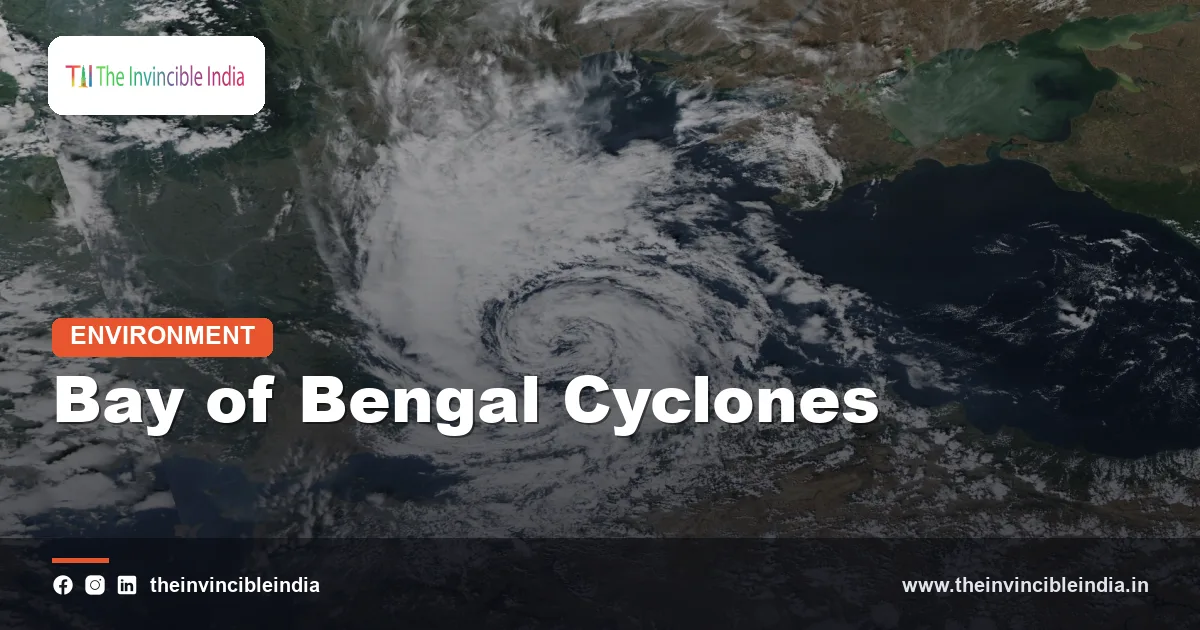
Bay of Bengal cyclones are the tropical storms that form over the warm waters of the northern Bay of Bengal and strike India’s east coast, Bangladesh and Myanmar, and they are among the most frequent and deadly cyclones on Earth. Although the north Indian Ocean produces only a small share of the world’s tropical cyclones, the Bay of Bengal accounts for most of them and for a disproportionate share of cyclone deaths, because warm seas, a funnel-shaped coastline and crowded low-lying deltas combine to create ideal conditions for destructive storm surges.
For the states of Odisha, Andhra Pradesh, Tamil Nadu and West Bengal, Bay of Bengal cyclones are a recurring fact of life. Last updated: 30 October 2026. This explainer sets out why the bay breeds so many storms, when they arrive, how they are classified, and why the toll has fallen sharply in recent decades even as the storms remain powerful.
| Attribute | Detail |
|---|---|
| Type of storm | Tropical cyclone (called hurricane in the Atlantic and typhoon in the western Pacific) |
| Basin | Bay of Bengal, part of the North Indian Ocean cyclone basin |
| Share of North Indian Ocean storms | Roughly four out of five storms form over the Bay of Bengal rather than the Arabian Sea |
| Peak seasons | Pre-monsoon (April to May) and post-monsoon (October to December) |
| Required sea-surface temperature | About 26.5 degrees Celsius or warmer |
| Official monitoring agency | India Meteorological Department (IMD), the WMO-designated Regional Specialised Meteorological Centre in New Delhi |
| Most vulnerable coasts | Odisha, Andhra Pradesh, West Bengal, Tamil Nadu, Bangladesh and Myanmar |
| Deadliest recorded storm | The 1970 Bhola cyclone, which struck what was then East Pakistan (now Bangladesh) |
Key Takeaways
- Roughly four out of every five tropical storms in the North Indian Ocean form over the Bay of Bengal, making the bay the most cyclone-prone part of the region.
- The Bay of Bengal has two cyclone seasons: April to May before the monsoon and October to December after it.
- Storm surge, the wall of sea water pushed ashore by a cyclone, causes most deaths in Bay of Bengal cyclones, and the funnel shape of the northern bay and shallow coastal waters amplify it.
- Tropical cyclones need sea-surface temperatures of about 26.5 degrees Celsius or higher, and the Bay of Bengal remains that warm for much of the year.
- The 1999 Odisha super cyclone killed roughly 10,000 people, while Cyclone Phailin in 2013 and Cyclone Fani in 2019 caused far fewer deaths thanks to large-scale evacuations.
- The India Meteorological Department classifies north Indian Ocean cyclones by wind speed, from depression up to super cyclonic storm at 221 km/h or more.
Why does the Bay of Bengal produce so many cyclones?
The Bay of Bengal produces so many cyclones because its surface water stays warm, its air is humid, and its position and winds allow tropical disturbances to organise and strengthen. A tropical cyclone is a giant heat engine that draws energy from warm ocean water, and the northern Indian Ocean provides the warmest large water body outside the western Pacific.
Sea-surface temperatures in the bay generally stay above 28 degrees Celsius in the pre-monsoon and early post-monsoon periods, well beyond the 26.5 degrees usually needed for cyclone formation. Warm water evaporates, humidifying the air and releasing heat as the vapour condenses in towering storm clouds.
In addition, the bay lies north of about 5 degrees north latitude, where the Earth’s rotation (the Coriolis effect) is strong enough to spin a disturbance into a cyclonic vortex. The region also receives frequent seed disturbances, such as monsoon troughs, low-pressure areas and remnants of storms from the western Pacific that cross Southeast Asia. Together these ingredients make the bay a natural nursery for storms.
What makes the Bay of Bengal’s water so favourable for cyclones?
The Bay of Bengal’s water is especially favourable because huge volumes of river water flowing in from the Ganga, Brahmaputra, Irrawaddy and other rivers form a fresher, lighter surface layer that keeps heat near the top of the sea. This layering, called a barrier layer, limits the mixing of cooler water from below, so passing storms are less likely to chill the surface and weaken themselves.
The result is a shallow, strongly stratified, warm upper ocean that sustains storms as they grow. In many other basins, a cyclone churns up deeper cold water and cuts off its own fuel. Over the bay, the surface often stays warm enough for the cyclone to keep strengthening, and rapid intensification, when winds jump sharply within a day, has been seen repeatedly in recent storms.
The bay is also relatively enclosed. Land to the north, east and west limits the flow of cooler dry air from the continents during storm season, and moisture is supplied abundantly by the monsoon systems that precede and follow the cyclone seasons.
Why are Bay of Bengal cyclones so deadly?
Bay of Bengal cyclones are so deadly mainly because of storm surge, the rapid rise of sea level pushed ashore by a cyclone’s winds and low pressure. Surges can flood many kilometres inland over flat coastal land, and the northern bay’s geography magnifies the effect.
The funnel-shaped coastline
The northern Bay of Bengal narrows towards the head of the bay, where the Ganga-Brahmaputra delta meets the sea. As a cyclone drives water into this narrowing, shallow, funnel-like basin, the water piles up higher and higher. The gently sloping continental shelf off Odisha, West Bengal and Bangladesh adds to the effect, because shallow water slows the surge’s retreat and lets it build.
Low, crowded deltas
The deltaic coasts are only a few metres above sea level and are densely settled. The Sundarbans, the Mahanadi delta in Odisha and the Krishna-Godavari deltas in Andhra Pradesh all hold large populations in areas where a surge of three to five metres or more can submerge entire villages. Salt water also ruins farmland and drinking water for months afterwards.
Winds, rain and inland floods
The storms also bring destructive winds, torrential rain and river flooding. In several major events, rain swelled rivers and caused flooding far from the coast, even after the cyclone’s winds had died down.
When do Bay of Bengal cyclones occur?
Bay of Bengal cyclones occur mainly in two seasons: the pre-monsoon months of April to May and the post-monsoon months of October to December. The pattern is bimodal because the summer monsoon months bring strong vertical wind shear, which tears developing storms apart, and the winter months are too cool and dry.
In the transition periods, the winds in the upper atmosphere are light and uniform, which lets storms grow tall and organised. May and November are typically the most active months. Storms in the pre-monsoon season often curve northward and strike Odisha, West Bengal, Bangladesh or Myanmar, while many post-monsoon storms move westward, crossing Tamil Nadu, Puducherry or Andhra Pradesh.
- April to May: Storms often intensify quickly over very warm water and may curve north or northeast, as with Fani (2019), Amphan (2020) and Mocha (2023).
- October to December: Storms commonly track west or northwest towards the south and central east coast, as with Phailin (2013), Hudhud (2014) and Michaung (2023).
- June to September: Full cyclones are uncommon, but monsoon depressions are frequent and bring heavy rain.
What are some of the most notable Bay of Bengal cyclones?
Several Bay of Bengal cyclones are remembered for their human toll or for lessons in preparedness. The storms listed below are well-known examples, and the death tolls given are approximate and should be treated as general indications.
| Cyclone | Year | Main area affected | Why it is remembered |
|---|---|---|---|
| Bhola cyclone | 1970 | East Pakistan (now Bangladesh) | Often cited as the deadliest tropical cyclone on record, with hundreds of thousands of deaths |
| Odisha super cyclone | 1999 | Odisha coast near Paradip | Killed roughly 10,000 people and exposed gaps in warning and shelter systems |
| Nargis | 2008 | Myanmar (Irrawaddy delta) | A devastating surge in the delta killed well over a hundred thousand people |
| Phailin | 2013 | Odisha and Andhra Pradesh | Very severe storm met with a mass evacuation of about a million people and low casualties |
| Hudhud | 2014 | Visakhapatnam and Andhra Pradesh | Caused heavy damage to a major port city and its infrastructure |
| Fani | 2019 | Odisha, near Puri | An extremely severe storm that caused large damage but relatively few deaths |
| Amphan | 2020 | West Bengal, Odisha and Bangladesh | A super cyclonic storm that devastated the Sundarbans and parts of Kolkata |
How does the India Meteorological Department classify Bay of Bengal cyclones?
The India Meteorological Department classifies north Indian Ocean storms by their maximum sustained wind speed, using a scale that runs from a depression to a super cyclonic storm. The IMD in New Delhi is a Regional Specialised Meteorological Centre of the World Meteorological Organization (WMO) and issues cyclone advisories for the region, including naming storms from a list agreed by countries around the basin.
- Depression: sustained winds of about 31 to 49 km/h.
- Deep depression: about 50 to 61 km/h.
- Cyclonic storm: about 62 to 88 km/h, the stage at which a storm is given a name.
- Severe cyclonic storm: about 89 to 117 km/h.
- Very severe cyclonic storm: about 118 to 165 km/h.
- Extremely severe cyclonic storm: about 166 to 220 km/h.
- Super cyclonic storm: 221 km/h or more.
Storm names are drawn from a rotating list contributed by member countries of the WMO/ESCAP Panel on Tropical Cyclones, a system in use since 2004. The names help avoid confusion when more than one storm is active and make public warnings easier to follow.
How have warnings and preparedness reduced cyclone deaths?
Warnings and preparedness have reduced cyclone deaths dramatically in India, so that even very powerful storms now cause far fewer fatalities than comparable events decades ago. The change is most visible in Odisha, which has built one of the best-known cyclone preparedness systems in the developing world after the 1999 super cyclone.
Key measures include satellite and radar tracking, improved forecasts of landfall and surge, and clear colour-coded warnings. States have built cyclone shelters, strengthened embankments, and trained local volunteers. Large coordinated evacuations before landfall, as seen before Phailin and Fani, have moved hundreds of thousands to over a million people out of harm’s way.
Central and state agencies, including the National Disaster Management Authority (NDMA), the National Disaster Response Force (NDRF) and state disaster management authorities, coordinate response. The National Cyclone Risk Mitigation Project has supported shelters, early warning dissemination and coastal protection in several coastal states. Property damage and livelihood losses remain large, but the loss of life has fallen sharply.
Is climate change affecting Bay of Bengal cyclones?
Climate change is affecting Bay of Bengal cyclones mainly by making the strongest storms more intense and more likely to intensify rapidly, although the total number of storms in the bay has not shown a clear rise. Warmer seas hold more heat and moisture, and a warmer atmosphere carries more water vapour, which increases rainfall from each storm.
Rising sea levels also raise the base on which a storm surge builds, so the same cyclone can flood farther inland than it did decades ago. Scientists continue to study changes in cyclone tracks, timing and speed, and interactions with natural climate cycles such as El Nino and the Indian Ocean Dipole. The long-term picture for the bay is therefore a mixed one: possibly not more storms, but a higher share of intense, rapidly strengthening ones.
For coastal planning, the practical implication is to prepare for stronger storms, higher surges and heavier rain, and to protect natural buffers such as mangroves and coastal forests that reduce wave and surge energy.
Bottom Line
Bay of Bengal cyclones are a product of warm seas, a funnel-shaped northern coast and densely settled deltas, and they will remain India’s most significant coastal hazard. Early warnings and evacuation have shown that heavy storms need not mean heavy loss of life, but rising seas and stronger storms make continued investment essential.
Frequently Asked Questions
Why does the Bay of Bengal get more cyclones than the Arabian Sea?
The Bay of Bengal gets more cyclones than the Arabian Sea because its water is warmer, its air is more humid and its weather patterns provide more seed disturbances. Heavy river inflow keeps the bay’s surface warm and layered, which helps storms last. Roughly four out of five North Indian Ocean storms form in the bay.
When is the cyclone season in the Bay of Bengal?
The cyclone season in the Bay of Bengal has two peaks: April to May before the monsoon and October to December after it. Storms are rare in the monsoon months because strong winds aloft tear them apart. May and November are usually the most active months.
Which Indian states are most at risk from Bay of Bengal cyclones?
Odisha, Andhra Pradesh, West Bengal and Tamil Nadu are the Indian states most exposed to Bay of Bengal cyclones. Odisha is hit particularly often, while the Sundarbans region in West Bengal is highly vulnerable to storm surge. Puducherry and the Andaman and Nicobar Islands are also affected.
What is a storm surge and why is it dangerous?
A storm surge is a rise of sea level caused by a cyclone’s winds and low pressure, which pushes water onto the land. It is the leading cause of death in Bay of Bengal cyclones because it can flood low-lying coastal areas within minutes. The funnel shape of the northern bay and shallow shelf waters make surges higher here.
What was the deadliest cyclone to hit the Bay of Bengal region?
The 1970 Bhola cyclone is generally regarded as the deadliest tropical cyclone on record, striking what was then East Pakistan and is now Bangladesh. Estimates of deaths run to hundreds of thousands. In India, the 1999 Odisha super cyclone was among the deadliest, killing roughly 10,000 people.
Are Bay of Bengal cyclones getting stronger?
Evidence suggests that the strongest Bay of Bengal cyclones are intensifying more rapidly as the seas warm, even though the overall number of storms has not clearly increased. Higher sea levels and heavier rainfall also make each storm more damaging. Research is continuing, so projections carry some uncertainty.
{“@context”:”https://schema.org”,”@graph”:[{“@type”:”FAQPage”,”mainEntity”:[{“@type”:”Question”,”name”:”Why does the Bay of Bengal get more cyclones than the Arabian Sea?”,”acceptedAnswer”:{“@type”:”Answer”,”text”:”The Bay of Bengal gets more cyclones than the Arabian Sea because its water is warmer, its air is more humid and its weather patterns provide more seed disturbances. Heavy river inflow keeps the bay’s surface warm and layered, which helps storms last. Roughly four out of five North Indian Ocean storms form in the bay.”}},{“@type”:”Question”,”name”:”When is the cyclone season in the Bay of Bengal?”,”acceptedAnswer”:{“@type”:”Answer”,”text”:”The cyclone season in the Bay of Bengal has two peaks: April to May before the monsoon and October to December after it. Storms are rare in the monsoon months because strong winds aloft tear them apart. May and November are usually the most active months.”}},{“@type”:”Question”,”name”:”Which Indian states are most at risk from Bay of Bengal cyclones?”,”acceptedAnswer”:{“@type”:”Answer”,”text”:”Odisha, Andhra Pradesh, West Bengal and Tamil Nadu are the Indian states most exposed to Bay of Bengal cyclones. Odisha is hit particularly often, while the Sundarbans region in West Bengal is highly vulnerable to storm surge. Puducherry and the Andaman and Nicobar Islands are also affected.”}},{“@type”:”Question”,”name”:”What is a storm surge and why is it dangerous?”,”acceptedAnswer”:{“@type”:”Answer”,”text”:”A storm surge is a rise of sea level caused by a cyclone’s winds and low pressure, which pushes water onto the land. It is the leading cause of death in Bay of Bengal cyclones because it can flood low-lying coastal areas within minutes. The funnel shape of the northern bay and shallow shelf waters make surges higher here.”}},{“@type”:”Question”,”name”:”What was the deadliest cyclone to hit the Bay of Bengal region?”,”acceptedAnswer”:{“@type”:”Answer”,”text”:”The 1970 Bhola cyclone is generally regarded as the deadliest tropical cyclone on record, striking what was then East Pakistan and is now Bangladesh. Estimates of deaths run to hundreds of thousands. In India, the 1999 Odisha super cyclone was among the deadliest, killing roughly 10,000 people.”}},{“@type”:”Question”,”name”:”Are Bay of Bengal cyclones getting stronger?”,”acceptedAnswer”:{“@type”:”Answer”,”text”:”Evidence suggests that the strongest Bay of Bengal cyclones are intensifying more rapidly as the seas warm, even though the overall number of storms has not clearly increased. Higher sea levels and heavier rainfall also make each storm more damaging. Research is continuing, so projections carry some uncertainty.”}}]}]}


