

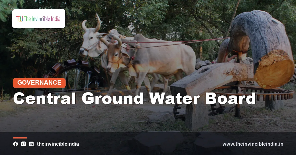
The Central Ground Water Board (CGWB) is India’s national apex agency for surveying, assessing, monitoring and managing groundwater, functioning under the Ministry of Jal Shakti. It maps India’s underground aquifers, measures how much groundwater is being drawn out each year, and advises the Union and State governments on recharge, conservation and regulation.
Groundwater is the largest source of irrigation and the main source of drinking water in rural India, so the Central Ground Water Board’s findings affect farmers, cities and policymakers alike. This explainer covers the Board’s origins, work, the famous “over-exploited” blocks, and its relationship with the Central Ground Water Authority. Last updated: 17 October 2026.
| Full name | Central Ground Water Board (CGWB) |
|---|---|
| Established | 1970, by reorganising the Exploratory Tubewells Organisation (set up in 1954) and merging it with the groundwater wing of the Geological Survey of India |
| Parent ministry | Ministry of Jal Shakti (Department of Water Resources, River Development and Ganga Rejuvenation) |
| Headquarters | Bhujal Bhawan, Faridabad, Haryana |
| Nature of body | Subordinate scientific and technical organisation of the Government of India |
| Core functions | Hydrogeological surveys, aquifer mapping, groundwater monitoring, resource assessment, advice on recharge |
| Regulatory arm | Central Ground Water Authority (CGWA), constituted under the Environment (Protection) Act, 1986 |
| Key programmes | National Aquifer Mapping and Management Programme (NAQUIM), national groundwater monitoring, Master Plan for Artificial Recharge |
| Assessment categories | Safe, Semi-Critical, Critical, Over-Exploited (plus saline areas) |
Key Takeaways
- The Central Ground Water Board was formed in 1970 and is India’s apex scientific agency for groundwater exploration, assessment and management.
- The Central Ground Water Board has its headquarters in Faridabad, Haryana, and works under the Ministry of Jal Shakti through regional offices across the country.
- The Central Ground Water Board, together with State governments, carries out the national groundwater resource assessment that classifies assessment units as safe, semi-critical, critical or over-exploited.
- The Central Ground Water Board leads the National Aquifer Mapping and Management Programme (NAQUIM), which maps aquifers over the mappable area of the country and proposes local management plans.
- The Central Ground Water Authority, a separate regulator supported by the Central Ground Water Board, controls the extraction of groundwater in notified areas through permissions known as no-objection certificates.
- India is generally described as the world’s largest user of groundwater, and a large share of its irrigation and rural drinking water depends on wells and tubewells.
What is the Central Ground Water Board?
The Central Ground Water Board is the Government of India’s scientific organisation responsible for understanding what lies beneath India’s soil and how much usable water it holds. It drills exploratory wells, studies rock formations, measures water levels and quality, and publishes the national picture of groundwater.
The Board is a technical and advisory agency. It tells governments where aquifers are, how fast they are being drawn down and what remedies might work. It does not supply water, and it does not itself regulate wells; regulation is the work of the Central Ground Water Authority and the State governments.
The Board is staffed by hydrogeologists, hydrologists, geophysicists, chemists and engineers, and it works through a headquarters, regional directorates and state unit offices so that field knowledge reaches every region.
How did the Central Ground Water Board begin?
The Central Ground Water Board began in 1970 when the government reorganised the Exploratory Tubewells Organisation, which had been created in 1954 under the agriculture ministry, and combined it with the groundwater wing of the Geological Survey of India. The new body brought drilling capacity and geological science together in a single national agency.
Early decades were about exploration. After Independence, India needed to find out where groundwater could support the farming boom that accompanied the Green Revolution, and the Board’s rigs went into the field to drill test wells. With the spread of electric and diesel pumps, extraction grew rapidly, and the Board’s role shifted from simply finding water to measuring how much was safe to withdraw.
Milestones in brief
- 1954: the Exploratory Tubewells Organisation is established.
- 1970: the Central Ground Water Board is created.
- 1997: the Central Ground Water Authority is constituted under the Environment (Protection) Act, 1986 following directions of the Supreme Court.
- 2010s: systematic aquifer mapping under NAQUIM expands across the country.
- 2019: the Ministry of Jal Shakti is formed, and the Board comes under its Department of Water Resources.
- 2019-20: the Atal Bhujal Yojana, a community-led groundwater management scheme, is launched.
What does the Central Ground Water Board do?
The Central Ground Water Board does five main things: it explores aquifers, monitors groundwater levels and quality, assesses the yearly resource, advises on recharge and management, and builds national databases. Each activity feeds into the others.
- Exploration: drilling exploratory and observation wells to learn the depth, thickness and yield of aquifers.
- Monitoring: measuring water levels and sampling water quality at thousands of observation wells at set times each year.
- Assessment: estimating recharge and extraction to arrive at the stage of groundwater development in each area.
- Management advice: preparing aquifer management plans, artificial recharge schemes and guidance for States.
- Data and research: publishing yearbooks, reports and maps on groundwater and its chemistry.
How does the Central Ground Water Board assess groundwater?
The Central Ground Water Board assesses groundwater by estimating how much water recharges the aquifers each year from rain, canals and irrigation return flows, deducting natural discharge, and comparing the remaining extractable resource with the amount that is actually drawn out. The comparison gives a figure called the stage of groundwater extraction, expressed as a percentage.
The assessment is run jointly with State groundwater departments using a methodology prescribed by the Groundwater Resource Estimation Committee. The country is divided into assessment units, which are usually blocks, mandals, talukas or similar sub-districts, and each unit receives a category.
How are areas classified?
| Category | Stage of extraction (approximate) | Meaning |
|---|---|---|
| Safe | Up to 70 per cent | Groundwater use is well within the annual extractable resource |
| Semi-Critical | 70 to 90 per cent | Use is rising and needs careful watching |
| Critical | 90 to 100 per cent | Use is close to the limit of the annual resource |
| Over-Exploited | More than 100 per cent | Extraction exceeds annual recharge, so water tables keep falling |
| Saline | Not rated by extraction | Groundwater is naturally too salty for most uses |
Water levels and long-term trends are also considered, so a block may be flagged if its water table shows a consistent fall even when the headline percentage looks moderate.
What are “dark zones” and over-exploited blocks?
Over-exploited blocks, once commonly called dark zones, are assessment units where the amount of groundwater extracted each year is greater than the amount naturally recharged. The older phrase “dark block” or “dark zone” is still used in popular writing for areas in the over-exploited category, and “white zones” is sometimes used for safe areas.
Such areas have been reported in parts of Punjab, Haryana, Rajasthan, Delhi, Gujarat, Tamil Nadu, Karnataka and other States, though the exact list changes with each assessment. Typical causes include heavy irrigation of water-intensive crops, dense borewell use and limited recharge in dry regions.
Being labelled over-exploited has practical consequences. New industrial or commercial extraction is more tightly controlled, and State governments may restrict new tubewells, promote recharge structures and encourage crop diversification. The classification is not permanent, and areas can improve when recharge and demand management work.
What is the National Aquifer Mapping and Management Programme?
The National Aquifer Mapping and Management Programme (NAQUIM) is a Central Ground Water Board programme that maps the aquifers beneath India in three dimensions, characterises their storage and quality, and prepares management plans for each mapped unit. The programme covers roughly the mappable area of the country, which is a little under the total land area because hard mountainous terrain is excluded.
Aquifer mapping goes beyond measuring water levels. It identifies where an aquifer is, how thick it is, how water moves through it and how it connects to rivers and rock layers. Mapping uses drilling data, geophysical surveys, water-chemistry tests and remote sensing.
The outputs are aquifer maps and management plans intended for use at the village, block and district level. They suggest whether recharge structures, demand-side measures or changes in cropping may work best in a given hydrogeological setting.
Major aquifer types in India
- Alluvial aquifers: thick sand and gravel deposits of the Indo-Gangetic and Brahmaputra plains, generally the most productive.
- Hard-rock aquifers: basalt (such as the Deccan Traps), granite and gneiss, where water sits in fractures and weathered zones and yields are modest.
- Sedimentary aquifers: sandstone and limestone belts that can provide good yields in parts of the peninsula and the west.
- Coastal aquifers: fresh water shallowly floating above saline water, vulnerable to seawater intrusion.
What is the Central Ground Water Authority and how is it different?
The Central Ground Water Authority (CGWA) is the Government of India’s regulatory body for the development and management of groundwater, set up in 1997 under the Environment (Protection) Act, 1986 after Supreme Court directions. The Central Ground Water Board is the scientific agency that supplies the data, while the Authority makes regulatory decisions.
The Authority notifies areas where groundwater needs control, grants or refuses permission for extraction by industries, mines, infrastructure projects and some commercial users, and issues guidelines on water conservation conditions. Permission is generally given in the form of a no-objection certificate (NOC), and the rules have been revised several times to cover metering, recharge conditions and water-use audits.
| Feature | Central Ground Water Board | Central Ground Water Authority |
|---|---|---|
| Nature | Scientific and technical body | Regulatory body |
| Year | 1970 | 1997 |
| Legal basis | Government of India administrative order | Environment (Protection) Act, 1986 |
| Main task | Survey, monitor, assess, advise | Regulate and control extraction in notified areas |
| Output | Maps, assessments, reports | Notifications, permissions, guidelines |
Under Indian law, groundwater has traditionally been linked to land ownership through the Indian Easements Act, 1882, which is one reason why regulating wells is difficult. Several States have their own groundwater laws, and a model bill circulated by the Centre has been used as a guide.
How does artificial recharge fit into the Board’s work?
Artificial recharge is a set of methods for putting more water back into aquifers, and the Central Ground Water Board promotes it by identifying suitable areas and designing structures. The Board has prepared a national master plan for artificial recharge that estimates how much surplus rain and river water can be directed underground and where.
- Check dams and percolation tanks: slow runoff so that it soaks into the ground.
- Recharge shafts and trenches: carry water past clogged surface layers directly into aquifers.
- Rooftop rainwater harvesting: collects roof runoff in urban areas and passes it into wells or pits.
- Revival of ponds and step-wells: restores traditional storage that also feeds groundwater.
The Jal Shakti Abhiyan, launched as a water conservation campaign, and the Atal Bhujal Yojana both draw on Board data. Atal Bhujal Yojana, started around 2019 with support from the World Bank, works with communities in water-stressed districts of seven States: Gujarat, Haryana, Karnataka, Madhya Pradesh, Maharashtra, Rajasthan and Uttar Pradesh.
Why does groundwater matter so much to India?
Groundwater matters to India because it supplies a majority of irrigation water, a large share of rural and urban drinking water and much of the water used by industry, and because it acts as a buffer during droughts. India is generally described as the largest user of groundwater in the world, accounting for roughly a quarter of global groundwater extraction by commonly cited estimates.
The shift to tubewells after the 1960s made farming less dependent on rainfall and canals, and it supported higher yields and multiple crops each year. The same shift has brought problems: falling water tables, deeper and costlier borewells, subsidised electricity that encourages over-pumping and, in some areas, natural contaminants such as arsenic and fluoride.
Groundwater quality is therefore a core part of the Board’s work. It reports on salinity, nitrate, fluoride, arsenic, iron and heavy metals in various regions, and these studies guide drinking-water programmes and health interventions.
How can the public use Central Ground Water Board information?
The public can use Central Ground Water Board information by consulting its reports, groundwater level data, yearbooks, aquifer maps and the national assessment, most of which are posted online through official portals. Village councils, farmers, builders, journalists and researchers all use the findings.
- Checking whether a block is classified as safe, semi-critical, critical or over-exploited before planning a borewell or industrial unit.
- Understanding the depth to water and the seasonal fluctuation in a district.
- Looking at water-quality maps before choosing a drinking water source.
- Applying for a no-objection certificate where a project needs one, through the process prescribed by the Authority.
Readers who need legally relevant figures should refer to the latest official assessment, because categories are revised periodically, and the exact numbers change from one report to the next.
What challenges does the Central Ground Water Board face?
The Central Ground Water Board faces the challenges of over-extraction, uneven data coverage, weak enforcement of rules, changing rainfall patterns and the fact that groundwater is difficult to see and measure. These challenges are as much social and economic as technical.
- Volume of wells: millions of private wells make metering and control extremely hard.
- Monitoring density: observation wells are limited compared with the size and variety of terrain.
- Policy overlap: power, crop and water policies of the States influence extraction more than any single agency can.
- Climate stress: erratic rainfall changes recharge and raises demand.
- Quality concerns: geogenic and human-caused contamination limits the use of otherwise abundant aquifers.
The Board has responded with more telemetric water level recorders, satellite-aided studies, community participation and better data sharing with States.
Bottom Line
The Central Ground Water Board is the scientific eyes of India’s groundwater system. Its assessments and aquifer maps decide how the country understands “safe” and “over-exploited” areas, while its partner, the Central Ground Water Authority, turns that knowledge into permissions and restrictions where necessary.
Frequently Asked Questions
What does the Central Ground Water Board do?
The Central Ground Water Board surveys, monitors, assesses and advises on groundwater in India. It drills exploratory wells, maps aquifers, tracks water levels and quality, and helps estimate the yearly groundwater resource with the States. It works under the Ministry of Jal Shakti and is headquartered in Faridabad.
What is the difference between the Central Ground Water Board and the Central Ground Water Authority?
The Central Ground Water Board is a scientific agency, while the Central Ground Water Authority is a regulator. The Board collects data and prepares assessments, and the Authority uses that data to notify areas, issue no-objection certificates and set conditions for extraction. The Authority was constituted in 1997 under the Environment (Protection) Act, 1986.
What does an over-exploited block mean?
An over-exploited block is an area where the groundwater extracted each year is greater than the amount recharged naturally, generally above 100 per cent of the annual extractable resource. Water tables in such blocks usually keep falling. Such areas face tighter limits on new extraction, and the list is updated whenever a fresh national assessment is released.
How often does India assess its groundwater resources?
India assesses its groundwater resources periodically through a joint exercise of the Central Ground Water Board and State agencies. Past national assessments came every few years, and more recent ones have become more frequent as digital tools improved. The latest official report should always be used for current figures.
What is NAQUIM?
NAQUIM is the National Aquifer Mapping and Management Programme run by the Central Ground Water Board. It maps aquifers in three dimensions, assesses their storage and quality, and prepares management plans that local authorities can use. It aims to move groundwater planning from guesswork to evidence at the local level.
Can anyone drill a borewell in India?
For ordinary domestic use, drilling a borewell is generally permitted in most places, but rules vary by State and by area. In notified areas, and for industrial, commercial or infrastructure use, permission from the Central Ground Water Authority or the State authority is usually required. Anyone planning a borewell should check the local regulations first.
{“@context”:”https://schema.org”,”@graph”:[{“@type”:”FAQPage”,”mainEntity”:[{“@type”:”Question”,”name”:”What does the Central Ground Water Board do?”,”acceptedAnswer”:{“@type”:”Answer”,”text”:”The Central Ground Water Board surveys, monitors, assesses and advises on groundwater in India. It drills exploratory wells, maps aquifers, tracks water levels and quality, and helps estimate the yearly groundwater resource with the States. It works under the Ministry of Jal Shakti and is headquartered in Faridabad.”}},{“@type”:”Question”,”name”:”What is the difference between the Central Ground Water Board and the Central Ground Water Authority?”,”acceptedAnswer”:{“@type”:”Answer”,”text”:”The Central Ground Water Board is a scientific agency, while the Central Ground Water Authority is a regulator. The Board collects data and prepares assessments, and the Authority uses that data to notify areas, issue no-objection certificates and set conditions for extraction. The Authority was constituted in 1997 under the Environment (Protection) Act, 1986.”}},{“@type”:”Question”,”name”:”What does an over-exploited block mean?”,”acceptedAnswer”:{“@type”:”Answer”,”text”:”An over-exploited block is an area where the groundwater extracted each year is greater than the amount recharged naturally, generally above 100 per cent of the annual extractable resource. Water tables in such blocks usually keep falling. Such areas face tighter limits on new extraction, and the list is updated whenever a fresh national assessment is released.”}},{“@type”:”Question”,”name”:”How often does India assess its groundwater resources?”,”acceptedAnswer”:{“@type”:”Answer”,”text”:”India assesses its groundwater resources periodically through a joint exercise of the Central Ground Water Board and State agencies. Past national assessments came every few years, and more recent ones have become more frequent as digital tools improved. The latest official report should always be used for current figures.”}},{“@type”:”Question”,”name”:”What is NAQUIM?”,”acceptedAnswer”:{“@type”:”Answer”,”text”:”NAQUIM is the National Aquifer Mapping and Management Programme run by the Central Ground Water Board. It maps aquifers in three dimensions, assesses their storage and quality, and prepares management plans that local authorities can use. It aims to move groundwater planning from guesswork to evidence at the local level.”}},{“@type”:”Question”,”name”:”Can anyone drill a borewell in India?”,”acceptedAnswer”:{“@type”:”Answer”,”text”:”For ordinary domestic use, drilling a borewell is generally permitted in most places, but rules vary by State and by area. In notified areas, and for industrial, commercial or infrastructure use, permission from the Central Ground Water Authority or the State authority is usually required. Anyone planning a borewell should check the local regulations first.”}}]}]}


