

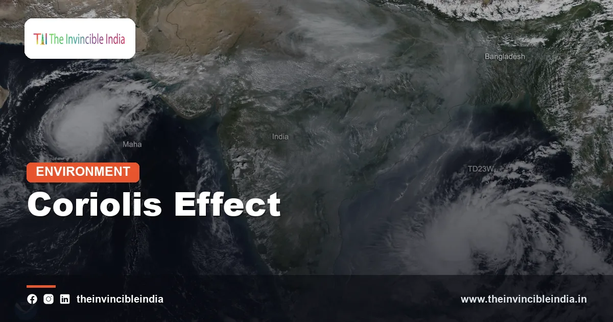
The Coriolis effect is the apparent sideways bend in the path of anything that moves across the rotating Earth, such as wind or ocean water, deflecting it to the right in the Northern Hemisphere and to the left in the Southern Hemisphere. It is not a real force pushing on the air but a consequence of watching motion from a spinning planet, and yet it shapes some of the most important features of India’s weather: the curve of the monsoon winds, the anticlockwise spin of cyclones over the Bay of Bengal and the Arabian Sea, and the reason storms almost never form right on the equator. Updated 4 November 2026, this guide explains the idea without heavy mathematics and ties it to what Indians see in their skies and seas.
The effect carries the name of the French engineer and mathematician Gaspard-Gustave de Coriolis, who described the mathematics of motion in rotating systems in the 1830s. Meteorologists use it constantly, since without it the atmosphere would be a much simpler place, with air flowing straight from high pressure to low pressure and no swirling storms.
| What it is | Apparent deflection of moving air and water caused by Earth’s rotation |
|---|---|
| Direction of deflection | To the right in the Northern Hemisphere, to the left in the Southern Hemisphere |
| Strength at the equator | Zero; it grows with latitude and is greatest at the poles |
| Depends on | Latitude and the speed of the moving air or water; it is negligible for small, slow motions |
| Cyclone spin in India’s seas | Anticlockwise around the low-pressure centre (Northern Hemisphere) |
| Rough minimum latitude for cyclone birth | Around 5 degrees from the equator |
| Monsoon connection | Bends southeast trade winds into the southwesterly summer monsoon |
| Named after | Gaspard-Gustave de Coriolis, French scientist (1835 paper) |
Key Takeaways
- The Coriolis effect deflects moving air and water to the right in the Northern Hemisphere and to the left in the Southern Hemisphere because the Earth rotates.
- It is zero at the equator and strengthens toward the poles, which is why tropical cyclones do not form within a few degrees of the equator.
- Cyclones over the Bay of Bengal and the Arabian Sea spin anticlockwise because winds converging on a low-pressure centre are bent to the right.
- The southwest monsoon is partly the southeast trade wind from the Southern Hemisphere bent to the right after it crosses the equator.
- Coriolis bends winds but does not create them: pressure differences and heating start the motion, and Coriolis steers it.
- The effect is far too weak to decide which way water swirls down a household sink or toilet.
What exactly is the Coriolis effect?
The Coriolis effect is the apparent deflection of a moving object when viewed from a rotating frame of reference such as the surface of the Earth. Imagine throwing a ball straight across a spinning merry-go-round. To someone standing on the ground, the ball travels in a straight line. To someone riding the merry-go-round, the ball seems to curve away, because the platform has turned beneath it during the flight.
The Earth is the same kind of spinning platform, turning once about every 24 hours from west to east. A parcel of air moving north or south over a long distance is carried over ground that is moving at a different eastward speed, and relative to the ground it appears to veer. Near the equator the ground moves eastward at a high speed of more than 1,600 kilometres an hour, while near the poles the surface speed is tiny. An air parcel heading poleward keeps its larger eastward momentum and drifts east of the ground beneath it, which in the Northern Hemisphere appears as a turn to the right.
Physicists often call it a fictitious or apparent force, which does not mean it is imaginary in its effects. For weather forecasters it behaves like a real push in the equations, with a size that grows with the wind speed and with the sine of the latitude. A faster wind or a higher latitude means a stronger deflection.
Why is the Coriolis effect zero at the equator?
The Coriolis effect is zero at the equator because there the local vertical direction lies at right angles to the Earth’s axis of rotation, so rotation produces no horizontal turning of the ground beneath moving air. The strength depends on the sine of latitude, and the sine of zero degrees is zero.
A useful picture is a turntable. At the centre, the point under the axis, the surface rotates in place and a rolling ball is clearly deflected. At the equator, by contrast, the local ground does not spin around its own vertical line; it simply carries a flat horizontal surface along in a straight eastward path. The horizontal component of the effect therefore vanishes and grows steadily as you move toward the poles, reaching its maximum there.
For India this has a geographic meaning. The country stretches from about 8 degrees north at the southern tip near Kanyakumari to above 35 degrees north in Ladakh and Kashmir. At the southern tip the Coriolis effect is only a small fraction of its value at higher latitudes, whereas over the north Indian plains at around 25 to 30 degrees it is roughly three to four times stronger than near the southern tip. This gradient helps explain why the weather systems of Tamil Nadu and Kerala behave a little differently from those of Punjab or Uttar Pradesh.
How does the Coriolis effect shape the Indian monsoon?
The Coriolis effect shapes the Indian monsoon by bending the winds that cross the equator into the southwesterly stream that brings summer rain. In the Northern Hemisphere summer, the land of South Asia heats strongly and a low-pressure area develops over the north-west. Air is drawn toward it from the cooler Indian Ocean, beginning as the southeast trade winds south of the equator.
As these winds cross the equator, their direction relative to the Earth changes. In the Southern Hemisphere, the deflection is to the left, which is why trade winds there blow from the southeast. Once the same air crosses into the Northern Hemisphere, the deflection switches to the right. The wind therefore swings from a southeasterly flow into a southwesterly one, which is the direction in which the monsoon strikes the Kerala coast and the Western Ghats.
Near the Horn of Africa the cross-equatorial flow is concentrated into a narrow, fast low-level jet known as the Somali or Findlater jet, and part of this stream feeds moisture to India. In winter the pattern reverses: a high-pressure area builds over cold Asia and the winds blow from the northeast, producing the northeast monsoon that brings rain to Tamil Nadu in October to December. Coriolis steers both flows, but the heating contrast between land and sea supplies the energy.
Why do cyclones in the Bay of Bengal and Arabian Sea spin anticlockwise?
Cyclones over India’s seas spin anticlockwise because air rushing in toward the low-pressure centre is deflected to the right by the Coriolis effect, and a rightward bend on all sides produces a counterclockwise circulation. Without the Coriolis effect the air would flow directly into the centre and fill the low quickly, so no organised spiral would be sustained.
Think of air moving toward a low from every direction. In the Northern Hemisphere each stream turns right as it advances, so the inflow circles around the centre rather than plunging into it. The turning builds a balance in which the pressure force pulling inward is matched by the deflection pushing outward, and the winds around the centre circulate in anticlockwise loops. In the Southern Hemisphere, cyclones such as those off Madagascar or Australia spin clockwise for the opposite reason.
This is why every tropical storm in the North Indian Ocean, from the fierce cyclones of the Odisha and Andhra coasts to those that strike Gujarat, rotates anticlockwise when seen from above on a satellite image. Warm sea surface, high humidity and low wind shear power the storm, but the Coriolis effect gives it the spin that lets it organise and intensify. India Meteorological Department bulletins describe cyclone tracks and intensity on this assumption of anticlockwise circulation.
Why do cyclones rarely form near the equator?
Cyclones rarely form near the equator because the Coriolis effect there is too weak to start and sustain the rotating circulation a storm needs. Forecasters generally treat a latitude of around 5 degrees as the practical minimum, below which the deflection is so small that air simply flows into a low and fills it instead of spiralling.
This matters for India. The southern tip of the country, at roughly 8 degrees north, and the island of Sri Lanka below it, lie on the edge of the zone where the deflection starts to be adequate. Storms are therefore far more common in the northern Bay of Bengal, where latitudes of 10 to 20 degrees combine with warm water, than in the equatorial waters near the Maldives and southern Sri Lanka. Systems that form in the southern Bay often intensify only after drifting north-westward into higher latitudes.
There are rare exceptions. A storm named Vamei formed very close to the equator over the South China Sea in 2001 and surprised meteorologists, showing that strong local vorticity from a surge of winds can occasionally make up for weak Coriolis. Such cases are exceptions that prove the rule: the great majority of tropical cyclones form beyond about 5 degrees, and the most intense ones tend to develop between 10 and 20 degrees.
How does the Coriolis effect work with the pressure gradient to create wind?
The Coriolis effect works with the pressure gradient force by steering the wind that pressure differences set in motion until the two forces nearly balance and the wind blows along the isobars. Air first accelerates from high to low pressure, then turns as it speeds up, and in the upper atmosphere it ends up flowing parallel to the lines of equal pressure rather than across them. This balanced state is called geostrophic wind.
Close to the ground, friction weakens the wind and therefore weakens the deflection, so surface winds cross the isobars at a slight angle toward low pressure. That is why surface winds spiral inward around a low and outward around a high instead of moving in perfect circles. A handy rule of thumb used in the Northern Hemisphere is Buys Ballot’s law: stand with your back to the wind and the low pressure lies to your left.
The same balance shapes the subtropical jet stream over the Himalaya in winter and the westerly disturbances that sweep across north India. In summer, the monsoon trough over the Gangetic plain and the cyclonic circulation around it follow the same logic. Understanding the partnership between pressure and Coriolis is the basis of weather map reading: lines packed closely together imply strong gradients and strong winds, while their direction follows from the deflection.
Does the Coriolis effect influence ocean currents around India?
Yes, the Coriolis effect influences ocean currents around India by deflecting moving surface water and by driving Ekman transport, in which wind-stressed surface layers move at an angle to the wind. In the Northern Hemisphere, the net transport of the upper ocean layer is roughly at right angles, to the right, of the wind direction.
This has practical consequences along India’s coasts. During the southwest monsoon, winds along the Somali and Arabian coasts drive offshore Ekman transport that pulls cold, nutrient-rich water up from depth, creating productive fishing grounds. Along parts of the Indian west coast, similar processes during the monsoon bring upwelling and a seasonal increase in fish such as oil sardine and mackerel. The reversal of surface currents in the north Indian Ocean twice a year, with the monsoon, is among the most distinctive features of this ocean, and Coriolis helps shape the paths the currents take.
The effect also contributes to the intensification of western boundary currents, such as the Somali Current off East Africa, which is among the strongest currents in the world during the southwest monsoon. For coastal communities, these deflected flows influence water temperature, plankton and fish catch, and for forecasters they help determine the heat stored in the sea that fuels cyclones.
Does water really swirl in opposite directions in a sink?
No, the direction in which water swirls down a household sink or toilet is not decided by the Coriolis effect, because the effect is far too weak at that small scale and slow speed. The swirl is set by the shape of the basin, leftover motion in the water and how the tap was last used, not by the planet’s rotation.
Careful experiments with still water in specially prepared tanks have shown the Coriolis influence only when the water is left to settle for a day or more and the shape is nearly perfectly symmetrical. In an ordinary Indian bathroom, someone can easily make the water spin either way by stirring it slightly. Claims that water drains differently at places close to the equator, which tourists sometimes see in staged demonstrations, are tricks rather than science.
The effect matters when motions are large in size and duration, such as a storm hundreds of kilometres across lasting days, or ocean currents spanning thousands of kilometres. A useful way of judging is the Rossby number, which compares the inertia of a flow to the rotational influence; small values mean rotation dominates, and large values mean it can be ignored. A sink has a very large value, a cyclone a small one.
How does the Coriolis effect compare across India’s latitudes and phenomena?
The Coriolis effect increases steadily with latitude, so its influence differs between the southern peninsula and the northern plains and mountains. The table below gives approximate relative strength compared with its maximum value at the pole, using the sine of latitude, along with the main phenomena it affects.
| Place or zone | Approximate latitude | Relative Coriolis strength | Where it matters |
|---|---|---|---|
| Equator, Maldives edge | 0 to 5 degrees north | 0 to under 10 percent | Almost no cyclone formation |
| Kanyakumari, southern Kerala | About 8 degrees north | About 14 percent | Monsoon winds turning, weak storm spin |
| Chennai, Visakhapatnam | 13 to 18 degrees north | 22 to 31 percent | Cyclone intensification zone |
| Delhi, Gangetic plain | 25 to 29 degrees north | 42 to 49 percent | Monsoon trough circulation, western disturbances |
| Ladakh, Kashmir | 32 to 35 degrees north | 53 to 57 percent | Strong westerly jet stream steering |
Why does the Coriolis effect matter for India’s forecasts and safety?
The Coriolis effect matters for forecasts and safety because every numerical weather model includes it, and without it predictions of cyclone tracks, monsoon flow and rainfall would be wrong. Understanding the effect also explains why storm warnings concentrate on the Bay of Bengal and the northern Arabian Sea.
The India Meteorological Department and the National Centre for Medium Range Weather Forecasting run models in which the rotation of the Earth appears as a core term in the equations of motion. Forecasts of landfall, wind speed and storm surge rely on how well the models reproduce spin-up and track curvature. Improvements in these systems over the past decades, together with satellite and radar coverage, have helped India cut cyclone death tolls dramatically, as with the evacuations carried out in Odisha before major storms.
For ordinary readers, the effect offers a better way to read the weather. A storm moving toward the Odisha coast will typically curve northward and then north-eastward, a track that follows from the way flow around subtropical highs and the steering winds interact with the planet’s rotation. Knowing that winds around a low in the Northern Hemisphere circle anticlockwise helps one interpret the arrows on a weather map or the news that a cyclone’s strongest winds lie on its right-hand side as it advances.
Bottom Line
The Coriolis effect is a quiet but essential part of India’s climate. It bends the cross-equatorial winds into the summer monsoon, gives the cyclones of the Bay of Bengal and the Arabian Sea their anticlockwise spin, steers ocean currents and sets the practical limit that keeps storms away from the equator. It is real and powerful for large, long-lived systems, yet negligible for a draining sink.
Frequently Asked Questions
What is the Coriolis effect in one line?
It is the apparent deflection of moving air and water caused by the Earth’s rotation, to the right in the Northern Hemisphere and to the left in the Southern Hemisphere.
Why do cyclones in India spin anticlockwise?
Winds flowing toward the low-pressure centre are deflected to the right in the Northern Hemisphere, which makes the circulation around the centre anticlockwise. Southern Hemisphere cyclones spin clockwise.
Why don’t cyclones form on the equator?
The Coriolis effect is zero at the equator and very weak within about 5 degrees of it, so air cannot develop the sustained spin that a cyclone needs.
How does the Coriolis effect help create the Indian monsoon?
It bends the southeast trade winds from the Southern Hemisphere into southwesterly winds after they cross the equator. Land heating draws them in, and the deflection sets their direction toward India.
Does the Coriolis effect decide which way water drains in a sink?
No. The effect is too weak at that small scale, and the swirl is controlled by the basin shape and any leftover motion in the water.
Who discovered the Coriolis effect?
French scientist Gaspard-Gustave de Coriolis described the mathematics of motion in rotating systems in 1835, and the effect now carries his name. Meteorologists later applied it to the atmosphere and the oceans.
{“@context”:”https://schema.org”,”@graph”:[{“@type”:”FAQPage”,”mainEntity”:[{“@type”:”Question”,”name”:”What is the Coriolis effect in one line?”,”acceptedAnswer”:{“@type”:”Answer”,”text”:”It is the apparent deflection of moving air and water caused by the Earth’s rotation, to the right in the Northern Hemisphere and to the left in the Southern Hemisphere.”}},{“@type”:”Question”,”name”:”Why do cyclones in India spin anticlockwise?”,”acceptedAnswer”:{“@type”:”Answer”,”text”:”Winds flowing toward the low-pressure centre are deflected to the right in the Northern Hemisphere, which makes the circulation around the centre anticlockwise. Southern Hemisphere cyclones spin clockwise.”}},{“@type”:”Question”,”name”:”Why don’t cyclones form on the equator?”,”acceptedAnswer”:{“@type”:”Answer”,”text”:”The Coriolis effect is zero at the equator and very weak within about 5 degrees of it, so air cannot develop the sustained spin that a cyclone needs.”}},{“@type”:”Question”,”name”:”How does the Coriolis effect help create the Indian monsoon?”,”acceptedAnswer”:{“@type”:”Answer”,”text”:”It bends the southeast trade winds from the Southern Hemisphere into southwesterly winds after they cross the equator. Land heating draws them in, and the deflection sets their direction toward India.”}},{“@type”:”Question”,”name”:”Does the Coriolis effect decide which way water drains in a sink?”,”acceptedAnswer”:{“@type”:”Answer”,”text”:”No. The effect is too weak at that small scale, and the swirl is controlled by the basin shape and any leftover motion in the water.”}},{“@type”:”Question”,”name”:”Who discovered the Coriolis effect?”,”acceptedAnswer”:{“@type”:”Answer”,”text”:”French scientist Gaspard-Gustave de Coriolis described the mathematics of motion in rotating systems in 1835, and the effect now carries his name. Meteorologists later applied it to the atmosphere and the oceans.”}}]}]}


