

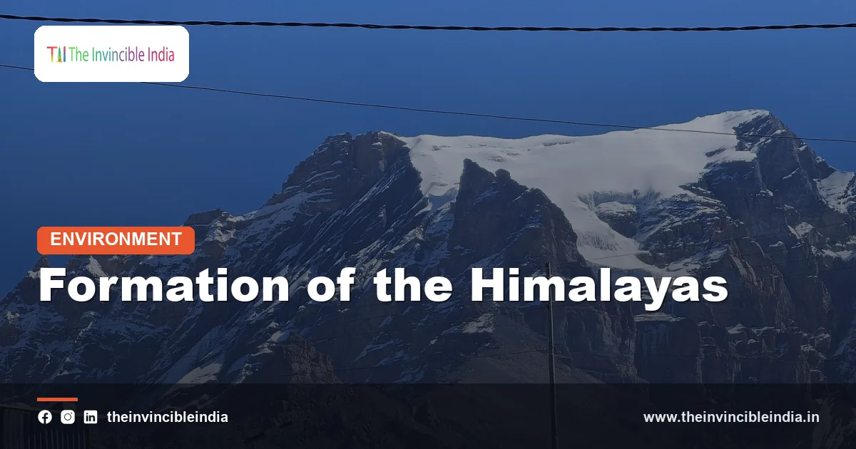
The formation of the Himalayas began roughly 50 to 55 million years ago, when the northward-moving Indian plate collided with the Eurasian plate, closed the ancient Tethys Sea between them and crumpled the crust into the highest mountain range on Earth. The collision did not end the story: India is still pushing north at a few centimetres a year, the range is still rising and the stress it stores is released in the earthquakes that periodically strike the Himalayan arc.
The Himalayas are therefore young, active and still being built, unlike the ancient, worn-down Aravallis or the Western Ghats. Seashells and marine fossils found at heights of thousands of metres show that rocks laid down on a sea floor have been lifted into the sky. The formation of the Himalayas is a textbook case of continent-to-continent collision, and it shapes India’s rivers, monsoon, soils, hazards and borders.
Quick Facts
| Mountain type | Young fold-and-thrust mountains formed by continental collision |
|---|---|
| Colliding plates | Indian plate (moving north) and Eurasian plate |
| Start of collision | About 50 to 55 million years ago, though estimates in the scientific literature range from about 60 to 40 million years |
| Ocean that closed | The Tethys Sea |
| Length of the arc | About 2,400 kilometres from Nanga Parbat in the west to Namche Barwa in the east |
| Highest peak | Mount Everest at about 8,849 metres |
| Present convergence rate | About 4 to 5 centimetres a year between India and stable Eurasia, with roughly half absorbed in the Himalaya |
| Main faults | Main Central Thrust, Main Boundary Thrust and Main Frontal Thrust |
| Zones from south to north | Sub-Himalaya (Siwaliks), Lesser Himalaya, Greater Himalaya and Tethys Himalaya |
| Hazards | Great earthquakes, landslides, glacial floods |
Key Takeaways
- The Himalayas rose because the Indian plate, moving north after breaking from Gondwana, collided with Eurasia and could not sink beneath it, so the crust buckled, folded and stacked upward.
- The collision began about 50 to 55 million years ago, but the exact age and the question of whether it happened all at once or in stages remain debated among geologists.
- The range is built from slices of rock pushed southward along great thrust faults, including the Main Central Thrust, Main Boundary Thrust and Main Frontal Thrust.
- Rock that now forms the summits was once sea floor, as shown by marine limestone and fossils near the top of Mount Everest.
- Uplift continues at the order of millimetres a year in many places, balanced by erosion, and a few spots rise faster, so the often-quoted figure of about a centimetre a year is an upper range rather than a general rate.
- Strain stored along the locked faults is released in major earthquakes such as Kangra in 1905, Bihar-Nepal in 1934 and Gorkha in 2015, and large future earthquakes are expected.
What was India’s position before the Himalayas formed?
Before the Himalayas formed, India was an island-continent in the Southern Hemisphere that had broken away from the supercontinent Gondwana and was drifting north across the Tethys Ocean. Around 120 million years ago, the Indian plate lay far to the south, near the latitude of present-day Madagascar and Antarctica, with an open ocean between it and Asia.
Tethys was a vast sea that once separated the northern and southern supercontinents. Its floor was covered in sediments, shells and the remains of marine organisms, which accumulated over hundreds of millions of years and eventually hardened into limestone, sandstone and shale. These layers lay on the north edge of India and on the southern margin of Asia, and they would later be squeezed, folded and lifted.
India moved north fast. At its peak, the plate travelled at perhaps 15 to 20 centimetres a year, much quicker than most plates today. That speed is thought to have been helped by a strong pull from the sinking ocean floor ahead of it, and possibly by a push from a hot plume beneath the region. By the time India approached Asia, it had covered thousands of kilometres.
How and when did India collide with Asia?
India collided with Asia when the Tethys Sea floor between them had been almost entirely consumed by subduction, bringing the two continental margins into contact roughly 50 to 55 million years ago. Subduction, in which an ocean plate dives under another, had been pulling the ocean floor beneath the southern edge of Asia, building a volcanic mountain chain along it.
When the thick, buoyant continental crust of India reached the trench, it could not be pulled down easily, because continental rock is lighter than the mantle beneath. The ocean crust at the front was closed up, and slices of old sea floor, called ophiolites, were caught between the two continents. These are preserved today in a belt known as the Indus-Tsangpo suture zone, which marks the line where the Tethys closed and where Indian and Asian crust were welded together. It runs along the upper valleys of the Indus and the Yarlung Tsangpo, the river that becomes the Brahmaputra.
The timing is not fully settled. Different lines of evidence, including the age of the youngest marine sediments in the suture zone, the changing direction of plate motion and the first appearance of Indian rock debris in Tibet, give dates that range from about 60 to 40 million years ago. Many researchers think the collision began in the north-west first and then spread eastward, and that the closure of the ocean took place over several million years rather than at a single moment. A minority view argues that the collision involved an additional island arc, so the true story may be more complex than a single impact.
Why did the crust crumple instead of one plate sliding under the other?
The crust crumpled because both colliding plates carried thick continental rock, which is too light to sink deep into the mantle, so instead of one plate disappearing beneath the other, the crust shortened, thickened and rose. Ocean crust is dense and subducts easily. Continental crust is not.
The Indian plate did not stop when it hit Asia. It kept moving north, and the collision zone absorbed this continuing push. Part of the Indian crust slid beneath southern Tibet, doubling the thickness of the crust there to around 70 kilometres, among the thickest on Earth. Part was scraped off and stacked up along thrust faults to form the Himalaya, and part pushed material sideways, leading to the formation of the Tibetan Plateau, which stands at an average of over 4,500 metres.
Geologists estimate that India has moved some 2,000 kilometres or more northward since the collision began, though how much of that shortening happened by squeezing Indian crust and how much by deforming Asia is still debated. The slowdown in the speed of India’s drift, from the earlier extremely high rate to the present rate of about 5 centimetres a year, is itself a topic of research, with some researchers linking it to the drag of the collision and others to events deep in the mantle.
How are the Himalayas built from folds and thrusts?
The Himalayas are built from folds and thrusts in the sense that slabs of rock have been pushed southward over each other along low-angle faults, like a stack of shingles, with the oldest and deepest rocks pushed furthest. The main structure is a great wedge of crust sliding over India along a master fault at depth, called the Main Himalayan Thrust.
The range is split into four parallel belts, separated by major faults. From south to north, they are as follows.
Sub-Himalaya or Siwaliks
The Siwaliks, also called the outer Himalaya, are the lowest and youngest belt, with an average height of under 1,500 metres. They are made of sand, silt and gravel eroded from the rising mountains and then folded and uplifted again. A fault called the Main Frontal Thrust bounds them on the south, where the mountains meet the Gangetic plain.
Lesser Himalaya
The Lesser Himalaya, or Himachal, lies north of the Siwaliks, and consists of older sedimentary and metamorphic rocks. Peaks here reach 3,500 to 4,500 metres, and hill towns such as Shimla, Mussoorie and Nainital are located here. The Main Boundary Thrust separates it from the Siwaliks.
Greater Himalaya
The Greater Himalaya, or Himadri, is the highest belt, carrying the main snowy summits. Its core consists of crystalline rocks, such as gneiss and granite, that were buried deep, heated and then pushed upward. The Main Central Thrust marks its southern boundary and is one of the key faults of the range.
Tethys Himalaya
The Tethys Himalaya, also called the Tibetan-Tethys zone, lies to the north, along the border with Tibet, and contains the old sea-floor sediments of the Tethys, rich in marine fossils. It is separated from the Greater Himalaya by a fault system that moves the opposite way, called the South Tibetan Detachment, which shows that the upper crust is also slipping northward even as the whole pile is pushed south.
What evidence shows the Himalayas were once under the sea?
Evidence that the Himalayas were once under the sea includes marine fossils such as ammonites and shells in the rocks of the Tethys Himalaya, and limestone containing sea creatures near the summit of Mount Everest. These are the same kinds of rock that form on the floor of a warm, shallow sea.
In parts of Spiti, Kumaon and Nepal, fossil ammonites are so common that local people have long collected them as sacred stones, called shaligrams. The yellow band of limestone near Everest’s summit, known as the Qomolangma Formation, is of Ordovician age, around 450 million years old, and formed in the sea long before India collided with Asia. Such finds show both that the area was ocean and that vast amounts of rock have been lifted several kilometres.
Other evidence supports the story. The slivers of ocean floor in the Indus-Tsangpo suture, magnetic records in rocks that show India’s northward drift, and the similarity between India’s ancient fossils and those of Africa and Antarctica all fit the model of collision following a long journey. Satellite measurements today can detect the continued convergence directly.
Are the Himalayas still rising?
Yes, the Himalayas are still rising, because the Indian plate is still moving north and squeezing the range, although the rate varies from place to place and erosion removes much of the new height. Geodetic surveys using GPS and satellite radar show that parts of the range are rising at a few millimetres a year, and that some places rise faster.
The rate is often described as about a centimetre a year. That figure is better read as the upper end of the range, since measured uplift in most areas is a few millimetres a year, with a few hotspots faster. One of the fastest is the region around Nanga Parbat in the west, where uplift of several millimetres a year has been recorded. The region near Namche Barwa in the east is another site of rapid rise and rapid erosion.
The altitude of a peak depends on both uplift and erosion. Rain, ice and rivers strip away rock at great speed in the steep terrain, and the heavy monsoon rain adds to the work. In a rough balance, a mountain can stay at about the same height even while the crust beneath it is being squeezed upward. Everest’s elevation was most recently re-measured by Nepal and China in 2020, giving 8,848.86 metres, and other studies suggest its height may be increasing by a few millimetres a year.
What is the relationship between the Himalayas and earthquakes?
The Himalayas and earthquakes are directly linked, because the plate collision stores strain along locked faults beneath the range and releases it suddenly as earthquakes. The main fault, the Main Himalayan Thrust, is the plate boundary itself, and it is capable of generating earthquakes of magnitude 8 or larger.
The region has a long record of damaging earthquakes. The following list shows some of the major events.
- The 1905 Kangra earthquake in Himachal Pradesh, of magnitude near 7.8, killed around 20,000 people.
- The 1934 Bihar-Nepal earthquake, of magnitude near 8, devastated north Bihar and Kathmandu.
- The 1950 Assam-Tibet earthquake, one of the strongest ever recorded on land, reached magnitude about 8.6.
- The 2005 Kashmir earthquake, of magnitude about 7.6, killed tens of thousands in Pakistan-administered Kashmir and the Indian side.
- The 2015 Gorkha earthquake in Nepal, of magnitude about 7.8, killed nearly 9,000 people.
Some seismologists warn of a seismic gap in the central Himalaya, a section of the arc, between the rupture zones of the 1905 and 1934 earthquakes, that has not had a great earthquake for centuries and so may hold a large stored strain. The idea is debated, since the 2015 event released only part of the strain and the exact size of future shocks is hard to predict. What is certain is that the whole Himalayan arc is a high seismic hazard zone and that building codes matter.
How did the Himalayas change India’s climate and rivers?
The Himalayas changed India’s climate and rivers by acting as a barrier to cold northern air and monsoon moisture, feeding perennial rivers with glacier and snow melt, and supplying the sediment that built the Indo-Gangetic plain. Their rise is one of the main reasons northern India has the climate and farmland it does.
The high wall blocks frigid Central Asian winds, keeping the Indian winter far milder than at the same latitudes in China. It traps the moist monsoon winds on the Indian side, helping to produce heavy summer rain. The heating of the Tibetan Plateau in summer is also thought to strengthen the monsoon circulation, though how large the effect is, and when it began, are subjects of active research.
The rivers that rise in or cross the range, including the Indus, Ganga and Brahmaputra and their tributaries, carry water from snow and ice in all seasons. They also carry a huge load of sediment eroded from the mountains, depositing it in a deep foreland basin at the foot of the range. Over millions of years this created the flat, fertile alluvial plains that now support hundreds of millions of people. The same geology has produced hazards, such as landslides on steep slopes and floods in glacial lakes.
How do the stages of Himalayan formation compare?
The stages of Himalayan formation can be summarised as a sequence from ocean closure and collision to uplift, folding and thrusting, and continuing deformation, each with an approximate time and a main result. The table below presents a simplified timeline, and the dates are approximate and sometimes debated.
| Stage | Approximate time | What happened |
|---|---|---|
| Drift of India | About 120 to 55 million years ago | India moves north across the Tethys, subducting the sea floor beneath Asia |
| Initial collision | About 50 to 55 million years ago | Indian and Asian continental margins meet, the Tethys closes and a suture forms |
| Early thickening and uplift | About 50 to 25 million years ago | Crust thickens, the Tibetan region rises and the first thrusts form |
| Rise of the Greater Himalaya | About 25 to 15 million years ago | The Main Central Thrust moves and deeply buried rocks are brought to the surface |
| Growth of the Lesser Himalaya and Siwaliks | About 15 million years ago to the present | The Main Boundary Thrust and Main Frontal Thrust become active, and foreland sediments are folded |
| Present activity | Now | Convergence of a few centimetres a year, ongoing uplift and great earthquakes |
What are the remaining questions about the Himalayas?
The remaining questions about the Himalayas include exactly when and how the collision began, how much crust has been lost or squeezed out sideways, and what controls the timing of great earthquakes. Scientists agree on the broad picture but disagree on many of the details.
One major debate concerns the size of what is called Greater India, the part of the northern Indian margin that has been shortened or subducted. Estimates vary widely. Another concerns the relative role of crustal thickening and deeper processes in raising the Tibetan Plateau, including the possible loss of dense lower lithosphere. A third concerns how the timing of uplift compares with the monsoon’s history. New techniques, such as dating minerals in rocks, tracking tiny movements with GPS and imaging the structure with seismic waves, are helping to narrow the answers.
Bottom Line
The Himalayas are the product of a slow-motion collision that is still under way, in which the Indian plate closed an ocean, thickened the crust and lifted ancient sea floor into the sky. The range shapes India’s climate, rivers and hazards, and the same forces that built it will continue to shake it. Last updated: 2 November 2026.
Frequently Asked Questions
How were the Himalayas formed?
The Himalayas formed when the Indian plate collided with the Eurasian plate about 50 to 55 million years ago. The Tethys Sea between them closed, and because neither continental plate could sink easily, the crust folded, thickened and was thrust upward into a mountain range.
Are the Himalayas still growing?
Yes, the Himalayas are still rising because India continues to move north at a few centimetres a year. Measured uplift in most places is a few millimetres a year, with faster rates in a few spots. Erosion removes much of the new height, so peaks rise slowly.
Why are marine fossils found on Mount Everest?
Marine fossils are found near the top of Everest because its summit rocks are limestone that formed on a sea floor around 450 million years ago. The collision of India and Asia lifted these rocks several kilometres upward, so ancient sea creatures now lie at the roof of the world.
What is the Main Central Thrust?
The Main Central Thrust is a major fault that runs along the Himalaya and separates the Lesser Himalaya from the Greater Himalaya. Along it, high-grade crystalline rocks were pushed southward over younger rocks. It is one of three main thrusts, alongside the Main Boundary Thrust and Main Frontal Thrust.
Why do earthquakes happen in the Himalayas?
Earthquakes happen because the Indian plate is pushing under the Himalaya and stress builds up on a locked fault called the Main Himalayan Thrust. When the stress is suddenly released, a large earthquake occurs. The 1905 Kangra, 1934 Bihar-Nepal and 2015 Gorkha earthquakes are examples.
How old are the Himalayas?
The Himalayas began to form around 50 to 55 million years ago, which is young compared with ranges like the Aravallis. Some of the rocks in them are far older, and the highest peaks rose mostly in the last 20 million years or so. The exact dates are still debated.
{“@context”:”https://schema.org”,”@graph”:[{“@type”:”FAQPage”,”mainEntity”:[{“@type”:”Question”,”name”:”How were the Himalayas formed?”,”acceptedAnswer”:{“@type”:”Answer”,”text”:”The Himalayas formed when the Indian plate collided with the Eurasian plate about 50 to 55 million years ago. The Tethys Sea between them closed, and because neither continental plate could sink easily, the crust folded, thickened and was thrust upward into a mountain range.”}},{“@type”:”Question”,”name”:”Are the Himalayas still growing?”,”acceptedAnswer”:{“@type”:”Answer”,”text”:”Yes, the Himalayas are still rising because India continues to move north at a few centimetres a year. Measured uplift in most places is a few millimetres a year, with faster rates in a few spots. Erosion removes much of the new height, so peaks rise slowly.”}},{“@type”:”Question”,”name”:”Why are marine fossils found on Mount Everest?”,”acceptedAnswer”:{“@type”:”Answer”,”text”:”Marine fossils are found near the top of Everest because its summit rocks are limestone that formed on a sea floor around 450 million years ago. The collision of India and Asia lifted these rocks several kilometres upward, so ancient sea creatures now lie at the roof of the world.”}},{“@type”:”Question”,”name”:”What is the Main Central Thrust?”,”acceptedAnswer”:{“@type”:”Answer”,”text”:”The Main Central Thrust is a major fault that runs along the Himalaya and separates the Lesser Himalaya from the Greater Himalaya. Along it, high-grade crystalline rocks were pushed southward over younger rocks. It is one of three main thrusts, alongside the Main Boundary Thrust and Main Frontal Thrust.”}},{“@type”:”Question”,”name”:”Why do earthquakes happen in the Himalayas?”,”acceptedAnswer”:{“@type”:”Answer”,”text”:”Earthquakes happen because the Indian plate is pushing under the Himalaya and stress builds up on a locked fault called the Main Himalayan Thrust. When the stress is suddenly released, a large earthquake occurs. The 1905 Kangra, 1934 Bihar-Nepal and 2015 Gorkha earthquakes are examples.”}},{“@type”:”Question”,”name”:”How old are the Himalayas?”,”acceptedAnswer”:{“@type”:”Answer”,”text”:”The Himalayas began to form around 50 to 55 million years ago, which is young compared with ranges like the Aravallis. Some of the rocks in them are far older, and the highest peaks rose mostly in the last 20 million years or so. The exact dates are still debated.”}}]}]}


