

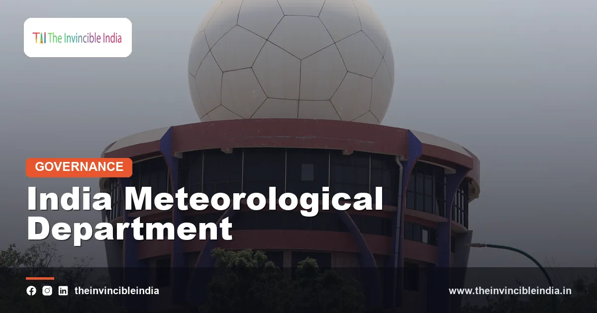
The India Meteorological Department (IMD) is the national weather service of India, established in 1875 and operating today under the Ministry of Earth Sciences. It issues daily weather forecasts, the annual monsoon forecast, cyclone and heatwave warnings, and specialised services for farmers, airports and the shipping lanes around the Indian coast.
From the evening television forecast to the cyclone alert that triggers a coastal evacuation, the India Meteorological Department is the source behind most official weather information in the country. This explainer sets out how the department began, what it does, how its forecasts and colour-coded warnings work, and what its limits are. Last updated: 17 October 2026.
| Full name | India Meteorological Department (IMD) |
|---|---|
| Established | 15 January 1875 |
| First head | Henry Francis Blanford, the first Meteorological Reporter to the Government of India |
| Parent ministry | Ministry of Earth Sciences (since 2006) |
| Headquarters | Mausam Bhavan, Lodi Road, New Delhi |
| Headed by | Director General of Meteorology |
| Regional centres | Six Regional Meteorological Centres: New Delhi, Mumbai, Chennai, Kolkata, Nagpur and Guwahati |
| International role | Regional Specialised Meteorological Centre (RSMC) of the World Meteorological Organization for tropical cyclones over the North Indian Ocean |
| Key services | Weather forecasts, monsoon outlooks, cyclone warnings, agromet advisories, aviation meteorology |
Key Takeaways
- The India Meteorological Department was established on 15 January 1875 and is the official national agency for weather, climate and related warnings in India, with its headquarters at Mausam Bhavan in New Delhi.
- The India Meteorological Department issues the all-India long-range monsoon forecast, which is announced in stages before and during the June to September rainy season.
- The India Meteorological Department is a Regional Specialised Meteorological Centre of the World Meteorological Organization for tropical cyclones, so it names storms and issues advisories for the Bay of Bengal and the Arabian Sea.
- The India Meteorological Department uses a four-colour system of green, yellow, orange and red to rank the severity of its weather warnings.
- The India Meteorological Department operates a national network of observatories, automatic weather stations, Doppler weather radars and satellite links, and it works closely with the Indian Space Research Organisation.
- The India Meteorological Department also provides district-level agricultural advisories and aviation weather services, along with rainfall inputs for river flood forecasts.
What is the India Meteorological Department?
The India Meteorological Department is the government agency that observes, forecasts and warns about weather, and that records climate data for the whole country. It is the principal body for official meteorological information, and it provides weather guidance to the public, disaster managers, farmers, aviation, shipping, industry and the armed forces.
The department functions as a scientific agency of the Ministry of Earth Sciences. It collects data from thousands of observing points, runs computer models with partner institutions, and combines the results with the experience of forecasters in its national and regional centres. Its forecasts are issued in English, Hindi and several regional languages.
Weather forecasting is only one part of the mandate. The department also maintains climate records that stretch back more than a century, supports research and trains meteorologists for the country.
How did the India Meteorological Department begin?
The India Meteorological Department began in 1875 after a series of disasters, including a devastating cyclone near Calcutta in 1864 and failed monsoons that led to famines in the 1860s and 1870s, showed the need for a central weather organisation. Henry Francis Blanford was appointed as the first Meteorological Reporter, and the department was founded on 15 January 1875.
Observation in India was much older. Astronomical and weather observatories existed in Madras (in the 1790s), Bombay’s Colaba (in the 1820s) and other places, and scientific societies kept weather records. The 1875 reorganisation brought these efforts together under a single authority.
Blanford’s work on the monsoon is often cited as the beginning of long-range forecasting in India, and a monsoon outlook is reported to have been issued as early as 1886. Later, Gilbert Walker, who served as head of the department in the early twentieth century, studied global pressure patterns and described the Southern Oscillation, a discovery that later became part of the understanding of El Niño.
Milestones in brief
- 1875: the India Meteorological Department is founded.
- 1886: an early seasonal monsoon forecast is attempted.
- 1900s-1920s: Gilbert Walker develops statistical forecasting and identifies large-scale climate patterns.
- 1940s: the headquarters moves to New Delhi.
- 1950s onwards: expansion of weather services, cyclone warning systems and radar.
- 2006: the department is placed under the Ministry of Earth Sciences.
- 2025: the department completes 150 years of service.
What does the India Meteorological Department do?
The India Meteorological Department observes the atmosphere, produces forecasts at different time scales and issues warnings for dangerous weather. It also supports specialised users and international exchange of data.
- Observation: running surface observatories, upper-air stations, automatic weather stations, rain gauges, radars and satellite receiving systems.
- Forecasting: issuing local, regional and national forecasts, from a few hours to a season ahead.
- Warnings: alerting authorities and the public about cyclones, heavy rain, heatwaves, cold waves, thunderstorms, dust storms and fog.
- Climate services: maintaining records, issuing seasonal outlooks and publishing climate summaries.
- Specialised services: agrometeorology, aviation, marine and hydrometeorology.
- Research and training: improving models and training forecasters and meteorological staff.
How does the India Meteorological Department forecast the monsoon?
The India Meteorological Department forecasts the monsoon by combining statistical models and dynamical computer models that use ocean temperatures, atmospheric pressure, snow cover and global climate signals such as El Niño and the Indian Ocean Dipole. It issues the all-India long-range forecast for the June to September season in two stages, usually in April and then late May or early June.
The forecast is expressed as a percentage of the Long Period Average (LPA), which is the average seasonal rainfall of the country over a reference period of several decades and is about 87 centimetres in recent calculations. The department then groups the outlook into categories.
| Category | Seasonal rainfall as a share of the Long Period Average |
|---|---|
| Deficient | Below 90 per cent |
| Below normal | 90 to 95 per cent |
| Normal | 96 to 104 per cent |
| Above normal | 105 to 110 per cent |
| Excess | More than 110 per cent |
The southwest monsoon normally sets in over Kerala around 1 June and spreads across the country by about 8 July, then begins to withdraw from northwest India in September. These normal dates are averages, and in any given year the onset may come earlier or later. The department also issues forecasts for July and August, and monthly outlooks, which update the seasonal expectation as the season progresses.
Seasonal forecasts predict the total, not where or when it will rain, so a “normal” monsoon can still include floods in one region and dry spells in another.
How does the India Meteorological Department warn about cyclones?
The India Meteorological Department warns about cyclones by tracking disturbances over the Bay of Bengal and the Arabian Sea using satellites, radars, ships, buoys and computer models, and then issuing graded bulletins to State governments and the public. As a Regional Specialised Meteorological Centre of the World Meteorological Organization, it is responsible for tropical cyclone advisories for the North Indian Ocean region, which includes neighbouring countries.
The department uses a staged warning system that includes a pre-cyclone watch, a cyclone alert, a cyclone warning and a post-landfall outlook. Storms are classified by their sustained wind speed, from depressions at the low end to super cyclonic storms at the top.
| Category | Sustained wind speed (approximate) |
|---|---|
| Depression | 31 to 49 km/h |
| Deep depression | 50 to 61 km/h |
| Cyclonic storm | 62 to 88 km/h |
| Severe cyclonic storm | 89 to 117 km/h |
| Very severe cyclonic storm | 118 to 166 km/h |
| Extremely severe cyclonic storm | 167 to 221 km/h |
| Super cyclonic storm | 222 km/h and above |
Cyclones in the region are named from an agreed list contributed by member countries, so a named storm such as those seen in recent years comes from a rotating alphabetical list. The cyclone seasons are mainly April to June and October to December. Improved forecasts, early evacuations and local preparedness are widely credited with reducing deaths from major cyclones on the Indian coast over the last few decades.
What do the colour-coded warnings mean?
The colour-coded warnings of the India Meteorological Department are a four-level alert system in which green means no action is needed, yellow means be aware, orange means be prepared and red means take action. The colours apply to a district or a sub-division for a stated period, usually up to five days ahead.
| Colour | Meaning | Suggested response |
|---|---|---|
| Green | No warning | No action needed |
| Yellow | Be aware | Watch the situation and follow updates |
| Orange | Be prepared | Prepare for disruption, travel and utility problems |
| Red | Take action | Act on official instructions, move to safety if advised |
The colour reflects the expected impact, not just the amount of weather. Heavy rain in a hilly district can warrant a higher colour than the same rain on dry plains. Terms such as heavy, very heavy and extremely heavy rainfall have defined ranges, with heavy rain broadly meaning about 64.5 to 115.5 millimetres in 24 hours.
Heatwaves are declared using temperature thresholds and departures from normal: generally when the maximum temperature reaches at least 40 degrees Celsius in the plains, at least 37 degrees on the coast or at least 30 degrees in hilly regions, together with a significant rise above the normal for that place.
How does the India Meteorological Department collect its data?
The India Meteorological Department collects its data through a layered network of surface observatories, upper-air balloon stations, automatic weather stations and rain gauges, Doppler weather radars, and satellites. Together these give the continuous, three-dimensional picture of the atmosphere required for modern forecasting.
- Surface observatories: record temperature, humidity, pressure, wind and rainfall at fixed times.
- Upper-air stations: release balloons carrying radiosondes that measure the atmosphere up to high altitudes.
- Doppler Weather Radar: detects rainfall, storm structure and wind within a range of a few hundred kilometres, important for thunderstorms and cyclones.
- Satellites: India’s INSAT series and other satellites supply cloud, moisture and sea-surface information at regular intervals.
- Ocean data: ships, buoys and coastal stations contribute to cyclone and monsoon tracking.
In 2024 the government approved Mission Mausam, a programme to strengthen observation, computing and forecasting, including a larger radar network and improved models. The department uses high-performance computers in cooperation with institutions such as the Indian Institute of Tropical Meteorology in Pune and the National Centre for Medium Range Weather Forecasting in Noida.
What time ranges do the forecasts of the India Meteorological Department cover?
The forecasts of the India Meteorological Department cover time ranges from a few hours to an entire season, with accuracy generally falling as the range lengthens. Each range serves a different purpose.
| Type | Approximate range | Typical use |
|---|---|---|
| Nowcast | Up to about 3 hours | Thunderstorms, squalls, sudden heavy rain |
| Short range | Up to about 3 days | Daily city and district forecasts |
| Medium range | About 3 to 10 days | Agriculture, events, travel planning |
| Extended range | Up to about 4 weeks | Weekly outlooks for rainfall and temperature trends |
| Long range | A season | Monsoon and winter outlooks |
What special services does the India Meteorological Department offer to farmers and aviation?
The India Meteorological Department offers agrometeorological advisories to farmers and meteorological briefings to aviation, along with marine bulletins for fishermen and ships. These services turn raw weather data into advice for a specific activity.
Agriculture
Through its Gramin Krishi Mausam Sewa, the department works with agricultural universities and research institutions to issue district-level advisories on sowing, irrigation, pest risk and harvesting, usually in local languages and delivered by text messages, radio and mobile applications. Rainfall forecasts also shape crop insurance and procurement planning.
Aviation
For aviation, the department posts meteorological offices at major airports to supply weather observations, landing and take-off forecasts, and warnings about turbulence, low visibility and thunderstorms. Safe flying depends on this support, especially in fog and monsoon storms.
Marine and hydrometeorology
The department issues sea-state and wind warnings for coastal waters, and its flood meteorological offices supply rainfall forecasts to the Central Water Commission for river flood forecasting. A forecast of heavy rain in a catchment often comes from IMD before a river level starts rising.
What are the limits of weather forecasting in India?
Weather forecasting in India has limits because the atmosphere is chaotic, the monsoon is complex, and fast local events such as thunderstorms and cloudbursts are hard to pin down to a specific village or hour. The India Meteorological Department itself describes forecasts as probabilistic guidance.
- Small-scale events: cloudbursts and localised thunderstorms can occur within a few kilometres and a few hours.
- Complex terrain: the Himalaya and Western Ghats create sharp local contrasts in rainfall.
- Monsoon variability: breaks and surges within the season make a seasonal total an imperfect guide to local conditions.
- Climate change: a warming climate is linked to more extreme rainfall events and shifting storm behaviour.
- Last-mile delivery: an accurate forecast helps only if it reaches people in a language and format they can act on.
The department has been investing in denser observation, higher-resolution models and impact-based warnings that describe what the weather will do, not only what it will be.
How can the public use the India Meteorological Department’s information?
The public can use the India Meteorological Department’s information through its official website, mobile applications, social media accounts, regional centre bulletins, and through newspapers, radio and television that carry its forecasts. Official channels are preferable to unverified forwarded messages during a cyclone or flood.
- Check the colour-coded warning for the district before travel or outdoor work.
- Follow cyclone bulletins for the coast, along with directions from the State disaster management authority.
- Farmers can subscribe to district agromet advisories.
- Check city weather pages and radar images for rainfall in the next few hours.
Bottom Line
The India Meteorological Department is the country’s official weather voice, with a history reaching back to 1875 and a role that now covers everything from the monsoon outlook to cyclone alerts. Its forecasts are probabilities rather than promises, but they remain the most reliable guide for planning, safety and farming across India.
Frequently Asked Questions
What does the India Meteorological Department do?
The India Meteorological Department observes weather, issues forecasts and warns about dangerous conditions such as cyclones, heatwaves and heavy rain. It also publishes the annual monsoon forecast and offers specialised services for agriculture, aviation and shipping. It operates under the Ministry of Earth Sciences and is headquartered in New Delhi.
When was the India Meteorological Department established?
The India Meteorological Department was established on 15 January 1875. Henry Francis Blanford became the first Meteorological Reporter to the Government of India. The department completed 150 years in 2025.
How does the India Meteorological Department predict the monsoon?
The India Meteorological Department predicts the monsoon with statistical and dynamical models that use ocean temperatures, atmospheric pressure and global climate signals. It issues a seasonal forecast in April and an update around the end of May, expressed as a percentage of the Long Period Average rainfall. Forecast categories range from deficient to excess.
What do the red, orange, yellow and green warnings mean?
The colours are a four-level alert scale from the India Meteorological Department. Green means no action is required, yellow means be aware, orange means be prepared, and red means take action as per official instructions. The colour is based on the expected impact of the weather in a district or sub-division.
Where is Mausam Bhavan?
Mausam Bhavan is the headquarters building of the India Meteorological Department and is located on Lodi Road in New Delhi. The word “mausam” means weather in Hindi. Regional meteorological centres in other cities support the headquarters.
Does the India Meteorological Department monitor earthquakes?
Not any more, because earthquake monitoring is now handled by the National Centre for Seismology, which is part of the Ministry of Earth Sciences. Seismology used to be part of the India Meteorological Department’s work in earlier decades. Today the department concentrates on weather, climate and related warnings.
{“@context”:”https://schema.org”,”@graph”:[{“@type”:”FAQPage”,”mainEntity”:[{“@type”:”Question”,”name”:”What does the India Meteorological Department do?”,”acceptedAnswer”:{“@type”:”Answer”,”text”:”The India Meteorological Department observes weather, issues forecasts and warns about dangerous conditions such as cyclones, heatwaves and heavy rain. It also publishes the annual monsoon forecast and offers specialised services for agriculture, aviation and shipping. It operates under the Ministry of Earth Sciences and is headquartered in New Delhi.”}},{“@type”:”Question”,”name”:”When was the India Meteorological Department established?”,”acceptedAnswer”:{“@type”:”Answer”,”text”:”The India Meteorological Department was established on 15 January 1875. Henry Francis Blanford became the first Meteorological Reporter to the Government of India. The department completed 150 years in 2025.”}},{“@type”:”Question”,”name”:”How does the India Meteorological Department predict the monsoon?”,”acceptedAnswer”:{“@type”:”Answer”,”text”:”The India Meteorological Department predicts the monsoon with statistical and dynamical models that use ocean temperatures, atmospheric pressure and global climate signals. It issues a seasonal forecast in April and an update around the end of May, expressed as a percentage of the Long Period Average rainfall. Forecast categories range from deficient to excess.”}},{“@type”:”Question”,”name”:”What do the red, orange, yellow and green warnings mean?”,”acceptedAnswer”:{“@type”:”Answer”,”text”:”The colours are a four-level alert scale from the India Meteorological Department. Green means no action is required, yellow means be aware, orange means be prepared, and red means take action as per official instructions. The colour is based on the expected impact of the weather in a district or sub-division.”}},{“@type”:”Question”,”name”:”Where is Mausam Bhavan?”,”acceptedAnswer”:{“@type”:”Answer”,”text”:”Mausam Bhavan is the headquarters building of the India Meteorological Department and is located on Lodi Road in New Delhi. The word “mausam” means weather in Hindi. Regional meteorological centres in other cities support the headquarters.”}},{“@type”:”Question”,”name”:”Does the India Meteorological Department monitor earthquakes?”,”acceptedAnswer”:{“@type”:”Answer”,”text”:”Not any more, because earthquake monitoring is now handled by the National Centre for Seismology, which is part of the Ministry of Earth Sciences. Seismology used to be part of the India Meteorological Department’s work in earlier decades. Today the department concentrates on weather, climate and related warnings.”}}]}]}


