

In India, lagoons are shallow bodies of coastal water separated from the open sea by a sand bar, spit or barrier island, and they are among the most productive wetlands in the country. Chilika in Odisha and Pulicat on the Andhra Pradesh-Tamil Nadu border are the two giants, each with a narrow ridge of sand between it and the Bay of Bengal. On the west coast, the backwaters of Kerala belong to the same family. Lagoons feed fishing communities, shelter millions of migratory birds, soften storm surges and hold some of the most fragile ecosystems on the coast. (Last updated 3 November 2026.)
This guide explains how a lagoon forms, why the water inside is brackish, what lives there, how Chilika and Pulicat differ, and why these shallow waters are under pressure from silt, pollution and unregulated fish farms.
| Feature | Quick fact |
|---|---|
| What it is | A shallow coastal water body cut off from the sea by a sand barrier |
| Water type | Brackish, a mix of river fresh water and seawater |
| Typical depth | Very shallow, often only a metre or two across most of the area |
| Largest Indian examples | Chilika (Odisha) and Pulicat (Andhra Pradesh and Tamil Nadu) |
| Related waters | Kerala backwaters such as Vembanad and Ashtamudi |
| Island lagoons | Coral atoll lagoons of Lakshadweep |
| Main resources | Fish, prawns, crabs, migratory birds, salt, tourism |
| Main threats | Siltation, shrinking sea mouth, pollution, illegal prawn enclosures |
Key Takeaways
- A lagoon is a shallow coastal water body separated from the sea by a sand bar, spit or reef, usually connected to it by one or more narrow channels.
- Chilika is among the largest brackish water lagoons in the world and the biggest in India, while Pulicat is India’s second largest.
- Lagoon water is brackish, and its salinity changes with the seasons as monsoon rivers push it toward fresh and dry-season tides push it toward salty.
- Lagoons are rich nurseries for fish and prawns and winter homes for huge numbers of migratory birds, which makes them vital for both livelihoods and conservation.
- Lagoons are temporary landforms that tend to fill with silt, so keeping the sea mouth open and the rivers clean is central to their survival.
- Kerala’s backwaters and the atoll lagoons of Lakshadweep are related water bodies, but they form in different ways from the sand-bar lagoons of the east coast.
What is a lagoon and how is it different from a lake?
A lagoon is a shallow body of water that lies parallel to the coast and is partly or wholly enclosed by a barrier of sand or coral, whereas an ordinary lake is an inland basin with no direct link to the sea. A lagoon shares features of both. It looks like a lake, but its water is influenced by tides and salt, and its life is a blend of freshwater and marine species.
The enclosing barrier may be a spit, a bar, a barrier island or a coral reef. Most lagoons have at least one inlet, a narrow gap through which the tide enters and leaves. When the inlet is wide, the lagoon behaves almost like an arm of the sea. When the inlet is narrow or sometimes closed, the water becomes more isolated, and the salinity can swing between very fresh after heavy rain and very salty in the hot dry months.
It also helps to separate lagoons from related terms. An estuary is a river mouth where fresh and salt water mix, and its flow is dominated by the river. A backwater is a local name, especially in Kerala, for a network of lagoons, lakes and canals running parallel to the coast and linked to the sea. A creek is a narrow tidal channel. Many Indian water bodies have features of more than one category, which is why names do not always follow strict scientific definitions.
How do lagoons form?
Lagoons form when waves and currents build a sand barrier across the mouth of a bay, inlet or low-lying coastal depression, trapping a body of water behind it. The most common recipe on India’s east coast is longshore drift working over thousands of years.
Waves rarely hit the coast head-on. They arrive at a slight angle, push sand up the beach in the direction of the wave, and the backwash carries it straight down the slope, so the grains move in a zigzag along the shore. This steady movement is longshore drift. Where it meets a bay or river mouth, the sand is dropped in the calmer water, and a spit grows out across the opening. Given enough time and a steady sand supply, the spit stretches across the bay and leaves only a small gap. Behind it lies a lagoon.
Several other routes lead to the same result. A rising sea after the last ice age drowned low coastal valleys and depressions, and sand barriers later closed their mouths. Offshore bars built by waves in shallow water can migrate landward and trap water behind them. On coral islands, a ring of reef rises around a sinking volcano and leaves a central lagoon, the origin of the Lakshadweep atolls. A river delta can also enclose lagoons between its distributaries and the beach ridges.
Because the sand barrier is built by moving sediment, it is not fixed. Cyclones can break it. Longshore drift can push the inlet along the coast or even close it. This is why some lagoon mouths shift position and why engineers sometimes need to intervene to keep them open.
Why is lagoon water brackish?
Lagoon water is brackish because it receives fresh water from rivers and rain and salt water from the sea through the inlet, and the two mix in varying proportions. Brackish water is saltier than a river but less salty than the open ocean.
The mix changes through the year. In the monsoon, rivers pour fresh water and silt into the lagoon, pushing salinity down and sometimes making large parts almost fresh. In the dry summer months, evaporation is strong, river flow is weak, and seawater enters through the mouth, so salinity rises. A lagoon therefore has a gradient from fresher zones near river inflow to saltier zones near the sea. At Chilika, for example, the northern sector receives distributary water from the Mahanadi and is relatively fresh in the rains, the central part is intermediate, and the southern sector and the area near the sea mouth stay saltier.
This variability sounds like a nuisance, but it is the secret of the lagoon’s productivity. Species that can handle shifting salinity, called euryhaline species, thrive here, and many marine fish and prawns use lagoons as nurseries where the young find shelter and abundant food before they move out to sea.
What makes Chilika Lagoon special?
Chilika is special because it is the largest coastal lagoon in India and one of the largest brackish water lagoons in the world, a vast sheet of shallow water in Odisha that is both a major fishery and a famous bird haven. It lies mainly in Puri, Khordha and Ganjam districts and is separated from the Bay of Bengal by a long, narrow sandy ridge.
Its size changes with the seasons, spreading widest after the monsoon floods and shrinking in the dry months. Dozens of rivers and streams, including Mahanadi distributaries, feed it, and it drains to the sea through a narrow outlet. Within the lagoon are islands and rocky patches, among them Kalijai island with its shrine, and Nalabana, an island that is part of a bird sanctuary.
In winter, Chilika hosts a large gathering of migratory waterfowl that travel from far northern regions, including Central Asia and Siberia, to feed and rest. Resident species such as herons and egrets are joined by ducks, waders and others in numbers that have made the lagoon a Ramsar wetland of international importance. It is also known for one of the few places in India where the Irrawaddy dolphin can be seen in brackish water, near the channel to the sea. The lagoon also supports a variety of fish, prawns and crabs, and its fisheries support a very large number of people living in the surrounding villages.
Chilika is also a conservation success story. By the 1990s, silt from rivers and a shifting, narrowing sea mouth had cut the exchange of water with the sea, lowering salinity and encouraging weeds and invasive vegetation. Fish catches fell. In 2000, authorities opened a new mouth in the sandy barrier to restore tidal flow. Salinity patterns, fish stocks and dolphin sightings improved in the years afterwards, and the lagoon was recognised internationally for its restoration. It shows that a managed opening can revive a struggling lagoon, though the work must be maintained as sand keeps moving.
What is special about Pulicat Lagoon?
Pulicat is India’s second-largest brackish water lagoon, a long, shallow water body straddling the Andhra Pradesh and Tamil Nadu border north of Chennai. It is separated from the Bay of Bengal by Sriharikota, a barrier island that is also home to India’s main satellite launch centre.
Unlike Chilika, Pulicat receives less fresh water, and it is fed mainly by small rivers and seasonal streams, with a narrow opening to the sea. Its water is on average more saline and is shallower, and parts of it nearly dry up in summer. Silting and the shifting of the inlet have been persistent problems, and fishers have long complained when the mouth narrows or closes.
Pulicat is best known for its birds. Flamingos, pelicans, painted storks, spoonbills and many ducks and waders arrive in the cooler months, drawn by the shallow water and the abundant food in the mudflats. The lagoon is protected in part as a bird sanctuary. It is also a place of history, as the town of Pulicat on its shore was a trading post under the Dutch, and the Buckingham Canal, an old inland waterway, runs along the coast nearby. Local fishing communities depend on its fish and prawns, and traditional methods remain in use.
| Aspect | Chilika | Pulicat |
|---|---|---|
| Location | Odisha (Puri, Khordha, Ganjam) | Andhra Pradesh and Tamil Nadu border |
| Size rank in India | Largest | Second largest |
| Sea barrier | Long sandy ridge along the coast | Sriharikota barrier island |
| Fresh water supply | Mahanadi distributaries and many streams | Small rivers and seasonal streams |
| Salinity pattern | Fresher north, saltier south and near mouth | Generally saltier, shallower |
| Famous for | Migratory birds, dolphins, fisheries, restoration | Flamingos, pelicans, history, fishing |
What lives in a lagoon?
A lagoon supports a food web based on plankton, seagrass, algae and mud-dwelling invertebrates, and on top of it sit fish, crabs, prawns and birds. Sunlight reaches the bottom of the shallow water, so plants and algae grow across a large area, giving lagoons a high production of living matter for their size.
Seagrasses and aquatic plants stabilise the bottom, shelter young fish and feed grazers. Molluscs, worms and crustaceans live in the mud and are eaten by fish and wading birds. The fish community includes species that live permanently in brackish water and species that move in from the sea to breed or feed. Mullets, milkfish, catfish, pearl spots and others are typical, along with commercially valuable prawns and crabs. Fish-eating birds such as pelicans, cormorants and kingfishers, and mud-probing waders, find food at different depths and in different zones.
The edges of the lagoon often hold reed beds, salt-tolerant marsh plants and in warmer regions mangroves, which add shelter and nutrients. The ecosystem is therefore layered, and any damage to one layer, whether seagrass loss or a blocked inlet, can ripple through the others.
How do lagoons support livelihoods and the economy?
Lagoons support livelihoods mainly through fishing, which is the economic backbone for the communities that live around them. Traditional fishers catch fish, prawns and crabs with nets, traps and small boats, and much of the produce goes to nearby markets and to larger towns. Lagoon prawns have been an export item, which has encouraged intensive prawn farming that now creates its own problems.
Other benefits include tourism, as visitors come for boat rides, birdwatching and dolphin spotting, and in some places salt-making, collection of shells and reeds, and small-scale agriculture on the margins. Lagoons also provide ecosystem services that are harder to count. They absorb floodwater from monsoon rivers, buffer coastal villages from storm waves, filter nutrients and store carbon in sediments and plants. Cyclones such as those that have struck Odisha show the value of a wide, shallow lagoon and a barrier ridge that takes part of the surge.
How are Kerala’s backwaters related to lagoons?
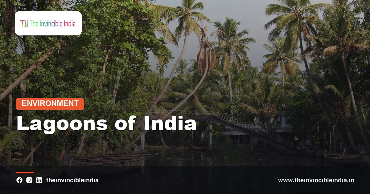
Kerala’s backwaters are a chain of interconnected lagoons, lakes, canals and estuaries running parallel to the Arabian Sea coast, and they are closely related to the lagoons of the east coast in origin and function. The coastal strip of Kerala was shaped by waves building sand bars across river mouths and low valleys, which trapped water behind the beaches.
Vembanad, the largest water body of the system and one of the longest lakes in India, stretches behind the coast around Kochi and Alappuzha, and it is separated from the sea by a narrow strip of land with a gap at Kochi. Ashtamudi in Kollam, with its many arms, is another large brackish water body, and both are recognised as wetlands of international importance. Rivers such as the Periyar and the Pamba feed them, and the Thanneermukkom bund was built across Vembanad to keep salt water away from rice fields in Kuttanad.
The backwaters mix salt and fresh water, sustain fisheries, clam gathering, coir retting and houseboat tourism, and shelter migratory and resident birds. They also face pollution, reclamation and a shrinking surface area, so their management resembles that of the larger lagoons.
Are the atoll lagoons of Lakshadweep the same?
Atoll lagoons are a different kind of lagoon, because they are enclosed by a ring of coral reef rather than a sand bar, and their water is clear and salty rather than brackish. Lakshadweep consists of coral atolls, each a ring of islands around a central lagoon, formed on the tops of submerged volcanic or ridge structures where corals have grown upward.
These lagoons are the source of the islands’ fish, sheltered anchorage and calm water for tourism. They have little river input, so they lack the freshwater mixing of Chilika or Pulicat, but they face their own threats, including warming seas that bleach corals and storms that damage reefs. Understanding them as a separate type avoids confusion when the word lagoon is used in India.
What threatens India’s lagoons?
India’s lagoons are threatened mainly by siltation, pollution and unregulated aquaculture, which together shrink and degrade the water body. Rivers carry silt, much of it from eroded farmland and construction, and the shallow basin steadily fills. As the lagoon gets shallower, its area and storage capacity decline, and its mouth may narrow or close.
Fertiliser runoff, sewage and industrial waste raise nutrient levels, fuelling algal blooms and weed growth such as water hyacinth, which choke the water and lower oxygen. Illegal prawn enclosures, locally known as gheris in Chilika, take up large areas, block the movement of water and fish and discharge waste, and they have been the source of long disputes between large operators and traditional fishers. Overfishing, the use of fine nets and disturbance to birds add to the strain.
Climate change adds new uncertainty. Rising seas may overtop or breach sand barriers, stronger cyclones can reshape them, and changes in rainfall alter the balance of fresh and salt water. Port and harbour construction nearby may change the sand supply and shift the mouth. Because the lagoon depends on the movement of sand, water and fish, the solution is rarely only local.
How can India protect its lagoons?
India can protect its lagoons by keeping their sea mouths open, controlling silt and pollution at the source in the catchment, regulating aquaculture and involving fishing communities in management. The Chilika restoration is the clearest proof that such measures can work. It combined hydrological study, a new channel to the sea, removal of illegal enclosures and a degree of community participation through a dedicated development authority.
Other measures include protecting the catchment with vegetation and soil conservation to cut silt, treating sewage before it reaches the water, using Ramsar and wetland rules to restrict harmful activity, and monitoring salinity, fish stocks and birds regularly. Sustainable fishing, with seasonal closures and mesh-size limits, and low-impact tourism can provide an income without wearing down the resource. Given that lagoons naturally evolve and fill, the aim is not to freeze them in place, but to slow the harmful human acceleration of that ageing.
Bottom Line
Lagoons are shallow, brackish, sand-fenced waters where river and sea meet, and in India they are productive fisheries, bird sanctuaries and storm buffers. Chilika and Pulicat show both their richness and their fragility, and Kerala’s backwaters and the atoll lagoons of Lakshadweep show how varied the family can be. Their survival depends on open sea mouths, clean rivers and fair use of their resources.
Frequently Asked Questions
What is the largest lagoon in India?
Chilika Lagoon in Odisha is the largest coastal lagoon in India and one of the largest brackish water lagoons in the world. Pulicat, on the Andhra Pradesh-Tamil Nadu border, is the second largest.
How is a lagoon formed?
A lagoon forms when waves and longshore drift build a sand bar or spit across a bay or inlet, trapping shallow water behind it. Rising sea level, offshore bars and coral reefs can create lagoons in a similar way.
Why is lagoon water brackish?
Because it receives fresh water from rivers and rain and salt water from the sea through a narrow inlet. The mix varies with seasons, fresher in the monsoon and saltier in the dry months.
What is the difference between a lagoon and a backwater?
A lagoon is a shallow water body enclosed by a sand barrier, while backwater is a regional term, mainly in Kerala, for a network of lagoons, lakes and canals running behind the coast. Kerala’s backwaters are in fact formed in a similar way to lagoons.
Which birds visit Chilika and Pulicat?
Chilika hosts large numbers of migratory ducks, waders and other waterfowl in winter, while Pulicat is known for flamingos, pelicans, painted storks and spoonbills. Many also stay as resident species through the year.
Why are lagoons in danger?
Silt, sewage, weed growth, illegal prawn farms and a narrowing sea mouth all degrade them, while rising seas and cyclones add further risk. Restoration at Chilika shows that opening the mouth and controlling pollution can help recovery.
{“@context”:”https://schema.org”,”@graph”:[{“@type”:”FAQPage”,”mainEntity”:[{“@type”:”Question”,”name”:”What is the largest lagoon in India?”,”acceptedAnswer”:{“@type”:”Answer”,”text”:”Chilika Lagoon in Odisha is the largest coastal lagoon in India and one of the largest brackish water lagoons in the world. Pulicat, on the Andhra Pradesh-Tamil Nadu border, is the second largest.”}},{“@type”:”Question”,”name”:”How is a lagoon formed?”,”acceptedAnswer”:{“@type”:”Answer”,”text”:”A lagoon forms when waves and longshore drift build a sand bar or spit across a bay or inlet, trapping shallow water behind it. Rising sea level, offshore bars and coral reefs can create lagoons in a similar way.”}},{“@type”:”Question”,”name”:”Why is lagoon water brackish?”,”acceptedAnswer”:{“@type”:”Answer”,”text”:”Because it receives fresh water from rivers and rain and salt water from the sea through a narrow inlet. The mix varies with seasons, fresher in the monsoon and saltier in the dry months.”}},{“@type”:”Question”,”name”:”What is the difference between a lagoon and a backwater?”,”acceptedAnswer”:{“@type”:”Answer”,”text”:”A lagoon is a shallow water body enclosed by a sand barrier, while backwater is a regional term, mainly in Kerala, for a network of lagoons, lakes and canals running behind the coast. Kerala’s backwaters are in fact formed in a similar way to lagoons.”}},{“@type”:”Question”,”name”:”Which birds visit Chilika and Pulicat?”,”acceptedAnswer”:{“@type”:”Answer”,”text”:”Chilika hosts large numbers of migratory ducks, waders and other waterfowl in winter, while Pulicat is known for flamingos, pelicans, painted storks and spoonbills. Many also stay as resident species through the year.”}},{“@type”:”Question”,”name”:”Why are lagoons in danger?”,”acceptedAnswer”:{“@type”:”Answer”,”text”:”Silt, sewage, weed growth, illegal prawn farms and a narrowing sea mouth all degrade them, while rising seas and cyclones add further risk. Restoration at Chilika shows that opening the mouth and controlling pollution can help recovery.”}}]}]}


