

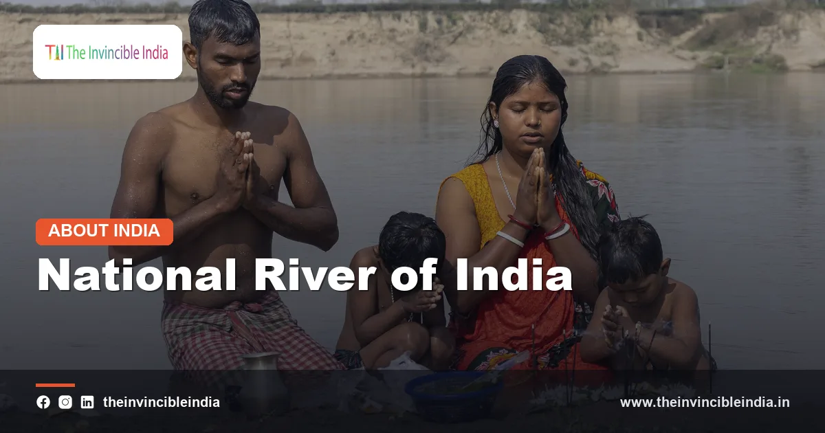
The national river of India is the Ganga (Ganges), a roughly 2,525-kilometre river that rises in the Himalaya and flows across northern and eastern India into the Bay of Bengal. The Government of India declared the Ganga the national river on 4 November 2008 in recognition of its cultural, spiritual and economic importance and to give the effort to clean it a higher national profile.
The Ganga is the longest river in India, and its basin supports a population of several hundred million people, which makes it one of the most densely settled river basins in the world. This guide explains why the Ganga is the national river of India, where it begins and ends, why it is sacred, which animals live in it, how it has been polluted and how the Namami Gange mission is attempting to restore it.
| Attribute | Details |
|---|---|
| Official status | National river of India, declared on 4 November 2008 |
| Length | Approximately 2,525 kilometres from Gaumukh to the Bay of Bengal |
| Source | Gaumukh, the snout of the Gangotri Glacier, in Uttarakhand, at roughly 3,900 metres above sea level |
| Formation of the Ganga | Confluence of the Bhagirathi and Alaknanda rivers at Devprayag, Uttarakhand |
| Mouth | Bay of Bengal, through the Sundarbans delta shared with Bangladesh |
| States on the main stem | Uttarakhand, Uttar Pradesh, Bihar, Jharkhand (along a short border stretch) and West Bengal |
| Basin area in India | About 1.08 million square kilometres, roughly a quarter of the country’s land area |
| Key tributaries | Yamuna, Ghaghara, Gandak, Kosi, Son, Gomti and Ramganga |
| Clean-up programme | Namami Gange, implemented by the National Mission for Clean Ganga (NMCG) under the Ministry of Jal Shakti |
Key Takeaways
- The Ganga was declared the national river of India on 4 November 2008, and the Ganges river dolphin was later named the national aquatic animal.
- The Ganga is about 2,525 kilometres long and starts as the Bhagirathi at Gaumukh, in the Gangotri Glacier of Uttarakhand.
- The Ganga river basin covers roughly a quarter of India’s land area and supports a population of more than 400 million people.
- The cities of Haridwar, Prayagraj and Varanasi make the Ganga the central river of Hindu pilgrimage, and the Kumbh Mela is held on its banks at Haridwar and Prayagraj.
- The Ganges river dolphin, the gharial and the hilsa fish are the best-known species that depend on the Ganga.
- Namami Gange, launched in 2014, is the flagship national programme for the cleaning and rejuvenation of the Ganga and is run by the National Mission for Clean Ganga.
Why was the Ganga declared the national river of India?
The Ganga was declared the national river of India because of its unmatched cultural and spiritual standing, its role in feeding the northern plains and the urgent need to coordinate efforts against its pollution. The declaration of 4 November 2008 was made by the Union government under the Prime Minister’s leadership and was followed in February 2009 by the creation of the National Ganga River Basin Authority (NGRBA).
The NGRBA was set up under the Environment (Protection) Act, 1986, with the Prime Minister as its chair, so that the work of the many states along the river could be managed as one basin-wide programme. Its role was later taken over by the National Ganga Council, which was constituted in 2016.
The designation does not by itself create a special legal status for the river. Its practical effect has been to place the Ganga at the centre of national water and environment policy and to attract dedicated funding.
Where does the Ganga originate and how does it form?
The Ganga originates at Gaumukh, the snout of the Gangotri Glacier in the Garhwal Himalaya of Uttarakhand, where it begins as the Bhagirathi river. The Bhagirathi flows through Gangotri, Uttarkashi and Tehri, and meets the Alaknanda at Devprayag. From that confluence the combined river is known as the Ganga.
The Bhagirathi and the Alaknanda
The Bhagirathi is regarded as the source stream in Hindu tradition, named after the legendary king Bhagiratha who is said to have brought the river down from heaven. The Alaknanda rises near the Satopanth and Bhagirath Kharak glaciers and carries a larger volume of water. It meets several tributaries at confluences known as the Panch Prayag: Vishnuprayag, Nandaprayag, Karnaprayag, Rudraprayag and Devprayag.
Entering the plains
The Ganga leaves the mountains at Haridwar in Uttarakhand, after passing Rishikesh, and enters the Indo-Gangetic plain. From here the river slows, widens and begins to meander across a flat alluvial landscape.
How long is the Ganga and where does it flow?
The Ganga is approximately 2,525 kilometres long from Gaumukh to the Bay of Bengal, and the river flows through Uttarakhand, Uttar Pradesh, Bihar and West Bengal, with a short stretch along the border of Jharkhand. Beyond the Farakka Barrage in West Bengal, the main flow passes into Bangladesh, where it is known as the Padma.
| Stage | Region | Key places |
|---|---|---|
| Upper course | Garhwal Himalaya, Uttarakhand | Gaumukh, Gangotri, Uttarkashi, Devprayag, Rishikesh, Haridwar |
| Middle course | Uttar Pradesh plains | Bijnor, Kannauj, Kanpur, Prayagraj, Mirzapur, Varanasi |
| Lower course | Bihar and Jharkhand border | Buxar, Patna, Bhagalpur |
| Delta region | West Bengal and Bangladesh | Farakka, Murshidabad, Kolkata (on the Hooghly), Sagar Island, the Sundarbans |
The Farakka split
At Farakka in Murshidabad district, a barrage commissioned in the 1970s diverts part of the Ganga water into the Bhagirathi-Hooghly channel, which flows south past Kolkata to the sea. The remaining main stream continues east as the Padma and eventually joins the Brahmaputra and the Meghna in Bangladesh. India and Bangladesh signed a treaty on the sharing of Ganga waters at Farakka in 1996 for a period of thirty years.
The Sundarbans delta
The Ganga, together with the Brahmaputra and Meghna, builds the largest river delta in the world, the Ganges-Brahmaputra delta. Its Indian portion in West Bengal and the adjoining Bangladeshi portion form the Sundarbans, the world’s largest mangrove forest and a home of the Bengal tiger.
What is the Ganga river basin and how many people depend on it?
The Ganga river basin is the area drained by the Ganga and its tributaries, and in India it covers about 1.08 million square kilometres across eleven states and union territories, which is roughly a quarter of the country. The basin supports a population of more than 400 million people, making it among the most populated river basins on earth.
The states that lie partly or wholly in the basin are Uttarakhand, Uttar Pradesh, Madhya Pradesh, Rajasthan, Haryana, Himachal Pradesh, Chhattisgarh, Jharkhand, Bihar, West Bengal and the National Capital Territory of Delhi.
Why the basin matters
- Agriculture: the fertile alluvial soil of the Indo-Gangetic plain produces wheat, rice, sugarcane, pulses and oilseeds for a large share of the country.
- Drinking water: towns and cities along the river and its groundwater aquifers draw on the basin for domestic and industrial supply.
- Irrigation: canals such as the Upper Ganga Canal, begun in the nineteenth century, carry river water to farmland.
- Energy: hydroelectric projects, including the Tehri Dam on the Bhagirathi, generate power in the upper reaches.
- Transport: the river is part of National Waterway 1, which runs from Haldia in West Bengal to Prayagraj in Uttar Pradesh.
What are the major tributaries of the Ganga?
The major tributaries of the Ganga are the Yamuna and the Son from the right bank, and the Ramganga, Gomti, Ghaghara, Gandak and Kosi from the left bank. The Himalayan tributaries bring most of the monsoon and snowmelt water, while the peninsular tributaries add less.
| Tributary | Bank | Origin or character |
|---|---|---|
| Yamuna | Right | Rises at Yamunotri in Uttarakhand; joins the Ganga at Prayagraj |
| Son | Right | Rises in the Amarkantak plateau region of Madhya Pradesh; joins in Bihar near Patna |
| Ramganga | Left | Rises in the Kumaon Himalaya; joins near Kannauj in Uttar Pradesh |
| Gomti | Left | A plains river that flows through Lucknow; joins in Uttar Pradesh |
| Ghaghara | Left | A Himalayan river from Tibet and Nepal; one of the largest tributaries by volume; joins in Bihar |
| Gandak | Left | A Himalayan river through Nepal; joins near Patna |
| Kosi | Left | A Himalayan river from Nepal known for shifting its course and causing floods in Bihar |
The Yamuna is the largest tributary by length, and its meeting with the Ganga at Prayagraj is known as the Triveni Sangam, the confluence of three rivers. Tradition holds that the third river is the invisible Saraswati.
Why is the Ganga sacred in Hinduism?
The Ganga is sacred in Hinduism because it is worshipped as the goddess Ganga, a divine mother whose water is believed to purify sins and help the soul attain liberation. Hindus bathe in the river, carry its water home in small vessels and immerse the ashes of the dead in it.
The legend of the descent
According to tradition, King Bhagiratha performed severe penance so that the Ganga would descend from heaven to release the souls of his ancestors, the sons of King Sagara. Because the force of her fall could shatter the earth, Lord Shiva is said to have caught her in his matted locks and released her gently. The word Bhagiratha prayatna, meaning a great and persistent effort, comes from this story.
The three great pilgrimage cities
- Haridwar: the place where the Ganga enters the plains, known for the evening aarti at Har Ki Pauri and as one of the four sites of the Kumbh Mela.
- Prayagraj: the site of the Triveni Sangam, where the Kumbh Mela is held every twelve years, with the most recent Maha Kumbh taking place in 2025.
- Varanasi: also called Kashi, one of the oldest continuously inhabited cities in the world, famed for its ghats, the Kashi Vishwanath temple and the Ganga aarti at Dashashwamedh Ghat.
Festivals and rites
Ganga Dussehra marks the descent of the river, and the Gangasagar Mela at Sagar Island, where the Hooghly meets the sea, takes place around Makar Sankranti. The Kumbh Mela was inscribed on UNESCO’s Representative List of the Intangible Cultural Heritage of Humanity in 2017.
What wildlife lives in the Ganga?
The Ganga supports several rare freshwater species, most famously the Ganges river dolphin, the gharial, softshell turtles and the hilsa fish. The river is an important habitat because it connects the Himalayan foothills, the plains and the mangrove delta.
The Ganges river dolphin
The Ganges river dolphin (Platanista gangetica gangetica) is a freshwater dolphin that is nearly blind and navigates by echolocation. It was declared the national aquatic animal of India in 2009 and is classified as endangered by the International Union for Conservation of Nature. Local people call it susu because of the sound it makes when it surfaces. The Vikramshila Gangetic Dolphin Sanctuary in Bihar was established in 1991, and the Government announced Project Dolphin in 2020 to conserve river and marine dolphins.
Other species
- Gharial: a fish-eating crocodilian found in the Ganga system and its tributaries, classed as critically endangered.
- Softshell and freshwater turtles: several species live in the river and have been used in conservation work to improve water quality.
- Hilsa: a prized migratory fish that moves between the sea and the river and supports fisheries in the lower basin.
- Waterbirds: storks, ibises, cranes and migratory ducks use the river’s sandbars and wetlands.
How polluted is the Ganga and what causes the pollution?
The Ganga is badly polluted along many stretches of its middle and lower course, mainly because large quantities of untreated or partly treated sewage and industrial effluent flow into it. Water-quality monitoring by the Central Pollution Control Board (CPCB) has repeatedly flagged high levels of faecal coliform bacteria and low dissolved oxygen in some reaches.
The main sources of pollution are the following.
- Municipal sewage: towns and cities along the river generate far more sewage than their treatment plants can handle.
- Industrial effluent: tanneries, textile and chemical units, sugar mills and distilleries discharge waste, with tanneries in the Kanpur area being a long-standing concern.
- Solid waste and plastics: household garbage and plastic are dumped into the river and onto its banks.
- Religious and cremation waste: flowers, idols and partly burnt remains add to the load on the river.
- Agricultural runoff: fertiliser and pesticide residues wash into the river from farmland.
- Reduced flow: dams, barrages and canals divert water, which lowers the river’s ability to dilute waste.
The Himalayan stretches above Haridwar are comparatively clean, and the problem becomes severe in the densely populated plains where the river carries less water relative to the waste it receives.
What is Namami Gange?
Namami Gange is the Government of India’s flagship programme, launched in 2014, to clean, protect and rejuvenate the Ganga and its tributaries. The programme is carried out by the National Mission for Clean Ganga (NMCG), which was registered as a society in 2011 and works under the Ministry of Jal Shakti.
Namami Gange was approved with an outlay of about ₹20,000 crore for the period to 2020, and its timeline and funding were later extended. The programme works through several linked pillars.
- Sewage treatment infrastructure: building and upgrading sewage treatment plants and sewer networks in towns along the river.
- River-front development: improving ghats and crematoria so that waste does not reach the water.
- River-surface cleaning: removing floating waste with skimmers and collection boats.
- Industrial pollution control: monitoring factories and requiring treatment of effluents.
- Afforestation and biodiversity: planting trees on the banks and protecting dolphins, turtles and fish.
- Public participation: awareness campaigns and the Ganga Gram scheme, which improves sanitation in villages on the banks.
- Ecological flow: a notification in 2018 set minimum environmental flows for different stretches of the river.
Earlier efforts
Namami Gange followed the Ganga Action Plan, which began in the mid-1980s and focused on intercepting and treating sewage in selected towns, and the NGRBA programme that began in 2009. In March 2017 the High Court of Uttarakhand declared the Ganga and Yamuna to be legal persons, but the Supreme Court of India stayed that order later in the same year.
How successful has the clean-up of the Ganga been?
The clean-up of the Ganga has produced visible gains in sewage treatment capacity, ghat management and monitoring, yet many stretches of the river still fail water-quality standards. Progress has been uneven because of delays in building infrastructure, shortfalls in operation and maintenance of treatment plants, and the continued growth of towns.
Several lessons are widely noted by researchers and officials.
- Treatment plants only work when sewer networks deliver sewage to them and when the plants are operated reliably.
- Pollution control must cover the tributaries, because rivers such as the Yamuna and the Gomti carry heavy loads into the Ganga.
- Maintaining enough flow in the river is as important as treating waste.
- Public behaviour at ghats, in homes and in industry affects the result.
Bottom Line
The national river of India, the Ganga, carries enormous natural and cultural weight: it nourishes the northern plains, shapes Hindu belief and sustains species such as the Ganges river dolphin. The task of restoring it through Namami Gange is long, and its success depends on sewage treatment, adequate flow and the cooperation of the states and people along its banks. Last updated: 17 October 2026.
Frequently Asked Questions
Which is the national river of India?
The national river of India is the Ganga, also called the Ganges. The Government of India declared it the national river on 4 November 2008. The designation recognises its cultural, spiritual and economic importance and its need for protection.
How long is the Ganga river?
The Ganga is approximately 2,525 kilometres long from its source at Gaumukh in the Gangotri Glacier to the Bay of Bengal. It flows through Uttarakhand, Uttar Pradesh, Bihar and West Bengal, with a stretch along the border of Jharkhand. In Bangladesh the main stream is known as the Padma.
Where does the Ganga originate?
The Ganga originates at Gaumukh, the snout of the Gangotri Glacier in Uttarakhand, where it begins as the Bhagirathi. The Bhagirathi meets the Alaknanda at Devprayag, and from there the combined river is called the Ganga. It reaches the plains at Haridwar.
Why is the Ganga considered holy?
The Ganga is considered holy because Hindus worship it as the goddess Ganga, whose water is believed to purify sins and aid liberation. Millions bathe at Haridwar, Prayagraj and Varanasi, and the Kumbh Mela is held on its banks. Cremation ashes are also immersed in the river as a final rite.
What is Namami Gange?
Namami Gange is the Government of India’s flagship programme, launched in 2014, to clean and rejuvenate the Ganga. It is implemented by the National Mission for Clean Ganga under the Ministry of Jal Shakti. The programme covers sewage treatment, ghat development, industrial pollution control, afforestation and biodiversity conservation.
Which animal is the national aquatic animal living in the Ganga?
The Ganges river dolphin is the national aquatic animal of India and lives in the Ganga and its tributaries. It was given this status in 2009 and is listed as endangered by the IUCN. The animal is nearly blind and relies on echolocation to find food and move through muddy water.
{“@context”:”https://schema.org”,”@graph”:[{“@type”:”FAQPage”,”mainEntity”:[{“@type”:”Question”,”name”:”Which is the national river of India?”,”acceptedAnswer”:{“@type”:”Answer”,”text”:”The national river of India is the Ganga, also called the Ganges. The Government of India declared it the national river on 4 November 2008. The designation recognises its cultural, spiritual and economic importance and its need for protection.”}},{“@type”:”Question”,”name”:”How long is the Ganga river?”,”acceptedAnswer”:{“@type”:”Answer”,”text”:”The Ganga is approximately 2,525 kilometres long from its source at Gaumukh in the Gangotri Glacier to the Bay of Bengal. It flows through Uttarakhand, Uttar Pradesh, Bihar and West Bengal, with a stretch along the border of Jharkhand. In Bangladesh the main stream is known as the Padma.”}},{“@type”:”Question”,”name”:”Where does the Ganga originate?”,”acceptedAnswer”:{“@type”:”Answer”,”text”:”The Ganga originates at Gaumukh, the snout of the Gangotri Glacier in Uttarakhand, where it begins as the Bhagirathi. The Bhagirathi meets the Alaknanda at Devprayag, and from there the combined river is called the Ganga. It reaches the plains at Haridwar.”}},{“@type”:”Question”,”name”:”Why is the Ganga considered holy?”,”acceptedAnswer”:{“@type”:”Answer”,”text”:”The Ganga is considered holy because Hindus worship it as the goddess Ganga, whose water is believed to purify sins and aid liberation. Millions bathe at Haridwar, Prayagraj and Varanasi, and the Kumbh Mela is held on its banks. Cremation ashes are also immersed in the river as a final rite.”}},{“@type”:”Question”,”name”:”What is Namami Gange?”,”acceptedAnswer”:{“@type”:”Answer”,”text”:”Namami Gange is the Government of India’s flagship programme, launched in 2014, to clean and rejuvenate the Ganga. It is implemented by the National Mission for Clean Ganga under the Ministry of Jal Shakti. The programme covers sewage treatment, ghat development, industrial pollution control, afforestation and biodiversity conservation.”}},{“@type”:”Question”,”name”:”Which animal is the national aquatic animal living in the Ganga?”,”acceptedAnswer”:{“@type”:”Answer”,”text”:”The Ganges river dolphin is the national aquatic animal of India and lives in the Ganga and its tributaries. It was given this status in 2009 and is listed as endangered by the IUCN. The animal is nearly blind and relies on echolocation to find food and move through muddy water.”}}]}]}


