

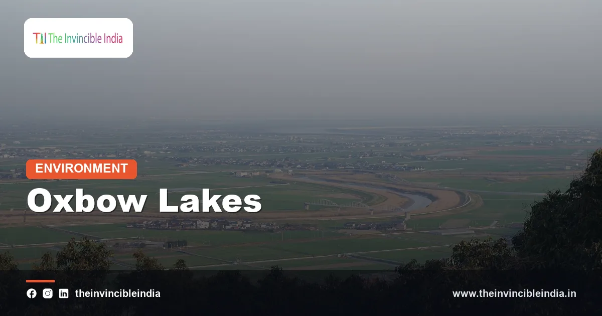
In India, an oxbow lake is a curved, crescent-shaped lake left behind when a meandering river cuts through the neck of a loop and abandons its old bend, a feature common on the flat floodplains of the Ganga, Kosi, Gandak and Brahmaputra. Cut off from the main stream, the old loop becomes a quiet pool that slowly fills with silt and plant growth.
These lakes are among the clearest signs that a river is alive and moving. They hold water for fish, birds and farmers across the plains of Bihar, Uttar Pradesh, West Bengal and Assam, and they tell the story of how rivers wander over time. Learning how they form, what they are called locally and why they matter helps explain a good part of the wetland map of the Indian plains.
| Attribute | Detail |
|---|---|
| What it is | A crescent or horseshoe-shaped lake formed from an abandoned river meander |
| Where it forms | On flat floodplains where rivers meander widely |
| How it forms | A meander loop is cut off when the river takes a shorter path across its neck |
| Other names | Cut-off lake, meander scar lake, billabong in Australia |
| Local Indian names | Chaur and maun in Bihar, beel in Assam and Bengal, baor in the Bengal delta, tal in parts of Uttar Pradesh |
| Typical rivers | Ganga, Kosi, Gandak, Ghaghara, Brahmaputra and their tributaries |
| Lifespan | Decades to centuries, before it silts up into marsh or farmland |
| Key uses | Fisheries, irrigation, migratory-bird habitat, flood buffer |
Key Takeaways
- An oxbow lake is a crescent-shaped lake formed when a river meander is cut off from the main channel, leaving a curved body of still water on the floodplain.
- Oxbow lakes form on the plains, where mature rivers like the Ganga, Kosi and Brahmaputra swing in wide loops over soft alluvium.
- In north Bihar the wetlands called chaur and maun are low-lying, seasonally flooded depressions, many of them linked to abandoned river channels, and Kanwar Jheel (Kabartal) is among the best-known of the oxbow type.
- These lakes are rich in fish, aquatic plants and migratory birds, and they support fishing and farming communities.
- Siltation, encroachment, drainage for agriculture, pollution and embankments that stop the river from refilling them are the main threats.
- Oxbow lakes also act as natural storage for floodwater and help to recharge groundwater around them.
What is an oxbow lake?
An oxbow lake is a U-shaped or crescent-shaped lake that was once a bend of a river and now lies separate from it. The name comes from the shape of an ox yoke, the curved wooden collar once used for pulling a plough.
The lake is a small piece of river history. Its curved outline records the exact shape of the old meander, and its soft muddy bed shows the sediment that has gathered since the river left. Geographers also call such features cut-off lakes or meander-scar lakes, and in Australia they are called billabongs.
Oxbow lakes are not part of the river any more, but they are tied to it. Floods can refill them, groundwater keeps them wet, and over time they fade back into the floodplain from which they came.
How does an oxbow lake form?
An oxbow lake forms when a meander grows so large that the river breaks through its narrow neck, takes the shorter route and leaves the old loop isolated. The process runs in clear steps that unfold over many years.
- Meander growth: a river on a gentle slope begins to swing in curves. Fast water erodes the outer bank of each bend, called the cut bank.
- Point bar deposition: on the inside of each bend the water is slow, and sand and silt settle there, building a point bar.
- Neck narrowing: as the outer banks retreat, the loop becomes larger and the strip of land across its base narrows.
- Cutoff: during a flood, the river breaks through the neck and takes the shorter, steeper path. This event is called a neck cutoff.
- Sealing: silt builds up at the ends of the abandoned loop, closing it off from the main channel and leaving a crescent lake.
The process shows why oxbow lakes appear only on rivers that meander. Steep mountain streams cut straight down and rarely form them. The slow, silt-laden rivers of the plains, which swing freely across soft alluvium, are ideal places.
Why do oxbow lakes form on India’s great plains rivers?
Oxbow lakes form on India’s plains rivers because the Ganga, Brahmaputra and their tributaries flow across flat, soft alluvial land with a very gentle slope and a huge load of sediment. These are exactly the conditions in which meanders grow and are cut off.
When the Himalayan rivers leave the mountains, their speed drops and they begin to drop silt. The Indo-Gangetic Plain is built of this silt, so the banks are easy to erode and the rivers can shift their channels freely. The monsoon floods then supply the energy to break through meander necks.
Few such lakes form on peninsular rivers. They flow over hard rock and have stable courses, so they have little room to swing or to cut off loops. The oxbow lake is therefore mostly a feature of the north Indian plains, the Brahmaputra valley and the Bengal delta.
Where are oxbow lakes found in India?
Oxbow lakes are found chiefly along the floodplains of the Ganga and its tributaries in Uttar Pradesh and Bihar, along the Kosi, and across the Brahmaputra valley in Assam and the Bengal plains. They occur wherever a river has meandered over wide alluvial land.
- Ganga plain: abandoned channels and loops of the Ganga, Ghaghara, Gandak and Yamuna hold lakes and marshes across Uttar Pradesh and Bihar.
- Kosi region, north Bihar: the Kosi has moved across a very wide belt, leaving behind many old channels and chains of lakes and wetlands.
- Brahmaputra valley, Assam: hundreds of floodplain wetlands called beels occupy former channels and low basins; some are oxbow in origin.
- Bengal delta: in the Nadia and Murshidabad districts the abandoned loops of the Bhagirathi and other delta rivers form lakes, known in the delta region as baors.
Not every floodplain lake is a true oxbow. Some floodplain wetlands are simple depressions, or are formed by shifting sand bars and levees, and many local names cover several origins. The common thread is a river-made water body on a floodplain.
What are maun and chaur wetlands in Bihar?
Maun and chaur are local names for the low-lying, seasonally flooded wetlands of north Bihar, many of which occupy old river channels and shallow basins on the Gandak, Kosi and Mahananda floodplains. They fill in the monsoon and shrink in the dry months.
The word chaur is used for a wetland depression that can be farmed when dry, while maun usually refers to a more permanent lake or marsh. Together they cover a large area of the Mithila and Kosi regions. Many are linked to meander scars and paleochannels, though some are simply low spots in the flat alluvial land where water gathers.
These wetlands are a basic part of rural life. Villagers fish in them, harvest makhana (fox nut), grow water chestnut and graze cattle on their margins. Makhana cultivation in the ponds and wetlands of Mithila is famous, and Bihar produces most of India’s makhana.
What is Kanwar Jheel, and why is it important?
Kanwar Jheel, also called Kabartal, is a large freshwater wetland in Begusarai district of Bihar, widely described as Asia’s largest freshwater oxbow lake, and it was designated a Ramsar site in 2020. It lies on the Burhi Gandak floodplain, a former course of the river.
The wetland is a seasonal complex, with its area expanding greatly in the monsoon and contracting in winter. It supports many resident and migratory waterbirds on the Central Asian Flyway, as well as fish and aquatic plants. It has been declared a bird sanctuary, and it is the best-known example of how a cut-off river channel can become a major wetland.
Kanwar Jheel has also been shrinking. Siltation, farming on its margins and changes in the river have reduced the extent of open water in places. Its Ramsar status brings attention and a management plan, but protecting it requires cooperation between officials and the communities that depend on it.
What lives in an oxbow lake?
Oxbow lakes shelter rich communities of fish, aquatic plants, insects, amphibians and waterbirds, because their calm, nutrient-rich water suits many species. They act as nurseries and refuges for life that depends on the river.
During floods, fish enter the lakes from the river, breed in the shallow, vegetated water and grow before returning to the river or staying put. Carp, catfish, murrels and small fish thrive in them. Plants such as lotus, water lily, hydrilla and water hyacinth form floating and submerged beds, which in turn feed insects and snails and shelter young fish.
Waterbirds including ducks, geese, herons, storks, ibises and, in winter, migratory visitors from Central Asia gather on these lakes. The wet margins are also good for frogs and for reptiles such as turtles. Many oxbow wetlands are therefore small but important biodiversity hotspots on otherwise heavily farmed plains.
How do oxbow lakes support fisheries and livelihoods?
Oxbow lakes support fisheries and livelihoods by providing fish, makhana, water chestnut, reeds, irrigation water and grazing land to the communities living around them. For many fishing families in Bihar, Assam and Bengal these lakes are a main source of income.
- Capture fisheries: fish enter from the river during floods and are caught as the water falls.
- Culture fisheries: carp are stocked in managed floodplain lakes, a method promoted in Bihar and Assam to raise fish output.
- Aquatic crops: makhana, singhara (water chestnut), lotus roots and seeds are harvested.
- Agriculture: as the water recedes, rich silty land is exposed for crops such as pulses, oilseeds and vegetables.
- Water supply: the lakes top up groundwater and provide water for livestock and irrigation in the dry season.
Access and ownership of these lakes are often disputed. Many are common property or are leased to fishing cooperatives, and conflicts arise between traditional fishers, landowners and contractors.
What threatens oxbow lakes in India?
Oxbow lakes in India are threatened by siltation, encroachment, drainage for farming, pollution, invasive plants and embankments that cut them off from the river. Many have shrunk or disappeared over the last century.
Natural ageing already fills these lakes with silt and plants, turning them into marsh, then into meadow. Human action speeds this up. Embankments along the Kosi, Gandak and Brahmaputra stop the floodwaters that once refilled the lakes and flushed them. Farmers drain the margins to plant crops, and towns grow over the edges.
Sewage and farm fertiliser feed explosive growth of water hyacinth and algae, depriving the water of oxygen. Over-fishing and the use of fine nets reduce fish stocks. Climate change adds stress through changing rainfall, with longer dry spells and heavier floods.
How can oxbow lakes be protected?
Oxbow lakes can be protected by mapping and notifying them as wetlands, restoring their link with the river, controlling encroachment and pollution and involving local communities in management. India’s wetland rules and the Ramsar Convention provide the main legal tools.
Restoration measures include desilting, reopening feeder channels, removing invasive weeds, and fixing water-sharing arrangements with farmers. Community-managed fisheries and sustainable harvest of makhana and other crops give local people a stake in keeping the water. Mapping by satellite helps track the shrinkage of wetlands over time.
Since these lakes also absorb floodwater, protecting them lowers flood risk for nearby villages. In that sense, saving an oxbow lake is not only a conservation task but also a practical form of flood management.
Bottom Line
An oxbow lake is a small picture of a big process: a river swinging, cutting and changing its mind. Along the Ganga, Kosi and Brahmaputra these crescent lakes feed people, shelter birds and soak up floods, and their survival depends on allowing rivers and floodplains to keep some of their natural freedom.
Frequently Asked Questions
What is an oxbow lake?
An oxbow lake is a crescent-shaped lake formed when a river cuts off one of its meander loops. The old bend is left as a separate pool of still water. It forms on flat floodplains where rivers meander widely.
How is an oxbow lake formed?
An oxbow lake forms when a river erodes the outer banks of a meander until the narrow neck of land breaks through, usually in a flood. The river then takes the shorter route, and silt seals off the old loop. The loop becomes a curved lake.
Where are oxbow lakes found in India?
Oxbow lakes are found mainly on the Ganga plain, along the Kosi and Gandak in Bihar, and on the Brahmaputra floodplain in Assam and the Bengal delta. They occur wherever a river has meandered over soft alluvial land. Peninsular rivers rarely form them.
What are chaur and maun?
Chaur and maun are local names for floodplain wetlands in north Bihar. Many lie in old river channels and shallow basins on the Gandak and Kosi floodplains. People use them for fishing, makhana and grazing.
Is Kanwar Jheel an oxbow lake?
Kanwar Jheel, or Kabartal, in Begusarai district, Bihar, is widely described as Asia’s largest freshwater oxbow lake. It lies on the former course of the Burhi Gandak and became a Ramsar site in 2020. It is an important habitat for waterbirds.
What happens to an oxbow lake over time?
Over time an oxbow lake fills with silt and plant matter, turning into a marsh and finally into dry land. Floods may refresh it, but without them the process speeds up. Human drainage and embankments can hasten its disappearance.
{“@context”:”https://schema.org”,”@graph”:[{“@type”:”FAQPage”,”mainEntity”:[{“@type”:”Question”,”name”:”What is an oxbow lake?”,”acceptedAnswer”:{“@type”:”Answer”,”text”:”An oxbow lake is a crescent-shaped lake formed when a river cuts off one of its meander loops. The old bend is left as a separate pool of still water. It forms on flat floodplains where rivers meander widely.”}},{“@type”:”Question”,”name”:”How is an oxbow lake formed?”,”acceptedAnswer”:{“@type”:”Answer”,”text”:”An oxbow lake forms when a river erodes the outer banks of a meander until the narrow neck of land breaks through, usually in a flood. The river then takes the shorter route, and silt seals off the old loop. The loop becomes a curved lake.”}},{“@type”:”Question”,”name”:”Where are oxbow lakes found in India?”,”acceptedAnswer”:{“@type”:”Answer”,”text”:”Oxbow lakes are found mainly on the Ganga plain, along the Kosi and Gandak in Bihar, and on the Brahmaputra floodplain in Assam and the Bengal delta. They occur wherever a river has meandered over soft alluvial land. Peninsular rivers rarely form them.”}},{“@type”:”Question”,”name”:”What are chaur and maun?”,”acceptedAnswer”:{“@type”:”Answer”,”text”:”Chaur and maun are local names for floodplain wetlands in north Bihar. Many lie in old river channels and shallow basins on the Gandak and Kosi floodplains. People use them for fishing, makhana and grazing.”}},{“@type”:”Question”,”name”:”Is Kanwar Jheel an oxbow lake?”,”acceptedAnswer”:{“@type”:”Answer”,”text”:”Kanwar Jheel, or Kabartal, in Begusarai district, Bihar, is widely described as Asia’s largest freshwater oxbow lake. It lies on the former course of the Burhi Gandak and became a Ramsar site in 2020. It is an important habitat for waterbirds.”}},{“@type”:”Question”,”name”:”What happens to an oxbow lake over time?”,”acceptedAnswer”:{“@type”:”Answer”,”text”:”Over time an oxbow lake fills with silt and plant matter, turning into a marsh and finally into dry land. Floods may refresh it, but without them the process speeds up. Human drainage and embankments can hasten its disappearance.”}}]}]}


