

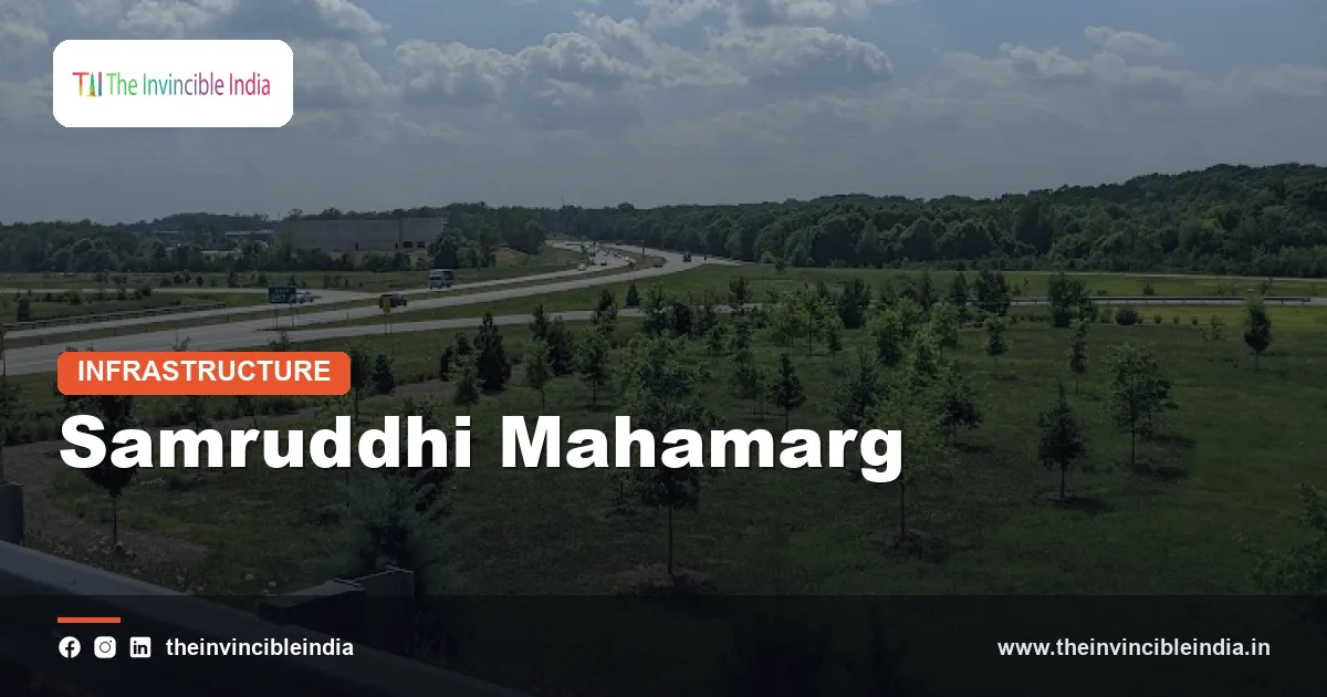
The Samruddhi Mahamarg, officially the Hindu Hrudaysamrat Balasaheb Thackeray Maharashtra Samruddhi Mahamarg and also called the Nagpur-Mumbai Expressway, is an access-controlled greenfield expressway of roughly 701 km that links Nagpur in eastern Maharashtra with the Mumbai region in the west. It was built by the Maharashtra State Road Development Corporation (MSRDC) as the state’s flagship infrastructure project and opened in phases from December 2022.
The Samruddhi Mahamarg passes through about ten districts of Maharashtra and is designed to shorten travel between Vidarbha and the Mumbai Metropolitan Region while stimulating agriculture, industry and new urban nodes along its alignment. This guide explains its route, phases, design features, environmental measures and economic goals. It was last reviewed on 16 October 2026.
| Attribute | Details |
|---|---|
| Official name | Hindu Hrudaysamrat Balasaheb Thackeray Maharashtra Samruddhi Mahamarg |
| Also known as | Samruddhi Mahamarg, Nagpur-Mumbai Expressway, Maharashtra Samruddhi Expressway |
| Implementing agency | Maharashtra State Road Development Corporation (MSRDC) |
| Approximate length | About 701 km |
| Lanes | Six lanes, with provision for expansion to eight lanes |
| Design speed | Around 150 km/h design speed, with a permitted limit of 120 km/h for cars as reported |
| Route | Nagpur to the Thane-Bhiwandi area near Mumbai, linking to the Mumbai-Nashik corridor and onward to JNPA |
| First section opened | Nagpur-Shirdi stretch, December 2022 |
| Districts covered | About ten districts directly, with many more influenced economically |
Key Takeaways
- The Samruddhi Mahamarg is an access-controlled expressway of roughly 701 km that connects Nagpur with the Mumbai region and was built by the Maharashtra State Road Development Corporation (MSRDC).
- The first section of the Samruddhi Mahamarg, from Nagpur to Shirdi, was opened in December 2022, and the remaining sections were opened in stages in 2023 and 2025.
- The Samruddhi Mahamarg is a six-lane concrete expressway designed with provision for widening to eight lanes and for high-speed travel.
- Agricultural and industrial hubs called Krishi Samruddhi Kendras, or agro-nodes, are planned along the Samruddhi Mahamarg to link farmers, processing units and markets.
- Wildlife overpasses, underpasses and other mitigation measures have been built on the Samruddhi Mahamarg in forested stretches, including areas in the Vidarbha region near tiger habitats.
- The Samruddhi Mahamarg is intended to cut the road journey between Nagpur and Mumbai to roughly half of the earlier travel time, and to open up economic opportunities for the interior districts of Maharashtra.
What is the Samruddhi Mahamarg?
The Samruddhi Mahamarg is Maharashtra’s long-distance access-controlled expressway that connects the city of Nagpur, the winter capital of the state, to the Mumbai Metropolitan Region, a distance of roughly 701 km. The word “Samruddhi” means prosperity in Marathi, and “Mahamarg” means great highway, which indicates the stated goal of linking prosperity to road access.
It was conceived by the Government of Maharashtra in the mid-2010s and renamed in honour of Balasaheb Thackeray, the founder of the Shiv Sena, during the tenure of a later state government. In official documents it is called the Hindu Hrudaysamrat Balasaheb Thackeray Maharashtra Samruddhi Mahamarg.
The project is a greenfield alignment, meaning that the road does not follow an old highway but passes through new land. It is separate from the national highways run by the National Highways Authority of India (NHAI), because the state agency MSRDC planned, built and manages it.
Which route does the Nagpur-Mumbai Expressway follow?
The Nagpur-Mumbai Expressway follows a route that runs from Nagpur through the districts of Wardha, Amravati, Washim, Buldhana, Jalna, Chhatrapati Sambhajinagar (formerly Aurangabad), Ahilyanagar (formerly Ahmednagar), Nashik and Thane, ending near Amane in the Bhiwandi-Thane area close to Mumbai. The route is usually described as passing through about ten districts and many more that are influenced by it.
Along the way, it passes close to major towns including Wardha, Karanja, Washim, Mehkar, Sindkhed Raja, Jalna, Chhatrapati Sambhajinagar, Shirdi, Sinnar and Igatpuri. In the western part, the road crosses the Sahyadri (Western Ghats) range using long tunnels and viaducts, which required complex engineering. The Kasara ghat twin tunnels, reported to be about 8 km long, are among the major structures.
The western end links to existing roads that serve Mumbai and the Jawaharlal Nehru Port Authority (JNPA) in Navi Mumbai. A connection to the Mumbai-Nashik highway and the Thane-Bhiwandi network gives the expressway access to the city’s port, airports and industrial areas.
When did the Samruddhi Mahamarg open, and in what phases?
The Samruddhi Mahamarg opened in phases, beginning with the 520 km Nagpur-Shirdi stretch in December 2022 and followed by later sections that completed the road to the Mumbai area by 2025. Construction began in the late 2010s after the state government finalised the alignment and arranged land through negotiated purchase and other mechanisms.
The phased opening allowed traffic to use completed sections while construction continued on difficult segments such as the Igatpuri ghat. The following table gives a general outline, and exact dates and kilometre figures can vary slightly between official sources.
Phases of the Samruddhi Mahamarg
| Phase | Approximate stretch | Approximate length | Opening |
|---|---|---|---|
| Phase 1 | Nagpur to Shirdi | About 520 km | December 2022 |
| Phase 2 | Shirdi to Bharvir (Nashik district) | About 80 km | May 2023 |
| Phase 3 | Bharvir to Igatpuri | About 25 km | June 2023 |
| Phase 4 | Igatpuri to Amane (Thane) | About 76 km | 2025 |
The total, when the phases are added together, is about 701 km. Smaller extensions, link roads and interchanges have been planned or completed in addition to the main alignment.
What are the design features and speed of the Samruddhi Mahamarg?
The Samruddhi Mahamarg has a six-lane concrete carriageway, a wide median, fenced access control and a design speed of around 150 km/h, with a speed limit of about 120 km/h for light vehicles. Access is limited to entry and exit interchanges, which are spaced along the route to prevent local traffic from joining at random points.
Two-wheelers, three-wheelers, tractors, animal-drawn carts and pedestrians are not allowed on the main carriageway. The road uses cement concrete pavement, which is designed for long life and lower maintenance than bitumen in heavy rainfall regions. Tolls are generally collected electronically using FASTag, and the corridor includes wayside amenities, fuel stations, emergency call arrangements and traffic management systems.
Safety has been an important topic because very straight, long stretches can induce driver fatigue and a phenomenon sometimes called highway hypnosis. Authorities have used signage, rumble strips, patrolling, speed monitoring and awareness campaigns to address risks, and road-safety experts continue to recommend rest breaks and tyre checks for long trips.
What are the Krishi Samruddhi Kendras along the expressway?
The Krishi Samruddhi Kendras are planned agro-industrial nodes, sometimes called new towns, set along the Samruddhi Mahamarg to link farms with warehousing, processing, logistics and markets. The concept is to develop clusters in which farmers, food processors, traders and service providers can operate near the expressway.
MSRDC identified a series of locations, roughly two dozen in number according to planning documents, across the districts the road crosses. These nodes are expected to include storage facilities, cold chains, agricultural markets, skill centres, residential areas and industrial plots. The aim is to let produce such as oranges from the Nagpur region, cotton, soybean, pulses and fruits move faster to consumers and ports.
The success of these nodes depends on land development, private investment, power, water and market linkages. Progress differs from node to node, and planners often describe the programme as a long-term effort that will take years to mature rather than an immediate outcome.
How are wildlife and the environment protected on the expressway?
Wildlife and the environment are protected on the Samruddhi Mahamarg through dedicated animal crossings such as overpasses and underpasses, fencing, noise barriers, special lighting rules and tree plantation drives. Parts of the route in the Vidarbha and Nashik regions pass near forests and habitats of species such as tigers, leopards, blackbuck, nilgai and other mammals.
Wildlife experts, including those associated with the Wildlife Institute of India (WII), advised on mitigation measures for sensitive stretches, including areas near the Tadoba-Andhari landscape. Dozens of crossing structures were planned along the whole road, with some designed specifically for larger animals. Fencing guides animals towards the crossings and reduces collisions.
Environmental groups have raised questions about the effect of the expressway on movement corridors, groundwater and farmland, and about the size of tree felling for the project. The authorities say that compensatory plantation and monitoring measures are part of the plan. The long-term effectiveness of crossings is best judged through continued monitoring by wildlife scientists.
Why was the Samruddhi Mahamarg built, and what are its economic goals?
The Samruddhi Mahamarg was built to cut the travel time between Nagpur and Mumbai, connect the interior and less developed districts of Maharashtra to ports and metropolitan markets, and promote balanced regional growth. Before the expressway, the road journey took on the order of 14 to 18 hours depending on traffic and route, and officials expect it to be reduced to roughly 8 hours or somewhat more in practice.
The state government has described the corridor as a way to increase investment in Marathwada, Vidarbha and North Maharashtra. Industrial areas around Nagpur, including the Multi-modal International Cargo Hub and Airport at Nagpur (MIHAN), as well as pilgrimage centres such as Shirdi, gain better access. Business in Nashik, a hub for wine, agriculture and manufacturing, is likewise connected to Mumbai and JNPA.
The reported cost of the project is more than Rs 55,000 crore, though the final figure depends on how land costs, tunnels and later link roads are counted. Supporters argue that the expressway will pay back through economic activity, while critics ask for careful evaluation of traffic volumes, toll levels and environmental effects.
How does the expressway connect with other corridors and future extensions?
The expressway connects with other corridors through interchanges that link it to national highways, state highways and the Mumbai-Nashik road, and several extensions have been proposed. These include spurs from Nagpur toward Gondia and Gadchiroli in eastern Vidarbha and a link toward Goa through the planned Shaktipeeth expressway concept, though plans of this kind can change.
The road also supports other infrastructure, such as Shirdi airport, Nagpur’s airport and the Mumbai-Nagpur rail corridors. A proposed connection toward the Vadhavan port in Palghar district is often mentioned as part of future western access, together with other ports and freight terminals on the Konkan coast.
Planners also look at Bharatmala-type national corridors and freight corridors as complementary networks. Connecting road, rail and port hubs is meant to reduce logistics costs, which in India are higher than in many other large economies.
What challenges does the Samruddhi Mahamarg face?
The Samruddhi Mahamarg faces challenges in road safety, farmer and land concerns, environmental management and the pace of economic development along the corridor. Accidents on long, straight stretches have drawn public attention, which has led to extra patrolling, awareness measures and speed management.
Land acquisition was addressed through a mix of voluntary purchase and compensation packages, but farmers and local groups raised concerns in several districts about prices, loss of fertile land and access across the road. Underpasses and service roads were added to restore movement between fields and villages. Maintenance of a concrete road, drainage in monsoon rains and the upkeep of amenities also require sustained funding.
Finally, the economic benefits depend on the development of the planned nodes, the arrival of private investors and the health of the wider economy. Evaluations after several years of operation will give a clearer picture of whether the expressway meets its goals.
Bottom Line
The Samruddhi Mahamarg is an access-controlled expressway of roughly 701 km that links Nagpur with the Mumbai region and aims to reshape the economy of Maharashtra’s interior. Its long-term value will depend on safety, environmental management and the actual growth of the nodes along its path.
Frequently Asked Questions
What is the Samruddhi Mahamarg?
The Samruddhi Mahamarg is a roughly 701 km access-controlled expressway in Maharashtra that links Nagpur with the Mumbai region. It is also called the Nagpur-Mumbai Expressway and was built by the Maharashtra State Road Development Corporation.
How long is the Nagpur-Mumbai Samruddhi Expressway?
The Samruddhi Expressway is about 701 km long, according to official descriptions. The exact length can vary slightly between sources depending on where the western terminus and link roads are counted.
Who built the Samruddhi Mahamarg?
The Maharashtra State Road Development Corporation (MSRDC) built the Samruddhi Mahamarg for the Government of Maharashtra. Contractors were engaged for individual packages, and the first section opened in December 2022.
How much time does the Samruddhi Mahamarg save?
The Samruddhi Mahamarg is meant to reduce the road journey between Nagpur and Mumbai to roughly half of the earlier travel time. Actual times vary with traffic, speed limits and stops, and official estimates have been around eight hours for the full route.
What are Krishi Samruddhi Kendras?
Krishi Samruddhi Kendras are planned agro-industrial nodes along the expressway for storage, processing, logistics and markets. They are intended to connect farmers to buyers and help the districts along the road develop economically.
Are there wildlife crossings on the Samruddhi Mahamarg?
Yes, the Samruddhi Mahamarg includes animal overpasses, underpasses and fencing in forested stretches. These were designed with advice from wildlife experts, including for areas in the Vidarbha region near tiger habitats such as the Tadoba landscape.
{“@context”:”https://schema.org”,”@graph”:[{“@type”:”FAQPage”,”mainEntity”:[{“@type”:”Question”,”name”:”What is the Samruddhi Mahamarg?”,”acceptedAnswer”:{“@type”:”Answer”,”text”:”The Samruddhi Mahamarg is a roughly 701 km access-controlled expressway in Maharashtra that links Nagpur with the Mumbai region. It is also called the Nagpur-Mumbai Expressway and was built by the Maharashtra State Road Development Corporation.”}},{“@type”:”Question”,”name”:”How long is the Nagpur-Mumbai Samruddhi Expressway?”,”acceptedAnswer”:{“@type”:”Answer”,”text”:”The Samruddhi Expressway is about 701 km long, according to official descriptions. The exact length can vary slightly between sources depending on where the western terminus and link roads are counted.”}},{“@type”:”Question”,”name”:”Who built the Samruddhi Mahamarg?”,”acceptedAnswer”:{“@type”:”Answer”,”text”:”The Maharashtra State Road Development Corporation (MSRDC) built the Samruddhi Mahamarg for the Government of Maharashtra. Contractors were engaged for individual packages, and the first section opened in December 2022.”}},{“@type”:”Question”,”name”:”How much time does the Samruddhi Mahamarg save?”,”acceptedAnswer”:{“@type”:”Answer”,”text”:”The Samruddhi Mahamarg is meant to reduce the road journey between Nagpur and Mumbai to roughly half of the earlier travel time. Actual times vary with traffic, speed limits and stops, and official estimates have been around eight hours for the full route.”}},{“@type”:”Question”,”name”:”What are Krishi Samruddhi Kendras?”,”acceptedAnswer”:{“@type”:”Answer”,”text”:”Krishi Samruddhi Kendras are planned agro-industrial nodes along the expressway for storage, processing, logistics and markets. They are intended to connect farmers to buyers and help the districts along the road develop economically.”}},{“@type”:”Question”,”name”:”Are there wildlife crossings on the Samruddhi Mahamarg?”,”acceptedAnswer”:{“@type”:”Answer”,”text”:”Yes, the Samruddhi Mahamarg includes animal overpasses, underpasses and fencing in forested stretches. These were designed with advice from wildlife experts, including for areas in the Vidarbha region near tiger habitats such as the Tadoba landscape.”}}]}]}


