

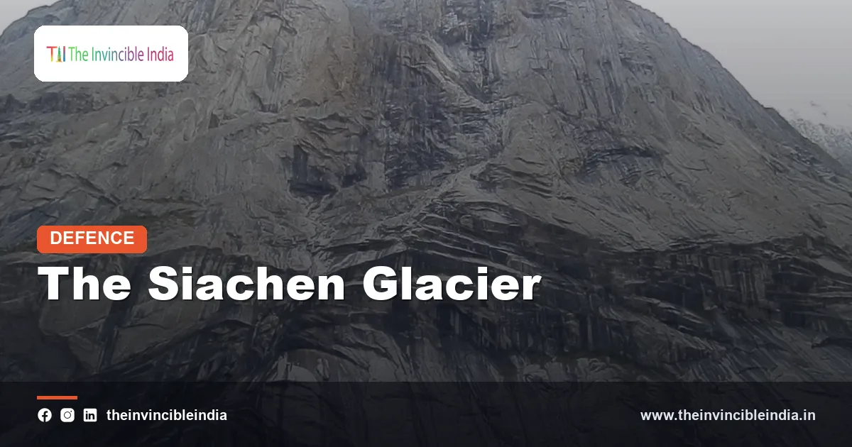
The Siachen Glacier is a vast river of ice in the eastern Karakoram range, and it is best known as the highest militarised battlefield on Earth. Since the mid-1980s, soldiers of the Indian Army have been posted along its heights, living and working in conditions that few human beings ever experience: thin air, relentless cold, shifting crevasses and avalanches that arrive without warning. For decades it has featured in Indian school textbooks, defence journalism and public memory as a symbol of endurance.
This explainer sets out what the glacier is, how a remote wilderness of ice became a theatre of confrontation between India and Pakistan, what happened during Operation Meghdoot in April 1984, and why the posts that followed are so hard to sustain. It also looks at the logistics, the human cost of altitude and weather, and the strategic reasoning behind India’s continued presence. The aim is a clear, factual and neutral account that remains useful as an evergreen reference.
| Item | Details |
|---|---|
| Location | Eastern Karakoram, Ladakh, at the northern end of the Line of Control |
| Meaning of the name | “Place of wild roses” in the Balti language |
| Approximate length | About 70 kilometres, among the longest glaciers outside the polar regions |
| Military operation | Operation Meghdoot, launched on 13 April 1984 |
| Key reference point | NJ9842, where the mapped Line of Control ends |
| Controlling formation | 14 Corps (Fire and Fury Corps), headquartered at Leh |
| Ceasefire in the sector | In place since 26 November 2003 |
| Draining river system | Nubra River, a tributary of the Shyok and ultimately the Indus |
Where the Siachen Glacier Lies
The Siachen Glacier sits in the eastern part of the Karakoram, a mountain system that includes some of the highest peaks on the planet. It lies roughly between the Saltoro Ridge on its west and the main Karakoram range on its east. Its northern edge touches the Indira Col area near the watershed with the Shaksgam region, while its snout, where meltwater emerges, feeds the Nubra River in Ladakh. Because the ice descends over some seventy kilometres, the altitude difference between its head and its tongue is enormous, running from well over five thousand metres down to roughly the three-and-a-half-thousand-metre mark.
A glacier of many parts
Siachen is not a single sheet of ice but a trunk glacier fed by many tributary glaciers that slide down from the surrounding ridges. This is why the area has been described as a maze of ice, rock and snow. The surface is broken by crevasses, many of them hidden under fresh snow, and is traversed by moraines, the ridges of rock debris carried along by the moving ice.
Water source
The glacier is a significant freshwater store for the Nubra Valley. Its meltwater joins the Shyok River, which eventually reaches the Indus. Scientists and environmentalists have long noted that military activity in such a fragile high-altitude ecosystem produces waste that is difficult to manage, and the debate about the glacier’s ecology has formed part of the wider conversation on the region.
The Un-delineated Line and the NJ9842 Point
To understand why the glacier became disputed, one must go back to the end of the first India-Pakistan war over Jammu and Kashmir. The Karachi Agreement of July 1949 established a ceasefire line, which was described in detail up to a map reference point known as NJ9842. Beyond that, towards the north, the agreement used only a general phrase indicating that the line would run “thence north to the glaciers”. At that time, neither side expected soldiers to operate in such terrain, so the line was never precisely marked.
When the 1972 Simla Agreement converted the ceasefire line into the Line of Control, the same pattern was followed: the line was delineated up to NJ9842 and no further. This stretch of mountains, therefore, came to rest on an ambiguity. India reads the phrase as a line running in a north-easterly direction along the Saltoro Ridge and the watershed. Pakistan has historically preferred an alignment extending the line towards the Karakoram Pass. The difference between these two readings covers thousands of square kilometres of ice and rock.
Maps, Expeditions and the Road to 1984
The ambiguity might have remained theoretical had it not been for mountaineering. From the 1970s, expeditions to the Karakoram were being permitted by Pakistan on the western side of the glacier, and some foreign maps began to show the territory beyond NJ9842 as lying within Pakistan. Indian military planners and mountaineers saw this as an attempt to build a record of control through cartography and activity.
In response, the Indian Army sent its own expeditions to the area, including a notable reconnaissance and mountaineering effort in the late 1970s led by Colonel Narendra Kumar, an Army officer and mountaineer. His team explored the glacier and brought back information about the terrain, the passes and the approaches. Colonel Kumar later gave his name to one of the most prominent forward positions, Kumar Post. The expeditions persuaded Indian planners that if the Saltoro heights were left unoccupied, the other side could take them first.
Operation Meghdoot, 13 April 1984
Operation Meghdoot was launched on 13 April 1984, and its name was drawn from Kalidasa’s classical Sanskrit poem about a cloud carrying a message across the land. The operation was designed to occupy the key passes on the Saltoro Ridge before Pakistani forces could do so. Indian Army troops, largely from the Kumaon Regiment and the Ladakh Scouts, were airlifted by Indian Air Force helicopters to the high ground, and the Air Force played a critical role in landing men and material in terrain where roads did not exist.
What was achieved
- Indian troops secured positions on the major passes of the Saltoro Ridge, including Sia La and Bilafond La, and later Gyong La.
- The occupation gave India control of the high ground overlooking the glacier and its western approaches.
- Pakistan responded with attempts to dislodge these posts, and a long-running confrontation began.
The operation is often described as the first time the Indian Army carried out a sustained military occupation at such altitudes. It set a pattern: instead of a short battle, the deployment became a permanent one, with rotation, supply and acclimatisation at its centre.
The Saltoro Ridge and the Key Passes
The Saltoro Ridge is the most important feature in the entire dispute. It runs roughly parallel to the glacier on its western side, and its crest is the natural watershed that India treats as the proper boundary alignment. By holding the crest and the main passes, Indian troops dominate the approaches from the Pakistani side of the ridge, while the Pakistani posts sit lower on the other side.
- Sia La: a high pass north of the glacier’s western flank, one of the principal Indian-held crossings on the ridge.
- Bilafond La: another important pass further south, also under Indian control.
- Gyong La: a pass in the southern part of the ridge, overlooking the Gayari area on the Pakistani side, a point of long-running friction.
The consequence of this geometry is that India occupies the heights while Pakistan occupies the lower ground on the western side. The Indian presence runs across the ridge, and Pakistani troops hold positions below it. Military planners treat height as a vital advantage, since it provides observation and dominance over approaches and avoids the need to fight uphill.
Life at Extreme Altitude
Living on the glacier is a challenge more physiological than tactical. At posts that lie above five thousand metres, the air contains roughly half the oxygen available at sea level. Soldiers are exposed to altitude sickness in its several forms, which include high-altitude pulmonary oedema, high-altitude cerebral oedema and, over time, cognitive and sleep problems. Winter temperatures at the higher posts are commonly described as falling to around minus fifty degrees Celsius or lower, and blizzards and winds can multiply the effect.
Acclimatisation and training
Before moving up, troops go through a staged process of acclimatisation. The Siachen Battle School, set up by the Army in Ladakh, trains soldiers in ice-craft, crevasse rescue, high-altitude survival and the use of specialised equipment. The upward movement is gradual, with pauses at progressively higher camps so that the body can adjust.
Everyday hardships
- Frostbite, which can lead to loss of fingers or toes, is a constant threat.
- Simple actions such as cooking, washing or even speaking can be difficult in the thin air.
- Sunlight reflecting off snow causes snow blindness without proper eye protection.
- Isolation and monotony can take a psychological toll, and the posts depend on regular rotation.
Weather, Not Bullets: The Real Toll
One of the most commonly cited facts about Siachen is that the environment, not enemy fire, has claimed most of the lives lost there. Since the ceasefire of November 2003, exchanges of fire in the area have largely stopped, but avalanches, crevasse falls, exposure and altitude sickness have continued to claim lives on both sides. Over the decades the cumulative toll on the Indian side has been substantial, and most of it is attributed to weather and terrain rather than combat.
Two events in particular are frequently recalled. In April 2012, a massive avalanche buried a Pakistani camp at Gayari in the same region, killing well over a hundred people. In February 2016, an avalanche struck an Indian post, and one soldier, Lance Naik Hanumanthappa Koppad, was pulled alive from beneath the snow after about six days before dying in hospital a few days later. His case drew national attention and illustrated both the dangers and the resilience of troops on the glacier.
Logistics: Keeping the Posts Alive
Supplying a front where roads end at the base and everything above must be carried, flown or hauled is a remarkable engineering and organisational task. The system relies on layers of supply, each reaching a little higher than the last.
Air supply
Helicopters, particularly of the Army Aviation and Indian Air Force fleets, are central to the effort. They carry rations, fuel, ammunition, equipment and mail to forward helipads, and evacuate the sick and wounded. Some of these landing points sit among the highest anywhere in the world, and flying there requires special techniques since the thin air reduces lift and engine power. Fixed-wing transport aircraft support the chain from the plains up to the airbase at Leh and other airfields in Ladakh.
Ground and specialised support
- Porters and soldiers carry loads on foot along fixed routes and ropes.
- Pipelines and ropeways have been used to move fuel and stores over some stretches.
- Special clothing, multi-layered tents, kerosene-based heating and high-calorie rations form the soldier’s basic kit.
- Medical support includes forward posts, rapid evacuation and a network of hospitals in Ladakh.
Because the operating cost is high, successive governments have faced questions about the financial burden, though official figures vary and are not treated here as settled numbers.
Notable Posts and Landmarks
| Landmark | Significance |
|---|---|
| Kumar Post | Named after Colonel Narendra “Bull” Kumar, the mountaineer-officer who led early Army expeditions to the glacier. |
| Bana Top | Formerly Quaid Post; captured in 1987 under Operation Rajiv and renamed after Naib Subedar Bana Singh, who received the Param Vir Chakra. |
| Indira Col | A high pass at the northern end of the glacier, named by explorers early in the twentieth century. |
| Siachen Base Camp | The main staging area at the foot of the glacier, from which troops begin their upward movement. |
| Sia La and Bilafond La | Strategic passes on the Saltoro Ridge held by India. |
The 1987 capture of Quaid Post, a strongly held Pakistani position, remains one of the most celebrated actions in the history of the glacier. Bana Singh and his small team climbed a nearly vertical ice wall to reach the post, and the feat was recognised with the country’s highest gallantry award.
Strategic Value of the Glacier
Indian defence analysts typically list several reasons for retaining the Saltoro heights. First, the position overlooks routes towards the Karakoram Pass and the area near the Shaksgam Valley, and it provides observation of the approaches that lie beyond the ridge. Second, the Indian presence prevents the creation of a continuous Pakistani-held link along the glacier region towards areas under Chinese control, a concern that grew after Pakistan ceded the Shaksgam Valley to China in 1963. Third, holding the passes protects the Nubra Valley and the approaches to Leh from the north-west.
Others argue that the glacier is of limited tactical use compared with its cost. The strategic debate, therefore, balances the value of dominating high ground against the financial and human cost of maintaining it. In either view, the fact that the glacier lies at the junction of the three regions of Ladakh, Gilgit-Baltistan and the Shaksgam area gives it importance beyond its size.
Talks, Ceasefire and Attempts at Resolution
Since the late 1980s, India and Pakistan have discussed Siachen at the level of defence secretaries and in the wider composite dialogue. The talks have touched on ideas such as demilitarisation, a zone of disengagement and the mapping of current positions. India has consistently held that any such arrangement must be preceded by authentication of the existing ground positions, so that troops do not withdraw without a record of where each side stands. Pakistan has generally argued for a return to positions held before 1984.
The most durable development has been the ceasefire along the Line of Control and the Actual Ground Position Line that came into effect on 26 November 2003. Although no final settlement has emerged, the cessation of firing greatly reduced casualties from combat. In 2019, India announced that the glacier area, up to Kumar Post, would be opened to tourists and trekkers, a step intended to promote adventure tourism in Ladakh. The question of Siachen remains part of the unresolved India-Pakistan boundary agenda.
In summary, the Siachen Glacier shows how a boundary that was never fully drawn can shape decades of military planning. What began as a gap in a 1949 map description turned into a permanent deployment at the top of the world, sustained through technology, training and the resolve of ordinary soldiers. Its story is one of geography, diplomacy and endurance in equal parts, and it continues to be studied as a case of high-altitude warfare and logistics. Last reviewed: 2 October 2026.
Frequently Asked Questions
What is the Siachen Glacier known for?
The Siachen Glacier is known as the world’s highest militarised battlefield. It is a roughly seventy-kilometre glacier in the eastern Karakoram, where Indian troops have been stationed since Operation Meghdoot in 1984 and where conditions are among the harshest on Earth.
What was Operation Meghdoot?
Operation Meghdoot was the Indian Army operation launched on 13 April 1984 to occupy the key passes of the Saltoro Ridge overlooking the Siachen Glacier. Troops were airlifted by helicopters, and the operation secured the high ground before Pakistani forces could occupy it.
What is NJ9842 and why does it matter?
NJ9842 is the map reference point where the delineated Line of Control ends. Beyond it, the 1949 Karachi Agreement and the 1972 Simla Agreement only stated that the line would run “thence north to the glaciers”, leaving the alignment unclear and giving rise to the Siachen dispute.
Do more soldiers die from weather or from combat at Siachen?
The great majority of deaths on the glacier are attributed to weather and terrain, such as avalanches, crevasse falls, frostbite and altitude sickness. Combat casualties fell sharply after the ceasefire that began on 26 November 2003.
How are soldiers supplied at such heights?
Supplies are moved mainly by helicopters to high-altitude helipads, supported by transport aircraft, porters, fixed ropes, pipelines and ropeways in places. Troops also rely on special clothing, fuel for heating, high-calorie rations and a forward medical network.
Can tourists visit the Siachen Glacier?
In 2019, India announced that the area up to Kumar Post would be opened for trekkers and tourists. Visits remain subject to permissions, fitness requirements and the prevailing security and weather conditions.


