

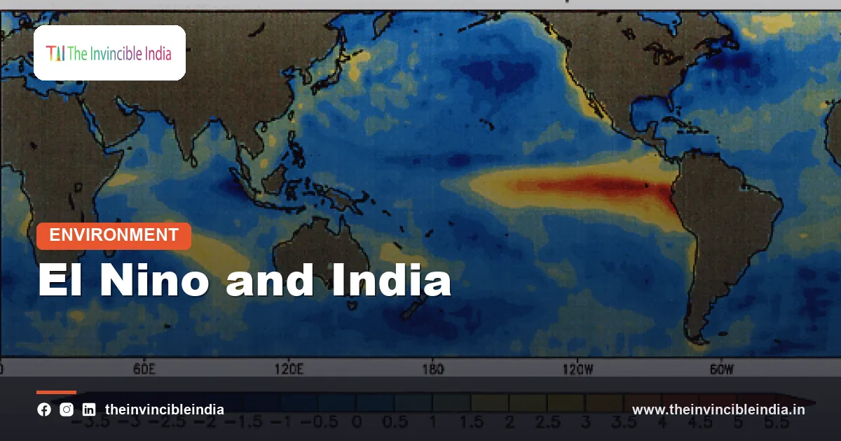
El Nino is a periodic warming of the surface waters of the central and eastern tropical Pacific Ocean that tends to weaken the Indian monsoon and raise the chance of drought in India. El Nino is the warm phase of a natural climate cycle called the El Nino-Southern Oscillation (ENSO), and it is one of the most closely watched influences on India’s monsoon rainfall.
The link between El Nino and the Indian monsoon is a statistical tendency, not a guarantee. Many El Nino years have brought deficient rain to India, but some have not, and other factors such as the Indian Ocean Dipole can offset the Pacific’s effect.
| Quick Facts | Details |
|---|---|
| What it is | Warm phase of the El Nino-Southern Oscillation (ENSO) in the tropical Pacific |
| Where it happens | Central and eastern equatorial Pacific Ocean |
| How often | Irregularly, roughly every two to seven years |
| How long it lasts | Typically around nine to twelve months, usually peaking in the northern winter |
| Opposite phase | La Nina, the cool phase of ENSO |
| Usual effect on India | Weaker southwest monsoon, higher risk of drought and heat |
| Main offsetting factor | A positive Indian Ocean Dipole (IOD) |
| Agencies that monitor it | India Meteorological Department (IMD), NOAA, World Meteorological Organization |
| Name origin | Spanish for “the boy” or Christ child, given by Peruvian fishermen who noticed warm water around Christmas |
Key Takeaways
- El Nino is the warm phase of ENSO, in which surface water in the central and eastern equatorial Pacific becomes unusually warm for several months.
- El Nino years have been associated with below-normal Indian monsoon rainfall more often than not, but the relationship is a tendency and not a rule.
- The main physical link is a shift in the Walker circulation, which moves rising air eastward in the Pacific and increases sinking air over the Indian region, suppressing monsoon rain.
- A positive Indian Ocean Dipole can offset El Nino and rescue the monsoon, as happened in 1997, when a strong El Nino coincided with a near-normal Indian monsoon.
- El Nino can affect the timing and spread of Indian rain as well as the total, with dry spells, weak July or August rain and heat all more likely in some years.
- The IMD includes the ENSO state in its monsoon forecasts, which it issues in April and updates around the end of May.
What Is El Nino?
El Nino is a natural climate event in which sea-surface temperatures in the central and eastern equatorial Pacific Ocean rise well above their long-term average and stay that way for months, changing winds and rainfall patterns around the world. The name comes from Peruvian fishermen, who noticed unusually warm coastal water around Christmas and called it El Nino, meaning “the boy”, a reference to the Christ child.
El Nino is one half of ENSO, a see-saw in the tropical Pacific that has two opposite phases, El Nino (warm) and La Nina (cool), with a neutral state in between. The “Southern Oscillation” part of the name refers to a matching change in atmospheric pressure between the eastern and western Pacific.
Scientists usually declare an El Nino when temperatures in a key region of the Pacific, known as Nino 3.4, stay about half a degree Celsius or more above normal for an extended period and the atmosphere responds in step. Agencies such as the US National Oceanic and Atmospheric Administration (NOAA), the Bureau of Meteorology in Australia and the IMD monitor these signals and issue alerts.
How Does El Nino Work?
El Nino works through a partnership between the ocean and the atmosphere: weaker trade winds let warm water slosh eastward across the Pacific, and that warm water in turn weakens the trade winds further. In a normal year, steady easterly trade winds pile warm water up in the western Pacific near Indonesia and the Philippines, while cold water rises up along the coast of South America.
During an El Nino, the trade winds slacken. Warm water spreads east, the cold upwelling off South America weakens, and the region of heavy tropical rain and towering clouds, which normally sits over the western Pacific, shifts toward the central Pacific. This rearranges the atmosphere over a huge region.
The Walker circulation in plain language
The Walker circulation is a giant loop of air along the equator, with air rising over the warm western Pacific, flowing eastward high up and sinking over the cooler eastern Pacific, then returning westward at the surface as the trade winds. El Nino disrupts this loop. The rising branch moves eastward, so the sinking branch shifts as well, and air sinks over parts of the Indian Ocean, Indonesia and northern Australia that would normally have rising, rainy air.
Because the monsoon depends on rising, moist air over India and the Bay of Bengal, extra sinking air over the region works against it. That is the central idea behind the El Nino-monsoon link. The effect travels through the atmosphere in what scientists call a teleconnection, a link between weather in two far-apart places.
How Does El Nino Affect the Indian Monsoon?
El Nino tends to weaken the Indian southwest monsoon by increasing sinking air over the subcontinent, which suppresses cloud formation and reduces rainfall, especially in the core monsoon zone of central and north-west India. The monsoon season runs from June to September and supplies roughly three-quarters of India’s annual rainfall.
The effects of an El Nino can show up in several ways:
- Lower total rain: The seasonal total is more likely to end below the long-period average, which the IMD takes as about 87 cm for the country, using a long-term baseline.
- Weaker or erratic spells: Long dry spells, called breaks in the monsoon, can become more frequent, especially in July and August when crops need steady moisture.
- Uneven distribution: Rain can fall heavily in a few days and then vanish, so the total may look acceptable while the crop suffers.
- Heat: Reduced cloud and rain let temperatures stay high, so heat stress is greater in the monsoon and the following months.
- Late or weak rain in some regions: Parts of central and north-west India are often hit hardest, while the north-east may behave differently.
A well-known illustration is the run of strong El Nino years in the past, such as 1972, 1987, 2002, 2009 and 2015, when India experienced notable monsoon deficits or drought declarations. A strong El Nino in 2023 coincided with a monsoon that finished below normal, marked by a very dry August, though a late recovery in September helped to limit the shortfall.
Does Every El Nino Cause a Drought in India?
No, not every El Nino causes a drought in India. El Nino raises the odds of a weak monsoon, but studies of past records show that a good share of El Nino years had normal rainfall, and that some Indian droughts occurred in years without any El Nino.
The strongest example of an El Nino year without a drought is 1997. That year, one of the strongest El Nino events of the twentieth century developed, yet the Indian monsoon was near normal. Scientists later attributed this to a strong positive Indian Ocean Dipole, which brought extra moisture and rain to India and cancelled out much of the El Nino effect.
The reverse also holds. Some years with weak or no El Nino have had poor rain because of local conditions, the behaviour of the monsoon trough, or other tropical influences such as the Madden-Julian Oscillation, a moving pulse of cloud and rain that switches the monsoon between active and break spells.
Researchers have also noticed that the strength of the El Nino-monsoon relationship has varied over decades. It was weaker in some periods and stronger in others. For this reason, forecasters treat El Nino as one important ingredient, not the whole recipe.
What Is the Difference Between a Canonical El Nino and El Nino Modoki?
A canonical El Nino has its warmest water in the far eastern Pacific near South America, while an El Nino Modoki has its warmest water in the central Pacific, with cooler water on both sides. “Modoki” is a Japanese word meaning “similar but different”.
The difference matters because the two types can shift the Walker circulation in different ways and so can have different effects on India. Some studies suggest that central Pacific events are linked to dry conditions over parts of India and may, in some seasons, be more damaging to the monsoon than eastern Pacific events, though results vary between studies and research continues.
For ordinary readers the practical point is simple: not all El Nino events are alike. The location and strength of the warming and the timing of its development all change what happens to the monsoon. That is why forecasters examine the actual pattern each year instead of relying on the label alone.
How Can the Indian Ocean Dipole Offset El Nino?
The Indian Ocean Dipole (IOD) can offset El Nino because a positive IOD warms the western Indian Ocean and cools the east, which pulls extra moisture-laden air toward India and encourages rain even when the Pacific is working against it. The IOD is a see-saw of sea temperatures between the western and eastern halves of the Indian Ocean.
El Nino and a positive IOD often occur in the same year, partly because the two are loosely linked, and when they do, their effects on India can pull in opposite directions. The result depends on which is stronger and how long each lasts. A negative IOD, on the other hand, does the reverse, and combined with an El Nino it can deepen the monsoon’s problems.
In 2023, a positive IOD developed during the monsoon season alongside El Nino. Forecasters hoped it would cushion the monsoon, and the late-season rains did improve the total, but the season still ended below normal. The example shows how the two influences interact without either having the final word.
| Pacific and Indian Ocean combination | Typical tendency for the Indian monsoon |
|---|---|
| El Nino with neutral or negative IOD | Greater chance of a weak monsoon and drought |
| El Nino with positive IOD | Effects partly cancel, so a near-normal monsoon is possible |
| La Nina with positive IOD | Both favour rain, so a strong monsoon is likely |
| La Nina with negative IOD | Mixed signals, outcome depends on which influence dominates |
| Neutral ENSO with neutral IOD | Local factors and other tropical patterns decide the result |
What Does a Weak Monsoon Mean for Farming and the Economy?
A weak monsoon during an El Nino year hurts farming and can raise food prices and rural distress, because about half of India’s farmland still depends on rain and the kharif crops are sown with the monsoon. Rice, pulses, oilseeds, cotton and sugarcane are all sensitive to the quantity and timing of the rains.
- Crop output: Lower rain can cut yields of rice, pulses and oilseeds, particularly in rain-fed districts of central and western India.
- Food prices: Poorer harvests and uncertainty push up prices of vegetables, pulses and cereals, and government may respond with stock limits or export curbs, as was seen for some rice varieties in 2023.
- Water and power: Reservoir levels fall, hydropower output drops and irrigation relies more heavily on groundwater, which accelerates depletion.
- Rural incomes: Farm households lose income, and demand for jobs under rural employment schemes tends to rise.
The economy as a whole is less exposed to the monsoon than it was decades ago, because agriculture is a smaller share of national output. Even so, farm income, rural consumption and food inflation remain closely tied to the monsoon, which is why an El Nino watch attracts attention from economists and policymakers.
How Do Scientists Forecast El Nino and the Monsoon?
Scientists forecast El Nino by tracking Pacific sea temperatures, winds and ocean heat content and by running computer models that simulate the coupled ocean-atmosphere system. Forecasts of the ENSO state are usually reliable several months ahead, although the spring months are known to be a harder period to predict.
The IMD issues its first long-range forecast of the monsoon in April and an update around the end of May. These forecasts take into account the ENSO state, the IOD, snow cover and other indicators. India’s Monsoon Mission, launched by the Ministry of Earth Sciences with the Indian Institute of Tropical Meteorology (IITM) in Pune as a key partner, aims to improve dynamical model forecasts, and the government has also backed a wider Mission Mausam programme to strengthen weather and climate services.
Forecasts of the total seasonal rain are expressed as a percentage of the long-period average, with categories ranging from deficient to excess. Forecasters stress that such numbers carry an error range, and that a normal seasonal total does not guarantee even rain across space and time.
How Is Climate Change Affecting El Nino?
Climate change is affecting El Nino mainly by warming the background climate, which makes El Nino years register as hotter than past ones and may alter the strength and impacts of events, though scientists are still working out the exact response. The global temperature records set in recent years have coincided with El Nino periods layered on top of long-term warming.
Some model studies suggest that extreme El Nino events could become more frequent in a warmer world, while others find the picture less clear. Researchers are more confident that a warmer atmosphere holds more moisture, so when the monsoon does rain, heavy downpours become more intense. This means that a weak monsoon year and an extreme rainfall day can coexist.
The safe reading for readers is that El Nino remains a natural cycle, but it now plays out on a warmer planet. The cycle itself is not new, yet the heat and water stress it brings may be harder to bear.
How Should India Prepare for an El Nino Year?
India prepares for an El Nino year by issuing early forecasts, preparing contingency crop plans, managing reservoirs and stocks carefully, and supporting farmers with advisories. State agriculture departments and Krishi Vigyan Kendras advise on shifting to short-duration or drought-tolerant varieties when the rains look poor.
- Early warnings and district-level weather advisories help farmers choose crops and sowing dates.
- Efficient irrigation, such as drip and sprinkler systems, stretches limited water.
- Buffer stocks of grain help to steady prices if production falls.
- Crop insurance under the Pradhan Mantri Fasal Bima Yojana helps cushion losses.
- Drinking water plans and heat action plans protect people during hot, dry spells.
Bottom Line
El Nino is a warm phase of the Pacific that tends to dry out the Indian monsoon by shifting the great atmospheric loops that carry rain. It raises the risk of drought but does not seal the monsoon’s fate, since the Indian Ocean Dipole and local factors can tip the balance. Watching the Pacific is a useful early warning, and not a final verdict.
Frequently Asked Questions
What is El Nino in simple words?
El Nino is an unusual warming of the surface water in the central and eastern tropical Pacific Ocean that lasts for months. The warm water changes winds and rainfall patterns across the globe. It is the warm phase of the El Nino-Southern Oscillation, and its opposite is La Nina.
How does El Nino affect the Indian monsoon?
El Nino tends to weaken the Indian monsoon by shifting the rising branch of the Walker circulation eastward, which increases sinking air over the Indian region. This suppresses cloud and rain, raising the chance of drought and long dry spells. It is a tendency and not a certainty, since other factors can change the outcome.
Does El Nino always cause drought in India?
No, El Nino does not always cause drought in India. It raises the odds of a poor monsoon, but some El Nino years, such as 1997, had near-normal rain because a positive Indian Ocean Dipole offset the effect. Droughts have also occurred in years with no El Nino.
How often does El Nino occur?
El Nino occurs irregularly, roughly once every two to seven years. A typical event lasts around nine to twelve months and often peaks in the northern winter. Events vary widely in strength, from weak to very strong.
What is the difference between El Nino and La Nina?
El Nino is a warming of the central and eastern Pacific, while La Nina is a cooling of the same region. El Nino tends to weaken the Indian monsoon, whereas La Nina tends to strengthen it. Both are phases of the same ENSO cycle, with a neutral state in between.
Can the Indian Ocean Dipole cancel the effect of El Nino?
Yes, a positive Indian Ocean Dipole can partly or wholly offset El Nino’s drying influence on India. A positive IOD warms the western Indian Ocean, which boosts moisture and rainfall over India. The 1997 monsoon is the classic example, though the result depends on how strong and long-lasting each influence is.
{“@context”:”https://schema.org”,”@graph”:[{“@type”:”FAQPage”,”mainEntity”:[{“@type”:”Question”,”name”:”What is El Nino in simple words?”,”acceptedAnswer”:{“@type”:”Answer”,”text”:”El Nino is an unusual warming of the surface water in the central and eastern tropical Pacific Ocean that lasts for months. The warm water changes winds and rainfall patterns across the globe. It is the warm phase of the El Nino-Southern Oscillation, and its opposite is La Nina.”}},{“@type”:”Question”,”name”:”How does El Nino affect the Indian monsoon?”,”acceptedAnswer”:{“@type”:”Answer”,”text”:”El Nino tends to weaken the Indian monsoon by shifting the rising branch of the Walker circulation eastward, which increases sinking air over the Indian region. This suppresses cloud and rain, raising the chance of drought and long dry spells. It is a tendency and not a certainty, since other factors can change the outcome.”}},{“@type”:”Question”,”name”:”Does El Nino always cause drought in India?”,”acceptedAnswer”:{“@type”:”Answer”,”text”:”No, El Nino does not always cause drought in India. It raises the odds of a poor monsoon, but some El Nino years, such as 1997, had near-normal rain because a positive Indian Ocean Dipole offset the effect. Droughts have also occurred in years with no El Nino.”}},{“@type”:”Question”,”name”:”How often does El Nino occur?”,”acceptedAnswer”:{“@type”:”Answer”,”text”:”El Nino occurs irregularly, roughly once every two to seven years. A typical event lasts around nine to twelve months and often peaks in the northern winter. Events vary widely in strength, from weak to very strong.”}},{“@type”:”Question”,”name”:”What is the difference between El Nino and La Nina?”,”acceptedAnswer”:{“@type”:”Answer”,”text”:”El Nino is a warming of the central and eastern Pacific, while La Nina is a cooling of the same region. El Nino tends to weaken the Indian monsoon, whereas La Nina tends to strengthen it. Both are phases of the same ENSO cycle, with a neutral state in between.”}},{“@type”:”Question”,”name”:”Can the Indian Ocean Dipole cancel the effect of El Nino?”,”acceptedAnswer”:{“@type”:”Answer”,”text”:”Yes, a positive Indian Ocean Dipole can partly or wholly offset El Nino’s drying influence on India. A positive IOD warms the western Indian Ocean, which boosts moisture and rainfall over India. The 1997 monsoon is the classic example, though the result depends on how strong and long-lasting each influence is.”}}]}]}


