

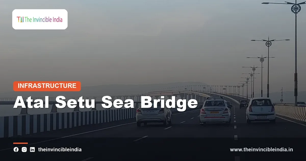
Atal Setu, officially the Atal Bihari Vajpayee Sewri-Nhava Sheva Atal Setu and also known as the Mumbai Trans Harbour Link (MTHL), is India’s longest sea bridge, a roughly 21.8-kilometre road link across Mumbai Harbour and Thane Creek that connects Sewri in Mumbai with Chirle near Navi Mumbai in Raigad district. About 16.5 kilometres of the bridge run over the sea, and the remaining stretch of around 5.5 kilometres runs over land as viaducts and ramps.
Atal Setu opened to traffic in January 2024 and cut the journey between south Mumbai and Navi Mumbai from well over an hour to roughly twenty minutes in good conditions. It was built by the Mumbai Metropolitan Region Development Authority (MMRDA) and is named after former Prime Minister Atal Bihari Vajpayee. This explainer covers its route, engineering, tolling, environment safeguards and regional importance.
| Attribute | Details |
|---|---|
| Official name | Atal Bihari Vajpayee Sewri-Nhava Sheva Atal Setu (Mumbai Trans Harbour Link, MTHL) |
| Length | About 21.8 km in total, of which about 16.5 km is over the sea |
| Opened | January 2024 |
| Route | Sewri (Mumbai) to Chirle (near Navi Mumbai), crossing Thane Creek and Mumbai Harbour |
| Executing agency | Mumbai Metropolitan Region Development Authority (MMRDA) |
| Carriageway | Six lanes (three in each direction) with emergency lanes |
| Key technology | Orthotropic steel decks for the main spans; open-road tolling; intelligent traffic management |
| Funding | Mainly a loan from the Japan International Cooperation Agency (JICA), with state and MMRDA funds |
| Design life | Designed for a service life of about 100 years |
Key Takeaways
- Atal Setu is India’s longest sea bridge, measuring about 21.8 kilometres, with about 16.5 kilometres of that length over the sea.
- Atal Setu connects Sewri in Mumbai to Chirle near Navi Mumbai and opened to traffic in January 2024.
- The Mumbai Metropolitan Region Development Authority (MMRDA) planned and built Atal Setu, with a major loan from the Japan International Cooperation Agency (JICA).
- Atal Setu uses orthotropic steel decks for its main marine spans, a design that allows long spans with less weight than conventional concrete decks.
- Atal Setu uses open-road tolling, which collects tolls electronically without requiring vehicles to stop at barriers.
- Atal Setu improves access from Mumbai to Navi Mumbai, the Navi Mumbai International Airport, Jawaharlal Nehru Port and the Mumbai-Pune Expressway.
What is Atal Setu?
Atal Setu is a six-lane road bridge and expressway link that crosses the Arabian Sea inlet between Mumbai and the mainland of the Konkan region, designed to connect the island city of Mumbai with the mainland through Navi Mumbai. The official name honours Atal Bihari Vajpayee, who served as Prime Minister of India from 1998 to 2004.
Before the bridge opened, a driver travelling from south Mumbai to Navi Mumbai or towards Pune had to travel north through congested corridors such as the Eastern Express Highway and the Sion-Panvel Highway, often spending one and a half hours or more on the way. Atal Setu offers a direct southern route across the water and has become a key part of the road network of the wider Mumbai Metropolitan Region.
Where does Atal Setu run and what does it connect?
Atal Setu runs from Sewri on the eastern waterfront of Mumbai Island across Mumbai Harbour, passes over a stretch of Thane Creek and reaches the mainland at Chirle near Uran and Navi Mumbai in Raigad district. At the Mumbai end, it connects to the Eastern Freeway and other arterial roads through connecting ramps, and at the mainland end, it links to national and state highways.
At Chirle, the link connects to the Mumbai-Pune Expressway, the Mumbai-Goa national highway corridor and the road network leading to Jawaharlal Nehru Port at Nhava Sheva, India’s busiest container port. The route also provides much easier access to the Navi Mumbai International Airport, which is being developed at Ulwe as Mumbai’s second major airport.
How much time does Atal Setu save?
Atal Setu reduces the journey between Sewri and Chirle to about twenty minutes in free-flowing traffic, compared with an hour and a half or more by the older routes. Time savings vary with traffic, but the bridge also reduces distance and fuel use for long trips towards Pune, Raigad and the Konkan.
Why was the Mumbai Trans Harbour Link built?
The Mumbai Trans Harbour Link was built to relieve congestion in Mumbai, to open the eastern and southern parts of the metropolitan region for development and to improve links between Mumbai, Navi Mumbai and the major ports and highways to the east and south. Mumbai is geographically a narrow island city, and for decades, all road traffic from the mainland had to funnel through a few northern entry points.
Navi Mumbai was planned in 1971 by the City and Industrial Development Corporation of Maharashtra (CIDCO) as a satellite city to reduce pressure on Mumbai, but its full potential depended on strong transport links. A sea link had been discussed since the 1960s and 1970s, with various proposals for bridges and tunnels, and planning intensified in the 2000s under the MMRDA. The project went through repeated rounds of feasibility studies, bidding, clearances and financing before construction started.
When did construction start and finish?
The foundation stone for the project was laid in December 2016, and major construction began around 2018. The project was delayed by environmental clearances, contract issues and the COVID-19 pandemic, and it was opened to the public in January 2024.
How was Atal Setu built and what is special about its engineering?
Atal Setu was built using piles driven into the seabed and creek bed, concrete and steel piers, and a deck made of prestressed concrete and orthotropic steel in the marine sections. The sea section had to withstand strong tidal currents, high salinity, monsoon conditions and the risk of ship collisions in a busy harbour.
The main engineering features include:
- Orthotropic steel decks (OSD) for the longest marine spans, which allow fewer piers in the water and lighter superstructure weight.
- Deep pile foundations that reach firm strata below the soft marine clay and silt.
- Corrosion-resistant materials and protective coatings, designed for a service life of about 100 years.
- Structural health monitoring sensors that track the behaviour of the bridge over time.
- An intelligent transport system with cameras, variable message signs and control-room monitoring.
The work was executed by consortia of Indian and international firms, including Larsen and Toubro with IHI Infrastructure Systems of Japan and Tata Projects with Daewoo Engineering and Construction of South Korea. Japanese expertise in steel bridge design and construction supported the orthotropic deck sections, and prefabricated steel segments were lifted into place at sea.
What is an orthotropic steel deck?
An orthotropic steel deck is a bridge deck made of a steel plate stiffened by ribs running in two directions, which lets the plate carry traffic loads efficiently with relatively little steel. This type of deck is used in long-span bridges worldwide because it is lighter than a concrete deck and can be fabricated in factory-controlled conditions. On Atal Setu, it allowed long spans over the water and faster erection of large segments.
Who built and who runs Atal Setu?
The Mumbai Metropolitan Region Development Authority (MMRDA) planned, implemented and manages Atal Setu, working with contractors and with financing from the Japan International Cooperation Agency (JICA). MMRDA is the planning and development authority for the Mumbai Metropolitan Region and also runs metro lines, monorail, flyovers and other major infrastructure in the region. The Government of Maharashtra oversees the broader policy and approvals.
JICA, Japan’s development-cooperation agency, supported the project with a long-term concessional loan, in line with Japan’s long-standing infrastructure partnership with India. The remaining funds came from the state government and MMRDA’s own resources. Day-to-day operation, tolling and maintenance are managed under the authority of MMRDA and its appointed agencies.
How does tolling work on Atal Setu?
Tolling on Atal Setu works through open-road tolling (ORT), an electronic system that detects vehicles with cameras and electronic tags and charges tolls without stopping them at a plaza. The system relies on FASTag, the national electronic toll collection system, together with automatic number-plate recognition for vehicles that do not have valid tags.
Open-road tolling avoids the queues common at traditional toll booths and keeps traffic moving at higher speeds. Toll rates are set by the state government and differ for cars, light commercial vehicles, buses and heavy vehicles, and they are revised from time to time. At the time of opening, the one-way toll for a car was about 250 rupees, and concessions or pass options were introduced later for frequent users.
Certain types of vehicles are not permitted on the bridge, including motorcycles, three-wheelers, tractors and slow-moving vehicles, because the road is designed as a high-speed expressway-type facility with a speed limit of about 100 kilometres per hour on the main section.
| Feature | Details |
|---|---|
| Toll system | Open-road tolling with FASTag and number-plate recognition |
| Lanes | Six traffic lanes plus emergency lanes |
| Typical speed limit | Around 100 km/h on the main bridge |
| Restricted vehicles | Two-wheelers, three-wheelers, tractors and other slow vehicles |
| Monitoring | Cameras, control room, variable message signs and structural sensors |
How does Atal Setu protect the environment and wildlife?
Atal Setu includes environmental safeguards such as noise barriers, controlled lighting, waste management and monitoring plans, mainly because the bridge passes near the Thane Creek Flamingo Sanctuary, a protected area that hosts large flocks of flamingos every year. The design includes acoustic barriers along sensitive stretches so that traffic noise does not disturb the birds, and the lighting is directed downwards to reduce disturbance.
The project required clearances relating to coastal regulation zones, mangroves and wildlife, and compensatory mangrove plantation was part of the conditions. Environmental groups have debated the trade-offs between infrastructure growth and coastal ecology, and monitoring of mangroves, marine life and bird populations has been part of the project’s compliance process.
What impact does Atal Setu have on Mumbai and Navi Mumbai?
Atal Setu strengthens connectivity across the Mumbai Metropolitan Region by shortening trips, supporting development in Navi Mumbai, Raigad and Uran and improving freight access to Jawaharlal Nehru Port. It also supports the Navi Mumbai International Airport, since travellers from south Mumbai have a much faster route to the airport side of the region.
Real estate and commercial activity in Navi Mumbai, Panvel and Uran have drawn attention because improved accessibility tends to raise demand for housing, warehouses and offices. Planners also see the link as part of a larger network that includes the Mumbai Coastal Road, the Eastern Freeway, metro lines in Navi Mumbai and the proposed multi-modal corridors, all of which aim to distribute growth beyond the congested island city.
Critics and independent analysts have pointed out that traffic volumes depend on toll levels, connecting roads and last-mile links. A bridge improves access only to the extent that its approach roads, junctions and feeder routes can handle the traffic it generates, and these have been the focus of continuing work.
Is Atal Setu the longest sea bridge in the world?
Atal Setu is not the longest sea bridge in the world, but it is the longest in India and ranks among the longest sea bridges globally. China has several sea-crossing bridges that are considerably longer, such as the Hong Kong-Zhuhai-Macau Bridge and the Jiaozhou Bay Bridge. Atal Setu’s distinction is mainly national, as India’s longest sea bridge and its longest bridge in total.
Bottom Line
Atal Setu, the Mumbai Trans Harbour Link, is a major road bridge that links Sewri in Mumbai with Chirle near Navi Mumbai across about 21.8 kilometres, opened in January 2024 after years of planning and construction by the MMRDA. It shortens journeys, supports the new airport and port access and showcases modern bridge engineering, while its long-term value depends on good approach roads and careful environmental management.
Frequently Asked Questions
How long is Atal Setu?
Atal Setu is about 21.8 kilometres long, which makes it India’s longest sea bridge. Roughly 16.5 kilometres of the structure lie over the sea, and about 5.5 kilometres run over land as viaducts and ramps. It has six lanes for traffic along with emergency lanes.
When did Atal Setu open?
Atal Setu opened to the public in January 2024. The foundation stone had been laid in December 2016, and construction began around 2018. The project faced delays from clearances and the COVID-19 pandemic before it was completed.
What does Atal Setu connect?
Atal Setu connects Sewri in Mumbai with Chirle near Navi Mumbai in Raigad district. At the mainland end, it links to the Mumbai-Pune Expressway, highways towards Goa and Jawaharlal Nehru Port. It also provides faster access to the Navi Mumbai International Airport.
Who built Atal Setu?
The Mumbai Metropolitan Region Development Authority (MMRDA) built Atal Setu through contractor consortia that included Larsen and Toubro with IHI Infrastructure Systems of Japan and Tata Projects with Daewoo Engineering and Construction. The Japan International Cooperation Agency (JICA) provided a major loan. The bridge is named after former Prime Minister Atal Bihari Vajpayee.
How is the toll collected on Atal Setu?
Toll on Atal Setu is collected electronically through open-road tolling, which uses FASTag and number-plate recognition so that vehicles do not stop at barriers. Rates vary by vehicle type and are set by the state government. Motorcycles, three-wheelers, tractors and other slow vehicles are not allowed on the bridge.
How much time does Atal Setu save?
Atal Setu cuts the trip between south Mumbai and Navi Mumbai to roughly twenty minutes in free-flowing traffic, compared with an hour and a half or more on the older road routes. Exact savings depend on traffic and the connecting roads. The bridge also shortens trips towards Pune and the Konkan.
{“@context”:”https://schema.org”,”@graph”:[{“@type”:”FAQPage”,”mainEntity”:[{“@type”:”Question”,”name”:”How long is Atal Setu?”,”acceptedAnswer”:{“@type”:”Answer”,”text”:”Atal Setu is about 21.8 kilometres long, which makes it India’s longest sea bridge. Roughly 16.5 kilometres of the structure lie over the sea, and about 5.5 kilometres run over land as viaducts and ramps. It has six lanes for traffic along with emergency lanes.”}},{“@type”:”Question”,”name”:”When did Atal Setu open?”,”acceptedAnswer”:{“@type”:”Answer”,”text”:”Atal Setu opened to the public in January 2024. The foundation stone had been laid in December 2016, and construction began around 2018. The project faced delays from clearances and the COVID-19 pandemic before it was completed.”}},{“@type”:”Question”,”name”:”What does Atal Setu connect?”,”acceptedAnswer”:{“@type”:”Answer”,”text”:”Atal Setu connects Sewri in Mumbai with Chirle near Navi Mumbai in Raigad district. At the mainland end, it links to the Mumbai-Pune Expressway, highways towards Goa and Jawaharlal Nehru Port. It also provides faster access to the Navi Mumbai International Airport.”}},{“@type”:”Question”,”name”:”Who built Atal Setu?”,”acceptedAnswer”:{“@type”:”Answer”,”text”:”The Mumbai Metropolitan Region Development Authority (MMRDA) built Atal Setu through contractor consortia that included Larsen and Toubro with IHI Infrastructure Systems of Japan and Tata Projects with Daewoo Engineering and Construction. The Japan International Cooperation Agency (JICA) provided a major loan. The bridge is named after former Prime Minister Atal Bihari Vajpayee.”}},{“@type”:”Question”,”name”:”How is the toll collected on Atal Setu?”,”acceptedAnswer”:{“@type”:”Answer”,”text”:”Toll on Atal Setu is collected electronically through open-road tolling, which uses FASTag and number-plate recognition so that vehicles do not stop at barriers. Rates vary by vehicle type and are set by the state government. Motorcycles, three-wheelers, tractors and other slow vehicles are not allowed on the bridge.”}},{“@type”:”Question”,”name”:”How much time does Atal Setu save?”,”acceptedAnswer”:{“@type”:”Answer”,”text”:”Atal Setu cuts the trip between south Mumbai and Navi Mumbai to roughly twenty minutes in free-flowing traffic, compared with an hour and a half or more on the older road routes. Exact savings depend on traffic and the connecting roads. The bridge also shortens trips towards Pune and the Konkan.”}}]}]}


