

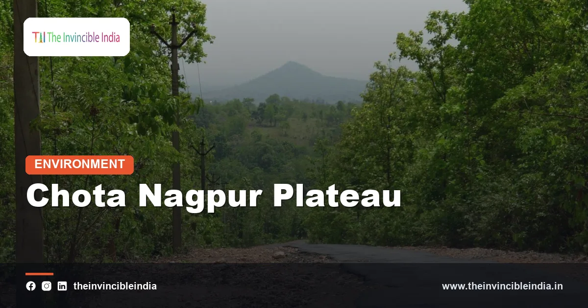
The Chota Nagpur Plateau is the broad, mineral-rich upland of eastern India that covers most of Jharkhand and spills into neighbouring Odisha, West Bengal and Chhattisgarh, built on ancient crystalline rock and famed for its coal, iron ore, mica and bauxite. It forms the north-eastern block of the Peninsular Plateau and is often described as the mineral heartland of India.
The Chota Nagpur Plateau (also spelt Chotanagpur) is also the main homeland of the Santhal, Munda, Oraon and Ho communities, and its rivers, forests and waterfalls are as distinctive as its mines. This explainer sets out where the Chota Nagpur Plateau lies, how it formed, which rivers drain it, what minerals it holds and why it is so important to the economy and culture of eastern India.
| Attribute | Detail |
|---|---|
| Landform type | Dissected upland plateau of the Peninsular Plateau |
| Main states | Jharkhand, with parts of Odisha, West Bengal, Chhattisgarh and southern Bihar |
| Area | Roughly 65,000 square kilometres in most descriptions |
| Typical elevation | Around 700 metres on the central Ranchi plateau |
| Highest point | Parasnath Hill, about 1,350 metres |
| Geology | Precambrian granite-gneiss with Gondwana coal basins and some basalt |
| Major rivers | Damodar, Subarnarekha, North Koel, South Koel, Barakar |
| Key minerals | Coal, iron ore, mica, bauxite, copper, uranium, kyanite |
| Cultural identity | Homeland of major Adivasi communities; Jharkhand state formed in 2000 |
Key Takeaways
- The Chota Nagpur Plateau is a mineral-rich upland covering most of Jharkhand, rising to roughly 700 metres on its central Ranchi plateau.
- The Chota Nagpur Plateau is made mainly of Precambrian granite-gneiss, with younger Gondwana rocks holding the coal of the Damodar valley.
- The Chota Nagpur Plateau is the source of the Damodar and Subarnarekha rivers and others that radiate outwards from the Ranchi plateau.
- The Chota Nagpur Plateau holds the Jharia, Bokaro and Karanpura coalfields, including the bulk of India’s coking coal.
- The Chota Nagpur Plateau is the traditional homeland of Adivasi communities such as the Santhal, Munda, Oraon and Ho.
- The Chota Nagpur Plateau is home to Jharkhand’s best-known waterfalls, including Hundru, Dassam and Jonha, formed where rivers drop off the plateau’s edges.
What is the Chota Nagpur Plateau?
The Chota Nagpur Plateau is a high, undulating tableland in eastern India, made of very old rock and cut into smaller plateaus, ridges and valleys by many rivers. It forms the north-eastern extension of the Peninsular Plateau and stands noticeably above the Gangetic plain to its north and the Odisha and Bengal lowlands to its east.
The plateau is not a single flat sheet. It is a staircase of surfaces at different heights, with a central high plateau around Ranchi flanked by lower tiers to the north and east. Many of the hills are isolated, rounded granite domes or flat-topped caps that survived while the surrounding rock was worn away.
The name comes from the old district and region of Chotanagpur, centred on Ranchi. In local tradition the area was also known as Jharkhand, “the land of forests”, a name later given to the state that was carved out in 2000.
Where is the Chota Nagpur Plateau located?
The Chota Nagpur Plateau is located in eastern India, covering nearly the whole of Jharkhand and extending into the neighbouring states of Odisha, West Bengal, Chhattisgarh and southern Bihar. It lies between the Gangetic plain in the north and the Mahanadi basin in the south.
Its boundaries are fairly clear on the ground:
- North: the plateau drops by an escarpment to the Ganga plain in Bihar, and the Rajmahal Hills mark its north-eastern corner.
- East: the plateau descends to the Bengal basin, where its edge in Purulia and Bankura merges into the lower lateritic plains of West Bengal.
- South: it extends into Odisha’s Singhbhum and Mayurbhanj uplands, and then falls to the Mahanadi valley.
- West: it merges into the Chhattisgarh uplands and the Baghelkhand region, with the Son valley on the north-western side.
Major cities on the plateau include Ranchi, Jamshedpur, Dhanbad, Bokaro Steel City and Hazaribagh, and many of them grew around mines and steel works.
How did the Chota Nagpur Plateau form?
The Chota Nagpur Plateau formed from very ancient crystalline rocks of the Indian shield that were uplifted, eroded and cut by rivers over hundreds of millions of years, with younger rocks added in downfaulted rift valleys. It is one of the oldest landscapes in India and has not been folded by mountain-building for a very long time.
The geological ingredients are easy to list:
- Granite-gneiss basement: the Chotanagpur Gneissic Complex, a vast area of Precambrian granites, gneisses and schists that makes up most of the plateau.
- Singhbhum Craton and iron ore belts: in the south, an even older nucleus with banded iron formations, which became the iron ore of the Singhbhum region.
- Gondwana rift basins: long fault-bounded troughs, such as the Damodar valley, filled with Permian sandstones, shales and coal.
- Rajmahal Traps: basalt flows in the north-east, erupted in the Early Cretaceous as the Gondwana supercontinent broke up and distinct from the younger Deccan Traps.
After the Gondwana basins formed, the whole region was gently uplifted. Rivers then cut deep valleys and left the harder rocks as plateaus and hill ranges, creating a classic dissected plateau.
What are the main sub-regions of the Chota Nagpur Plateau?
The Chota Nagpur Plateau is usually divided into the Ranchi plateau, the Hazaribagh plateau, the Kodarma (Koderma) plateau, the Pat region and the Damodar valley, each at a different height. The Ranchi plateau lies at the centre and is the highest of the main surfaces.
| Sub-region | Approximate height | Notable features |
|---|---|---|
| Ranchi plateau | About 700 metres | Central tier; source of radiating rivers; Hundru and Jonha falls |
| Hazaribagh plateau | About 600 metres | Lower tier to the north; forests, coalfields and the Parasnath range nearby |
| Kodarma plateau | Lower, about 400 metres | Famous historically for mica |
| Pat region (western) | Higher, over 900 metres in places | Flat-topped uplands such as Netarhat, with bauxite caps |
| Damodar valley | Lower trough | Rift valley of Gondwana coal and industrial towns |
The “pat” lands in the west are high, flat plateaus often capped by laterite and bauxite. Netarhat, with its sunrise views, is a well-known example and is called the Queen of Chotanagpur.
Which rivers drain the Chota Nagpur Plateau?
The main rivers of the Chota Nagpur Plateau are the Damodar, the Subarnarekha, the North Koel and South Koel, and the Barakar, and they radiate outwards from the central Ranchi plateau in a pattern called radial drainage. Some reach the Ganga system through the Son and the Hooghly, while others flow to the Bay of Bengal directly or through the Brahmani.
- Damodar: rises in the Palamu-Hazaribagh uplands and flows east through a rift valley, past the coalfields, to join the Hooghly in West Bengal.
- Subarnarekha: rises near Ranchi and flows east and south to the Bay of Bengal, passing Jamshedpur and dropping over the Hundru Falls.
- Koel rivers: the North Koel flows north to the Son, while the South Koel flows south and joins the Sankh to form the Brahmani in Odisha.
- Barakar: the main tributary of the Damodar, draining the northern plateau.
The Damodar was once nicknamed the Sorrow of Bengal because its floods ravaged the lower valley. The Damodar Valley Corporation (DVC), set up in 1948 and modelled on the Tennessee Valley Authority, built dams at Tilaiya, Konar, Maithon and Panchet, creating one of India’s first multipurpose river valley projects for flood control, irrigation and power.
Why is the Chota Nagpur Plateau famous for waterfalls?
The Chota Nagpur Plateau is famous for waterfalls because its rivers cross resistant rock ledges and drop sharply from one plateau tier to the next, producing scenic cascades during and after the monsoon. The falls mark the steps between the high and low surfaces of the dissected plateau.
- Hundru Falls: the Subarnarekha drops nearly a hundred metres near Ranchi.
- Dassam Falls: the Kanchi river tumbles over a rocky ledge near Taimara.
- Jonha (Gautamdhara) Falls: a cascade of the Raro river reached by a long stair from the plateau rim.
- Lodh (Burhaghagh) Falls: on the Burha river in the Latehar district, regarded as the tallest waterfall in Jharkhand.
The waterfalls swell in the monsoon and shrink sharply in summer, and they draw large numbers of visitors to the Ranchi region. They are also sacred places in local tradition.
Which minerals does the Chota Nagpur Plateau hold?
The Chota Nagpur Plateau holds a larger variety of minerals than almost any other region of India, including coal, iron ore, mica, bauxite, copper, uranium and kyanite. This is why it is described as India’s Ruhr and the heart of its mineral belt.
| Mineral | Main area | Significance |
|---|---|---|
| Coking and non-coking coal | Jharia, Bokaro, Karanpura, Giridih, Ramgarh | Fuels steel plants and power stations |
| Iron ore | Singhbhum (Noamundi, Gua) and adjoining Odisha | Feeds Jamshedpur, Bokaro and Rourkela |
| Mica | Kodarma, Hazaribagh, Giridih belt | Once the world’s leading source of sheet mica |
| Bauxite | Netarhat and Lohardaga region | Aluminium ore |
| Copper | Singhbhum copper belt (Ghatsila, Mosabani) | One of India’s older copper mining areas |
| Uranium | Jaduguda in Singhbhum | India’s pioneer uranium mine |
Industry grew around these minerals. Jamshedpur, founded by the Tata Iron and Steel Company in 1907, was India’s first modern steel city, and the Bokaro Steel Plant followed with Soviet assistance. Refractories, cement and fertiliser plants cluster around the coal belt.
What are the Gondwana coalfields of the Chota Nagpur Plateau?
The Gondwana coalfields of the Chota Nagpur Plateau are coal-bearing basins in downfaulted valleys, formed from Permian swamp forests about 250 to 300 million years ago, and they hold a major share of India’s coal. They lie mainly along the Damodar valley and its tributaries.
The key coalfields include:
- Jharia: India’s premier source of coking coal, used in steelmaking, with underground fires burning since the early twentieth century.
- Bokaro and Ramgarh: large fields supplying the Bokaro steel and power plants.
- Karanpura: a big field with rich non-coking and some coking coal in the north.
- Raniganj: on the plateau’s eastern edge in West Bengal, India’s oldest commercially mined coalfield.
The coal formed when plants of the Gondwana flora, including Glossopteris, grew in swamps that sank into the rift valleys and were buried by sediment. The same process created coal basins in the Satpura, Mahanadi and Godavari regions.
What are the climate and forests of the Chota Nagpur Plateau?
The Chota Nagpur Plateau has a tropical monsoon climate moderated by altitude, with hot summers, a rainy monsoon from June to September and cool winters, and annual rainfall of roughly 1,200 to 1,400 millimetres. The elevation makes the plateau cooler than the Ganga plain, and Ranchi has long been a hill-resort town for that reason.
Dry deciduous forest of sal (Shorea robusta) is the characteristic vegetation, along with mahua, tendu, palash and bamboo. The forests shelter elephants, tigers, leopards and many bird species, and Palamau Tiger Reserve was one of the nine reserves created at the launch of Project Tiger in 1973.
Forests are central to local livelihoods through mahua, tendu leaves, lac and sal seeds. Clearance for mining and farming has thinned them in many districts.
Why is the Chota Nagpur Plateau the heartland of Adivasi communities?
The Chota Nagpur Plateau is the heartland of Adivasi (tribal) communities because its forested, hilly terrain sheltered the Munda, Oraon, Santhal, Ho and Kharia peoples for centuries, and about a quarter of Jharkhand’s population is classified as Scheduled Tribes. Distinct languages, customs and forms of land holding survive here.
History and law reflect this. The Santhal Hul (rebellion) of 1855 and the Ulgulan, the movement led by Birsa Munda around 1899 to 1900, were protests against outside landlords and moneylenders. The Chota Nagpur Tenancy Act of 1908 was passed to protect tribal land rights, and the demand for a separate Jharkhand state grew from this history until the state was created on 15 November 2000.
The plateau’s natural features carry cultural meaning too. Sal groves are sacred in the Sarna religion, and festivals such as Sarhul celebrate the sal flowering in spring.
What environmental challenges does the Chota Nagpur Plateau face?
The Chota Nagpur Plateau faces environmental problems linked to mining, including land subsidence, coal fires, water pollution, deforestation and the displacement of villagers. Mining brings revenue and jobs but concentrates damage in a small area.
Several issues recur:
- Coal fires: long-burning underground fires in Jharia release smoke and cause the ground to collapse.
- Water stress: the hard crystalline rock stores little groundwater, and rivers shrink in summer.
- Soil erosion: steep terrain and loss of forest increase runoff in the monsoon.
- Displacement: mines, dams and steel plants have uprooted communities, and compensation and rehabilitation remain contested.
Reforestation, mine reclamation and community forest management are the main responses, though progress is uneven.
Bottom Line
The Chota Nagpur Plateau is the ancient, mineral-rich upland of Jharkhand and neighbouring states, built on Precambrian rock and Gondwana coal basins. Its coal, iron, mica and waterfalls, and its place as an Adivasi homeland, make it one of the most distinctive regions of India.
Frequently Asked Questions
What is the Chota Nagpur Plateau?
The Chota Nagpur Plateau is the mineral-rich upland of eastern India that covers most of Jharkhand and parts of Odisha, West Bengal and Chhattisgarh. It is made mainly of Precambrian granite-gneiss and rises to around 700 metres on its central Ranchi plateau. It is the north-eastern part of the Peninsular Plateau.
Which states does the Chota Nagpur Plateau cover?
The Chota Nagpur Plateau mainly covers Jharkhand, and it also extends into Odisha, West Bengal, Chhattisgarh and southern Bihar. Jharkhand holds the largest share, including Ranchi, Hazaribagh and Jamshedpur. The exact limits vary slightly between sources.
Why is the Chota Nagpur Plateau rich in minerals?
The Chota Nagpur Plateau is rich in minerals because its ancient crystalline rocks and Gondwana rift basins contain coal, iron ore, mica, bauxite and copper. The old shield rocks were rich in metals, while the rift valleys trapped Permian plant matter that turned into coal. Few other Indian regions combine so many minerals.
Which rivers originate on the Chota Nagpur Plateau?
The Damodar, Subarnarekha, North Koel, South Koel and Barakar rivers originate on the Chota Nagpur Plateau. They radiate outwards from the central Ranchi plateau. The Damodar flows through the coal belt and is controlled by DVC dams.
Which tribes live on the Chota Nagpur Plateau?
The Santhal, Munda, Oraon, Ho and Kharia are the main tribal communities of the Chota Nagpur Plateau. They have lived in its forests for centuries, and they make up around a quarter of Jharkhand’s population. Their history is linked to the Santhal Hul of 1855 and Birsa Munda’s movement.
What is the highest point of the Chota Nagpur Plateau?
Parasnath Hill is the highest point of the Chota Nagpur Plateau, at about 1,350 metres in the Giridih district of Jharkhand. It is a sacred site for Jains and the highest peak in the state. The Netarhat plateau and the western pat lands also rise above 900 metres.
{“@context”:”https://schema.org”,”@graph”:[{“@type”:”FAQPage”,”mainEntity”:[{“@type”:”Question”,”name”:”What is the Chota Nagpur Plateau?”,”acceptedAnswer”:{“@type”:”Answer”,”text”:”The Chota Nagpur Plateau is the mineral-rich upland of eastern India that covers most of Jharkhand and parts of Odisha, West Bengal and Chhattisgarh. It is made mainly of Precambrian granite-gneiss and rises to around 700 metres on its central Ranchi plateau. It is the north-eastern part of the Peninsular Plateau.”}},{“@type”:”Question”,”name”:”Which states does the Chota Nagpur Plateau cover?”,”acceptedAnswer”:{“@type”:”Answer”,”text”:”The Chota Nagpur Plateau mainly covers Jharkhand, and it also extends into Odisha, West Bengal, Chhattisgarh and southern Bihar. Jharkhand holds the largest share, including Ranchi, Hazaribagh and Jamshedpur. The exact limits vary slightly between sources.”}},{“@type”:”Question”,”name”:”Why is the Chota Nagpur Plateau rich in minerals?”,”acceptedAnswer”:{“@type”:”Answer”,”text”:”The Chota Nagpur Plateau is rich in minerals because its ancient crystalline rocks and Gondwana rift basins contain coal, iron ore, mica, bauxite and copper. The old shield rocks were rich in metals, while the rift valleys trapped Permian plant matter that turned into coal. Few other Indian regions combine so many minerals.”}},{“@type”:”Question”,”name”:”Which rivers originate on the Chota Nagpur Plateau?”,”acceptedAnswer”:{“@type”:”Answer”,”text”:”The Damodar, Subarnarekha, North Koel, South Koel and Barakar rivers originate on the Chota Nagpur Plateau. They radiate outwards from the central Ranchi plateau. The Damodar flows through the coal belt and is controlled by DVC dams.”}},{“@type”:”Question”,”name”:”Which tribes live on the Chota Nagpur Plateau?”,”acceptedAnswer”:{“@type”:”Answer”,”text”:”The Santhal, Munda, Oraon, Ho and Kharia are the main tribal communities of the Chota Nagpur Plateau. They have lived in its forests for centuries, and they make up around a quarter of Jharkhand’s population. Their history is linked to the Santhal Hul of 1855 and Birsa Munda’s movement.”}},{“@type”:”Question”,”name”:”What is the highest point of the Chota Nagpur Plateau?”,”acceptedAnswer”:{“@type”:”Answer”,”text”:”Parasnath Hill is the highest point of the Chota Nagpur Plateau, at about 1,350 metres in the Giridih district of Jharkhand. It is a sacred site for Jains and the highest peak in the state. The Netarhat plateau and the western pat lands also rise above 900 metres.”}}]}]}


