

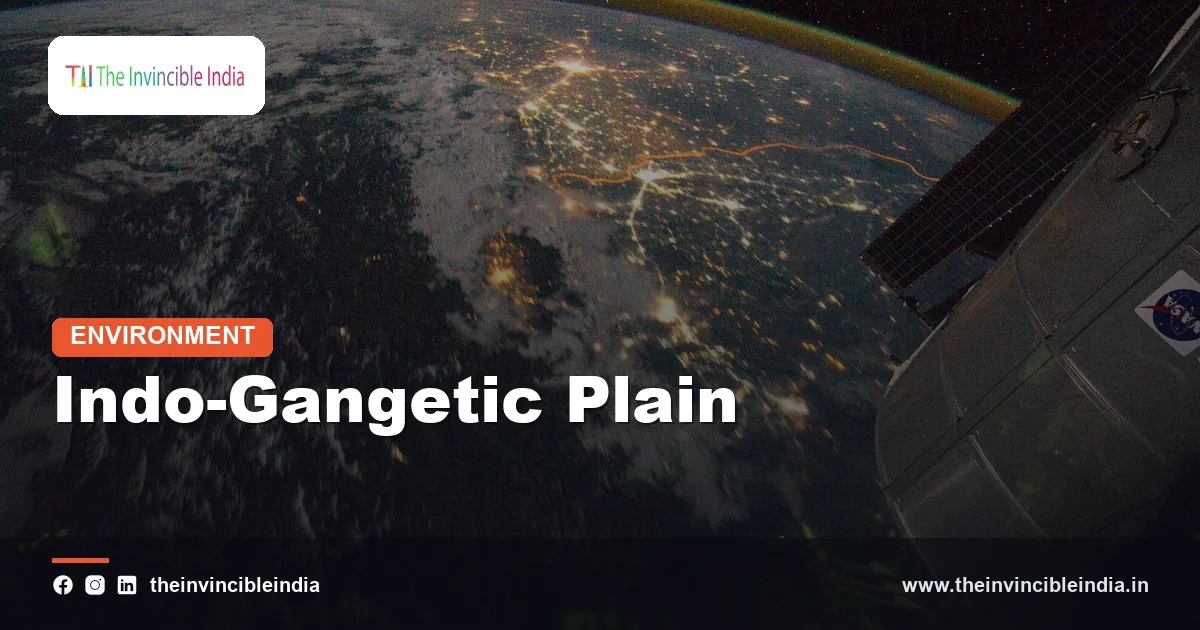
The Indo-Gangetic Plain is the vast, flat belt of fertile alluvial land that stretches across northern India, Pakistan, Nepal’s Terai and Bangladesh, formed by sediments carried down from the Himalayas by the Indus, Ganga and Brahmaputra river systems. It is one of the most heavily farmed and most densely populated regions on Earth.
The Indo-Gangetic Plain, also called the Northern Plains of India or the Indus-Ganga-Brahmaputra plain, lies between the Himalayas in the north and the Peninsular Plateau in the south. This explainer covers how the Indo-Gangetic Plain formed, its four soil belts, its regional divisions and rivers, and why it is both India’s food bowl and one of its most hazard-prone regions.
| Attribute | Detail |
|---|---|
| Landform type | Alluvial foreland plain (Himalayan foredeep) |
| Countries covered | India, Pakistan, Bangladesh, and the Terai of Nepal |
| Extent in India | About 2,400 kilometres long and 240 to 320 kilometres wide in standard descriptions |
| Area in India | Roughly 700,000 square kilometres |
| Rock and soil | Alluvium of sand, silt, clay and gravel, hundreds to thousands of metres thick |
| Soil belts | Bhabar, terai, bhangar and khadar |
| Regional divisions | Punjab plain, Ganga plain, Brahmaputra plain |
| Principal rivers | Indus system, Ganga, Yamuna, Ghaghara, Gandak, Kosi, Brahmaputra |
| Main crops | Wheat, rice, sugarcane, pulses, oilseeds, jute |
Key Takeaways
- The Indo-Gangetic Plain is an alluvial plain of northern India formed by sediments that Himalayan rivers have dumped in a deep trough, or foredeep, in front of the mountains.
- The Indo-Gangetic Plain is divided from north to south into four belts, the bhabar, terai, bhangar and khadar, defined by sediment size, age and drainage.
- The Indo-Gangetic Plain is made of alluvium that is in places several kilometres deep, which explains its flat surface, its fertile soils and its large groundwater reserves.
- The Indo-Gangetic Plain is India’s food bowl, producing a major share of the country’s wheat and rice under the rice-wheat cropping system.
- The Indo-Gangetic Plain has some of the highest rural population densities in the world, with Bihar, West Bengal and Uttar Pradesh among the most crowded Indian states.
- The Indo-Gangetic Plain faces floods, earthquakes, groundwater depletion, arsenic contamination and severe winter air pollution.
What is the Indo-Gangetic Plain?
The Indo-Gangetic Plain is a great alluvial plain, built from river-borne silt, sand and clay, that fills the low ground between the Himalayas and the peninsular plateau of India. Geographers also call it the Northern Plains or the Great Plains of India.
The name joins the two main river systems that created it, the Indus in the west and the Ganga in the east, though the Brahmaputra builds the easternmost section. The plain is among the flattest surfaces on any continent, and a traveller can cross hundreds of kilometres with almost no change in height.
Its importance goes beyond geology. The plain supported the Harappan cities of the Indus basin, the Vedic communities of the Ganga, the Magadha and Mauryan states and many later empires, and it contains cities such as Delhi, Lucknow, Kanpur, Patna, Kolkata and Lahore.
How big is the Indo-Gangetic Plain and where does it lie?
The Indo-Gangetic Plain stretches roughly 2,400 kilometres across northern India in standard accounts, from Punjab in the west to the Brahmaputra valley in Assam in the east, and it is typically 240 to 320 kilometres wide. The wider plain extends further west into Pakistan and further east into Bangladesh.
Its limits are easy to describe:
- North: the Shiwalik foothills, the outermost range of the Himalayas.
- South: the edge of the Peninsular Plateau, including the Aravalli range, the Vindhyas and the Chota Nagpur Plateau.
- West: the Thar desert and the lower Indus plain in Pakistan.
- East: the Purvanchal hills and the Bay of Bengal, where the plain merges into the Ganga-Brahmaputra delta.
In India the plain covers Punjab, Haryana, Delhi, most of Uttar Pradesh and Bihar, northern West Bengal and the Brahmaputra valley of Assam. It occupies roughly a fifth of India’s land but supports a far larger share of its people.
How did the Indo-Gangetic Plain form?
The Indo-Gangetic Plain formed as the Himalayas rose after India collided with Eurasia about 50 million years ago, creating a deep trough in front of the mountains that rivers then filled with sediment. Geologists call such a trough a foreland basin, or foredeep.
The process has four stages:
- Collision: the Indian plate pushed under Eurasia, thickening the crust and raising the Himalayas.
- Flexure: the weight of the rising mountains bent the Indian plate downwards, forming a long trough along the Himalayan front.
- Infilling: rivers carried the eroded rock of the young mountains into the trough, first as the coarse Shiwalik deposits and later as fine silts and sands.
- Levelling: shifting channels spread the sediment, over millions of years, into a smooth, almost level surface.
The alluvium is thickest near the mountains and thins towards the peninsular side, and below it lies a buried ridge-and-basin structure of old rocks. Most of the surface sediment is geologically young, dating from the Pleistocene and Holocene.
What are the bhabar, terai, bhangar and khadar belts?
The bhabar, terai, bhangar and khadar are the four soil and drainage belts of the Indo-Gangetic Plain, arranged in order from the Himalayan foothills southwards. Each reflects how far the sediment travelled and how old it is.
| Belt | Position | Character |
|---|---|---|
| Bhabar | Narrow strip along the foot of the Shiwalik hills, about 8 to 16 kilometres wide | Coarse pebbles and boulders; streams sink underground and disappear |
| Terai | South of the bhabar, about 15 to 30 kilometres wide | Damp, marshy ground where the streams re-emerge; once thick forest, now largely farmed |
| Bhangar | Older alluvium on higher terraces | Above flood level, often with lime nodules called kankar |
| Khadar | Newer alluvium on river floodplains | Renewed by floods each year; very fertile and sandy to loamy |
The bhabar acts as a natural recharge zone, because water soaking through its coarse gravel feeds the aquifers of the plain. The terai is a rich habitat for tall grasslands and wildlife, and it holds protected areas such as Dudhwa National Park.
The older bhangar soils are slightly darker and more clayey, while the newer khadar soils form on the active floodplain and are replenished by fresh silt whenever rivers overflow. Farmers distinguish them in their names for land, and the contrast shapes crop choice.
What are the regional divisions of the Indo-Gangetic Plain?
The Indo-Gangetic Plain in India is divided into the Punjab plain, the Ganga plain and the Brahmaputra plain, according to the main river system that built each part. The boundaries follow broad river watersheds.
- Punjab plain: the western part, formed by the Indus and its tributaries the Sutlej, Beas, Ravi, Chenab and Jhelum; the land between rivers is called a doab.
- Ganga plain: the largest part, stretching from the Delhi region through Uttar Pradesh and Bihar to West Bengal, and subdivided into upper, middle and lower sections.
- Brahmaputra plain: the narrow eastern valley in Assam, built by the Brahmaputra and its tributaries.
The divide between the Indus and Ganga systems is remarkably low. It runs near Ambala and the Delhi ridge, and a rise of only a few metres decides whether rain drains to the Arabian Sea or to the Bay of Bengal.
Rainfall increases from west to east, from about 500 to 700 millimetres in Punjab to well over 1,500 millimetres in the delta. This gradient explains why wheat dominates in the west and rice in the east.
Which rivers shape the Indo-Gangetic Plain?
The Ganga, the Yamuna, the Indus system, the Ghaghara, the Gandak, the Kosi and the Brahmaputra are the principal rivers that shaped the Indo-Gangetic Plain, carrying vast loads of silt from the Himalayas. Most are snow-fed and rain-fed, so they flow all year but swell greatly in the monsoon.
- Ganga: formed at Devprayag by the Bhagirathi and Alaknanda, it flows over 2,500 kilometres to the Bay of Bengal.
- Yamuna: the Ganga’s longest tributary, joining it at Prayagraj (Allahabad).
- Himalayan tributaries: the Ghaghara, Gandak and Kosi bring huge sediment loads from Nepal and the high Himalaya.
- Peninsular tributaries: the Chambal, Betwa and Son join from the south.
- Brahmaputra: flows through Assam and joins the Ganga in Bangladesh to form the world’s largest delta.
Rivers of the plain are mobile. They meander, form oxbow lakes, build natural levees and sometimes jump to new courses. The Kosi, nicknamed the Sorrow of Bihar, has shifted its course by well over a hundred kilometres westwards in about two centuries by commonly cited accounts.
Why is the Indo-Gangetic Plain so fertile?
The Indo-Gangetic Plain is so fertile because it is made of young alluvium, rich in minerals and replenished by annual river floods, spread over flat land with abundant water. The soil holds plant nutrients eroded from the Himalayas and refreshed every monsoon.
Several factors work together:
- Fresh mineral supply: the rivers deliver silt rich in potash, lime and other nutrients, though it is often low in nitrogen and humus.
- Level land: flat ground makes ploughing, irrigation and mechanisation easy.
- Water: snow-fed rivers, the monsoon and large aquifers allow irrigation almost anywhere.
- Deep soil: the alluvium is deep and free of stones, allowing strong root growth.
The Green Revolution of the 1960s and 1970s turned Punjab, Haryana and western Uttar Pradesh into the granary of India. Canals, tube wells, high-yielding wheat and rice, and fertiliser sharply raised output.
What crops are grown across the Indo-Gangetic Plain?
The Indo-Gangetic Plain grows mainly wheat and rice, with sugarcane, pulses, oilseeds, maize, potatoes and jute, and its main system is rice in the monsoon season followed by wheat in winter. The mix changes from west to east with rainfall.
| Zone | Season and crops |
|---|---|
| Punjab, Haryana, western Uttar Pradesh | Wheat in winter (rabi); rice in the monsoon (kharif); sugarcane in Uttar Pradesh |
| Eastern Uttar Pradesh and Bihar | Rice, wheat, pulses, maize, sugarcane and vegetables |
| West Bengal and the delta | Rice (often two or three crops a year), jute, vegetables and fish |
| Brahmaputra valley | Rice, tea on the margins, jute, oilseeds |
The rice-wheat system feeds much of India and supplies the public distribution system, but it also draws heavily on groundwater and burns large volumes of crop residue.
Why is the Indo-Gangetic Plain so densely populated?
The Indo-Gangetic Plain is densely populated because fertile soil, reliable water and flat land can feed many people per square kilometre, and the region has supported settled agriculture for thousands of years. It holds several hundred million people, a large share of India’s total.
The 2011 census recorded densities of well over 800 persons per square kilometre in Uttar Pradesh and above 1,000 in Bihar and West Bengal, far higher than the national average. Cities such as Delhi, Kanpur, Patna, Varanasi and Kolkata add to the pressure.
The same concentration creates strain. Farm plots are small, jobs are scarce in many districts, and migration towards other states is large. The sheer number of people exposed to floods and pollution raises the stakes of every hazard on the plain.
What natural hazards and environmental problems affect the Indo-Gangetic Plain?
The Indo-Gangetic Plain is affected by river floods, earthquakes, groundwater depletion, arsenic contamination and winter air pollution, all of which are amplified by high population density. These problems are linked to the plain’s flat terrain and thick sediment.
- Floods: rivers such as the Kosi, Ghaghara and Brahmaputra regularly overflow because the gradient is so gentle that water spreads widely. The Kosi flood of 2008 displaced millions in Bihar.
- Earthquakes: the plain lies close to the active Himalayan front, and soft sediment can amplify shaking, as the 1934 Bihar-Nepal earthquake showed.
- Groundwater depletion: heavy pumping for rice and wheat has lowered water tables sharply in Punjab, Haryana and western Uttar Pradesh.
- Arsenic: naturally occurring arsenic in shallow groundwater affects parts of Bihar, Uttar Pradesh and West Bengal, and Bangladesh.
- Air pollution and fog: in winter, cold still air traps smoke, dust and moisture, producing thick smog and fog.
Managing these risks requires better flood forecasting, crop diversification away from water-hungry paddy, safe drinking water, and reduction in burning of crop stubble.
Bottom Line
The Indo-Gangetic Plain is the Himalayan foredeep filled with river-laid alluvium, giving northern India its flat, fertile and crowded heartland. It feeds a large part of South Asia, and it also bears some of the region’s heaviest environmental burdens.
Frequently Asked Questions
What is the Indo-Gangetic Plain?
The Indo-Gangetic Plain is the large alluvial plain of northern South Asia formed by the Indus, Ganga and Brahmaputra rivers. It lies between the Himalayas and the peninsular plateau. In India it is about 2,400 kilometres long and is the country’s main food-producing region.
How was the Indo-Gangetic Plain formed?
The Indo-Gangetic Plain was formed by rivers filling a deep trough in front of the rising Himalayas with sediment. The trough, known as a foredeep, opened as the mountains’ weight bent the Indian plate downward after its collision with Eurasia. Rivers then buried it under sand, silt and clay over millions of years.
What are bhabar, terai, bhangar and khadar?
Bhabar, terai, bhangar and khadar are the four belts of the Indo-Gangetic Plain. Bhabar is the pebbly foothill strip where streams vanish, and terai is the marshy belt where they re-emerge. Bhangar is older upland alluvium, while khadar is newer, flood-renewed floodplain soil.
Why is the Indo-Gangetic Plain so fertile?
The Indo-Gangetic Plain is fertile because rivers keep depositing mineral-rich Himalayan silt over level land with plentiful water. The alluvium is deep, stone-free and easy to irrigate. Annual floods renew the nutrients on the floodplains.
Which states lie in the Indo-Gangetic Plain?
The Indo-Gangetic Plain covers Punjab, Haryana, Delhi, Uttar Pradesh, Bihar and northern West Bengal, and it reaches Assam through the Brahmaputra valley. Parts of Uttarakhand’s foothills, Rajasthan’s edge and Jharkhand’s border also touch it. Beyond India it extends into Pakistan, Nepal and Bangladesh.
What are the main problems of the Indo-Gangetic Plain?
The main problems of the Indo-Gangetic Plain are floods, groundwater depletion, arsenic contamination, air pollution and earthquake risk. Intensive rice and wheat farming has lowered water tables, especially in the northwest. Dense population increases the number of people exposed to each hazard.
{“@context”:”https://schema.org”,”@graph”:[{“@type”:”FAQPage”,”mainEntity”:[{“@type”:”Question”,”name”:”What is the Indo-Gangetic Plain?”,”acceptedAnswer”:{“@type”:”Answer”,”text”:”The Indo-Gangetic Plain is the large alluvial plain of northern South Asia formed by the Indus, Ganga and Brahmaputra rivers. It lies between the Himalayas and the peninsular plateau. In India it is about 2,400 kilometres long and is the country’s main food-producing region.”}},{“@type”:”Question”,”name”:”How was the Indo-Gangetic Plain formed?”,”acceptedAnswer”:{“@type”:”Answer”,”text”:”The Indo-Gangetic Plain was formed by rivers filling a deep trough in front of the rising Himalayas with sediment. The trough, known as a foredeep, opened as the mountains’ weight bent the Indian plate downward after its collision with Eurasia. Rivers then buried it under sand, silt and clay over millions of years.”}},{“@type”:”Question”,”name”:”What are bhabar, terai, bhangar and khadar?”,”acceptedAnswer”:{“@type”:”Answer”,”text”:”Bhabar, terai, bhangar and khadar are the four belts of the Indo-Gangetic Plain. Bhabar is the pebbly foothill strip where streams vanish, and terai is the marshy belt where they re-emerge. Bhangar is older upland alluvium, while khadar is newer, flood-renewed floodplain soil.”}},{“@type”:”Question”,”name”:”Why is the Indo-Gangetic Plain so fertile?”,”acceptedAnswer”:{“@type”:”Answer”,”text”:”The Indo-Gangetic Plain is fertile because rivers keep depositing mineral-rich Himalayan silt over level land with plentiful water. The alluvium is deep, stone-free and easy to irrigate. Annual floods renew the nutrients on the floodplains.”}},{“@type”:”Question”,”name”:”Which states lie in the Indo-Gangetic Plain?”,”acceptedAnswer”:{“@type”:”Answer”,”text”:”The Indo-Gangetic Plain covers Punjab, Haryana, Delhi, Uttar Pradesh, Bihar and northern West Bengal, and it reaches Assam through the Brahmaputra valley. Parts of Uttarakhand’s foothills, Rajasthan’s edge and Jharkhand’s border also touch it. Beyond India it extends into Pakistan, Nepal and Bangladesh.”}},{“@type”:”Question”,”name”:”What are the main problems of the Indo-Gangetic Plain?”,”acceptedAnswer”:{“@type”:”Answer”,”text”:”The main problems of the Indo-Gangetic Plain are floods, groundwater depletion, arsenic contamination, air pollution and earthquake risk. Intensive rice and wheat farming has lowered water tables, especially in the northwest. Dense population increases the number of people exposed to each hazard.”}}]}]}


