

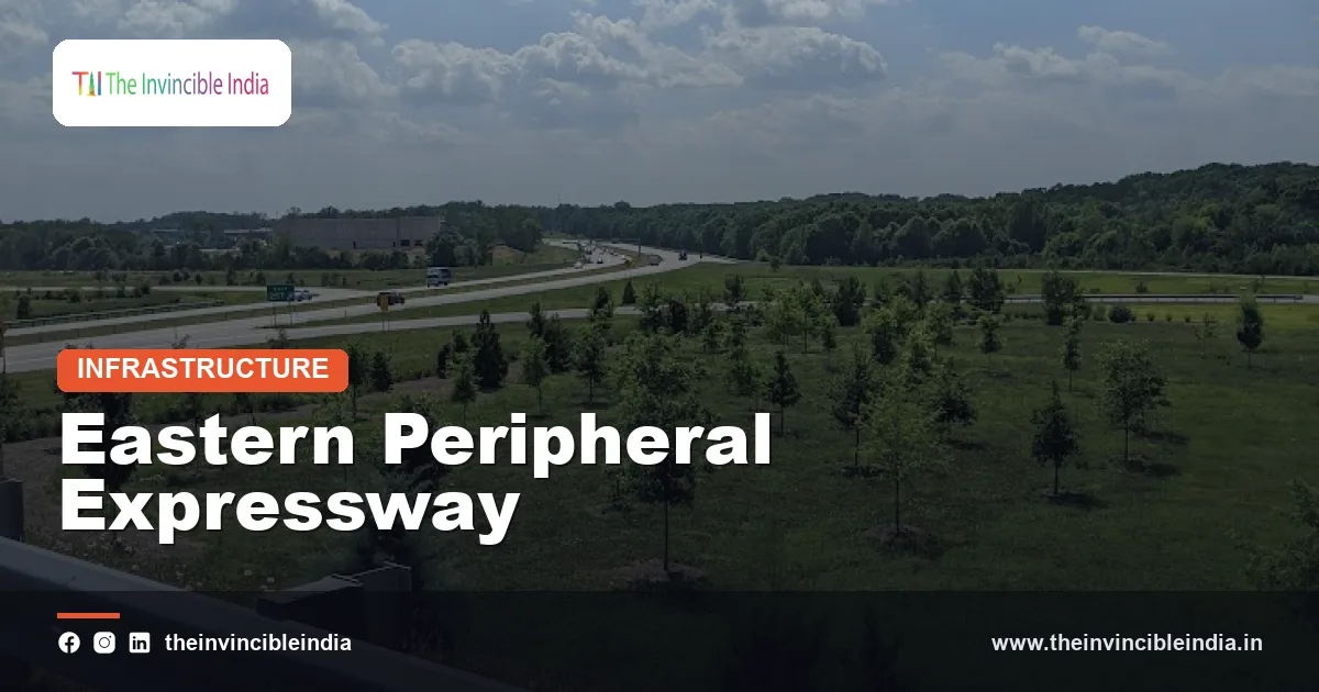
The Eastern Peripheral Expressway (EPE) is a roughly 135 km access-controlled, six-lane expressway that arcs around the eastern side of Delhi, connecting Kundli in Haryana with Palwal in Haryana through western Uttar Pradesh, so that vehicles not bound for the capital can bypass it. It is also known as the KGP Expressway, a name drawn from its three anchor points, Kundli, Ghaziabad and Palwal, and was opened to traffic in May 2018.
The Eastern Peripheral Expressway was built by the National Highways Authority of India (NHAI) after the Supreme Court of India directed that non-essential commercial traffic be kept out of Delhi to reduce congestion and air pollution. Together with its western counterpart, the Western Peripheral Expressway, it forms a ring road around the National Capital Region (NCR) and has become a reference point for green and technology-led highway design in India.
| Attribute | Detail |
|---|---|
| Official name | Eastern Peripheral Expressway (EPE), also called KGP Expressway |
| Route | Kundli (Sonipat, Haryana) to Palwal (Haryana) via Baghpat, Ghaziabad and Gautam Buddh Nagar in Uttar Pradesh |
| Length | Approximately 135 km |
| Type | Access-controlled expressway, six lanes with provision for widening to eight |
| Implementing agency | National Highways Authority of India (NHAI), under the Ministry of Road Transport and Highways |
| Opened | 27 May 2018 |
| Approximate cost | Around Rs 11,000 crore, including land acquisition |
| Purpose | Diverting through traffic away from Delhi and easing congestion and pollution |
| Companion project | Western Peripheral Expressway (Kundli-Manesar-Palwal) |
Key Takeaways
- The Eastern Peripheral Expressway is an approximately 135 km access-controlled expressway running from Kundli to Palwal around the eastern edge of Delhi.
- The Eastern Peripheral Expressway was opened to traffic on 27 May 2018 and was built by the National Highways Authority of India after a Supreme Court of India direction on diverting traffic from Delhi.
- The Eastern Peripheral Expressway is a six-lane road designed so that it can be widened to eight lanes when traffic grows.
- The Eastern Peripheral Expressway, with the Western Peripheral Expressway, forms a ring around Delhi, so vehicles that only need to pass through the region can avoid city roads.
- The Eastern Peripheral Expressway was promoted as a green expressway, with solar power for lighting, rainwater harvesting along the route and extensive roadside planting.
- The Eastern Peripheral Expressway uses an intelligent traffic management system, electronic tolling and weigh-in-motion equipment to manage safety and heavy vehicles.
What Is the Eastern Peripheral Expressway?
The Eastern Peripheral Expressway is a controlled-access highway of about 135 km that bypasses the eastern fringe of the Delhi region, built mainly to carry trucks and long-distance vehicles that do not need to enter the city. Access is limited to designated interchanges, which means there are no direct property entrances, level crossings or roadside junctions to slow traffic.
The expressway links several national highways, including those that run towards Punjab and the north, towards Uttar Pradesh and towards Agra and Mathura in the south. A driver heading from Punjab to Rajasthan or Uttar Pradesh, for instance, can now stay on the ring rather than crossing Delhi’s inner roads.
The road is sometimes described as a bypass, but it is more accurately a ring-road segment. Its job is to give the NCR a capacity layer that sits outside the city itself, with the national highways acting as the spokes feeding into it.
Why Was the Eastern Peripheral Expressway Built?
The Eastern Peripheral Expressway was built to reduce the very large number of commercial vehicles that used to enter Delhi only to pass through it, adding to congestion and air pollution. Before the ring roads existed, many trucks travelling between northern and western India or between Punjab and Uttar Pradesh took the shortest route through the city.
The Supreme Court of India took up the issue in the context of Delhi’s worsening air quality and, in 2015, directed that commercial vehicles not bound for Delhi should be diverted and that the two peripheral expressways be completed on a priority basis. The Court also set up monitoring of the work. Government agencies and the Environment Pollution (Prevention and Control) Authority, which advised on air-quality measures in the NCR, supported the plan.
The reasons for the project can be summarised as follows:
- Congestion: Thousands of through-vehicles a day added to traffic on city corridors.
- Air quality: Heavy diesel trucks are a significant source of particulate and nitrogen oxide emissions.
- Regional connectivity: Haryana, Uttar Pradesh and Rajasthan needed a faster link that did not depend on Delhi.
- Industrial growth: Industrial areas in Sonipat, Ghaziabad, Greater Noida and Faridabad benefited from smoother freight movement.
Where Does the Eastern Peripheral Expressway Run?
The Eastern Peripheral Expressway runs from the Kundli area near Sonipat in Haryana, through the Baghpat and Ghaziabad districts of Uttar Pradesh and the Gautam Buddh Nagar area, to Palwal in Haryana. This route takes it across the Yamuna and Hindon river regions on the eastern edge of the NCR.
At the northern end near Kundli, the expressway connects with the national highway towards Panipat, Karnal and Punjab. In the middle, it meets highways heading towards Meerut, Hapur and Ghaziabad, and it passes close to Greater Noida where it links with the Yamuna Expressway and the Noida-Greater Noida corridor. At the southern end near Palwal, it connects with the national highway towards Mathura and Agra.
The alignment was chosen to keep a distance from the densely built-up area of the capital while staying close enough to serve the industrial and urban districts of the NCR. Land along the route is a mix of farmland, small towns and industrial belts, which is why acquiring land was one of the most demanding parts of the project.
When Was the Eastern Peripheral Expressway Built and Opened?
The Eastern Peripheral Expressway was built in about two and a half years after work accelerated in late 2015, and it was inaugurated by Prime Minister Narendra Modi on 27 May 2018. Official statements at the time stressed the fast pace of construction and described the project as completed well ahead of its original target date.
The construction effort was split into packages, and contractors worked in parallel on several stretches. Land acquisition across districts in two states was a major task, supported by government coordination in Haryana and Uttar Pradesh. The project was funded by NHAI, with the cost generally cited at roughly Rs 11,000 crore, a figure that includes land.
How did the Supreme Court shape the timeline?
The Supreme Court of India monitored progress and set deadlines, so the timeline was driven by judicial supervision as well as by normal project planning. Later, the Western Peripheral Expressway was opened in November 2018 to complete the ring.
What Makes the Eastern Peripheral Expressway a Green Expressway?
The Eastern Peripheral Expressway is called a green expressway because it was designed with solar power, rainwater harvesting, large-scale planting and a pollution-reducing purpose built into its basic concept. Its builders and the ministry promoted it as one of the first expressways in India to give environmental features a prominent role.
The main green features reported for the project include the following:
- Solar power: Solar installations were set up to supply electricity for street lighting, tolling and other expressway services, which reduces dependence on grid power.
- Rainwater harvesting: Harvesting structures were built at regular intervals along the road to recharge groundwater.
- Plantation: A large number of trees and shrubs were planted along the median and the roadside, with a maintenance plan to help them survive.
- Reduced idling: Fewer stop-and-go vehicles in Delhi means fewer emissions in the city.
Whether the road actually improved Delhi’s air has been discussed in several studies and news reports. Estimates suggested that tens of thousands of vehicles were diverted from the city, but the effect on pollution measurements depends heavily on weather, crop burning, construction dust and other sources, so no single number should be treated as definitive.
What Smart Features Does the Eastern Peripheral Expressway Have?
The Eastern Peripheral Expressway has an intelligent traffic management system (ITMS), electronic toll collection, weigh-in-motion sensors, surveillance cameras and emergency facilities designed to make traffic management less dependent on manual intervention. The aim is to keep traffic flowing and to detect incidents quickly.
- Electronic toll collection: Toll plazas support FASTag so that vehicles do not need to stop for cash payments.
- Weigh-in-motion systems: Sensors measure the weight of heavy vehicles to discourage overloading, which damages road surfaces.
- Control room and cameras: Cameras and variable message signs help operators monitor traffic and inform drivers.
- Emergency services: Patrol vehicles, ambulances and helpline arrangements are part of the operating plan.
The project also included cultural and public elements. Along some stretches, murals and sculptures display Indian art and heritage, and wayside amenities were planned for rest stops. The exact range of facilities in operation can change over time as the expressway is managed and upgraded.
How Does the Eastern Peripheral Expressway Work With the Western Peripheral Expressway?
The Eastern Peripheral Expressway and the Western Peripheral Expressway together form a ring of roughly 270 km around Delhi, with the eastern arc running Kundli-Ghaziabad-Palwal and the western arc running Kundli-Manesar-Palwal. Both begin at Kundli and end at Palwal, so a driver can choose either arc depending on the destination.
| Feature | Eastern Peripheral Expressway | Western Peripheral Expressway |
|---|---|---|
| Common name | KGP Expressway | KMP Expressway |
| Approximate length | 135 km | 135 km |
| Side of Delhi | East | West |
| States touched | Haryana and Uttar Pradesh | Haryana |
| Opened | May 2018 | November 2018 |
| Lanes | Six, expandable to eight | Six |
The two expressways are designed as a pair. Heavy vehicles heading from the north to Rajasthan or Gujarat often use the western arc, while those headed to Uttar Pradesh, Agra or the east often prefer the eastern arc.
Who Uses the Eastern Peripheral Expressway and What Does It Cost?
The Eastern Peripheral Expressway is used mainly by trucks and long-haul freight, but cars, buses and intercity travellers also use it to avoid Delhi’s city traffic. Tolls are collected electronically, and the rates vary by vehicle class and are revised periodically by NHAI, so travellers should check current figures before a trip.
Speed limits are set higher than on ordinary roads, commonly up to around 100 km/h for cars, subject to the rules in force. Two-wheelers, tractors and slow-moving vehicles are generally not permitted on access-controlled expressways in India, and the rules are enforced at entry points. Drivers are expected to follow lane discipline and avoid stopping on the carriageway.
How Has the Eastern Peripheral Expressway Affected the Region?
The Eastern Peripheral Expressway has improved freight movement across the eastern NCR and has influenced real-estate and industrial planning along its route, although the scale of benefits differs by locality. Logistics parks, warehouses and industrial clusters have looked at the corridor as a base because it offers quick access to several highways without passing through Delhi.
Local effects include a shift of heavy traffic away from certain Delhi roads, better connectivity between Haryana’s industrial areas and Uttar Pradesh, and new demand for land around interchanges. There are also concerns, such as the loss of agricultural land, the need for adequate safety measures for villagers who live near the road, and the importance of regular maintenance. These issues are common to large expressway projects across India.
What Are the Challenges and Future Plans?
The main challenges facing the Eastern Peripheral Expressway are rising traffic volumes, maintenance of safety and green features, and integration with new corridors in the NCR. Because the expressway was built with provision for eight lanes, a future widening is possible if traffic justifies it.
New expressways, including those that connect to Delhi and the Yamuna corridor, are expected to feed more vehicles into the ring over time. Authorities have also expressed interest in cleaner fuels and electric charging along major expressways, though the extent of such facilities on the EPE specifically depends on later decisions and should be checked with NHAI.
Bottom Line
The Eastern Peripheral Expressway is a roughly 135 km, six-lane ring-road segment that moves through traffic away from Delhi and links Kundli to Palwal. Its significance lies in its role as half of the Delhi ring, its court-driven origin, and its attempt to combine freight efficiency with solar power, rainwater harvesting and smart traffic systems.
Frequently Asked Questions
What is the Eastern Peripheral Expressway?
The Eastern Peripheral Expressway is an access-controlled six-lane highway of about 135 km that runs from Kundli to Palwal around the eastern edge of Delhi. It lets vehicles that do not need to enter the capital bypass the city, which reduces congestion and pollution.
When was the Eastern Peripheral Expressway opened?
The Eastern Peripheral Expressway was opened on 27 May 2018 by Prime Minister Narendra Modi. It was completed in a little over two years after work gathered pace in late 2015.
Why is the Eastern Peripheral Expressway called the KGP Expressway?
The Eastern Peripheral Expressway is called the KGP Expressway because its name comes from the three key places on its route: Kundli, Ghaziabad and Palwal. The western ring is similarly called the KMP Expressway, after Kundli, Manesar and Palwal.
How long is the Eastern Peripheral Expressway?
The Eastern Peripheral Expressway is approximately 135 km long. Exact figures can differ slightly between sources, depending on how the start and end points are measured.
Which states does the Eastern Peripheral Expressway pass through?
The Eastern Peripheral Expressway passes through Haryana and Uttar Pradesh. It starts and ends in Haryana, at Kundli and Palwal, and runs through western Uttar Pradesh in the middle section.
What are the green features of the Eastern Peripheral Expressway?
The green features of the Eastern Peripheral Expressway include solar power for lighting and services, rainwater harvesting along the route and large-scale tree planting. The expressway also has a wider environmental purpose, since diverting trucks from Delhi was meant to help reduce city pollution.
{“@context”:”https://schema.org”,”@graph”:[{“@type”:”FAQPage”,”mainEntity”:[{“@type”:”Question”,”name”:”What is the Eastern Peripheral Expressway?”,”acceptedAnswer”:{“@type”:”Answer”,”text”:”The Eastern Peripheral Expressway is an access-controlled six-lane highway of about 135 km that runs from Kundli to Palwal around the eastern edge of Delhi. It lets vehicles that do not need to enter the capital bypass the city, which reduces congestion and pollution.”}},{“@type”:”Question”,”name”:”When was the Eastern Peripheral Expressway opened?”,”acceptedAnswer”:{“@type”:”Answer”,”text”:”The Eastern Peripheral Expressway was opened on 27 May 2018 by Prime Minister Narendra Modi. It was completed in a little over two years after work gathered pace in late 2015.”}},{“@type”:”Question”,”name”:”Why is the Eastern Peripheral Expressway called the KGP Expressway?”,”acceptedAnswer”:{“@type”:”Answer”,”text”:”The Eastern Peripheral Expressway is called the KGP Expressway because its name comes from the three key places on its route: Kundli, Ghaziabad and Palwal. The western ring is similarly called the KMP Expressway, after Kundli, Manesar and Palwal.”}},{“@type”:”Question”,”name”:”How long is the Eastern Peripheral Expressway?”,”acceptedAnswer”:{“@type”:”Answer”,”text”:”The Eastern Peripheral Expressway is approximately 135 km long. Exact figures can differ slightly between sources, depending on how the start and end points are measured.”}},{“@type”:”Question”,”name”:”Which states does the Eastern Peripheral Expressway pass through?”,”acceptedAnswer”:{“@type”:”Answer”,”text”:”The Eastern Peripheral Expressway passes through Haryana and Uttar Pradesh. It starts and ends in Haryana, at Kundli and Palwal, and runs through western Uttar Pradesh in the middle section.”}},{“@type”:”Question”,”name”:”What are the green features of the Eastern Peripheral Expressway?”,”acceptedAnswer”:{“@type”:”Answer”,”text”:”The green features of the Eastern Peripheral Expressway include solar power for lighting and services, rainwater harvesting along the route and large-scale tree planting. The expressway also has a wider environmental purpose, since diverting trucks from Delhi was meant to help reduce city pollution.”}}]}]}


