

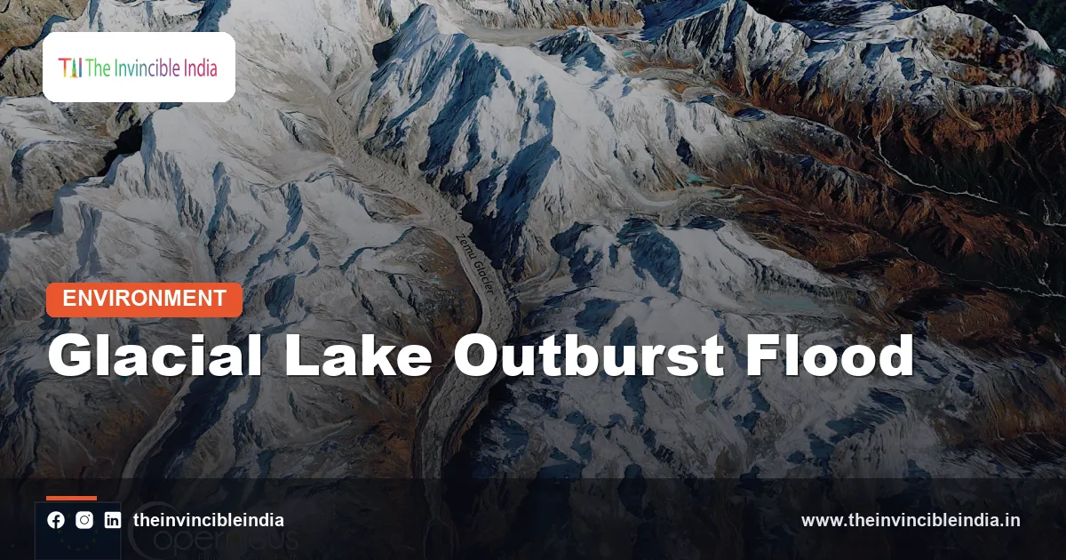
A glacial lake outburst flood (GLOF) is a sudden, violent release of water from a lake that sits in front of, on top of, or beside a glacier, usually when the natural dam of ice or loose rock debris holding the lake back fails. The surge can travel tens or even hundreds of kilometres down a mountain valley within hours, carrying boulders, sediment and uprooted trees, and it often arrives with little or no warning for the villages and power projects below.
In India, the glacial lake outburst flood has moved from a scientific worry to a recurring disaster. The Himalayan glaciers are shrinking and thousands of new or enlarging meltwater lakes have formed behind fragile moraines, particularly in Sikkim, Uttarakhand, Himachal Pradesh and Arunachal Pradesh. This explainer describes how a GLOF happens, why the Himalaya is exposed, what the 2013 Kedarnath and 2023 Sikkim events showed, and how early warning and lake-lowering reduce the risk. It was last reviewed on 30 October 2026.
| Attribute | Detail |
|---|---|
| Full name | Glacial lake outburst flood (abbreviated GLOF) |
| What it is | A sudden discharge of water and debris after the dam of a glacial lake fails |
| Common dam types | Moraine dams (loose rock and ice debris), ice dams and bedrock dams |
| Typical triggers | Avalanches or landslides into the lake, extreme rain, earthquakes, seepage and melting of ice inside the dam |
| Most exposed Indian regions | Sikkim, Uttarakhand, Himachal Pradesh, Arunachal Pradesh and the Union Territories of Ladakh and Jammu and Kashmir |
| Well-known Indian examples | Kedarnath, Uttarakhand (June 2013); South Lhonak Lake, Sikkim (October 2023) |
| National guidance | National Disaster Management Authority (NDMA) guidelines on managing GLOFs, issued in 2020 |
| Main risk-reduction tools | Satellite monitoring, sensors and sirens, controlled lake lowering, hazard zoning and community drills |
Key Takeaways
- A glacial lake outburst flood is the sudden failure of the ice or moraine dam of a glacial lake, releasing a surge of water and debris far larger than any normal river flood in the same valley.
- Most Himalayan GLOFs involve moraine-dammed lakes, which are made of loose, unconsolidated rock and are among the weakest natural dams on Earth.
- The October 2023 outburst of South Lhonak Lake in Sikkim destroyed the Teesta III hydropower dam at Chungthang and sent a flood wave down the Teesta valley into West Bengal and Bangladesh.
- The June 2013 Kedarnath disaster in Uttarakhand combined extreme rainfall, landslides and a breach of the Chorabari moraine lake, and killed thousands of people.
- Glacial lakes in the Himalaya have generally grown in number and area as glaciers lose mass, so the hazard is expected to remain high for decades.
- India reduces GLOF risk through satellite lake inventories, automatic sensors and sirens, controlled lowering of dangerous lakes, and hazard-aware planning of roads and hydropower.
What Is a Glacial Lake Outburst Flood?
A glacial lake outburst flood is a flood caused by the sudden emptying of a glacial lake, as opposed to a flood caused by rainfall or ordinary snowmelt. The water was stored for years or centuries in a basin hollowed out by ice, and it is released within minutes or hours once the dam gives way.
Glacial lakes form when meltwater collects against the snout of a retreating glacier, in hollows left on the glacier surface, or behind ridges of rock and gravel the glacier itself pushed up and left behind. As a glacier thins and pulls back, the lake can deepen and widen, and the volume of water behind a weak dam keeps rising. Because the dam is natural, nobody designed or tested it, and it carries no spillway or safety margin.
The flood is dangerous not only for its volume but for its speed. The initial wave can be many metres high at the source, and as it rushes downhill it scours the valley floor and picks up loose debris. The result is often a debris flow, a thick slurry of water, mud and boulders, which is more destructive than clear water.
How Does a Glacial Lake Burst?
A glacial lake bursts when something weakens or overtops its dam faster than the dam can hold, and the most common cause is a large mass of ice or rock falling into the lake. The impact creates a displacement wave that surges over the dam, cutting a channel that widens rapidly as flowing water erodes the loose material.
Scientists group the triggers into a few broad categories:
- Avalanche or landslide into the lake: A collapsing hanging glacier, a rock slope or a moraine wall pushes water out of the basin in a wave.
- Extreme rainfall or rapid melt: Heavy rain or a sudden warm spell raises the lake level quickly and can overtop the dam.
- Earthquakes: Shaking can crack the dam or trigger slope failures around the lake. The Himalaya is a seismically active zone.
- Piping and seepage: Water flowing through gaps inside a moraine can wash out fine material and hollow the dam from within.
- Melting of buried ice: Many moraines contain ice cores or are frozen with permafrost, and when that ice melts the dam sinks or weakens.
Often several of these act together. A warm, wet spell can load the lake with water, soften the surrounding slopes and set up an avalanche, so that a lake which sat stable for decades fails in a single afternoon.
What Are the Types of Glacial Lakes and Dams?
Glacial lakes are classified mainly by what holds the water in, and the type of dam largely decides how likely and how severe an outburst is. The main categories are moraine-dammed, ice-dammed, bedrock-dammed and supraglacial lakes.
| Lake type | What holds the water | Outburst risk |
|---|---|---|
| Moraine-dammed | A ridge of loose rock, gravel and sometimes buried ice left by the glacier | High, because the dam can erode or collapse quickly. These cause most Himalayan GLOFs. |
| Ice-dammed | A tongue of glacier ice blocking a valley or tributary | Moderate to high, with floods that often recur as the ice dam floats or melts |
| Bedrock-dammed | Solid rock basin carved by the glacier | Lower, since the rock dam is stable, though a landslide can still overtop it |
| Supraglacial | Ponds on the glacier surface | Smaller floods, but ponds can merge and grow into larger lakes |
The moraine-dammed type is the one most associated with catastrophic floods in India and the neighbouring countries. Its dam is steep, narrow and made of material that was never compacted or cemented, so even moderate overtopping can start rapid erosion.
Why Is the Himalaya So Exposed to GLOFs?
The Himalaya is exposed to glacial lake outburst floods because it holds the largest ice mass outside the polar regions, much of it is losing mass, and steep terrain lets small events turn into large disasters. Scientists often call the Himalaya, Karakoram and Hindu Kush together the Third Pole for that reason.
Satellite inventories of the Indian Himalayan region have recorded thousands of glacial lakes, and many have grown since the 1990s. Only a small share are considered potentially dangerous, but that share is not small in absolute terms when many sit above villages, pilgrimage routes, highways and hydropower stations. Researchers rank lakes by size, growth rate, dam type, slope stability of the surrounding walls and the population and infrastructure downstream.
Three conditions make the hazard worse in India:
- Warming: Higher temperatures thin glaciers and release more meltwater into growing lakes. Thawing permafrost also destabilises the rock walls above them.
- Steep valleys: Floods in narrow, steep gorges gain speed and erosive power and have little room to spread out and lose energy.
- Development in the path: Hydropower dams, roads, bridges, tourist camps and settlements are often built on river terraces and floodplains that a GLOF can reach.
What Happened in the South Lhonak Lake Disaster of 2023?
The South Lhonak Lake disaster was a glacial lake outburst flood in North Sikkim on 3 and 4 October 2023, in which the lake breached after a massive slope failure and the surge destroyed the Teesta III dam at Chungthang. The flood killed dozens of people, left many more missing, and damaged bridges, roads and homes along the Teesta river.
South Lhonak Lake lies at high altitude in the Teesta basin, fed by the South Lhonak Glacier. Researchers had listed it for years as one of the most dangerous lakes in Sikkim because it had grown rapidly as the glacier retreated, and it was held back by a moraine dam. In the 2023 event, a large mass of material is understood to have fallen into the lake and sent a wave over the moraine, and the flood then gathered sediment and debris on its way down the valley.
The wave hit the Teesta III hydropower project, a large run-of-the-river dam at Chungthang, which was overwhelmed and breached. The sudden release of water and silt from the reservoir added to the surge, which then moved through the valley and reached downstream areas in West Bengal and Bangladesh. This is a classic example of a cascading hazard, in which a natural flood triggers a failure of human infrastructure that makes the flood worse.
The disaster led to renewed attention on monitoring dangerous lakes, on how hydropower is sited and designed in the Himalaya, and on how quickly alerts can reach people downstream.
How Did the 2013 Kedarnath Flood Involve a Glacial Lake?
The 2013 Kedarnath flood was a catastrophic mountain disaster in June 2013 in which extreme monsoon rain, snowmelt and landslides combined with the breach of the Chorabari moraine lake above Kedarnath town, killing thousands of people. It is regarded as one of the deadliest natural disasters in modern Indian history.
The event began with unusually heavy early-monsoon rain over Uttarakhand around 16 and 17 June 2013, which overlapped with a western disturbance and melted fresh snow. The Chorabari Lake, a small moraine-dammed lake near the Chorabari Glacier above Kedarnath, overflowed and breached, and the resulting torrent hit the Mandakini river valley with enormous force. Studies differ on how much of the damage came from the lake itself and how much from the rain-fed debris flows and river floods, so it is more accurate to describe Kedarnath as a compound disaster in which a glacial lake outburst was one part.
The loss of life was especially severe because the flood struck during the Char Dham pilgrimage season, when the valley held large numbers of visitors, and because it destroyed roads, bridges and communication lines that rescuers needed.
Other Himalayan GLOFs worth knowing
- Dig Tsho, Nepal (1985): A moraine-dammed lake burst after an avalanche and destroyed a hydropower project under construction, an early warning to engineers.
- Bhutan (1994): The Luggye Tsho outburst sent a flood down the Punakha valley, causing deaths and damage along the Pho Chhu river.
- Chamoli, Uttarakhand (February 2021): A rock and ice avalanche, rather than a classic lake burst, swept down the Rishiganga and Dhauliganga valleys, damaged two hydropower projects and caused many deaths. Scientists treat it as a closely related glacier-linked flash flood.
How Can GLOFs Be Predicted and Prevented?
GLOF risk is reduced by combining three kinds of action: finding and ranking dangerous lakes, lowering or stabilising the most hazardous ones, and installing early warning systems that give people downstream time to move. No single tool is enough, because a flood can travel quickly and lakes sit in remote terrain.
Mapping and monitoring
Satellite images from agencies such as the Indian Space Research Organisation (ISRO) and the European and US space agencies are used to track the area of glacial lakes over time. The Central Water Commission (CWC) monitors the water spread of many high-altitude lakes through the monsoon season. Researchers also use computer models to estimate how large a flood from a given lake would be, how fast it would travel and which places it would reach.
Lowering the lake
Engineers can reduce the volume of a dangerous lake by siphoning or pumping water out, cutting a controlled outlet channel through the dam, or driving a tunnel through the rock. Countries such as Peru and Nepal have carried out lake-lowering projects at some of the world’s riskiest lakes. In the Himalaya the work is difficult because sites lie at very high altitude, roads are absent and the working season is short.
Early warning systems
An early warning system detects an outburst quickly and sends an alarm downstream. It typically combines water-level sensors, cameras, seismic or vibration sensors and automatic weather stations at the lake with sirens and mobile alerts in villages. Sirens placed along the river can give minutes to hours of notice, and that is often enough for people to climb to higher ground if they have rehearsed where to go.
Planning and community readiness
Hazard maps help decide where not to build. Restricting settlements, camps and roads in flood paths, designing hydropower projects with GLOF scenarios in mind, and training local volunteers all reduce losses. Public awareness of escape routes and of the warning signs, such as a sudden drop or surge in river level, matters as much as technology.
Who Manages GLOF Risk in India?
GLOF risk in India is managed by the National Disaster Management Authority (NDMA) at the national level, working with state disaster management authorities and technical agencies. The NDMA issued guidelines for the management of glacial lake outburst floods in 2020, setting out how to identify, assess and reduce risk.
Several bodies contribute different pieces of the work:
- NDMA: Frames national policy and guidelines and coordinates projects to reduce the risk at high-priority lakes.
- State disaster management authorities: Run local alerts, evacuation planning and field expeditions, as in Sikkim and Uttarakhand.
- Central Water Commission (CWC): Monitors glacial lakes and water spread using satellite data.
- ISRO and the National Remote Sensing Centre (NRSC): Map glacial lakes and track change.
- Geological Survey of India, the Wadia Institute of Himalayan Geology and universities: Study lake basins, moraine stability and glacier change.
- India Meteorological Department (IMD): Provides weather forecasts and heavy-rain warnings that help anticipate high-risk periods.
Will GLOFs Become More Common?
GLOFs are widely expected to remain a serious and in some places growing hazard, because ongoing warming is expanding existing lakes and creating new ones as glaciers retreat. The exact number and timing of future outbursts is uncertain, since each event depends on local conditions such as the dam, the slopes and the weather on a given day.
Scientists distinguish between the number of lakes, which tends to rise, and the number of outbursts, which depends on triggers that are hard to forecast. Over longer periods, some lakes will drain or shrink as glaciers recede entirely, but the transition itself is a period of heightened danger. Rising temperatures also thaw permafrost on steep rock walls, which raises the likelihood of large rock and ice avalanches that can fall into a lake.
Climate change is therefore best understood as a multiplier of an existing hazard in the Himalaya rather than as its only cause. The same mountains have produced outburst floods before, but there are now more people, more roads and more hydropower infrastructure in the way.
Bottom Line
A glacial lake outburst flood is a low-frequency, high-impact hazard that is increasingly relevant to the Indian Himalaya as glaciers retreat and lakes grow. Sikkim in 2023 and Kedarnath in 2013 show that GLOFs can destroy infrastructure and take many lives within hours. Careful monitoring, lowering of the most dangerous lakes, early warning and sensible siting of projects are the proven ways to cut the toll.
Frequently Asked Questions
What is a GLOF in simple words?
A GLOF is a glacial lake outburst flood, a sudden flood that happens when the natural dam of a glacier-fed lake breaks. The stored water rushes downstream with rocks and mud, often in a wave far larger than a normal river flood. Most Himalayan GLOFs come from lakes held back by loose moraine.
What caused the Sikkim flood of October 2023?
The Sikkim flood of October 2023 was caused by the outburst of South Lhonak Lake in North Sikkim after a large mass of material fell into the lake and sent water over its moraine dam. The surge travelled down the Teesta valley and destroyed the Teesta III dam at Chungthang. The event also damaged bridges, roads and settlements downstream.
Was the Kedarnath disaster of 2013 a GLOF?
The Kedarnath disaster of 2013 was a compound event that included the breach of the Chorabari moraine lake along with extreme rain, landslides and flooding of the Mandakini river. Scientists differ on how much of the damage came from the lake itself. It is generally described as a rain-triggered disaster in which a glacial lake outburst played a part.
Are glacial lakes increasing in the Himalaya?
Glacial lakes in the Himalaya have generally increased in number and size over recent decades as glaciers retreat and meltwater collects. Only a small share are considered dangerous, but those few can threaten many people. Satellite monitoring is used to track which lakes are growing fastest.
How can a GLOF be prevented or reduced?
A GLOF can be made less dangerous by lowering the water level in risky lakes, strengthening or channelling the outlet, and installing sensors and sirens that warn people downstream. Hazard maps that keep homes, roads and hydropower projects out of flood paths also cut the damage. These steps work best together, along with community drills.
Which Indian states are most at risk from GLOFs?
The Indian states most at risk from GLOFs are Sikkim, Uttarakhand, Himachal Pradesh and Arunachal Pradesh, along with the Union Territories of Ladakh and Jammu and Kashmir. These areas contain many glacial lakes in steep river valleys with settlements and hydropower projects below. Sikkim and Uttarakhand have both seen major outburst-related disasters in recent years.
{“@context”:”https://schema.org”,”@graph”:[{“@type”:”FAQPage”,”mainEntity”:[{“@type”:”Question”,”name”:”What is a GLOF in simple words?”,”acceptedAnswer”:{“@type”:”Answer”,”text”:”A GLOF is a glacial lake outburst flood, a sudden flood that happens when the natural dam of a glacier-fed lake breaks. The stored water rushes downstream with rocks and mud, often in a wave far larger than a normal river flood. Most Himalayan GLOFs come from lakes held back by loose moraine.”}},{“@type”:”Question”,”name”:”What caused the Sikkim flood of October 2023?”,”acceptedAnswer”:{“@type”:”Answer”,”text”:”The Sikkim flood of October 2023 was caused by the outburst of South Lhonak Lake in North Sikkim after a large mass of material fell into the lake and sent water over its moraine dam. The surge travelled down the Teesta valley and destroyed the Teesta III dam at Chungthang. The event also damaged bridges, roads and settlements downstream.”}},{“@type”:”Question”,”name”:”Was the Kedarnath disaster of 2013 a GLOF?”,”acceptedAnswer”:{“@type”:”Answer”,”text”:”The Kedarnath disaster of 2013 was a compound event that included the breach of the Chorabari moraine lake along with extreme rain, landslides and flooding of the Mandakini river. Scientists differ on how much of the damage came from the lake itself. It is generally described as a rain-triggered disaster in which a glacial lake outburst played a part.”}},{“@type”:”Question”,”name”:”Are glacial lakes increasing in the Himalaya?”,”acceptedAnswer”:{“@type”:”Answer”,”text”:”Glacial lakes in the Himalaya have generally increased in number and size over recent decades as glaciers retreat and meltwater collects. Only a small share are considered dangerous, but those few can threaten many people. Satellite monitoring is used to track which lakes are growing fastest.”}},{“@type”:”Question”,”name”:”How can a GLOF be prevented or reduced?”,”acceptedAnswer”:{“@type”:”Answer”,”text”:”A GLOF can be made less dangerous by lowering the water level in risky lakes, strengthening or channelling the outlet, and installing sensors and sirens that warn people downstream. Hazard maps that keep homes, roads and hydropower projects out of flood paths also cut the damage. These steps work best together, along with community drills.”}},{“@type”:”Question”,”name”:”Which Indian states are most at risk from GLOFs?”,”acceptedAnswer”:{“@type”:”Answer”,”text”:”The Indian states most at risk from GLOFs are Sikkim, Uttarakhand, Himachal Pradesh and Arunachal Pradesh, along with the Union Territories of Ladakh and Jammu and Kashmir. These areas contain many glacial lakes in steep river valleys with settlements and hydropower projects below. Sikkim and Uttarakhand have both seen major outburst-related disasters in recent years.”}}]}]}


