

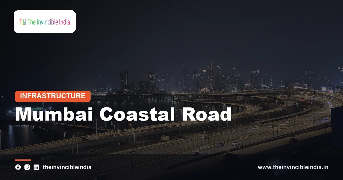
The Mumbai Coastal Road is a sea-facing, access-controlled freeway of roughly 10 to 11 kilometres along the western shore of Mumbai, running from Marine Drive in South Mumbai northward toward the Bandra-Worli Sea Link, and it includes India’s first undersea road tunnels. It was built by the Brihanmumbai Municipal Corporation (BMC) to relieve the heavy traffic on the city’s western corridor and to create new waterfront space through land reclamation.
The Mumbai Coastal Road is formally known as the Dharmaveer Swarajya Rakshak Chhatrapati Sambhaji Maharaj Coastal Road, and it is often shortened to the Coastal Road in everyday speech. It cuts the journey between South Mumbai and the western suburbs, and it has also raised long-running debates about the sea, shoreline ecology and the livelihoods of traditional fishing communities. 15 October 2026
Quick Facts
| Attribute | Details |
|---|---|
| Project | Mumbai Coastal Road Project (Phase 1) |
| Builder and owner | Brihanmumbai Municipal Corporation (BMC) |
| Route | From the Marine Lines and Princess Street area in South Mumbai to the Worli end of the Bandra-Worli Sea Link |
| Length | Roughly 10 to 11 km, mostly with eight lanes |
| Highlight | Twin undersea road tunnels under Malabar Hill, the first of their kind in India |
| Tunnelling method | A large-diameter tunnel-boring machine (TBM) named Mavala |
| Reclaimed land | More than 100 hectares reclaimed from the sea, with a large share planned as open and green space |
| Opening | Opened to traffic in stages from 2024 |
| Main contractors | Larsen and Toubro for the southern package; a joint venture of Hindustan Construction Company and Hyundai Development Company for the northern package |
Key Takeaways
- The Mumbai Coastal Road is a freeway of roughly 10 to 11 kilometres along Mumbai’s western shoreline that links South Mumbai with the Bandra-Worli Sea Link and was built by the Brihanmumbai Municipal Corporation (BMC).
- The Mumbai Coastal Road includes twin tunnels under Malabar Hill that are India’s first undersea road tunnels, and they were bored by a large tunnel-boring machine named Mavala.
- The Mumbai Coastal Road created more than 100 hectares of new land through reclamation, and a large part of it was planned as gardens, promenades and open public space.
- The Mumbai Coastal Road is designed to cut travel time between South Mumbai and the western suburbs from a long stop-and-go drive to a short run in free-flowing traffic.
- The Mumbai Coastal Road was funded largely by the BMC from its own resources, which made it an unusually large road project for an Indian municipal body.
- The Mumbai Coastal Road has been the subject of court cases and public debate over coastal ecology and the interests of traditional Koli fishing communities.
What is the Mumbai Coastal Road?
The Mumbai Coastal Road is a high-speed road along the Arabian Sea coast of Mumbai that links the southern tip of the city with the Bandra-Worli Sea Link, using a mix of reclaimed land, bridges, interchanges and tunnels. Its purpose is to provide a faster, signal-free alternative to the existing western road corridor, which is congested through most of the day.
The project is formally known as the Mumbai Coastal Road Project, and its first phase runs from the Princess Street flyover near Marine Lines to the Worli end of the sea link. The road was planned as the first part of a longer coastal corridor that could later extend north through the suburbs.
Mumbai is a long, narrow island city, and most of its north-south movement is squeezed along a few corridors. The coastal road adds a new spine along the sea, and it complements the metro and suburban rail lines, which carry the largest share of commuters.
Where does the Mumbai Coastal Road run?
The Mumbai Coastal Road runs along the western edge of South and Central Mumbai, starting near Marine Drive and Marine Lines and passing Girgaon Chowpatty, Malabar Hill, Haji Ali and Worli before it joins the Bandra-Worli Sea Link. Marine Drive, the famous curved promenade also known as the Queen’s Necklace, lies at the southern starting area.
The alignment uses different structures along its course. In places it runs on reclaimed land beside the sea, in places on elevated bridges, and under Malabar Hill it passes through twin tunnels. Interchanges at several points connect it with local roads, so that traffic can enter and exit in the main districts.
| Stretch | Structure and notes |
|---|---|
| Princess Street and Marine Drive area | Starting section with an interchange near Marine Lines |
| Girgaon Chowpatty to Priyadarshini Park | Twin tunnels under Malabar Hill, passing beneath both land and sea |
| Amarsons Garden and Haji Ali | Interchange areas on reclaimed land with promenade space |
| Worli | Connection to the Bandra-Worli Sea Link through a bridge arm and interchange |
How are the undersea tunnels of the Mumbai Coastal Road built?
The undersea tunnels of the Mumbai Coastal Road were built by a very large tunnel-boring machine (TBM) that cut twin tubes of roughly two kilometres each from the Girgaon Chowpatty side to the Priyadarshini Park side under Malabar Hill. A tunnel-boring machine is a mechanised drill that excavates the rock face at its front and lines the tunnel with concrete segments as it advances.
The machine used on this project was named Mavala, and it was among the largest TBMs used on an Indian road project, with a diameter of about twelve metres. The tunnels pass partly under the seabed, which makes them India’s first undersea road tunnels, and they required careful control of groundwater, rock conditions and settlement of buildings above.
Why tunnels were needed
- Dense hillside: The Malabar Hill area has buildings, gardens and heritage structures that cannot be demolished.
- Shoreline limits: A surface road around the hill would have required far more reclamation and disruption.
- Speed and continuity: Tunnels allow a smooth, signal-free path through the busiest part of the corridor.
- Safety features: The tubes include ventilation, fire safety, drainage and emergency exits.
Why was land reclaimed for the Mumbai Coastal Road?
Land was reclaimed for the Mumbai Coastal Road because the shoreline alongside the sea was the only available space for a new road in a crowded city, and the project also created large areas for public use. Reclamation means filling a part of the sea or shore with soil and rock to form new land, held in place by protective seawalls.
The project added more than a hundred hectares of land, and the planners described a significant share of it as gardens, promenades, cycle tracks, jogging paths and other open space for citizens. A protective seawall, built to withstand waves and high tides, runs along the sea edge of the reclaimed area.
The seawall also serves a flood protection function in a coastal city exposed to storm surges and rising sea levels. Supporters argue that this is a useful side benefit, while critics argue that reclamation changes natural coastal processes, a point that is discussed further below.
How much travel time does the Mumbai Coastal Road save?
The Mumbai Coastal Road is designed to cut the journey between South Mumbai and the Bandra-Worli Sea Link from a drive that can take the better part of an hour in peak traffic to roughly ten to fifteen minutes when the road is flowing freely. The actual savings depend on the time of day, the traffic at interchanges and weather conditions.
The road has eight lanes, and it is designed for fast vehicles, with restrictions on slow-moving categories such as two-wheelers and three-wheelers on the main carriageway. A dedicated lane for buses is part of the design on parts of the route, so the road can also support public transport.
The effect is not limited to the road itself. By drawing vehicles away from Pedder Road, Nepean Sea Road and the Western Express Highway, the project aims to reduce pressure on those older routes and to cut fuel use and idling.
Interchanges
Interchanges on the Mumbai Coastal Road connect the freeway to local roads at points such as the Marine Lines area, Girgaon, Amarsons Garden, Haji Ali and Worli. These connectors allow vehicles to enter and exit the expressway at selected locations without disturbing through traffic.
Who built the Mumbai Coastal Road?
The Mumbai Coastal Road was built by the Brihanmumbai Municipal Corporation (BMC), the civic body that governs Mumbai, which acted as the project owner and a principal funder. Construction was divided into packages and awarded to large engineering companies.
Larsen and Toubro handled the southern package that includes the tunnels, and a joint venture of Hindustan Construction Company and Hyundai Development Company handled the northern package toward the sea link. The BMC’s decision to take on a project of this size was notable, because large road projects in India are normally built by state or central agencies.
The project cost was in the range of several thousand crore rupees, and it grew over time as the scope, design and timelines changed. Final figures depend on the date and on what is counted, so they are best described only in broad terms.
How is traffic managed on the Mumbai Coastal Road?
Traffic on the Mumbai Coastal Road is managed as an access-controlled expressway, which means vehicles can enter and leave only at designated interchanges and the main carriageway has no signals or crossings. A speed limit applies on the road and in the tunnels, and cameras, signage and control rooms help monitor the flow of vehicles.
The tunnels have additional safety systems, including ventilation fans to clear exhaust, fire detection and suppression equipment, cross-passages for emergency evacuation and lighting designed to reduce driver fatigue. Slow-moving vehicles such as bicycles and handcarts are not allowed on the main road, and the authorities have varied the operating hours of some sections during the early period of service.
Because the road ends at the Bandra-Worli Sea Link, the planners also had to manage the way traffic merges at the Worli end. Interchange design, lane discipline and enforcement at this junction have a strong effect on whether the time saved in the tunnels is lost in queues at the exits.
What is the timeline of the Mumbai Coastal Road?
The Mumbai Coastal Road moved from planning to construction over several years, was delayed by legal proceedings and the pandemic, and opened to traffic in stages from 2024. The timeline below lists the main stages in order.
| Period | Milestone |
|---|---|
| Early planning | The idea of a coastal road is studied as part of Mumbai’s development plan to relieve western corridor traffic |
| 2017 | Environmental and coastal regulation approvals are granted and work is launched |
| 2019 | The Bombay High Court sets aside the clearances; the Supreme Court later allows the project to proceed subject to conditions |
| 2020-2022 | Work continues through the pandemic; tunnelling progresses under Malabar Hill |
| 2024 | The first stretches are opened to traffic, and the link to the Bandra-Worli Sea Link follows |
| Afterward | Remaining sections, finishing works and green spaces are completed, and an extension toward the northern suburbs is discussed |
What concerns have been raised about the Mumbai Coastal Road?
The concerns raised about the Mumbai Coastal Road centre on coastal ecology, the effect of reclamation on tides and shoreline, the livelihoods of fishing communities and the question of whether new roads reduce congestion in the long term. These concerns have been argued in court, in public hearings and in the press, and supporters and critics both present evidence.
Environmental groups argued that reclamation could damage intertidal habitats, change sediment movement and affect marine life. They also said that the project lay in a zone that is regulated under the Coastal Regulation Zone (CRZ) rules. The courts examined these claims, and the Supreme Court allowed the work to continue with conditions in 2019.
Fishing communities, notably the Koli community, which is considered the original inhabitant of Mumbai’s islands, raised concerns about access to the sea, the movement of boats and the effect on fish catches. In response, the project authorities agreed to widen the navigation span between certain piers near Worli so boats could pass more easily, and they offered measures for the affected fisherfolk.
Supporters point to the benefit of faster travel, lower fuel use and the new public space. Critics counter that expanding road capacity may attract more private cars over time. Both views are part of an ongoing debate on how coastal cities should balance mobility, ecology and livelihoods.
What comes next for the Mumbai Coastal Road?
The next steps for the Mumbai Coastal Road include the finishing of public spaces, improvements at the interchanges and discussions on extending the corridor northward through Bandra and beyond. A connection from the Bandra end of the sea link toward Versova and Dahisar has been discussed in planning documents as a future corridor.
The road is expected to work together with other projects, including the Mumbai Metro lines, the Trans Harbour Link and the suburban rail upgrades. Together they aim to give the city a more balanced transport system, where roads, rail and public transit each handle the trips they suit best.
Bottom Line
The Mumbai Coastal Road is one of the most ambitious urban road projects in India, combining land reclamation, undersea tunnels and a new waterfront for the city. It promises much shorter journeys along the western shore, while the environmental and community questions around it remain part of a continuing public discussion.
Frequently Asked Questions
What is the Mumbai Coastal Road?
The Mumbai Coastal Road is a freeway of roughly 10 to 11 kilometres along Mumbai’s western shore, running from the Marine Drive area to the Bandra-Worli Sea Link. It was built by the Brihanmumbai Municipal Corporation and includes twin undersea road tunnels under Malabar Hill. It is meant to relieve traffic on the western corridor.
Who built the Mumbai Coastal Road?
The Brihanmumbai Municipal Corporation (BMC) built the Mumbai Coastal Road as the project owner and main funder. Construction was split between Larsen and Toubro for the southern package and a joint venture of Hindustan Construction Company and Hyundai Development Company for the northern package. The project is unusual because a municipal body carried out a road project of this scale.
What are the undersea tunnels on the Mumbai Coastal Road?
The undersea tunnels are twin road tubes, each roughly two kilometres long, that run under Malabar Hill and partly beneath the seabed between Girgaon Chowpatty and Priyadarshini Park. They are the first undersea road tunnels in India. A large tunnel-boring machine named Mavala excavated them.
How much time does the Mumbai Coastal Road save?
The Mumbai Coastal Road is designed to reduce a South Mumbai to Bandra-Worli Sea Link journey from up to an hour in heavy traffic to around ten to fifteen minutes in free-flowing conditions. Actual times vary with the hour, traffic and weather. The saving is greatest in peak periods when the older corridors are most congested.
How much land was reclaimed for the Mumbai Coastal Road?
More than 100 hectares of land were reclaimed from the sea for the Mumbai Coastal Road project. A large share of this area was planned as gardens, promenades and other open space for the public. A seawall protects the reclaimed land from waves and high tides.
What environmental concerns surround the Mumbai Coastal Road?
The main concerns are the impact of reclamation on coastal habitats, tides and marine life, and the effect on traditional Koli fishing communities. The matter went before the Bombay High Court and the Supreme Court, which allowed work to continue with conditions in 2019. Authorities responded with measures such as a wider navigation span near Worli, and the debate continues.
{“@context”:”https://schema.org”,”@graph”:[{“@type”:”FAQPage”,”mainEntity”:[{“@type”:”Question”,”name”:”What is the Mumbai Coastal Road?”,”acceptedAnswer”:{“@type”:”Answer”,”text”:”The Mumbai Coastal Road is a freeway of roughly 10 to 11 kilometres along Mumbai’s western shore, running from the Marine Drive area to the Bandra-Worli Sea Link. It was built by the Brihanmumbai Municipal Corporation and includes twin undersea road tunnels under Malabar Hill. It is meant to relieve traffic on the western corridor.”}},{“@type”:”Question”,”name”:”Who built the Mumbai Coastal Road?”,”acceptedAnswer”:{“@type”:”Answer”,”text”:”The Brihanmumbai Municipal Corporation (BMC) built the Mumbai Coastal Road as the project owner and main funder. Construction was split between Larsen and Toubro for the southern package and a joint venture of Hindustan Construction Company and Hyundai Development Company for the northern package. The project is unusual because a municipal body carried out a road project of this scale.”}},{“@type”:”Question”,”name”:”What are the undersea tunnels on the Mumbai Coastal Road?”,”acceptedAnswer”:{“@type”:”Answer”,”text”:”The undersea tunnels are twin road tubes, each roughly two kilometres long, that run under Malabar Hill and partly beneath the seabed between Girgaon Chowpatty and Priyadarshini Park. They are the first undersea road tunnels in India. A large tunnel-boring machine named Mavala excavated them.”}},{“@type”:”Question”,”name”:”How much time does the Mumbai Coastal Road save?”,”acceptedAnswer”:{“@type”:”Answer”,”text”:”The Mumbai Coastal Road is designed to reduce a South Mumbai to Bandra-Worli Sea Link journey from up to an hour in heavy traffic to around ten to fifteen minutes in free-flowing conditions. Actual times vary with the hour, traffic and weather. The saving is greatest in peak periods when the older corridors are most congested.”}},{“@type”:”Question”,”name”:”How much land was reclaimed for the Mumbai Coastal Road?”,”acceptedAnswer”:{“@type”:”Answer”,”text”:”More than 100 hectares of land were reclaimed from the sea for the Mumbai Coastal Road project. A large share of this area was planned as gardens, promenades and other open space for the public. A seawall protects the reclaimed land from waves and high tides.”}},{“@type”:”Question”,”name”:”What environmental concerns surround the Mumbai Coastal Road?”,”acceptedAnswer”:{“@type”:”Answer”,”text”:”The main concerns are the impact of reclamation on coastal habitats, tides and marine life, and the effect on traditional Koli fishing communities. The matter went before the Bombay High Court and the Supreme Court, which allowed work to continue with conditions in 2019. Authorities responded with measures such as a wider navigation span near Worli, and the debate continues.”}}]}]}


