

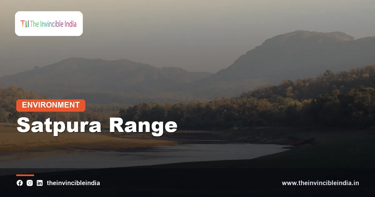
The Satpura Range is a rugged, forest-covered belt of block mountains and plateaus in central India, running roughly east-west between the Narmada river to the north and the Tapi river to the south, and it forms the heart of the country’s most celebrated tiger landscape. Its name is popularly read as “seven folds” or “seven hills”, and although the true structure is more complicated, the label captures the series of parallel ridges, deep valleys and wooded plateaus that make up the range. This explainer, last updated 4 November 2026, treats the Satpura as a subject of physical geography, geology and ecology.
The Satpura is not high by Himalayan standards, but it is the tallest and wildest of the central Indian ranges, and it plays a large role in the region’s water, forests and wildlife. It also holds a rare kind of geological story in India: a range that owes its present form not to compression and folding but to faulting, with the land between two sunken valleys left standing as a raised block.
| Feature | Detail |
|---|---|
| Type of range | Block-faulted highland (horst) lying between rift valleys |
| Approximate extent | Roughly 900 km, from eastern Gujarat through Maharashtra and Madhya Pradesh to Chhattisgarh |
| Bounding rivers | Narmada to the north, Tapi to the south |
| Highest point | Dhupgarh near Pachmarhi, about 1,350 m |
| Main sub-ranges | Rajpipla Hills, Mahadeo Hills, Gawilgarh Hills and Maikal Range |
| Rock types | Deccan basalt in the west; sandstone, granite and gneiss elsewhere |
| Vegetation | Moist and dry deciduous forest of teak, sal, bamboo and mixed species |
| Notable protected areas | Satpura, Pench, Melghat, Kanha and the Pachmarhi Biosphere Reserve |
Key Takeaways
- The Satpura Range is a block-mountain system stretching roughly 900 km across central India between the Narmada and Tapi valleys, with its highest point, Dhupgarh, at about 1,350 m.
- It is a horst, a raised block left between two sunken rift valleys, not a fold mountain like the Himalaya.
- Its rocks include volcanic Deccan basalt in the west and older crystalline and sedimentary rocks in the east, so its landscapes vary widely along its length.
- The range is a major watershed and the source of several rivers, and it feeds reservoirs that irrigate large parts of central India.
- Its dense forests form the core of the Satpura-Maikal tiger landscape, one of the largest connected tiger habitats in India, and include the Pachmarhi Biosphere Reserve.
- Mining, highways, dams and human-wildlife conflict are the chief pressures, and maintaining wildlife corridors between reserves is a leading conservation priority.
What Exactly Is the Satpura Range and Where Is It?
The Satpura Range is a chain of hills and plateaus in central India that extends from the Rajpipla hills in eastern Gujarat, through southern Madhya Pradesh and northern Maharashtra, to the Maikal Range and Amarkantak on the Madhya Pradesh and Chhattisgarh border. It runs broadly parallel to the Vindhya Range to its north, with the long Narmada valley wedged between them.
The range is a composite of several linked groups. In the west lie the Rajpipla hills and the ranges north of the Tapi, where the land is mostly basalt. In the centre rise the Mahadeo Hills, home to Pachmarhi and the highest peak. To the south in Maharashtra and Madhya Pradesh stand the Gawilgarh Hills, which shelter Melghat. In the east the Maikal Range curves up towards Amarkantak, where the Narmada itself is born.
Together these units form the northern edge of the Deccan peninsula’s central uplands. The range is bounded on the north by the deep trough of the Narmada and on the south by the Tapi plain, so on both sides it looks like a long, high shoulder rising out of lower ground.
How Was the Satpura Range Formed?
The Satpura Range was formed mainly by faulting, in which a long strip of crust was pushed up or left standing between two parallel sinking blocks, creating a horst flanked by the Narmada and Tapi rift valleys. This is why geographers classify the Satpura as a block mountain rather than a fold mountain.
The Narmada and Tapi both flow west along old lines of weakness in the crust, where the land dropped down along faults. The Narmada trough on the north and the Tapi trough on the south left the Satpura as a raised ridge between them. Movements along these faults are linked to the long geological history of the Indian plate, and some fault lines are still seismically active, with occasional tremors recorded along the Narmada-Son belt.
The rocks of the range come from several stages of earth history. Very old Precambrian gneisses and granites form the deep foundation in the east. Gondwana sandstones and shales, laid down in ancient river basins when India was part of a larger southern landmass, form striking plateaus and cliffs near Pachmarhi. In the west, great sheets of Deccan basalt, erupted around 66 million years ago, cap the land and give it a stepped, table-top look. The present relief is the result of this mix of ancient rock, later sedimentary cover, volcanic flows and long erosion.
What Is the Highest Peak of the Satpura Range?
The highest peak of the Satpura Range is Dhupgarh, which rises to roughly 1,350 m near Pachmarhi in the Mahadeo Hills of Madhya Pradesh. Its summit is a sandstone ridge and is often visited at sunset, but from a geographical point of view it is notable as the high point of an entire central Indian highland.
Other high areas include peaks in the Maikal Range near Amarkantak, which reach roughly a thousand metres or more, and various ridges in the Gawilgarh Hills. The range is therefore not a single crest but a series of elevated plateaus separated by gorges and valleys. The sandstone plateau of Pachmarhi, deeply cut by streams, shows the typical pattern: flat summits, vertical cliffs, hidden ravines and many waterfalls in the monsoon months.
How Do the Narmada and Tapi Rivers Relate to the Satpura?
The Narmada and Tapi rivers flow west through two parallel rift valleys on the northern and southern sides of the Satpura, making them unusual among peninsular rivers that mostly drain east to the Bay of Bengal. Both rivers empty into the Arabian Sea, the Narmada through the Gulf of Khambhat near Bharuch and the Tapi near Surat.
The Narmada rises at Amarkantak in the eastern Maikal Range, a spot sacred to Hindus, and runs along the northern foot of the Satpura for hundreds of kilometres in a long, deep trough. The Tapi rises in the Satpura hills of the Betul plateau area in Madhya Pradesh and flows west through Maharashtra and Gujarat. Many tributaries from the range feed both rivers, including the Tawa, Denwa and Shakkar rivers that join the Narmada.
Other rivers rise in the Satpura and flow in different directions. Rivers of the southern and eastern flank such as the Wardha and Wainganga feed the Godavari system and go east, so the range also acts as a continental watershed between west-flowing and east-flowing drainage. Large reservoirs such as Tawa and Bargi store monsoon runoff for irrigation and power, binding the highland to the farming plains below.
What Climate and Forests Does the Satpura Range Have?
The Satpura Range has a monsoon climate with hot summers, a rainy season from June to September and mild winters, and its slopes carry moist and dry deciduous forests dominated by teak, sal and bamboo. Rainfall is highest on the elevated plateau and windward edges, often well above 1,000 mm a year and reaching considerably more in places like Pachmarhi, while the lower and rain-shadowed fringes are drier.
Forest type changes with altitude, rainfall and soil. Sal prevails in moister eastern parts such as the Maikal region, while teak mixed with tendu, mahua, bamboo and many other species covers much of the west and centre. Deep, shaded ravines hold pockets of moist forest and rare plants that survive from wetter periods in the past, and hilltops host open grassland and savanna-like patches.
| Sub-range | Location | Distinctive features |
|---|---|---|
| Rajpipla Hills | Western end, eastern Gujarat | Basalt hills between the Narmada and Tapi lowlands |
| Mahadeo Hills | Central Madhya Pradesh | Highest peak Dhupgarh, Pachmarhi plateau, sandstone cliffs |
| Gawilgarh Hills | Southern Madhya Pradesh and Maharashtra | Forested ridges, Melghat tiger landscape |
| Maikal Range | Eastern end, Madhya Pradesh and Chhattisgarh | Source of the Narmada at Amarkantak, sal forests, Kanha |
What Wildlife Lives in the Satpura Range?
The Satpura Range shelters tigers, leopards, Indian gaur, sloth bears, wild dogs, sambar, chital and a large variety of birds and reptiles, making it one of India’s richest wildlife regions. The Indian gaur, the world’s largest wild cattle, is a flagship of these forests, and the range is also noted for Indian giant squirrels and for its many amphibians and insects.
The contiguous forests that stretch across the Satpura and Maikal hills support the Satpura-Maikal landscape, widely regarded as one of the most important tiger habitats in the country. Within or around the range lie Satpura Tiger Reserve, Pench, Melghat and Kanha, along with Bori and Pachmarhi wildlife sanctuaries. Pench, in the southern Satpura foothills, is linked in popular memory with the setting of Rudyard Kipling’s Jungle Book stories, though how directly the author drew on this region is a matter of literary tradition.
The Pachmarhi Biosphere Reserve, recognised by UNESCO, combines Satpura National Park and neighbouring sanctuaries and protects a remarkable mix of plant life, including relict species and many medicinal plants. Botanists regard the plateau as an ecological island because of its variety of habitats, from open sandstone ridges to humid gorges.
Why Are the Satpura Forests So Important for Tigers?
The Satpura forests are important for tigers because they form a large, connected block of habitat where animals can disperse between reserves, hold prey and breed, and this connectivity is considered vital for long-term genetic health. Unlike isolated forest patches, the central Indian landscape allows tigers to move between Kanha, Pench, Satpura, Melghat and beyond, provided corridors remain intact.
Several factors make the habitat favourable: dense forest cover, plentiful prey such as chital, sambar and gaur, and rugged terrain with water in ravines and streams. The sandstone and basalt hills offer rocky dens and shelter. Tigers from these reserves have been recorded moving long distances along forest strips, a reminder that protected areas are not self-contained.
Conservationists therefore treat corridors as seriously as core reserves. Roads, canals, mines and expanding farmland across corridors can cut off populations, and transport infrastructure such as highways crossing the southern Satpura has been a long-running concern, prompting underpasses and speed controls in some stretches.
Who Lives in the Satpura Hills?
The Satpura hills are home to several Adivasi communities, notably the Gond, Korku and Bhil peoples, whose lives and traditions are closely bound to the forest. Many depend on minor forest produce such as tendu leaves, mahua flowers, honey and bamboo, along with farming on small plots and seasonal work.
Human history here is long. Rock shelters in the Mahadeo Hills near Pachmarhi preserve painted scenes thought by researchers to be thousands of years old, and the high plateaus carry hill forts such as Asirgarh and Gawilgarh, which commanded the routes across the range. These forts show how the Satpura served as a defensive barrier and a corridor for armies moving between the north and the Deccan.
Today, the tension between conservation and community rights is a central question. Relocation of villages from core tiger areas, forest-rights recognition, and sharing of tourism and forest income are all subjects of active debate and policy experiment in the region.
What Threats Does the Satpura Range Face?
The Satpura Range faces threats from mining, dams, roads, forest degradation and human-wildlife conflict, all of which fragment habitat and strain local communities. The region has coal fields in the Pench-Kanhan area and mineral deposits including manganese and others in nearby districts, and open-cast mining can cut into forests and water sources.
- Coal and manganese mining and the associated transport routes.
- Reservoirs and canals that flood forest and displace villages.
- Highways and railways crossing tiger corridors.
- Livestock grazing, fuelwood use, forest fires and invasive weeds such as lantana.
- Crop raiding and livestock losses to wildlife, which erode local tolerance.
Climate change adds a further layer. Reports of erratic rainfall and hotter summers may stress forests and waterholes, though the long-term effects on the Satpura ecosystem are still being studied. Effective responses include securing corridors, regulating mining in sensitive zones, compensating communities fairly for losses and restoring water sources.
How Does the Satpura Compare With the Vindhya and Aravalli?
The Satpura is higher and more forested than the Vindhya and quite different in origin from the Aravalli, being a block-faulted highland rather than a layered scarp or a worn-down fold belt. The Vindhya lies north of the Narmada and consists largely of gently dipping sandstone, while the Satpura lies south of the Narmada and is a faulted ridge of mixed rocks.
The Aravalli is far older in its original mountain-building, but today it is lower and drier, and its main environmental story is about the desert fringe and urban pressure. The Satpura story is about forests, tigers and rivers. Taken together, the three ranges give central and northwestern India much of its physical structure.
Bottom Line
The Satpura Range is a faulted, forested highland whose position between the Narmada and Tapi shaped the geography of central India. Its rivers, reservoirs and tiger forests make it ecologically precious, and its future depends on keeping its forest corridors connected while respecting the rights and livelihoods of the people who live there.
Frequently Asked Questions
What is the Satpura Range?
It is a block-mountain highland in central India, lying between the Narmada and Tapi rivers and stretching about 900 km from Gujarat to Chhattisgarh. It is known for its dense forests and tiger habitat.
What is the highest point of the Satpura Range?
Dhupgarh, near Pachmarhi in Madhya Pradesh, is the highest point at roughly 1,350 m. It lies in the Mahadeo Hills section of the range.
Is the Satpura a fold mountain?
No, it is generally classified as a block mountain or horst, raised relative to the Narmada and Tapi rift valleys on either side. Faulting rather than folding shaped its main form.
Which rivers rise in or flow around the Satpura?
The Narmada rises at Amarkantak at the eastern end and runs along its northern side, while the Tapi rises in the range and flows along the south. Rivers such as the Tawa and Denwa join the Narmada from the Satpura.
Which tiger reserves lie in the Satpura region?
Satpura, Pench, Melghat and Kanha are major tiger reserves in or adjoining the range. Together with surrounding forests they form the Satpura-Maikal tiger landscape.
Why is Pachmarhi important in the Satpura?
Pachmarhi lies on a sandstone plateau in the Mahadeo Hills and is the centre of a UNESCO-recognised biosphere reserve rich in plants and wildlife. Dhupgarh, the range’s highest peak, stands nearby.
{“@context”:”https://schema.org”,”@graph”:[{“@type”:”FAQPage”,”mainEntity”:[{“@type”:”Question”,”name”:”What is the Satpura Range?”,”acceptedAnswer”:{“@type”:”Answer”,”text”:”It is a block-mountain highland in central India, lying between the Narmada and Tapi rivers and stretching about 900 km from Gujarat to Chhattisgarh. It is known for its dense forests and tiger habitat.”}},{“@type”:”Question”,”name”:”What is the highest point of the Satpura Range?”,”acceptedAnswer”:{“@type”:”Answer”,”text”:”Dhupgarh, near Pachmarhi in Madhya Pradesh, is the highest point at roughly 1,350 m. It lies in the Mahadeo Hills section of the range.”}},{“@type”:”Question”,”name”:”Is the Satpura a fold mountain?”,”acceptedAnswer”:{“@type”:”Answer”,”text”:”No, it is generally classified as a block mountain or horst, raised relative to the Narmada and Tapi rift valleys on either side. Faulting rather than folding shaped its main form.”}},{“@type”:”Question”,”name”:”Which rivers rise in or flow around the Satpura?”,”acceptedAnswer”:{“@type”:”Answer”,”text”:”The Narmada rises at Amarkantak at the eastern end and runs along its northern side, while the Tapi rises in the range and flows along the south. Rivers such as the Tawa and Denwa join the Narmada from the Satpura.”}},{“@type”:”Question”,”name”:”Which tiger reserves lie in the Satpura region?”,”acceptedAnswer”:{“@type”:”Answer”,”text”:”Satpura, Pench, Melghat and Kanha are major tiger reserves in or adjoining the range. Together with surrounding forests they form the Satpura-Maikal tiger landscape.”}},{“@type”:”Question”,”name”:”Why is Pachmarhi important in the Satpura?”,”acceptedAnswer”:{“@type”:”Answer”,”text”:”Pachmarhi lies on a sandstone plateau in the Mahadeo Hills and is the centre of a UNESCO-recognised biosphere reserve rich in plants and wildlife. Dhupgarh, the range’s highest peak, stands nearby.”}}]}]}


