

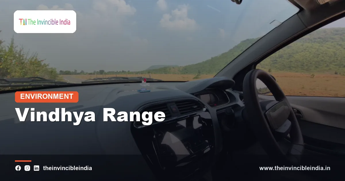
The Vindhya Range is a broken chain of hills, escarpments and plateau edges across central India, running roughly east-west north of the Narmada valley, and it has long been treated as the dividing line between the northern plains and the Deccan south. Unlike the Himalaya, it is not a tall, continuous wall; it is a series of sandstone scarps, flat-topped ridges and plateaus that appear and fade as one travels from Gujarat through Madhya Pradesh towards Bihar. This explainer, last updated 4 November 2026, treats the Vindhya as a piece of physical geography, geology and ecology.
The range matters because it sits at a natural hinge of the subcontinent. It separates drainage that flows north to the Ganga basin from drainage that flows west along the Narmada, it holds ancient sedimentary rocks of exceptional scientific interest, and it supports tiger forests, diamond-bearing gravels and some of the oldest human art in the country. Its fame as a “great divide” is partly physical and partly cultural, and it is worth separating the two.
| Feature | Detail |
|---|---|
| Type of range | Discontinuous scarps, hill ridges and plateau edges, not a single fold-mountain chain |
| Approximate extent | Over 1,000 km, from the Gujarat-Madhya Pradesh border towards Bihar |
| States crossed | Gujarat, Madhya Pradesh, Rajasthan fringe, Uttar Pradesh, Chhattisgarh and Bihar |
| Typical elevation | Mostly several hundred metres, with summits generally under about 1,000 m |
| Main rocks | Sandstone, shale, limestone and quartzite of the Vindhyan Supergroup |
| Age of main rocks | Proterozoic, commonly placed at roughly 1.6 to 0.6 billion years old |
| Neighbouring features | Narmada valley to the south, Malwa plateau and Ganga plain to the north |
| Notable protected areas | Bandhavgarh, Panna and several Madhya Pradesh sanctuaries on or near the range |
Key Takeaways
- The Vindhya Range is not a single mountain chain but a discontinuous series of escarpments, ridges and plateau edges stretching over 1,000 km across central India.
- Its rocks are ancient, layered Proterozoic sediments, mainly sandstone, shale and limestone, which have been gently tilted rather than crumpled into tall folds.
- The range lies just north of the Narmada rift valley and works as a major watershed between rivers flowing to the Ganga system and those flowing west to the Arabian Sea.
- The idea of the Vindhya as the dividing line between north and south India is a traditional cultural and linguistic convention more than a sharp physical barrier.
- Its forests and grasslands include important tiger habitat, while its sandstone, limestone and gravel deposits support quarrying, cement and diamond mining.
- Mining, dam and river-linking projects, and fragmentation of forest corridors are the main modern environmental pressures on the range.
What Exactly Is the Vindhya Range and Where Does It Run?
The Vindhya Range is a belt of hills, plateau edges and escarpments stretching from the Gujarat and western Madhya Pradesh region eastwards across Madhya Pradesh towards Sasaram in Bihar. The label covers several linked groups, including the central Vindhyan scarps, the Bhander and Kaimur ridges to the east, and the Panna hills, and different texts draw its limits a little differently.
Geographers often describe the Vindhya as the northern rim of the peninsular block and the southern rim of the Malwa plateau and the Gangetic plain. Looking from the north, the land rises in a gentle slope onto the plateau top. Looking from the south, from the Narmada valley, the range appears as a steep, cliff-like face. This one-sided shape, a gentle back slope and a steep front, is typical of a scarp formed on gently dipping layered rocks, and it is why the Vindhya looks like a wall from the Narmada side and like a rolling upland from the north.
The range is crossed or skirted by several highways and rail lines, and by important rivers, but it has never been a single obstacle. Passes, gorges and river gaps have always allowed movement between north and south.
How Was the Vindhya Range Formed?
The Vindhya Range was formed from a very thick pile of sediments laid down in ancient shallow seas and river basins, later lifted, tilted and cut into plateaus and scarps by erosion, rather than by the sort of intense folding that built the Himalaya. This makes it a different kind of “mountain”: the rocks lie in broad, gently dipping sheets, and the landscape is carved out of those sheets.
These sedimentary rocks belong to the Vindhyan Supergroup, which lies in a large basin in central and northern India and rests on much older crystalline rocks. Deposition is generally dated to the Proterozoic, spanning hundreds of millions of years. The basin filled with sand, mud and limestone, sometimes in tidal flats and sometimes in rivers, and the layers are still beautifully preserved, with ripple marks and cross-bedding visible in outcrops.
The southern edge of the range is closely tied to the great fracture zone along which the Narmada and Son rivers run. Movements along old faults in this zone have produced a long rift-like valley, and the Vindhya scarp is partly the northern wall of that valley. Dating and exact timing of these faults are still discussed by geologists, but the broad story of ancient basin, later tilting and long erosion is well accepted.
What Rocks Make Up the Vindhya Range?
The Vindhya Range is made mostly of sandstone, with shale, limestone and quartzite layers, giving it a distinctive pink, red, buff and grey colouring and a flat-topped, stepped profile. Sandstone is the star because it is hard enough to form cliffs but easy to cut into blocks, which made it a prized building material for centuries.
Many famous monuments in northern India used red and buff sandstone from Vindhyan quarries, and stone from this region has been used in forts, temples and palaces over a very long period. Limestone layers in the Vindhyan succession feed the cement industry in Madhya Pradesh, Rajasthan and neighbouring states. Shale beds are weaker and tend to erode into valleys, while thick sandstones remain as caps, which explains the stepped, terraced look of many hills.
Another feature is the Panna diamond belt. Diamonds in this region occur in ancient volcanic pipes and in conglomerate and gravel layers associated with the Vindhyan rocks, and the area around Panna has long been India’s most important diamond-producing region. How the stones reached these rocks is a subject of ongoing geological study, and the deposits are small by world standards.
Why Is the Vindhya Range Important to Geologists?
The Vindhya Range is important to geologists because its undisturbed sedimentary layers form one of the best Proterozoic records in Asia, including some of the oldest claimed traces of complex life in India. The Vindhyan basin preserves layer upon layer of ancient environments, helping scientists reconstruct climates, shorelines and early ecosystems.
Researchers have reported microscopic and larger fossil-like structures from some Vindhyan units, including items interpreted as early multicellular organisms. The age and interpretation of these fossils have been debated, and radiometric dating of the layers has revised some earlier estimates, so such claims should be taken as active science rather than settled facts. What is not in doubt is that the Vindhyan succession is an exceptionally long and well-exposed sedimentary record.
The range also offers a record of later human history. Rock shelters at Bhimbetka, in the foothills of the Vindhyan scarp near Bhopal, hold paintings and tools spanning a very long period of prehistory, and they are recognised as a World Heritage site. The sandstone shelters that sheltered these early people are themselves products of Vindhyan geology: soft layers weathered away beneath harder caps, creating natural overhangs.
Is the Vindhya Range Really the Divide Between North and South India?
The Vindhya is traditionally described as the divide between northern and southern India, but this is a cultural and linguistic convention more than a sharp physical or biological barrier. In old Sanskrit geography the line of the Vindhya and the Narmada marked the edge of Aryavarta, the northern heartland, and the beginning of the Dakshinapatha, the southern route.
There is real geography behind the tradition. North of the range the landscape drains towards the Yamuna and Ganga, while south of it the Narmada runs west and the plateau slopes gently eastwards towards the Bay of Bengal through other rivers. The language families of the north, largely Indo-Aryan, and those of the far south, largely Dravidian, meet and mix around central India, with many other tribal and regional languages between them. Yet the boundary is blurred, and the spread of cultures, trade and religion across the range has been continuous.
A popular legend speaks of the Vindhya growing ever taller until the sage Agastya asked it to bow and wait while he travelled south, and the mountain, it is said, has stayed low ever since. As with most such stories, the tale is best read as a cultural memory of the range as a threshold, not as a statement of geology.
How Does the Vindhya Range Affect Rivers and Climate?
The Vindhya Range affects rivers by acting as a major watershed, sending water north into the Ganga system and south into the Narmada, and it affects climate mainly through modest uplift, with rainfall that is moderate rather than heavy. The south-west monsoon reaches the range from the Arabian Sea and the Bay of Bengal, and the hills catch somewhat more rain than the surrounding plains, often in the range of roughly 800 to 1,200 mm a year across much of the belt.
Many important rivers rise on or near the Vindhya. The Chambal, Betwa, Ken and Sone, among others, drain northwards and eastwards towards the Yamuna and Ganga, while smaller streams on the southern face feed the Narmada. The Narmada itself flows west in the deep trough south of the Vindhya, then runs between the Vindhya and Satpura before reaching the Arabian Sea.
The range lies near the Tropic of Cancer, which passes through central India, and experiences hot summers, a distinct monsoon and cool, dry winters. Summer temperatures are high, and the dry months are marked by leaf fall in the deciduous forests and by pressure on streams and groundwater.
| Side of range | Dominant drainage | Landscape character |
|---|---|---|
| Northern flank | Chambal, Betwa, Ken, Sone and tributaries to the Yamuna and Ganga | Gently sloping plateau, Malwa uplands and plains |
| Southern flank | Narmada and its tributaries, flowing west | Steep scarp above a deep rift valley |
| Eastern extension | Son river and Kaimur drainage | Long sandstone plateau with waterfalls and gorges |
What Plants and Animals Live in the Vindhya Range?
The Vindhya Range is home to dry deciduous forests of teak, sal, tendu, mahua and bamboo, interspersed with grassland and rocky outcrops that support tigers, leopards, sloth bears, wild dogs, deer, nilgai and rich birdlife. The mix varies with rainfall and soil: moister slopes carry sal and mixed forests, while drier plateaus carry thorn-studded scrub and open grassy patches.
Several of India’s best-known tiger landscapes lie on or beside the range. Bandhavgarh in the eastern Vindhyan country is famed for its tiger density, and Panna, set on a plateau in the Ken river basin, has been a focus of tiger restoration after local populations collapsed and were later rebuilt through reintroductions. Other protected areas and reserves in the broader Vindhyan belt provide habitat for vultures, sloth bears and other species.
The Vindhya also forms part of a larger central Indian landscape in which forests of the Vindhya, Satpura and Maikal ranges are linked. Tigers and other wildlife can in principle move between reserves along forested corridors, which is why scientists emphasise connectivity as much as the protection of individual parks.
What Threats Does the Vindhya Range Face?
The Vindhya Range faces threats from mining and quarrying, dams and river projects, forest fragmentation by roads and rail, and pressure from agriculture and fuelwood use. Because much of the range is made of easily quarried sandstone and limestone, entire hillsides have been worked for stone, and the diamond belt has seen disputes over mining leases in forested land.
River engineering is another concern. Proposals to link rivers, such as the Ken-Betwa link, involve diverting water across Vindhyan landscapes, and conservationists have raised concern about the loss of forest and tiger habitat in the Panna region, while supporters point to the water needs of drought-prone areas. The balance between these views is a matter of ongoing public debate.
Linear infrastructure such as highways and railways cuts corridors that tigers, leopards and elephants use. Forest fires in the dry season, overgrazing and illegal felling add to the stress. Climate change may also play a role by making rainfall more erratic, and reported shifts in monsoon timing could affect water availability in these seasonally dry forests.
How Does the Vindhya Range Differ From the Satpura and Aravalli?
The Vindhya differs from the Satpura and Aravalli mainly in its rock type and structure: the Vindhya is built of gently tilted sedimentary layers, the Satpura is a block-faulted highland of mixed volcanic and crystalline rock, and the Aravalli is an ancient eroded fold belt. These differences explain why the three ranges look so different on the ground even though they lie in the same broad region.
The Vindhya stands on the northern side of the Narmada rift, the Satpura on the southern side between the Narmada and Tapi, and the Aravalli sweeps along the north-western side of the peninsula. In height the Satpura generally rises above the Vindhya, with its highest ground near Pachmarhi, while the Aravalli reaches its peak at Mount Abu. In role, the Vindhya is the great watershed between the Ganga and Narmada systems, while the Aravalli divides the arid west from the more watered east.
Why Does the Vindhya Range Matter Today?
The Vindhya Range matters today because it stores and shares water, shelters some of India’s richest tiger forests, supplies stone and cement raw materials, and carries a long human story visible in rock art and temples. Its plateaus and valleys also support a large rural and tribal population that depends on forests, farming and seasonal rivers.
For planners, the central question is how to balance extraction and development with water security and wildlife. For readers, the range is a reminder that mountains do not need to be tall to be important: even a modest ridge of sandstone can shape rivers, culture and ecosystems across half a country.
Bottom Line
The Vindhya Range is a long, low and geologically ancient belt of sandstone hills and scarps that links the Ganga basin, the Narmada valley and the Deccan edge. Its reputation as a north-south divide is traditional, but its real importance lies in its rivers, forests, fossils and human history, all of which are sensitive to mining, dams and fragmentation.
Frequently Asked Questions
Where is the Vindhya Range located?
The Vindhya Range runs across central India, mainly through Madhya Pradesh, from near the Gujarat border eastwards towards Bihar. It lies north of the Narmada valley and south of the Malwa plateau and Ganga plain.
Is the Vindhya a true mountain range?
It is better described as a discontinuous series of escarpments, ridges and plateau edges than as a single fold-mountain chain. Most summits are well under 1,000 m, but the scarps are sharp and visible.
What is the Vindhya Range made of?
It is made mostly of Proterozoic sandstone, shale, limestone and quartzite of the Vindhyan Supergroup, laid down in ancient basins and later tilted and eroded. These layers are well preserved and scientifically important.
Why is the Vindhya called the divide between north and south India?
Traditional Sanskrit geography used the Vindhya and Narmada line as the boundary between the northern heartland and the southern region. It is a cultural and linguistic convention rather than a hard physical barrier.
Which rivers are linked to the Vindhya Range?
The Chambal, Betwa, Ken and Sone rise on or near the range and flow towards the Ganga system, while the Narmada runs in the valley to its south. The range is therefore a major watershed.
What wildlife lives in the Vindhya Range?
The range supports tigers, leopards, sloth bears, wild dogs and many deer and birds in dry deciduous forests. Bandhavgarh and Panna are well-known tiger landscapes associated with the Vindhyan belt.
{“@context”:”https://schema.org”,”@graph”:[{“@type”:”FAQPage”,”mainEntity”:[{“@type”:”Question”,”name”:”Where is the Vindhya Range located?”,”acceptedAnswer”:{“@type”:”Answer”,”text”:”The Vindhya Range runs across central India, mainly through Madhya Pradesh, from near the Gujarat border eastwards towards Bihar. It lies north of the Narmada valley and south of the Malwa plateau and Ganga plain.”}},{“@type”:”Question”,”name”:”Is the Vindhya a true mountain range?”,”acceptedAnswer”:{“@type”:”Answer”,”text”:”It is better described as a discontinuous series of escarpments, ridges and plateau edges than as a single fold-mountain chain. Most summits are well under 1,000 m, but the scarps are sharp and visible.”}},{“@type”:”Question”,”name”:”What is the Vindhya Range made of?”,”acceptedAnswer”:{“@type”:”Answer”,”text”:”It is made mostly of Proterozoic sandstone, shale, limestone and quartzite of the Vindhyan Supergroup, laid down in ancient basins and later tilted and eroded. These layers are well preserved and scientifically important.”}},{“@type”:”Question”,”name”:”Why is the Vindhya called the divide between north and south India?”,”acceptedAnswer”:{“@type”:”Answer”,”text”:”Traditional Sanskrit geography used the Vindhya and Narmada line as the boundary between the northern heartland and the southern region. It is a cultural and linguistic convention rather than a hard physical barrier.”}},{“@type”:”Question”,”name”:”Which rivers are linked to the Vindhya Range?”,”acceptedAnswer”:{“@type”:”Answer”,”text”:”The Chambal, Betwa, Ken and Sone rise on or near the range and flow towards the Ganga system, while the Narmada runs in the valley to its south. The range is therefore a major watershed.”}},{“@type”:”Question”,”name”:”What wildlife lives in the Vindhya Range?”,”acceptedAnswer”:{“@type”:”Answer”,”text”:”The range supports tigers, leopards, sloth bears, wild dogs and many deer and birds in dry deciduous forests. Bandhavgarh and Panna are well-known tiger landscapes associated with the Vindhyan belt.”}}]}]}


