

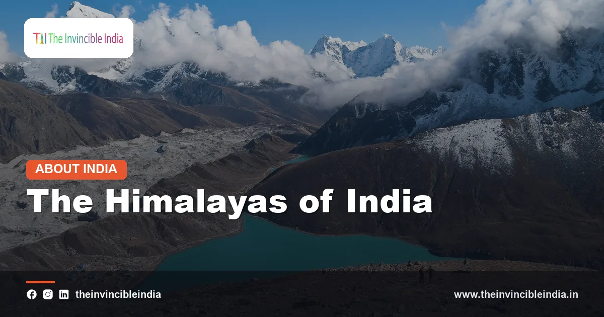
Few landscapes on Earth command the imagination quite like the Himalayas. Stretching in a great curved arc along India’s northern edge, the Himalayas form the highest and youngest major mountain system in the world, a wall of rock, ice and forest that has shaped the subcontinent’s weather, rivers, wildlife and civilisation for millennia.
This guide explains the range in plain terms: how it was born from a slow-motion collision of continents, how it is organised into three parallel ranges, which peaks and rivers matter most, and why this mountain barrier is far more than scenery. It is also a story of fragility, because the same forces that raised the mountains continue to shake them, and a warming climate is now changing them.
Quick Facts
| Feature | Details |
|---|---|
| Name meaning | “Abode of snow” (Sanskrit: hima + alaya) |
| Length | Roughly 2,400 km from the Indus bend in the northwest to the Brahmaputra bend in the east |
| Width | About 150 to 400 km, broader in the west than in the east |
| Origin | Collision of the Indian and Eurasian tectonic plates, beginning around 50 million years ago |
| Type of mountains | Young fold mountains, still rising and seismically active |
| Highest peak in the world | Mount Everest, about 8,849 m, on the Nepal-China border |
| Highest peak in India | Kanchenjunga, about 8,586 m, on the Sikkim-Nepal border |
| Major river systems fed | Indus, Ganga and Brahmaputra |
| Indian states and Union Territories | Ladakh, Jammu and Kashmir, Himachal Pradesh, Uttarakhand, Sikkim, Arunachal Pradesh and the hills of West Bengal |
What the Name Himalaya Means
The word “Himalaya” comes from Sanskrit, combining hima (snow) and alaya (abode or dwelling). The range is literally the “abode of snow”, a name that appears in ancient Indian literature, where the mountains are both a geographical feature and a sacred presence. In the Hindu tradition the Himalayas are personified as Himavan, the king of mountains and the father of the goddess Parvati.
One Range, Many Names
Local communities use their own names for individual mountains and sections. Everest is called Sagarmatha in Nepal and Chomolungma in Tibet. The three parallel ranges also carry traditional Indian names, Himadri, Himachal and Shiwalik, which are widely used in school geography and are explained below.
Why the Himalayas Matter Beyond the Map
The mountains define India’s northern frontier, but their influence reaches much further. They decide where the monsoon rains fall, supply water to hundreds of millions of people, and hold a remarkable share of the planet’s biodiversity. Understanding the Himalayas is therefore a good way of understanding India itself.
How the Himalayas Were Formed
The story begins long before the mountains existed. Around 200 million years ago, the landmass that would become India was part of the southern supercontinent Gondwana. As Gondwana broke apart, the Indian plate drifted northwards across the ocean, at times moving remarkably fast for a tectonic plate, covering thousands of kilometres over tens of millions of years.
The Collision with Eurasia
Between India and Asia lay the Tethys Sea. As the Indian plate advanced, the sea floor was squeezed and eventually closed. Beginning around 50 million years ago, the Indian plate ploughed into the Eurasian plate. Because both carry thick, buoyant continental crust, neither could sink easily beneath the other. Instead the crust crumpled, folded and thrust upwards, lifting sediments that had once lain on the sea floor into towering ridges. This is why marine fossils are found at great heights in the Himalayas.
Fold Mountains Still on the Move
The Himalayas are classic fold mountains. Unlike ancient ranges such as the Aravallis, which have been worn down over hundreds of millions of years, the Himalayas are geologically young and still rising. The Indian plate continues to push northwards at a few centimetres a year, and the range keeps growing by a few millimetres annually, although erosion works constantly against it. This ongoing pressure is also why the region is one of the most earthquake-prone in the world.
- The Indian plate is still moving north-northeast at roughly 4 to 5 cm a year.
- Stress builds up along deep faults and is released as earthquakes.
- Rivers carve deep gorges as fast as the land rises, producing some of the world’s steepest terrain.
The Three Parallel Ranges
From south to north, the Indian Himalayas are arranged in three roughly parallel belts running from the northwest to the southeast. Each has its own height, climate, vegetation and character.
| Range | Also called | Approximate height | Key features |
|---|---|---|---|
| Greater Himalayas | Himadri | Average above 6,000 m | Permanent snow, great glaciers and the highest peaks, including Everest and Kanchenjunga |
| Lesser or Middle Himalayas | Himachal | Roughly 3,700 to 4,500 m | Hill stations, Pir Panjal and Dhauladhar ranges, fertile valleys such as Kashmir and Kullu |
| Outer Himalayas | Shiwaliks | Roughly 900 to 1,500 m | Lowest and youngest foothills, with broad valleys known as Duns |
Himadri: The Greater Himalayas
The northernmost and loftiest belt is Himadri. Its core is made of ancient crystalline rock such as granite and gneiss, and it carries the permanent snowline and the biggest glaciers. Most of the world-famous peaks rise here, and crossing the range is possible only through high passes.
Himachal: The Lesser Himalayas
South of Himadri lies Himachal, a zone of steep ridges and deep valleys. It includes the Pir Panjal, the largest range of the Lesser Himalayas, and the Dhauladhar near Dharamshala. Many of India’s best-loved hill stations, such as Shimla, Mussoorie, Nainital and Darjeeling, sit in this belt.
Shiwaliks: The Outer Himalayas
The Shiwaliks are the youngest and outermost ridges, built from sand, gravel and clay washed down from the higher mountains. Between them and the Lesser Himalayas are flat-floored longitudinal valleys called Duns, of which Dehradun is the best known.
Regional Divisions of the Himalayas
Besides the north-south layering, geographers divide the range from west to east, using the great rivers as markers. This helps explain why the Himalayas of Kashmir look so different from those of Arunachal Pradesh.
- Punjab (or Kashmir) Himalayas: between the Indus and the Sutlej, covering Ladakh, Kashmir and much of Himachal Pradesh. This section is broad, dry in places and includes the Karakoram, Zanskar and Pir Panjal ranges.
- Kumaon Himalayas: between the Sutlej and the Kali, mostly in Uttarakhand. This is the land of Garhwal and Kumaon, the source region of the Ganga and the Yamuna.
- Nepal Himalayas: between the Kali and the Tista, containing Everest and many of the highest peaks, with Sikkim at its eastern end.
- Assam Himalayas: between the Tista and the Brahmaputra, covering Bhutan and Arunachal Pradesh, where the range receives heavy rainfall and is covered in dense forest.
The Eastern Hills
Beyond the Brahmaputra’s great bend, the mountains turn southwards into the Purvanchal, the eastern hills that include the Patkai, Naga and Mizo ranges. These are sometimes treated as an extension of the Himalayan system and form India’s frontier with Myanmar.
Passes and Gateways
High passes have always linked the plains to the plateau beyond. Well-known examples include Zoji La in Kashmir, Banihal and Rohtang in the west, Shipki La in Himachal Pradesh, and Nathu La and Jelep La in Sikkim, long used for trade and pilgrimage.
The Great Peaks of the Himalayas
The Himalayas hold most of the world’s highest mountains, including all of the fourteen peaks above 8,000 metres that lie in the Himalaya and the neighbouring Karakoram. A few names stand out.
| Peak | Approximate height | Location | Note |
|---|---|---|---|
| Mount Everest | 8,849 m | Nepal-China (Tibet) border | Highest mountain on Earth; first climbed in 1953 by Edmund Hillary and Tenzing Norgay |
| K2 | 8,611 m | Karakoram, Pakistan-China border | Second highest in the world; first climbed in 1954 |
| Kanchenjunga | 8,586 m | Sikkim-Nepal border | Third highest in the world and the highest in India; first climbed in 1955 |
| Nanda Devi | 7,816 m | Uttarakhand | Highest peak lying wholly within India; first climbed in 1936 |
Everest and K2
Everest needs little introduction, though many are surprised that it does not stand in India. It marks the border of Nepal and Tibet. K2 belongs to the Karakoram, a neighbouring range often discussed alongside the Himalayas, and has a reputation as one of the hardest mountains to climb.
Kanchenjunga and Nanda Devi
Kanchenjunga, whose name is usually translated as “five treasures of the snow”, is revered by the people of Sikkim as a guardian deity. Nanda Devi, named after a goddess, is the centre of a national park and, together with the Valley of Flowers, a UNESCO World Heritage Site in Uttarakhand.
Water Towers of Asia: The Himalayan Rivers
The Himalayas hold the largest store of ice outside the polar regions, which is why they are often called the “Third Pole” and the “water towers of Asia”. Meltwater and monsoon rain feed rivers that flow all year round, which is what separates the northern rivers from the largely rain-fed rivers of peninsular India.
The Three River Systems
- Indus system: the Indus rises in Tibet near Mount Kailash and flows through Ladakh. Its tributaries include the Jhelum, Chenab, Ravi, Beas and Sutlej.
- Ganga system: the Ganga is formed at Devprayag, where the Bhagirathi, which emerges from the Gangotri glacier, meets the Alaknanda. The Yamuna, Ghaghara, Gandak and Kosi join it from the Himalayas.
- Brahmaputra system: the river begins as the Yarlung Tsangpo in Tibet, enters India in Arunachal Pradesh as the Siang or Dihang, and flows through Assam. The Tista and other rivers add to its flow.
Glaciers: The Frozen Reservoirs
Gangotri, around 30 km long, is one of the major glaciers feeding the Ganga. Siachen, in the Karakoram, is among the longest glaciers outside the polar regions at roughly 70 km. Together with thousands of smaller ice bodies, they release water through the dry months, supporting agriculture, hydropower and drinking water across the Indo-Gangetic plain.
How the Himalayas Shape India’s Climate
The Himalayas act as a gigantic climatic divider. Their influence on weather is among their most important contributions to life in the subcontinent.
A Shield Against Cold Winds
In winter, frigid, dry air from Central Asia builds up north of the mountains. The high wall of the Himalayas blocks most of it from sweeping south, which is why northern India, despite its latitude, is far milder than regions at similar latitudes elsewhere in Asia.
Trapping the Monsoon
In summer, moisture-laden winds from the Bay of Bengal and the Arabian Sea move inland. When they meet the mountain wall, they are forced to rise, cool and release their moisture as rain over the plains and the lower slopes. Without this barrier, much of the monsoon would drift on into Central Asia, and northern India would be considerably drier.
Rain Shadows and Cold Deserts
The same wall leaves the northern side starved of rain. Ladakh and Spiti, sheltered behind the high ranges, are cold deserts with sparse vegetation. Winter snowfall in the west also depends on western disturbances, weather systems that bring rain and snow to the mountains and the northern plains.
Biodiversity: A Global Hotspot
The Himalayas, particularly the eastern section, are recognised as a global biodiversity hotspot. Over a short vertical distance, the landscape climbs from humid subtropical forests near the foothills through temperate oak and rhododendron forests and coniferous belts to alpine meadows and finally bare rock and ice.
Wildlife of the Heights
- Snow leopard: the elusive big cat of the high Himalaya, seen in Ladakh, Spiti and Sikkim.
- Red panda: a shy bamboo-eating mammal of the eastern forests, found in Sikkim, Arunachal Pradesh and parts of West Bengal.
- Others: Himalayan tahr, blue sheep, musk deer, black bear, and colourful birds such as the Himalayan monal.
Flora and Protected Areas
Spring and summer paint the slopes with rhododendrons, while alpine meadows such as the Valley of Flowers bloom with hundreds of species. Protected areas, including the Great Himalayan National Park, Nanda Devi National Park and Kanchenjunga National Park, safeguard some of the most important habitats.
Cultural and Spiritual Significance
For millions of people the Himalayas are as much sacred as physical. Ancient texts describe sages meditating in its caves, and the mountains remain a destination for pilgrims, seekers and travellers.
Pilgrimages of the Mountains
- Char Dham of Uttarakhand: Yamunotri, Gangotri, Kedarnath and Badrinath, visited every year when the high shrines open in the warmer months.
- Amarnath: a cave shrine in Kashmir associated with Lord Shiva and a naturally formed ice formation.
- Kailash and Manasarovar: sacred to Hindus, Buddhists, Jains and Bon followers, located across the border in Tibet.
A Mosaic of Peoples
The mountains are home to many communities, among them Ladakhis, Kashmiris, Gaddis, Garhwalis, Kumaonis, Lepchas, Bhutias and numerous peoples of Arunachal Pradesh. Buddhist monasteries such as Hemis, Rumtek and Tawang, the largest monastery in India, add another layer to the region’s heritage, alongside festivals, crafts and distinctive mountain architecture.
Strategic Importance for India
The Himalayas form a natural northern boundary and for centuries have served as a defensive barrier. Today they run along India’s frontiers with Pakistan, China, Nepal and Bhutan, and the high ranges and passes shape how the borders are patrolled, supplied and developed.
Roads, Tunnels and Connectivity
Because these frontiers are remote and difficult, the region has seen major investments in roads, bridges and tunnels, such as the tunnels under the Pir Panjal and Rohtang. Better connectivity serves both defence needs and the daily lives of mountain communities, who often remain cut off by snow for months.
Water as a Shared Resource
The Himalayan rivers cross national boundaries, so water-sharing and river management are an important aspect of regional relations. The Indus Waters Treaty of 1960 with Pakistan is one example of a framework governing a Himalayan river system.
Threats Facing the Himalayas
The mountains are majestic but delicate. Several pressures now threaten both the ecosystem and the people who depend on it.
Climate Change and Glacier Melt
Studies have shown that many Himalayan glaciers have been losing ice, with the pace increasing in recent decades. In the short term this can raise river flows, but over the longer term it threatens the dependable water supply that millions rely on.
Glacial Lake Outburst Floods
As glaciers retreat, meltwater collects in lakes held back by loose ice and rock. If the barrier fails, a glacial lake outburst flood (GLOF) can send a devastating surge of water downstream. The Chamoli disaster of 2021 in Uttarakhand and the flood from South Lhonak Lake in Sikkim in October 2023 showed how quickly such events can unfold.
Earthquakes and Landslides
Because the range sits on an active plate boundary, earthquakes are a constant risk. The great Kangra earthquake of 1905 and the Nepal earthquake of April 2015 are reminders. Steep slopes, heavy monsoon rain and road-building also cause frequent landslides.
Pressure from Tourism and Development
Rapid growth in tourism, construction, hydropower dams and roads can strain fragile slopes, water supplies and forests. Sustainable planning, careful site selection and respect for carrying capacity are widely seen as essential for the mountains’ future.
Conclusion
The Himalayas are the product of a collision that began around 50 million years ago, and in a real sense that collision has never stopped. The same force that raised the world’s highest peaks gave India its great rivers, its monsoon rhythm, its forests and its sacred geography. Protecting this range from the pressures of climate change and unplanned development is therefore not only an environmental task but a matter of securing water, safety and heritage for generations to come. Last updated: 1 October 2026.
Frequently Asked Questions
How were the Himalayas formed?
The Himalayas formed when the Indian tectonic plate collided with the Eurasian plate, beginning around 50 million years ago. Neither continental plate could sink easily, so the crust crumpled and folded upwards, creating fold mountains. The collision is still going on, which is why the range is rising and prone to earthquakes.
What does the name Himalaya mean?
Himalaya is a Sanskrit word meaning “abode of snow”. It joins hima (snow) and alaya (dwelling), a fitting name for a range that holds vast snowfields and glaciers.
What are the three parallel ranges of the Himalayas?
From north to south they are the Greater Himalayas or Himadri, the Lesser or Middle Himalayas or Himachal, and the Outer Himalayas or Shiwaliks. Himadri has the highest peaks and permanent snow, Himachal contains hill stations such as Shimla and Darjeeling, and the Shiwaliks are the low foothills with valleys called Duns.
Which is the highest peak in India?
Kanchenjunga, in Sikkim on the border with Nepal, is the highest peak in India and the third highest in the world at roughly 8,586 metres. Nanda Devi, at about 7,816 metres, is the highest peak lying entirely within India. Mount Everest, the world’s highest, is on the Nepal-China border.
Why are the Himalayas called the water towers of Asia?
The range stores huge amounts of ice and snow in glaciers such as Gangotri and Siachen. Their meltwater, along with monsoon rain, feeds the Indus, Ganga and Brahmaputra systems, which support hundreds of millions of people across South Asia.
How do the Himalayas affect India’s climate?
They block the cold, dry winds of Central Asia, keeping northern India much warmer in winter. They also stop the monsoon winds and force them to release rain over India, while leaving areas behind the mountains, such as Ladakh, dry.
{“@context”:”https://schema.org”,”@graph”:[{“@type”:”FAQPage”,”mainEntity”:[{“@type”:”Question”,”name”:”How were the Himalayas formed?”,”acceptedAnswer”:{“@type”:”Answer”,”text”:”The Himalayas formed when the Indian tectonic plate collided with the Eurasian plate, beginning around 50 million years ago. Neither continental plate could sink easily, so the crust crumpled and folded upwards, creating fold mountains. The collision is still going on, which is why the range is rising and prone to earthquakes.”}},{“@type”:”Question”,”name”:”What does the name Himalaya mean?”,”acceptedAnswer”:{“@type”:”Answer”,”text”:”Himalaya is a Sanskrit word meaning “abode of snow”. It joins hima (snow) and alaya (dwelling), a fitting name for a range that holds vast snowfields and glaciers.”}},{“@type”:”Question”,”name”:”What are the three parallel ranges of the Himalayas?”,”acceptedAnswer”:{“@type”:”Answer”,”text”:”From north to south they are the Greater Himalayas or Himadri, the Lesser or Middle Himalayas or Himachal, and the Outer Himalayas or Shiwaliks. Himadri has the highest peaks and permanent snow, Himachal contains hill stations such as Shimla and Darjeeling, and the Shiwaliks are the low foothills with valleys called Duns.”}},{“@type”:”Question”,”name”:”Which is the highest peak in India?”,”acceptedAnswer”:{“@type”:”Answer”,”text”:”Kanchenjunga, in Sikkim on the border with Nepal, is the highest peak in India and the third highest in the world at roughly 8,586 metres. Nanda Devi, at about 7,816 metres, is the highest peak lying entirely within India. Mount Everest, the world’s highest, is on the Nepal-China border.”}},{“@type”:”Question”,”name”:”Why are the Himalayas called the water towers of Asia?”,”acceptedAnswer”:{“@type”:”Answer”,”text”:”The range stores huge amounts of ice and snow in glaciers such as Gangotri and Siachen. Their meltwater, along with monsoon rain, feeds the Indus, Ganga and Brahmaputra systems, which support hundreds of millions of people across South Asia.”}},{“@type”:”Question”,”name”:”How do the Himalayas affect India’s climate?”,”acceptedAnswer”:{“@type”:”Answer”,”text”:”They block the cold, dry winds of Central Asia, keeping northern India much warmer in winter. They also stop the monsoon winds and force them to release rain over India, while leaving areas behind the mountains, such as Ladakh, dry.”}}]}]}


