

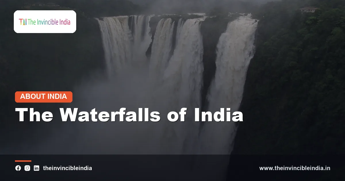
From the rain-soaked escarpment of the Western Ghats to the plateau edges of Meghalaya and the marble gorge of the Narmada, the waterfalls of India are among the country’s most dramatic natural features. They range from thin ribbons of water that drop several hundred metres to broad, thundering curtains that spread across an entire river. Many are fed by the south-west monsoon and are at their most spectacular in the months from July to September, when rivers swell and cliffs turn green.
Waterfalls are more than scenery. They show how rivers cut through rock, and they have long been used to generate hydroelectricity, shaped local legends and religious practice, and drawn visitors to some of the least accessible parts of the country. This explainer describes how waterfalls form, why India’s geography produces so many of them, profiles the best-known falls, and discusses their dependence on the monsoon, their role in power generation and tourism, and the need to protect them. Heights below are approximate, widely cited figures, and different sources often give slightly different values.
Quick Facts
| Feature | Details |
|---|---|
| Tallest waterfall (commonly cited) | Kunchikal Falls, Karnataka, about 455 metres |
| Best-known segmented falls | Jog Falls (Gersoppa), Karnataka, on the Sharavathi river |
| Tallest in the north-east | Nohkalikai Falls, Meghalaya, about 340 metres |
| Widest falls | Chitrakote Falls, Chhattisgarh, on the Indravati river |
| Falls on a state border | Dudhsagar Falls, between Goa and Karnataka |
| Famous for its setting | Athirappilly Falls, Kerala, on the Chalakudy river |
| Early hydropower site | Shivanasamudra, on the Cauvery, with a power station built in 1902 |
| Peak flow season | South-west monsoon, roughly July to September |
| Main regions | Western Ghats, Meghalaya plateau, central Indian plateaus, Eastern Ghats |
How Waterfalls Form
A waterfall develops where a river flows over an abrupt change in the level of its bed, so that the water falls vertically or nearly so. Most waterfalls are created by the contrast between hard and soft rocks. When a river crosses a layer of resistant rock such as granite, basalt or quartzite lying on top of a softer layer such as shale or sandstone, the soft rock beneath wears away faster. This undercutting leaves the hard rock jutting out as a ledge, over which the river plunges.
Plunge pools and retreating gorges
At the foot of the fall, the falling water churns up sediment and boulders, which grind a deep hollow called a plunge pool. Over thousands of years, the continued undercutting causes the overhanging ledge to collapse, and the waterfall slowly retreats upstream, leaving a steep-sided gorge downstream. Geologists describe the point where the river’s slope changes abruptly as a knickpoint, and many waterfalls are active knickpoints on the move.
Other causes
- Faulting and uplift: movement of the Earth’s crust can raise one side of a river’s course, creating a sudden step.
- Escarpments: rivers that flow off the edge of a high plateau must descend a steep slope in a short distance.
- Glaciation and landslides: in mountain areas, glaciers cut hanging valleys and landslides can dam or divert streams, creating falls.
- Volcanic rock layers: thick, resistant lava flows over softer materials make natural steps, as in parts of the Deccan.
Types of Waterfalls Seen in India
Geographers classify waterfalls by the way in which the water descends. The following forms are common in the country.
| Type | How the water falls | Indian example |
|---|---|---|
| Plunge | Water drops vertically, losing contact with the cliff | Kunchikal Falls |
| Segmented | The flow divides into separate streams over the same cliff | Jog Falls |
| Tiered or cascade | Water descends a series of steps or ledges | Dudhsagar Falls |
| Block | A broad river falls over a wide, horizontal ledge | Chitrakote Falls |
| Horsetail | Water keeps contact with the rock while falling | Several streams in the Western Ghats during the monsoon |
In practice, many waterfalls combine features. A fall may be a plunge at high water, and become segmented or cascade-like when the flow decreases, which is why a single waterfall can look very different in July and in January.
Why India Has So Many Waterfalls: The Western Ghats and Plateau Edges
India’s physical geography is particularly suited to waterfalls. The peninsular plateau is bordered by escarpments, steep edges where the high ground drops towards the coast or lower plains. Rivers that cross these edges descend rapidly, and, where the rock is hard, they form falls.
The Western Ghats
The Western Ghats, which run parallel to the west coast, form the most important waterfall region. Their western face is a steep escarpment, and it catches the heavy rain brought by the south-west monsoon. Short, fast rivers drain west to the Arabian Sea, falling hundreds of metres in a few tens of kilometres. Others, such as those draining east into the Cauvery, Krishna and Godavari systems, drop from the crest of the range to the plateau. Falls such as Kunchikal, Jog, Dudhsagar, Athirappilly and many smaller ones in Maharashtra, Karnataka, Goa and Kerala owe their existence to this setting.
Other regions
- Meghalaya plateau: the southern edge of the Khasi Hills falls sharply towards the plains of Bangladesh. This area receives some of the heaviest rainfall in the world, which feeds waterfalls such as Nohkalikai near Cherrapunji.
- Central Indian plateaus: rivers such as the Narmada, Indravati and Mahanadi cross rocky ledges in the Vindhya, Satpura and Chhattisgarh regions, creating falls like Dhuandhar and Chitrakote.
- Chota Nagpur plateau and Eastern Ghats: Jharkhand, Odisha and Andhra Pradesh have numerous falls at the edge of the plateau, among them Hundru Falls and Barehipani in the Similipal hills.
Kunchikal Falls: Often Cited as India’s Tallest
Kunchikal Falls is generally listed as the tallest waterfall in India, with a total drop of about 455 metres. It lies in the Shimoga district of Karnataka, in the Western Ghats near the hill station of Agumbe, which is itself known as one of the rainiest places in southern India. The fall is formed by the Varahi river, which tumbles down a series of tiers in a narrow ravine.
The water of the Varahi has been used for hydroelectric generation, and the flow below the fall is diverted for power at downstream stations. As a result, the fall is most spectacular during and just after the monsoon, and shrinks considerably in the dry season. The area is forested and remote, and access is controlled, so that it has remained relatively less visited than other waterfalls.
A note on rankings
Rankings of Indian waterfalls vary. Some lists give higher figures for tiered falls in Maharashtra or Odisha, such as Vajrai in the Western Ghats of Satara district, or Barehipani, which is also cited at around 400 metres. Differences arise from whether the entire height of a tiered cascade is counted and from the way heights are measured. Readers should therefore regard a ranking as indicative rather than definitive.
Jog Falls (Gersoppa Falls)
Jog Falls, also called Gersoppa Falls, is probably the best known waterfall of Karnataka. It is located in the Shimoga district, where the Sharavathi river drops from a plateau into a gorge, roughly 250 metres in height. The river divides into four distinct streams, which have traditional names: Raja, Roarer, Rocket and Rani, which are descriptive names for the way each stream falls. This division gives the falls their character as a segmented fall.
The fall has been a popular spot since the colonial period, when British officials and travellers wrote glowing accounts of the scene. Today, it is a major tourist destination, and a viewing area gives visitors a view of the gorge. It also shows the effects of hydropower on a natural wonder. The Sharavathi river is dammed upstream for electricity generation, and the amount of water that actually goes over the cliff depends on release decisions, especially outside the monsoon. During heavy rain, when the reservoir overflows, the falls are at full strength.
Nohkalikai, Dudhsagar, Athirappilly and Other Famous Falls
Nohkalikai Falls, Meghalaya
Nohkalikai, near Cherrapunji (Sohra) in the East Khasi Hills, drops about 340 metres from a limestone and sandstone plateau into a deep, green pool. Its name means “the leap of Ka Likai” in the Khasi language, after a local tale about a woman named Likai. It is one of the tallest plunge waterfalls in the country and is fed by rainwater collected on the plateau, so its flow is strongly seasonal.
Dudhsagar Falls, Goa and Karnataka
Dudhsagar, meaning “sea of milk”, descends in several tiers on the Mandovi river on the border of Goa and Karnataka, with a total height of about 310 metres. Its white water against the green forest of the Western Ghats gives it its name. A railway line crosses the face of the fall on a high viaduct, creating one of the best-known scenes in Indian rail travel. The area lies within a protected forest and sanctuary landscape, and access is regulated.
Athirappilly Falls, Kerala
Athirappilly, on the Chalakudy river in Thrissur district, is much shorter than the others, at around 24 metres, but it is wide and photogenic, and often described as the “Niagara of India” for its breadth and volume. The surrounding forest, which includes the Vazhachal area, is rich in wildlife and is known for its hornbills. The site has been the subject of debate regarding proposals for a hydroelectric project, since many ecologists argue that a dam would damage the river and forest.
Chitrakote Falls: The “Niagara of India”
Chitrakote Falls, on the Indravati river in the Bastar region of Chhattisgarh, is the widest waterfall in India and is often called the “Niagara of India”. The river spreads over a horseshoe-shaped ledge several hundred metres across and falls about 30 metres. During the monsoon, the entire ledge is covered in water, and the roar and mist can be sensed from a considerable distance.
The setting is part of the landscape of Bastar, which is home to forests and tribal communities. In the dry season, the volume falls and the fall splits into smaller streams, revealing the rock ledge. The region has been of interest for boat rides near the base and for cultural tourism connected to the Bastar area. Because it is a block fall formed on a wide, flat step, it differs from the tall, narrow falls of the Western Ghats.
Other falls with the same nickname
The label “Niagara of India” has been applied to more than one fall, including Hogenakkal on the Cauvery in Tamil Nadu and, at times, Athirappilly and Shivanasamudra. This reflects the popularity of the comparison rather than any strict criterion.
Shivanasamudra and Hogenakkal: Falls on the Cauvery
The Cauvery river is the source of some of south India’s finest falls. At Shivanasamudra, on the border of the Mandya and Chamarajanagar districts of Karnataka, the river splits around an island and drops in two main branches. The western branch is called Gaganachukki and the eastern branch Barachukki, with a drop of about 75 metres. Together, they form one of the largest waterfalls in the country by volume in the monsoon.
Shivanasamudra has a special place in the history of Indian electricity. A hydroelectric power station was established here in 1902 and is widely regarded as one of the earliest in Asia. It supplied power to the Kolar Gold Fields, which were far away, and later to Bengaluru, showing early use of waterfalls for energy.
Farther downstream, at Hogenakkal on the border of Karnataka and Tamil Nadu, the Cauvery tumbles over ancient rocks in a series of cascades. The area is well known for coracle boat rides, and for the geology of its rocks, which are among the oldest in India. The place attracts many visitors, particularly in the post-monsoon months.
Dhuandhar and Other Notable Falls
Several other waterfalls deserve mention because they illustrate different parts of the country.
- Dhuandhar Falls, Madhya Pradesh: near Jabalpur, the Narmada plunges around 30 metres and then flows through the Marble Rocks gorge at Bhedaghat. The mist rising from the fall gives it the name, which means “smoke cascade”.
- Hundru Falls, Jharkhand: the Subarnarekha river drops nearly 100 metres on the Ranchi plateau, a popular day trip.
- Elephant Falls, Meghalaya: near Shillong, a series of cascades set among ferns and rocks, named for a rock that resembled an elephant before it was destroyed in an earthquake.
- Nuranang Falls, Arunachal Pradesh: near Jang in the Tawang district, one of the more prominent falls in the eastern Himalaya.
- Thoseghar and Vajrai, Maharashtra: tiered falls in the hills near Satara that are at their best in the rainy season.
- Pykara Falls, Tamil Nadu: a series of cascades in the Nilgiri hills linked to hydropower.
Monsoon Dependence and Seasonal Change
Most Indian waterfalls are seasonal. Because the flow depends heavily on rainfall in the catchment area, falls fed by rain on the plateau or in the mountains may be at full strength for only a few months. In the Western Ghats, the south-west monsoon, between June and September, delivers the bulk of the water. In the north-east, the heavy rain of summer is the driver.
Seasons and visiting
The best time to see a waterfall is not always the same as the peak of the rains. During intense monsoon rain, roads can be cut by landslides, trekking paths can be dangerous, and some sites are closed for safety. Many travellers therefore prefer the period immediately after the monsoon, from September to November, when the water is still abundant and the surroundings are green but conditions are safer. In winter and summer, many falls are reduced to thin streams, and some dry up.
Regulated flow
For falls below dams, such as Jog, the flow can be controlled by the amount of water released from the reservoir. In the dry season the water may be diverted to power stations, which leaves the falls much reduced unless releases are scheduled for special occasions. This human influence on natural water features is an important consideration in river management.
Waterfalls and Hydropower
The steep drops that create waterfalls are also ideal for power generation, since water falling from a height has high potential energy. India began to exploit this early. The power station at Shivanasamudra in 1902 was among the first, and in the Western Ghats, a number of projects use the high rainfall and steep gradients of west-flowing rivers to generate electricity. Rivers like the Sharavathi, with a chain of dams and power houses, supply a large share of power in Karnataka.
The relationship between falls and hydropower is complex.
- Dams and diversions provide electricity and store water for irrigation and drinking.
- They can, however, reduce the natural flow over the falls and alter the ecology of the river below.
- Flooded reservoirs also change habitats, and may displace communities.
Disputes over new projects near well-known falls, such as the debates concerning Athirappilly, show the difficulty of balancing energy needs, local livelihoods and conservation. Environmental flow requirements, which set a minimum water release to maintain river health, are increasingly part of such discussions.
Tourism, Safety and Conservation
Waterfalls attract large numbers of visitors, and they support local economies through guides, homestays, food stalls and transport. Cherrapunji, Munnar, Jabalpur, Bastar and the Goa-Karnataka border region are among the places where tourism relies heavily on the falls and their surroundings.
Unmanaged tourism, however, brings problems. Slippery rocks, sudden floods and deep pools cause accidents each monsoon, and warning signs and barriers are essential. Littering, plastic waste and noise disturb wildlife, and construction near viewpoints can damage slopes and forests. Responsible practice includes the following.
- Staying within marked viewing areas and avoiding swimming in unsafe pools.
- Checking weather and local advice before travelling during the rainy season.
- Carrying out all waste and avoiding single-use plastic.
- Using local guides and following forest department rules, particularly in protected areas.
Conclusion
The waterfalls of India are the result of the meeting of rock, rain and relief: resistant rock ledges, steep escarpments of the Western Ghats and the north-east, and a monsoon that feeds rivers with abundant water for a few months each year. From the soaring plunge of Kunchikal and Nohkalikai to the broad curtain of Chitrakote and the multi-tiered Dudhsagar, each fall reflects its local geology and climate. They also record the long relationship between people and rivers, as sources of power, inspiration and livelihood. Protecting their flow, their forests and the safety of visitors is essential so that they continue to thunder through future monsoons.
Frequently Asked Questions
Which is the tallest waterfall in India?
Kunchikal Falls in Karnataka, on the Varahi river, is commonly cited as the tallest, with a drop of around 455 metres. Some lists give other tiered falls, such as Barehipani in Odisha or Vajrai in Maharashtra, comparable or higher figures, because height measurements vary by source.
Why is Chitrakote called the Niagara of India?
Chitrakote Falls on the Indravati river in Chhattisgarh is the widest waterfall in India and has a horseshoe shape and a broad curtain of water like Niagara Falls. The comparison is mainly about its width and volume during the monsoon, since its height is only about 30 metres.
Where is Dudhsagar Falls located?
Dudhsagar Falls lies on the Mandovi river on the border between Goa and Karnataka, in the Western Ghats. It is a multi-tiered waterfall about 310 metres high, famous for its milky white water and the railway viaduct that crosses its face.
What is the best time to visit waterfalls in India?
Most waterfalls are fullest during and shortly after the south-west monsoon, from July to September. Many visitors prefer September to November, when the flow is still strong but travel is safer. In the dry season, several falls shrink to trickles or dry up.
Which waterfalls are used for hydroelectric power?
Several rivers with famous falls are harnessed for power. Shivanasamudra on the Cauvery had a hydroelectric station built in 1902, among the earliest in Asia, and the Sharavathi river that feeds Jog Falls supports major power stations. Such use can reduce the natural flow over the falls outside the monsoon.
How do waterfalls form?
Waterfalls usually form where a river crosses from hard rock to softer rock, or drops over an escarpment, fault or plateau edge. The softer rock erodes faster and leaves a ledge, over which the water plunges. The fall slowly retreats upstream as the ledge is undercut.
{“@context”:”https://schema.org”,”@graph”:[{“@type”:”FAQPage”,”mainEntity”:[{“@type”:”Question”,”name”:”Which is the tallest waterfall in India?”,”acceptedAnswer”:{“@type”:”Answer”,”text”:”Kunchikal Falls in Karnataka, on the Varahi river, is commonly cited as the tallest, with a drop of around 455 metres. Some lists give other tiered falls, such as Barehipani in Odisha or Vajrai in Maharashtra, comparable or higher figures, because height measurements vary by source.”}},{“@type”:”Question”,”name”:”Why is Chitrakote called the Niagara of India?”,”acceptedAnswer”:{“@type”:”Answer”,”text”:”Chitrakote Falls on the Indravati river in Chhattisgarh is the widest waterfall in India and has a horseshoe shape and a broad curtain of water like Niagara Falls. The comparison is mainly about its width and volume during the monsoon, since its height is only about 30 metres.”}},{“@type”:”Question”,”name”:”Where is Dudhsagar Falls located?”,”acceptedAnswer”:{“@type”:”Answer”,”text”:”Dudhsagar Falls lies on the Mandovi river on the border between Goa and Karnataka, in the Western Ghats. It is a multi-tiered waterfall about 310 metres high, famous for its milky white water and the railway viaduct that crosses its face.”}},{“@type”:”Question”,”name”:”What is the best time to visit waterfalls in India?”,”acceptedAnswer”:{“@type”:”Answer”,”text”:”Most waterfalls are fullest during and shortly after the south-west monsoon, from July to September. Many visitors prefer September to November, when the flow is still strong but travel is safer. In the dry season, several falls shrink to trickles or dry up.”}},{“@type”:”Question”,”name”:”Which waterfalls are used for hydroelectric power?”,”acceptedAnswer”:{“@type”:”Answer”,”text”:”Several rivers with famous falls are harnessed for power. Shivanasamudra on the Cauvery had a hydroelectric station built in 1902, among the earliest in Asia, and the Sharavathi river that feeds Jog Falls supports major power stations. Such use can reduce the natural flow over the falls outside the monsoon.”}},{“@type”:”Question”,”name”:”How do waterfalls form?”,”acceptedAnswer”:{“@type”:”Answer”,”text”:”Waterfalls usually form where a river crosses from hard rock to softer rock, or drops over an escarpment, fault or plateau edge. The softer rock erodes faster and leaves a ledge, over which the water plunges. The fall slowly retreats upstream as the ledge is undercut.”}}]}]}


