

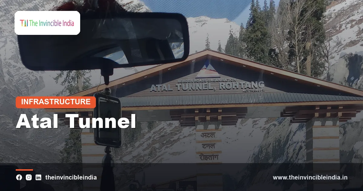
The Atal Tunnel, also known as the Rohtang Tunnel, is a 9.02-kilometre highway tunnel beneath the Pir Panjal range in Himachal Pradesh. Inaugurated on 3 October 2020, it connects Manali in the Kullu valley with Sissu in Lahaul and is widely recognised as one of the world’s longest highway tunnels at an altitude above 10,000 feet. By cutting through the mountain below the Rohtang Pass, it has given the remote Lahaul-Spiti region year-round road access that was once impossible.
The tunnel is more than a feat of civil engineering. It shortens the journey on the Manali-Leh route, strengthens the logistics of the armed forces in the high Himalaya, and has changed daily life in the villages of the Lahaul valley. It is also part of a broader programme of tunnelling in the Himalaya, including the Chenani-Nashri Tunnel, the Zojila Tunnel and the Sela Tunnel, which together are reshaping connectivity in Jammu and Kashmir, Ladakh, Himachal Pradesh and Arunachal Pradesh. This explainer covers the Atal Tunnel and its sister projects.
Quick Facts
| Aspect | Detail |
|---|---|
| Official name | Atal Tunnel (formerly the Rohtang Tunnel) |
| Location | Pir Panjal range, Himachal Pradesh; Manali (south portal) to Sissu-Teling (north portal) |
| Length | About 9.02 kilometres |
| Altitude | Roughly 3,000 metres (over 10,000 feet) above sea level |
| Inaugurated | 3 October 2020 |
| Built by | Border Roads Organisation (BRO) |
| Design | Single-tube, two-lane, horseshoe-shaped with an emergency escape tunnel |
| Named after | Atal Bihari Vajpayee, who announced the project in 2000 |
Why a Tunnel Under Rohtang Was Needed
The Rohtang Pass, at about 3,980 metres, is the gateway from the Kullu valley to the Lahaul valley. Its name is often translated as “pile of corpses” in folklore, a reminder of the dangers travellers once faced. Heavy snowfall typically blocks the pass for around six months each year, from about November to May, isolating Lahaul-Spiti and cutting the road to Leh for much of the winter.
The isolation of Lahaul
Before the tunnel, the people of Lahaul valley had little contact with the rest of the state during winter. Evacuation of patients, supply of essential goods and movement of students and officials depended on helicopters and on a short window when the pass was open. The pass was also prone to avalanches and landslides, and the road over it was steep, narrow and hazardous even in summer.
Strategic concerns
For the armed forces, the closure of the Manali-Leh road through Rohtang during winter limited the movement of troops and supplies to Ladakh. Because the Himalayan frontier requires logistics in all seasons, a more resilient road link was seen as a strategic imperative, particularly in an area where the border with China remains unresolved in sectors of Ladakh.
The History of the Project
The idea of a tunnel under Rohtang was first proposed decades ago. In June 2000, then Prime Minister Atal Bihari Vajpayee announced the decision to build the tunnel, and the foundation stone for the access road to the south portal was laid in 2002. Construction work began in earnest in 2010, with the project sanctioned and awarded to a joint venture between an Austrian firm and an Indian construction company, under the supervision of the Border Roads Organisation.
Delays and timelines
The project took much longer than expected. The original target was 2015, but difficult geology, severe weather and the short working season stretched the timeline. In December 2019, the Union Cabinet decided to name the tunnel after Vajpayee, and the finished structure was opened to traffic in October 2020 amid a ceremony attended by the Prime Minister.
| Year | Milestone |
|---|---|
| 2000 | Announcement of the Rohtang tunnel project |
| 2002 | Foundation stone laid for the approach road |
| 2010 | Main construction begins |
| 2017 | Excavation of the main tube achieves its final breakthrough |
| 2019 | Tunnel renamed Atal Tunnel |
| 2020 | Inauguration on 3 October |
Engineering of the Atal Tunnel
The tunnel is built in a horseshoe shape, with a single tube carrying two-way traffic. The carriageway is about 8 metres wide, with an overhead clearance of roughly 5 metres, and the tunnel is designed for a speed of around 80 kilometres per hour. It was designed to handle thousands of vehicles per day, both light vehicles and heavy trucks.
Construction method
Engineers used the New Austrian Tunnelling Method, which treats the surrounding rock as part of the supporting structure. The rock is excavated in stages, immediately supported with shotcrete, rock bolts and steel ribs, and monitored for deformation. Drilling and blasting were used in the harder sections, while softer zones required careful, slower excavation.
The Seri Nala fault zone
The biggest challenge was the Seri Nala fault zone, a stretch of weak, fractured rock through which large volumes of water flowed. Tunnelling through this section took several years and demanded extensive drainage, grouting and reinforcement, because the rock repeatedly collapsed and flooded. Overcoming this obstacle was among the major accomplishments of the project, and the experience gained helped in other Himalayan tunnelling works.
Safety and Smart Systems
The tunnel incorporates modern safety features that are rare on Indian roads. A key feature is the emergency escape tunnel, constructed beneath the main carriageway. If an accident or fire occurs, motorists can leave the main tube through cross passages at regular intervals and reach the escape route, which leads to the portal.
Key safety and control features
- Semi-transverse ventilation to supply fresh air and extract fumes and smoke.
- SCADA-controlled systems for monitoring power, lighting, ventilation and fire safety from a control room.
- Automatic incident detection through cameras covering the tunnel’s length.
- Fire protection, including fire hydrants and fire-fighting equipment at set intervals.
- Emergency communication, with telephones, public address and radio broadcast systems.
- Air quality monitoring to check carbon monoxide and visibility levels.
- Emergency lay-bys and signage along the tunnel for breakdowns and guidance.
Operations
The Border Roads Organisation manages the tunnel with strict rules on vehicle spacing, speed limits and prohibited activities such as stopping or overtaking inside the tube. Traffic is regulated at the portals, and vehicles are checked for fire hazards. Because of the extreme altitude, weather conditions at the portals, especially on the north side, can differ greatly from those at the south portal, so drivers need to remain careful.
Impact on Lahaul-Spiti and Himachal Pradesh
For the communities of Lahaul, the tunnel has been transformative. The journey between Manali and Keylong, the headquarters of Lahaul-Spiti district, has become faster and more predictable, and the valley is now accessible throughout the year, subject to snow clearance on the roads beyond the portal.
Livelihoods and services
- Agriculture: farmers in Lahaul grow off-season vegetables, potatoes, peas and hops, and can now reach markets in the plains more reliably.
- Healthcare: patients can be taken to hospitals in Kullu and Manali without waiting for a helicopter.
- Education: students and teachers are no longer cut off from the rest of the state in winter.
- Tourism: places such as Sissu, Keylong, Jispa and Chandratal have seen growing numbers of visitors, and winter tourism is emerging.
Balancing growth and fragility
Easier access also brings challenges. Rising visitor numbers raise concerns about traffic, waste, pressure on fragile mountain ecology, and the carrying capacity of small settlements. Planners and environmentalists point to the need to manage tourism sustainably, regulate construction and protect glaciers and wetlands in the region.
Strategic and Defence Significance
The tunnel is a key strategic asset. It lies on the Manali-Sarchu-Leh axis, one of the two main road routes to Ladakh, the other being the Srinagar-Kargil-Leh highway through Zojila. By reducing dependence on the Rohtang Pass, the tunnel makes it easier to move men and material to forward areas in all seasons.
Distance and time savings
The tunnel is reported to shorten the Manali-Leh distance by roughly 46 kilometres and to cut the journey time by several hours, while the crossing between Manali and Lahaul has been reduced from a long, slow climb over the pass to a drive of about ten minutes through the tunnel. An important qualification is that the highway beyond Lahaul crosses further high passes, such as Baralacha La, Lachung La and Tanglang La, which still face snow in winter. The tunnel therefore gives all-weather access to Lahaul-Spiti, and it extends the usable season for the road to Leh, but it does not by itself make the entire route open all year.
Part of a larger network
The Atal Tunnel is complemented by other works on the route, including the Shinku La tunnel proposed to link Lahaul with Zanskar in Ladakh, and upgrades to the Nimmu-Padum-Darcha road. Together, these would provide an alternate, shorter and more reliable corridor to Ladakh.
Other Strategic Himalayan Tunnels
The Atal Tunnel is part of a long line of Himalayan tunnelling works, some of which predate independence and some of which are under construction.
Chenani-Nashri (Dr Syama Prasad Mookerjee) Tunnel
Opened in April 2017 on National Highway 44 in Jammu and Kashmir, this 9.28-kilometre tunnel between Chenani and Nashri was for a few years India’s longest road tunnel, before the Atal Tunnel surpassed it. The main tube carries two-way traffic, and a parallel tube serves as an escape tunnel. It bypasses a snowy and landslide-prone stretch through the Patnitop region and saves around thirty kilometres and about two hours of travel between Jammu and Srinagar. It has been renamed in honour of Dr Syama Prasad Mookerjee.
Zojila Tunnel
The Zojila Tunnel, under construction beneath the Zojila Pass at around 3,500 metres, is planned at about 14 kilometres. It will form part of the Srinagar-Sonamarg-Kargil-Leh highway, which is cut off by heavy snow for several winter months. Once completed, it is expected to be among the longest bi-directional road tunnels in Asia and to provide all-weather connectivity between Kashmir and Ladakh. The related Z-Morh (Sonamarg) Tunnel on the approach, around 6.5 kilometres long, was opened in early 2025 and has made travel to Sonamarg possible in winter.
Sela Tunnel
In Arunachal Pradesh, the Sela Tunnel project, inaugurated in March 2024, consists of two tunnels on the road to Tawang, close to the Chinese border, at about 13,000 feet. Along with link roads, it keeps the Tawang sector connected despite snow on the Sela Pass and is regarded as one of the highest-altitude bi-lane tunnels in the world.
| Tunnel | Region | Key point |
|---|---|---|
| Atal (Rohtang) Tunnel | Himachal Pradesh | About 9 km, opened 2020, links Manali and Lahaul |
| Chenani-Nashri Tunnel | Jammu and Kashmir | About 9.3 km, opened 2017, NH-44 |
| Zojila Tunnel | Jammu and Kashmir, Ladakh | About 14 km, under construction, Kashmir-Ladakh link |
| Sela Tunnel | Arunachal Pradesh | Opened 2024, road to Tawang at about 13,000 feet |
| Jawahar Tunnel | Jammu and Kashmir | Opened 1956 at Banihal, an early road tunnel |
Other Tunnels of the Region and Railways
Tunnelling is also central to Himalayan railways. The Pir Panjal railway tunnel, at around 11 kilometres, between Banihal and Qazigund, opened in 2013 and is among the longest transport tunnels in India. The Udhampur-Srinagar-Baramulla Rail Link includes dozens of tunnels and the high Chenab bridge, aiming to connect Kashmir with the national rail network. The older Jawahar Tunnel at Banihal, built in the 1950s, once carried all road traffic between Jammu and the Kashmir valley, before newer tunnels reduced congestion on the route.
The role of the BRO and NHIDCL
In border areas, the Border Roads Organisation is the principal builder, working in some of the harshest terrain on earth. The National Highways and Infrastructure Development Corporation Limited has taken on several highway tunnel projects across the Himalaya, including in Jammu and Kashmir and the north-east. Both agencies work with private contractors and engineering consultants, using advanced geological investigation, tunnel boring and surface monitoring systems.
Challenges of Tunnelling in the Himalaya
The Himalaya is geologically young, tectonically active and prone to landslides, which makes tunnelling unusually hard. Engineers face fault zones, squeezing rock, heavy water inflow and seismic risk, as well as logistical difficulty because of altitude, remote sites and short working seasons.
Common problems
- Unpredictable geology: weak, fractured and water-bearing rock, as seen in the Seri Nala section of the Atal Tunnel.
- Extreme weather: snow, avalanches and low temperatures that reduce working months.
- Altitude: thin air affecting workers and equipment, along with fuel and material logistics.
- Environmental impact: disposal of excavated muck, pressure on springs and slope stability.
- Safety and emergency response: risk of fire, collapse or trapped workers in long tunnels.
Lessons from each project feed into design standards, safety codes and technology choices for later tunnels, including the use of tunnel boring machines where conditions permit.
Conclusion
The Atal Tunnel demonstrates what sustained engineering effort can achieve in some of the toughest terrain in the world. It gave the people of Lahaul-Spiti an all-weather road, shortened a critical route to Ladakh and set a benchmark for safety and design. With Chenani-Nashri already serving travellers, the Zojila and other projects advancing and the Sela Tunnel opened, India is steadily replacing seasonal mountain passes with permanent links. The challenge ahead is to balance this connectivity with the protection of the fragile Himalayan environment.
Frequently Asked Questions
How long is the Atal Tunnel and when was it opened?
The Atal Tunnel is about 9.02 kilometres long and was inaugurated on 3 October 2020. It runs under the Rohtang Pass in the Pir Panjal range of Himachal Pradesh, linking Manali with Sissu in the Lahaul valley.
Why is it called the Atal Tunnel?
It is named after former Prime Minister Atal Bihari Vajpayee, who announced the project in June 2000. The Union Cabinet decided in December 2019 to rename the Rohtang Tunnel in his honour.
Does the Atal Tunnel keep the Manali-Leh road open all year?
Not entirely. The tunnel gives all-weather access to Lahaul-Spiti and avoids the Rohtang Pass, but the road to Leh still crosses higher passes such as Baralacha La and Tanglang La, which can be closed by snow in winter. It does shorten the distance by roughly 46 kilometres and cuts travel time by several hours.
What safety features does the Atal Tunnel have?
It has an emergency escape tunnel beneath the carriageway, cross passages, semi-transverse ventilation, fire-fighting equipment, CCTV with automatic incident detection, emergency telephones and SCADA-based control. These systems are managed by the Border Roads Organisation.
Which other tunnels are important in the Himalaya?
Important tunnels include the Chenani-Nashri Tunnel, now named after Dr Syama Prasad Mookerjee, on the Jammu-Srinagar highway, the Zojila Tunnel under construction between Kashmir and Ladakh, the Sela Tunnel on the way to Tawang in Arunachal Pradesh and the older Jawahar Tunnel at Banihal.
Who built the Atal Tunnel?
The Border Roads Organisation built the tunnel, working with a joint venture of an Austrian firm and an Indian construction company. It used the New Austrian Tunnelling Method and overcame a difficult fault zone known as Seri Nala during construction.
{“@context”:”https://schema.org”,”@graph”:[{“@type”:”FAQPage”,”mainEntity”:[{“@type”:”Question”,”name”:”How long is the Atal Tunnel and when was it opened?”,”acceptedAnswer”:{“@type”:”Answer”,”text”:”The Atal Tunnel is about 9.02 kilometres long and was inaugurated on 3 October 2020. It runs under the Rohtang Pass in the Pir Panjal range of Himachal Pradesh, linking Manali with Sissu in the Lahaul valley.”}},{“@type”:”Question”,”name”:”Why is it called the Atal Tunnel?”,”acceptedAnswer”:{“@type”:”Answer”,”text”:”It is named after former Prime Minister Atal Bihari Vajpayee, who announced the project in June 2000. The Union Cabinet decided in December 2019 to rename the Rohtang Tunnel in his honour.”}},{“@type”:”Question”,”name”:”Does the Atal Tunnel keep the Manali-Leh road open all year?”,”acceptedAnswer”:{“@type”:”Answer”,”text”:”Not entirely. The tunnel gives all-weather access to Lahaul-Spiti and avoids the Rohtang Pass, but the road to Leh still crosses higher passes such as Baralacha La and Tanglang La, which can be closed by snow in winter. It does shorten the distance by roughly 46 kilometres and cuts travel time by several hours.”}},{“@type”:”Question”,”name”:”What safety features does the Atal Tunnel have?”,”acceptedAnswer”:{“@type”:”Answer”,”text”:”It has an emergency escape tunnel beneath the carriageway, cross passages, semi-transverse ventilation, fire-fighting equipment, CCTV with automatic incident detection, emergency telephones and SCADA-based control. These systems are managed by the Border Roads Organisation.”}},{“@type”:”Question”,”name”:”Which other tunnels are important in the Himalaya?”,”acceptedAnswer”:{“@type”:”Answer”,”text”:”Important tunnels include the Chenani-Nashri Tunnel, now named after Dr Syama Prasad Mookerjee, on the Jammu-Srinagar highway, the Zojila Tunnel under construction between Kashmir and Ladakh, the Sela Tunnel on the way to Tawang in Arunachal Pradesh and the older Jawahar Tunnel at Banihal.”}},{“@type”:”Question”,”name”:”Who built the Atal Tunnel?”,”acceptedAnswer”:{“@type”:”Answer”,”text”:”The Border Roads Organisation built the tunnel, working with a joint venture of an Austrian firm and an Indian construction company. It used the New Austrian Tunnelling Method and overcame a difficult fault zone known as Seri Nala during construction.”}}]}]}


