

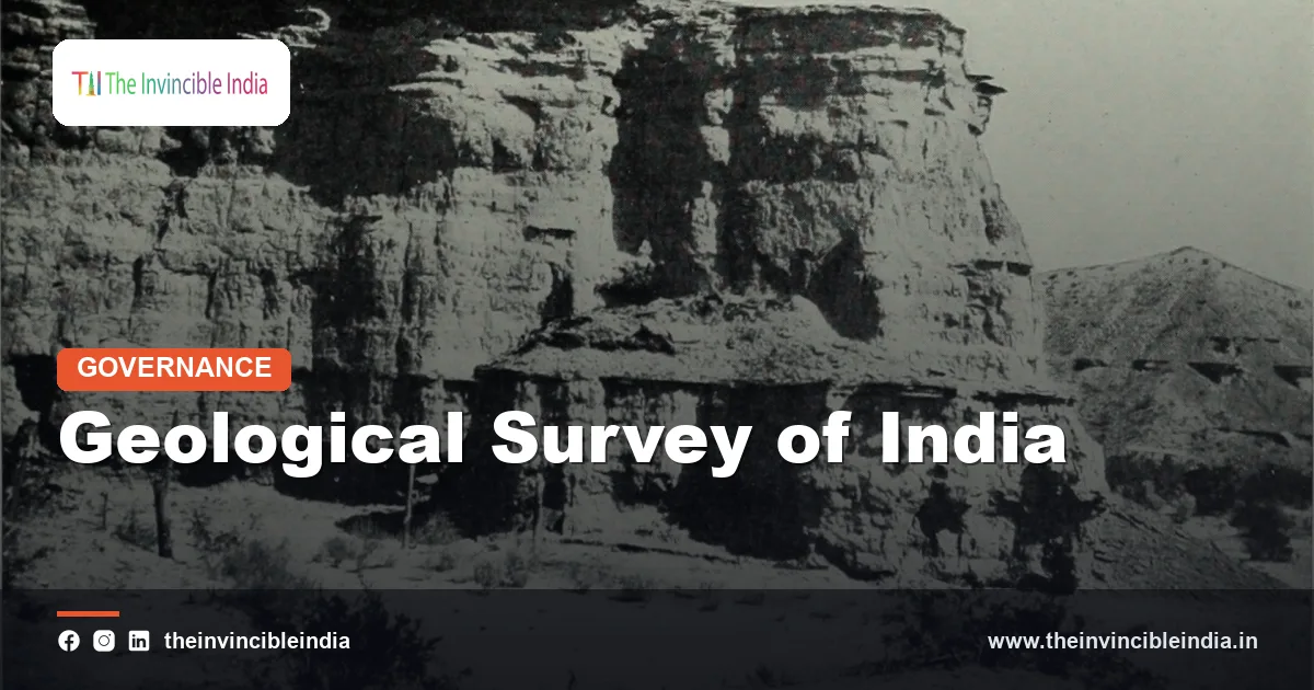
The Geological Survey of India (GSI) is India’s national agency for geoscientific information and mineral resource assessment, founded in 1851 and now functioning under the Ministry of Mines. It maps the rocks beneath the country, searches for minerals and coal, and studies natural hazards such as landslides, glaciers and earthquake-prone zones.
The Geological Survey of India is among the oldest scientific organisations in the country and one of the oldest geological surveys in the world. This explainer covers its history, what it does today, how it is organised, and how it differs from similar bodies such as the Survey of India and the National Centre for Seismology. Last updated: 17 October 2026.
| Full name | Geological Survey of India (GSI) |
|---|---|
| Established | 1851, initially to help find coal for the railways |
| First head | Thomas Oldham, appointed Geological Surveyor and later the first Superintendent |
| Parent ministry | Ministry of Mines, Government of India |
| Headquarters | Kolkata, West Bengal |
| Regional structure | Six regional headquarters (Kolkata, Lucknow, Jaipur, Nagpur, Hyderabad, Shillong) and State unit offices |
| Headed by | Director General |
| Core functions | Geological mapping, mineral exploration, geohazard studies, glaciology, marine geology, geoscience data |
| Notable fact | A GSI geologist, H.B. Medlicott, introduced the term “Gondwana” for the ancient rock sequence in India in the 1870s |
Key Takeaways
- The Geological Survey of India was founded in 1851 and is one of the oldest scientific agencies in India, working today under the Ministry of Mines with its headquarters in Kolkata.
- The Geological Survey of India is responsible for creating and updating national geological maps and for assessing the country’s mineral resources through regional and detailed exploration.
- The Geological Survey of India studies landslides, glaciers and active faults, and it is the nodal agency for national landslide susceptibility mapping.
- The Geological Survey of India is different from the Survey of India, which makes topographic maps and measures heights such as that of Mount Everest.
- The Geological Survey of India does not mine minerals itself; it finds and evaluates deposits, after which State governments and companies handle auctions and extraction.
- The Geological Survey of India shares much of its data through public geoscience portals such as Bhukosh and the National Geoscience Data Repository.
What is the Geological Survey of India?
The Geological Survey of India is the government’s scientific body for studying the earth’s crust within India and its seas, with the dual purpose of finding mineral wealth and explaining the geology that shapes the land. It is both a mapping organisation and a research institution, and it has a museum, laboratories and a training institute.
The organisation is an attached office of the Ministry of Mines. Its scientists, called geoscientists, include geologists, geophysicists, geochemists, hydrogeologists, palaeontologists and photogeologists, and they work in the field as well as in laboratories and data centres. Its findings are used by planners, mining companies, engineers, disaster managers and universities.
When and why was the Geological Survey of India founded?
The Geological Survey of India was founded in 1851 by the British East India Company, mainly to locate coal for the expanding railways and steam power, with Thomas Oldham, an Irish geologist, as its first head. A small survey began in 1846 and was reorganised and formalised in 1851.
The early years concentrated on coalfields in Bengal, Bihar and central India, but the survey soon broadened to general geological mapping. By the late nineteenth century, officers such as Henry Benedict Medlicott, William King, William Blanford and Valentine Ball had produced foundational accounts of Indian geology, palaeontology and economic minerals.
Some contributions had global significance. The term Gondwana, used for a thick sequence of rocks in peninsular India, was introduced by Medlicott in the 1870s, and it later became the name for the ancient southern supercontinent. Richard Dixon Oldham, a later member of the Survey, studied the 1897 Assam earthquake and in 1906 identified different types of seismic waves, evidence that helped establish the existence of the earth’s core.
Milestones in brief
- 1846: a preliminary geological survey begins.
- 1851: the Geological Survey of India is formally established.
- 1870s: the Gondwana System is described and named in Indian geology.
- 1897: the Assam earthquake is studied by the Survey, leading to important seismological insights.
- 1947: GSI continues as an Indian national organisation after Independence, with expanded national mapping.
- 2015 onwards: the National Mineral Exploration Trust, created under the mining law amendment of 2015, adds funding for exploration.
What does the Geological Survey of India do?
The Geological Survey of India creates geological maps, explores for minerals and coal, studies geological hazards and conducts research in fields such as palaeontology, geochemistry and glaciology. It also looks after geoscience training, museum collections and national databases.
- Geological mapping: producing systematic maps of rock types, structures and landforms at various scales, including detailed 1:50,000 mapping of the country.
- Mineral exploration: carrying out regional and detailed exploration for metals, industrial minerals, fertiliser minerals, coal and critical minerals.
- Geohazards: studying landslides, active faults, land subsidence and flood-prone terrain.
- Marine geology: surveying the seabed within India’s exclusive economic zone for minerals and sediments.
- Glaciology: monitoring selected Himalayan glaciers and studying their response to climate.
- Geoscience data: maintaining digital repositories and publishing reports and maps.
How does the Geological Survey of India explore for minerals?
The Geological Survey of India explores for minerals in stages, starting with regional mapping and geophysical or geochemical surveys, moving to detailed sampling and drilling, and finishing with estimates of resource size and quality. Each stage narrows the area and increases confidence in the findings.
Under the United Nations Framework Classification used in India, resources are graded by the level of exploration and economic viability, so that an early stage “reconnaissance” estimate is treated differently from a fully drilled and evaluated reserve. This helps governments and investors avoid mistaking a hopeful prospect for a proven deposit.
Once the Survey completes its work, the information is handed to State governments, which hold mineral rights in their territory, and to the Ministry of Mines. Blocks are then auctioned to companies under the mining laws. The Geological Survey of India itself does not run mines.
The Survey has also been involved in exploration for critical minerals. For instance, a preliminary inferred lithium resource was reported from the Reasi area of Jammu and Kashmir in 2023, though such early-stage findings need further drilling and study before they can be treated as economically proven.
Is the Geological Survey of India the same as the Survey of India?
No, the Geological Survey of India and the Survey of India are different organisations, with the first studying rocks and minerals and the second producing topographic maps and surveying positions and heights. The Survey of India, founded in 1767, is the oldest scientific department of the Government of India and works under the Department of Science and Technology.
| Feature | Geological Survey of India | Survey of India |
|---|---|---|
| Founded | 1851 | 1767 |
| Ministry | Mines | Science and Technology |
| Focus | Geology, minerals, geohazards | Topography, boundaries, geodesy, height measurement |
| Typical product | Geological maps, mineral reports | Topographic sheets, national spatial data |
| Headquarters | Kolkata | Dehradun |
The confusion is common because both are old survey bodies with maps as products. A simple way to separate them: the Survey of India shows where things are on the surface, and the Geological Survey of India explains what lies underneath.
What is the connection between the Geological Survey of India and the Himalaya?
The Geological Survey of India has studied the Himalaya since the nineteenth century, because the range is the clearest expression of India’s geological story, formed by the collision of the Indian plate with the Eurasian plate that began roughly 50 million years ago. The Survey’s work explains why the mountains are tall, young and still rising, and why the region has frequent earthquakes and landslides.
Measurement of Himalayan peak heights, including Mount Everest, was carried out by the Great Trigonometrical Survey, which was part of what became the Survey of India. In the 1850s, calculations identified the peak then known as Peak XV as the highest in the world, and it was named after Sir George Everest in the 1860s. Later, Nepal and China jointly announced an updated height of 8,848.86 metres in 2020.
The Geological Survey of India has a different task in the mountains: identifying rock units, thrust faults such as the Main Central Thrust and the Main Boundary Thrust, glaciers, and the sediments that tell the story of uplift. The two Survey organisations therefore complement each other in the Himalaya, one giving the heights and positions and the other revealing the rocks and processes.
How does the Geological Survey of India deal with landslides, earthquakes and glaciers?
The Geological Survey of India deals with landslides, earthquakes and glaciers by mapping susceptible zones, studying active faults and monitoring selected glaciers, rather than by issuing real-time warnings. Its role is mainly scientific and advisory for disaster planning.
Landslides
The Survey is the nodal agency for landslide studies in India. It has prepared national landslide susceptibility maps and a landslide inventory, and it investigates major slope failures in the Himalaya, the Western Ghats and the north-eastern hills. Its findings help State governments and road-building agencies decide where construction is risky.
Earthquakes
For earthquakes, the Survey maps active faults and studies past quakes through geological evidence, which feeds into seismic hazard assessments. Real-time earthquake recording and reporting is done by the National Centre for Seismology, which is part of the Ministry of Earth Sciences. The zoning of India into seismic zones is published by the Bureau of Indian Standards.
Glaciers
The Survey monitors a set of Himalayan glaciers for changes in length, area and mass, and it studies glacial lakes that could burst and cause floods. Such work gives long-term evidence of how mountain ice responds to a warming climate.
How is the Geological Survey of India organised?
The Geological Survey of India is organised under a Director General at Kolkata, with six regional headquarters and operation offices in the States, along with specialised divisions for different scientific themes. The structure allows the Survey to run field programmes in every region while keeping national standards.
- Northern Region: Lucknow, covering Himalayan and northern plains areas.
- Western Region: Jaipur, covering Rajasthan and the western parts of the country.
- Southern Region: Hyderabad, covering much of peninsular India.
- Central Region: Nagpur, covering the central Indian shield and basins.
- Eastern Region: Kolkata, covering eastern India and the eastern coalfields.
- North Eastern Region: Shillong, covering the north-eastern hills.
Specialised centres include the Geological Survey of India Training Institute in Hyderabad, the Geological Museum in Kolkata, laboratories for chemical and mineral analysis, and units for marine surveys, airborne surveys and geoinformatics.
Which resources and sites does the Geological Survey of India help protect?
The Geological Survey of India helps identify and protect important geological heritage sites as National Geological Monuments, which are places of outstanding scientific, educational or cultural value. They include columnar basalts at St Mary’s Island in Karnataka, the Lonar crater lake in Maharashtra, and sites with ancient fossils or striking rock formations.
Geoheritage matters because rocks and fossils are non-renewable records of the earth’s past. The Survey works with State governments to document, fence and interpret such sites, and to encourage geotourism that is respectful of the environment.
The Survey also looks after rock and fossil collections that are used for teaching and research, including meteorites and type fossils, at its museum and regional repositories.
How can the public use Geological Survey of India data?
The public can use Geological Survey of India data through open geoscience portals such as Bhukosh, the National Geoscience Data Repository and published memoirs, maps and reports. Students, builders, mining consultants, planners and journalists often turn to these resources.
- Looking up geological maps before planning roads, tunnels, dams or housing in hilly regions.
- Finding the published geology and mineral potential of a district.
- Using landslide susceptibility maps to understand local risk.
- Studying field guides and research papers for academic work.
Some data, such as certain sensitive or border-area information, is restricted, and users may need to request specific datasets. A published susceptibility map is a planning tool and is not a substitute for a site-specific engineering investigation.
What challenges does the Geological Survey of India face?
The Geological Survey of India faces challenges such as rugged terrain and limited access in hill regions, rising demand for critical minerals, the need for modern data technology and the pressure to convert exploration findings into mining quickly. Each of these tests a very old institution that must now work with satellites, drones and artificial intelligence.
- Remote terrain: large parts of the Himalaya, the north-east and forested central India are hard to access.
- Critical minerals: clean energy and electronics have raised demand for lithium, cobalt, nickel, graphite and rare earth elements.
- Deeper deposits: many near-surface deposits are known, so exploration must go deeper using advanced geophysics.
- Hazard communication: turning susceptibility maps into guidance that local planners can use is not always easy.
- Climate change: glacier retreat and intense rainfall change the pace of geological hazards.
Bottom Line
The Geological Survey of India is the country’s geological memory, mapping the rocks that make up India and pointing to the minerals and hazards within them. Its work underlies mining policy, infrastructure planning and disaster preparedness, even though most citizens only notice it when a discovery or a landslide makes the news.
Frequently Asked Questions
What is the Geological Survey of India responsible for?
The Geological Survey of India is responsible for national geological mapping, mineral resource assessment and geoscientific research. It also studies geohazards such as landslides and conducts glaciological and marine geological work. It works under the Ministry of Mines and is headquartered in Kolkata.
When was the Geological Survey of India established?
The Geological Survey of India was formally established in 1851. It was set up by the British East India Company, initially to find coal for the railways, with Thomas Oldham as its first head. It later became a national scientific organisation of independent India.
Does the Geological Survey of India measure the height of Mount Everest?
No, measuring the height of Mount Everest is work for survey and geodetic agencies, historically the Great Trigonometrical Survey and today agencies such as the Survey of India and its Nepali and Chinese counterparts. The Geological Survey of India studies the geology of the Himalaya, including rocks, faults and glaciers, rather than the heights of peaks.
Is the Geological Survey of India the same as the Survey of India?
No, they are two distinct organisations. The Geological Survey of India, founded in 1851, studies rocks, minerals and geological hazards under the Ministry of Mines. The Survey of India, founded in 1767, produces topographic maps and works under the Department of Science and Technology.
Does the Geological Survey of India mine minerals?
No, the Geological Survey of India explores for and evaluates mineral deposits but does not run mines. After exploration, State governments and the Ministry of Mines allocate blocks, usually through auctions, to companies that carry out the actual mining. The Survey’s reports guide those decisions.
Does the Geological Survey of India predict earthquakes?
No, nobody can currently predict the exact time and place of an earthquake, and the Geological Survey of India does not claim to do so. It maps active faults and studies past quakes to assess hazards, while the National Centre for Seismology records and reports earthquakes in real time. These activities support preparedness, not prediction.
{“@context”:”https://schema.org”,”@graph”:[{“@type”:”FAQPage”,”mainEntity”:[{“@type”:”Question”,”name”:”What is the Geological Survey of India responsible for?”,”acceptedAnswer”:{“@type”:”Answer”,”text”:”The Geological Survey of India is responsible for national geological mapping, mineral resource assessment and geoscientific research. It also studies geohazards such as landslides and conducts glaciological and marine geological work. It works under the Ministry of Mines and is headquartered in Kolkata.”}},{“@type”:”Question”,”name”:”When was the Geological Survey of India established?”,”acceptedAnswer”:{“@type”:”Answer”,”text”:”The Geological Survey of India was formally established in 1851. It was set up by the British East India Company, initially to find coal for the railways, with Thomas Oldham as its first head. It later became a national scientific organisation of independent India.”}},{“@type”:”Question”,”name”:”Does the Geological Survey of India measure the height of Mount Everest?”,”acceptedAnswer”:{“@type”:”Answer”,”text”:”No, measuring the height of Mount Everest is work for survey and geodetic agencies, historically the Great Trigonometrical Survey and today agencies such as the Survey of India and its Nepali and Chinese counterparts. The Geological Survey of India studies the geology of the Himalaya, including rocks, faults and glaciers, rather than the heights of peaks.”}},{“@type”:”Question”,”name”:”Is the Geological Survey of India the same as the Survey of India?”,”acceptedAnswer”:{“@type”:”Answer”,”text”:”No, they are two distinct organisations. The Geological Survey of India, founded in 1851, studies rocks, minerals and geological hazards under the Ministry of Mines. The Survey of India, founded in 1767, produces topographic maps and works under the Department of Science and Technology.”}},{“@type”:”Question”,”name”:”Does the Geological Survey of India mine minerals?”,”acceptedAnswer”:{“@type”:”Answer”,”text”:”No, the Geological Survey of India explores for and evaluates mineral deposits but does not run mines. After exploration, State governments and the Ministry of Mines allocate blocks, usually through auctions, to companies that carry out the actual mining. The Survey’s reports guide those decisions.”}},{“@type”:”Question”,”name”:”Does the Geological Survey of India predict earthquakes?”,”acceptedAnswer”:{“@type”:”Answer”,”text”:”No, nobody can currently predict the exact time and place of an earthquake, and the Geological Survey of India does not claim to do so. It maps active faults and studies past quakes to assess hazards, while the National Centre for Seismology records and reports earthquakes in real time. These activities support preparedness, not prediction.”}}]}]}


