

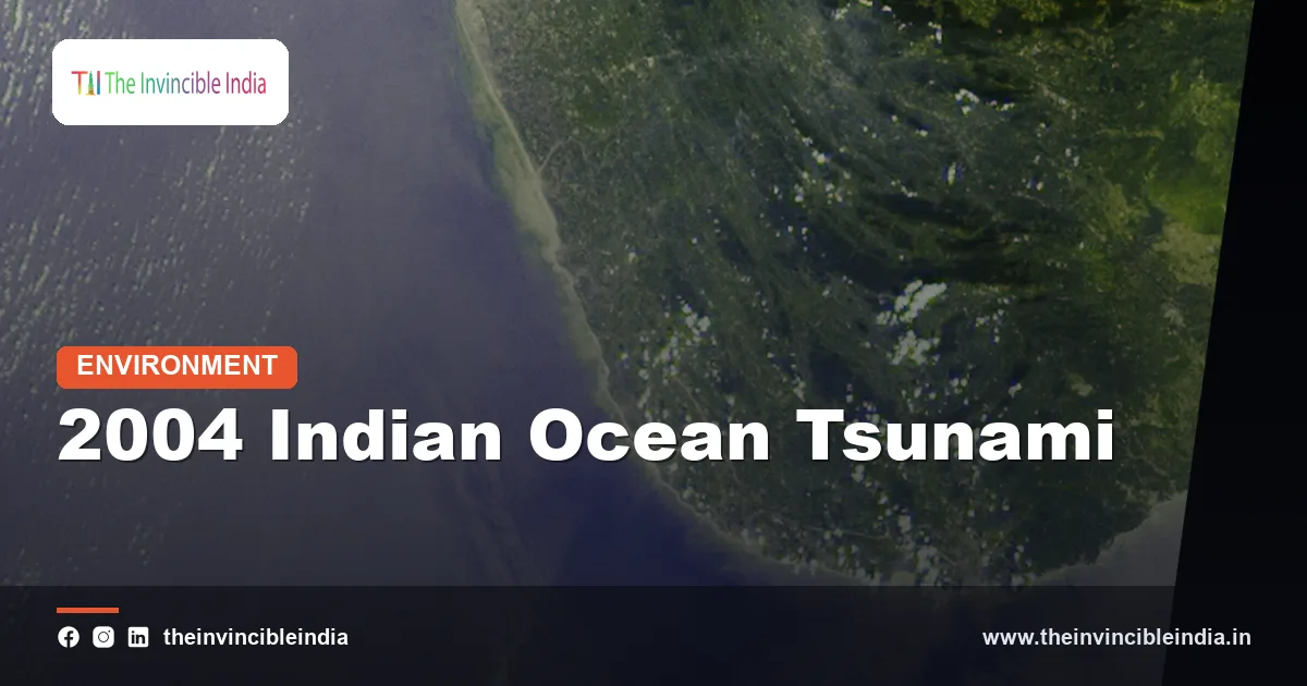
The 2004 Indian Ocean tsunami was a series of giant sea waves triggered by a magnitude 9.1 earthquake off the coast of Sumatra on 26 December 2004, and it struck India’s east coast and the Andaman and Nicobar Islands within hours, killing roughly ten thousand people in India and leaving many more missing or homeless. It remains the deadliest tsunami in recorded history and the event that persuaded India to build its own tsunami warning system.
Last updated: 2 November 2026. This explainer covers what caused the disaster, how the waves reached India, which coasts suffered most, why some places were hit harder than others, how the country responded and what warning systems exist today. It is written with respect for the many families who lost relatives on that Sunday morning.
| Attribute | Detail |
|---|---|
| Date | 26 December 2004, a Sunday, the day after Christmas |
| Cause | Sumatra-Andaman megathrust earthquake of about magnitude 9.1 off northern Sumatra |
| Rupture length | Roughly 1,200 to 1,300 kilometres of the fault, running north towards the Andaman Islands |
| Arrival in mainland India | About two to three hours after the earthquake, on the Tamil Nadu, Puducherry, Andhra Pradesh and Kerala coasts |
| Hardest-hit Indian areas | Nagapattinam and other Tamil Nadu coastal districts, the Nicobar Islands, Kanyakumari and parts of Andhra Pradesh and Kerala |
| Deaths in India | Roughly ten thousand confirmed dead, with thousands more reported missing |
| Deaths across the region | More than two lakh people across about fourteen countries |
| Major outcome | Indian Tsunami Early Warning Centre set up at INCOIS, Hyderabad, operational in 2007 |
Key Takeaways
- The tsunami was triggered by a magnitude 9.1 earthquake on 26 December 2004, one of the largest ever recorded, along the Sumatra-Andaman subduction zone.
- The waves reached the Indian mainland coast roughly two to three hours after the earthquake, which was long enough for a warning to have saved many lives had a system existed.
- Tamil Nadu, particularly Nagapattinam district, and the Andaman and Nicobar Islands suffered the heaviest losses in India, with the Nicobar Islands among the worst affected places on Earth.
- India lost roughly ten thousand lives, and many thousands more were missing, displaced or left without livelihoods, especially fishing families.
- Natural features such as mangroves, dunes and tree belts reduced damage in some places, and some island communities survived by recognising natural warning signs and moving to high ground.
- The disaster led to the Indian Tsunami Early Warning Centre at INCOIS in Hyderabad, which became operational in 2007 and now serves the whole Indian Ocean.
What caused the 2004 Indian Ocean tsunami?
The 2004 Indian Ocean tsunami was caused by a huge undersea earthquake on the Sumatra-Andaman megathrust, where the Indian tectonic plate slides beneath the Burma microplate, part of the Eurasian system. The plates had been locked together for a long time, and when they finally slipped the sea floor lurched upward by several metres along a rupture stretching over a thousand kilometres.
That sudden uplift pushed up the whole column of water above it. The displaced water spread outwards as a train of long waves that travel across deep ocean at the speed of a jet aircraft, often only a few tens of centimetres high in open water. When such waves enter shallow coastal water they slow down, bunch together and grow tall, which is why a tsunami can look like a rapidly rising tide or a towering wall of water at the shore.
The earthquake began off the west coast of northern Sumatra at about 7.58 in the morning local time there. It lasted several minutes, which is unusually long, and it was strong enough to cause measurable changes in the Earth’s rotation and to make the planet ring like a bell. It also shifted the sea floor and lifted or lowered land in the Andaman and Nicobar Islands.
How did the tsunami reach India?
The tsunami reached India as a series of waves that crossed the Bay of Bengal and struck the east coast, with the Andaman and Nicobar Islands hit within minutes to an hour and the mainland roughly two to three hours after the earthquake. Because the Nicobar and Andaman Islands lie close to the rupture, they felt both the strong shaking and the first waves very quickly.
On the mainland, the waves arrived in the morning, around nine o’clock Indian time, when many fishermen were preparing their boats and many families were on beaches or in coastal settlements, and when pilgrims and visitors were at seaside sites. The first sign for many people was a sudden withdrawal of the sea, which drew some onlookers towards the exposed sand rather than away from it. The first wave was followed by larger ones, and the sea surged inland, sweeping away boats, homes, vehicles and people.
Water levels rose several metres in many places, and in some locations the waves penetrated hundreds of metres to a kilometre or more inland, depending on the local slope. Repeated surges continued for hours, which is why people who returned to the shore after the first wave were in danger.
Which parts of India were hit hardest?
Tamil Nadu and the Andaman and Nicobar Islands were hit hardest, followed by Puducherry, Andhra Pradesh and Kerala. Within these areas, fishing villages, coastal towns and low-lying island settlements bore the brunt.
| Region | What happened |
|---|---|
| Tamil Nadu | The worst-hit part of the mainland; Nagapattinam district alone accounted for several thousand deaths, and Cuddalore, Kanyakumari and Chennai’s coast were also hit |
| Andaman and Nicobar Islands | Car Nicobar, Katchal, Nancowry and Great Nicobar suffered heavy loss of life and the near-total destruction of villages; land in the south sank by more than a metre in places |
| Puducherry | Coastal fishing hamlets were badly damaged with significant casualties |
| Andhra Pradesh | Coastal districts such as Prakasam, Nellore and Krishna lost lives and fishing assets |
| Kerala | Coastal Kollam district, especially the Alappad area, suffered deaths and extensive damage |
| West coast beyond Kerala | Waves also affected the Lakshadweep and nearby coast but with far lower impact |
The Nicobar Islands lay close to the quake’s source and lost a large share of their population. Indigenous communities, relief workers, Air Force personnel and families of service members were all among the victims in the islands. Infrastructure such as jetties, airstrips, power and communications were damaged.
How many people died in India?
Roughly ten thousand people died in India in the 2004 Indian Ocean tsunami according to official figures, and several thousand more were reported missing, many of whom were never found. Tamil Nadu accounted for the largest share of the mainland deaths, and a substantial number of deaths occurred in the Andaman and Nicobar Islands, with smaller numbers in Andhra Pradesh, Kerala and Puducherry.
Across the entire Indian Ocean the disaster killed well over two lakh people in about fourteen countries, with Indonesia, Sri Lanka and Thailand suffering enormous losses alongside India. Exact figures differ between sources because of the large numbers of missing, so they are best treated as approximate.
The human toll went beyond deaths. Hundreds of thousands of people in India lost their homes or livelihoods, thousands of children were orphaned or lost a parent, and fishing communities lost boats, nets and engines that took years to replace. Women and children formed a disproportionate share of the victims in some villages, because many men were at sea when the waves struck.
Why were some places hit harder than others?
Some places were hit harder than others because of their distance from the earthquake, the shape of the coast and sea floor, and the presence or absence of natural barriers. Wave height and reach depend on how the tsunami is focused or dispersed by the local shoreline and by the depth of the water offshore.
- Proximity to the source: The Nicobar Islands were closest and felt the force of both shaking and waves almost immediately.
- Coastal slope: Flat, low-lying coasts such as those of Nagapattinam allow water to travel far inland.
- Natural barriers: Mangrove forests, such as the Pichavaram mangroves in Tamil Nadu, and coastal tree belts helped to absorb wave energy and reduced damage in places behind them.
- Settlement pattern: Villages built right on the shore, with homes of light materials, suffered most.
- Time of day and activity: A holiday morning with crowds on beaches and fishing families near the shore increased exposure.
Researchers have also noted that some island communities in the Andamans, including indigenous groups with deep traditional knowledge of the sea, appear to have recognised natural warning signs such as the receding water and moved to higher ground, with comparatively few reported casualties. The accounts underline the value of local knowledge alongside technology.
How did India respond to the disaster?
India responded to the disaster with a large national relief effort led by the Government of India, the Armed Forces and state governments, and it notably chose to manage the immediate response without seeking large-scale foreign assistance while also sending help to neighbours. The Navy, Army and Air Force carried out rescue and relief operations, and sent ships and aircraft to Sri Lanka, the Maldives and other affected countries.
Relief camps, medical teams and temporary shelters were set up along the Tamil Nadu coast and in the islands, and a large number of national and international voluntary organisations worked alongside the government. Authorities faced the formidable tasks of identifying the dead, preventing epidemics and rebuilding thousands of homes, boats and schools.
Reconstruction included permanent housing for displaced families, rebuilding of fishing harbours and livelihoods, and, over the longer term, new coastal regulation and planning. The disaster also helped to drive the creation of the Disaster Management Act of 2005, which established the National Disaster Management Authority and a stronger framework for disaster response across the country.
What is the Indian Tsunami Early Warning Centre?
The Indian Tsunami Early Warning Centre is the national tsunami warning system, hosted at the Indian National Centre for Ocean Information Services (INCOIS) in Hyderabad and operational since October 2007. It was built because in 2004 India had no system to detect a tsunami or to warn coastal residents during the hours before the waves arrived.
The system detects large undersea earthquakes using a network of seismic stations, then checks whether a sea-level disturbance is actually travelling using bottom pressure recorders on the sea floor and tide gauges along the coast. Computer models of tsunami travel are used to predict arrival times and wave heights at different parts of the coast, and bulletins are issued to authorities within minutes of a major earthquake.
- Detection: Seismic stations estimate the location and size of an earthquake within minutes.
- Confirmation: Bottom pressure recorders in the Bay of Bengal and Arabian Sea and coastal tide gauges detect passing waves.
- Modelling: A database of pre-computed scenarios predicts arrival times and inundation for coastal areas.
- Dissemination: Warnings are sent to disaster agencies, ports, the media and coastal officials by phone, text, fax and email.
INCOIS also serves as a regional tsunami service provider for the Indian Ocean, issuing advisories to other countries around the basin, and India takes part in the international system coordinated through UNESCO.
Could the same thing happen again?
A similar tsunami could happen again, because the Indian Ocean has several active subduction zones, but India is far better prepared than in 2004. The Sumatra-Andaman and Makran zones are the main sources of tsunami risk for India. The Makran zone off Pakistan and Iran produced a damaging tsunami in 1945 that affected the west coast, and some scientists consider it a continuing threat to Gujarat and Maharashtra.
Because Sumatra lies so close to the Andaman and Nicobar Islands, warning times for the islands can be as short as a few minutes, which makes natural warning signs and drills particularly important there. For the mainland east coast, the travel time of a few hours leaves enough time for evacuation if warnings are received and acted upon.
India has since carried out community preparedness programmes and tsunami drills, installed sirens and signage in coastal villages and recognised some communities under international preparedness programmes. The remaining challenge is last-mile communication and keeping drills alive years after the memory of the disaster fades.
What lessons did the tsunami teach India?
The tsunami taught India that coastal risk had been underestimated, that early warning and community preparedness save lives and that natural barriers deserve protection. It showed the cost of having no warning system, and it ended the belief that tsunamis were a Pacific problem rather than an Indian Ocean one.
- Detection and warning need to be fast, automated and linked to local action.
- Mangroves, dunes and shelter belts are valuable defences and should be protected and restored.
- Buildings and settlements should respect coastal setbacks and be placed on higher ground where possible.
- Fishing communities need reliable communication and livelihood support after disasters.
- Public education should include the simple rule: if the sea suddenly withdraws, or the ground shakes strongly near the coast, move quickly to high ground.
Bottom Line
The 2004 Indian Ocean tsunami took roughly ten thousand lives in India and changed the country’s approach to ocean hazards. The warning system now run from Hyderabad, the stronger disaster management law and better coastal planning are part of its legacy, and keeping those defences and the memory of that day alive is the best way to honour those who were lost.
Frequently Asked Questions
What caused the 2004 Indian Ocean tsunami?
The 2004 Indian Ocean tsunami was caused by a magnitude 9.1 earthquake on 26 December 2004 on the Sumatra-Andaman subduction zone off northern Sumatra. The sea floor lifted suddenly along a rupture over a thousand kilometres long, displacing a huge volume of water that spread outwards as waves across the ocean.
How many people died in India in the 2004 tsunami?
Roughly ten thousand people died in India in the 2004 tsunami, according to official estimates, and several thousand more were reported missing. Tamil Nadu and the Andaman and Nicobar Islands suffered the most. Across the whole Indian Ocean, the death toll exceeded two lakh people.
Which Indian states were affected by the 2004 tsunami?
The 2004 tsunami affected Tamil Nadu, Puducherry, Andhra Pradesh, Kerala and the Andaman and Nicobar Islands. Tamil Nadu, especially Nagapattinam district, and the Nicobar Islands were the worst hit. The impact on other regions was smaller but still significant for coastal fishing communities.
How long did the tsunami take to reach India?
The tsunami took roughly two to three hours to reach the Indian mainland coast after the earthquake, while the Andaman and Nicobar Islands were struck within minutes to an hour. The gap on the mainland was long enough for a warning to have saved many lives if a system had been in place.
Does India have a tsunami warning system?
Yes, India has had a tsunami warning system since 2007, run by the Indian Tsunami Early Warning Centre at INCOIS in Hyderabad. It uses seismic stations, deep-sea bottom pressure recorders and tide gauges to detect tsunamis and issues warnings within minutes. INCOIS also provides advisories to other Indian Ocean countries.
What should you do if a tsunami warning is issued?
If a tsunami warning is issued, move immediately to high ground or inland, away from the coast, and follow instructions from local authorities. If you feel strong shaking near the coast or see the sea suddenly withdraw, do not wait for an official alert. Stay away from the shore until officials declare it safe, since later waves can be larger.
{“@context”:”https://schema.org”,”@graph”:[{“@type”:”FAQPage”,”mainEntity”:[{“@type”:”Question”,”name”:”What caused the 2004 Indian Ocean tsunami?”,”acceptedAnswer”:{“@type”:”Answer”,”text”:”The 2004 Indian Ocean tsunami was caused by a magnitude 9.1 earthquake on 26 December 2004 on the Sumatra-Andaman subduction zone off northern Sumatra. The sea floor lifted suddenly along a rupture over a thousand kilometres long, displacing a huge volume of water that spread outwards as waves across the ocean.”}},{“@type”:”Question”,”name”:”How many people died in India in the 2004 tsunami?”,”acceptedAnswer”:{“@type”:”Answer”,”text”:”Roughly ten thousand people died in India in the 2004 tsunami, according to official estimates, and several thousand more were reported missing. Tamil Nadu and the Andaman and Nicobar Islands suffered the most. Across the whole Indian Ocean, the death toll exceeded two lakh people.”}},{“@type”:”Question”,”name”:”Which Indian states were affected by the 2004 tsunami?”,”acceptedAnswer”:{“@type”:”Answer”,”text”:”The 2004 tsunami affected Tamil Nadu, Puducherry, Andhra Pradesh, Kerala and the Andaman and Nicobar Islands. Tamil Nadu, especially Nagapattinam district, and the Nicobar Islands were the worst hit. The impact on other regions was smaller but still significant for coastal fishing communities.”}},{“@type”:”Question”,”name”:”How long did the tsunami take to reach India?”,”acceptedAnswer”:{“@type”:”Answer”,”text”:”The tsunami took roughly two to three hours to reach the Indian mainland coast after the earthquake, while the Andaman and Nicobar Islands were struck within minutes to an hour. The gap on the mainland was long enough for a warning to have saved many lives if a system had been in place.”}},{“@type”:”Question”,”name”:”Does India have a tsunami warning system?”,”acceptedAnswer”:{“@type”:”Answer”,”text”:”Yes, India has had a tsunami warning system since 2007, run by the Indian Tsunami Early Warning Centre at INCOIS in Hyderabad. It uses seismic stations, deep-sea bottom pressure recorders and tide gauges to detect tsunamis and issues warnings within minutes. INCOIS also provides advisories to other Indian Ocean countries.”}},{“@type”:”Question”,”name”:”What should you do if a tsunami warning is issued?”,”acceptedAnswer”:{“@type”:”Answer”,”text”:”If a tsunami warning is issued, move immediately to high ground or inland, away from the coast, and follow instructions from local authorities. If you feel strong shaking near the coast or see the sea suddenly withdraw, do not wait for an official alert. Stay away from the shore until officials declare it safe, since later waves can be larger.”}}]}]}


