

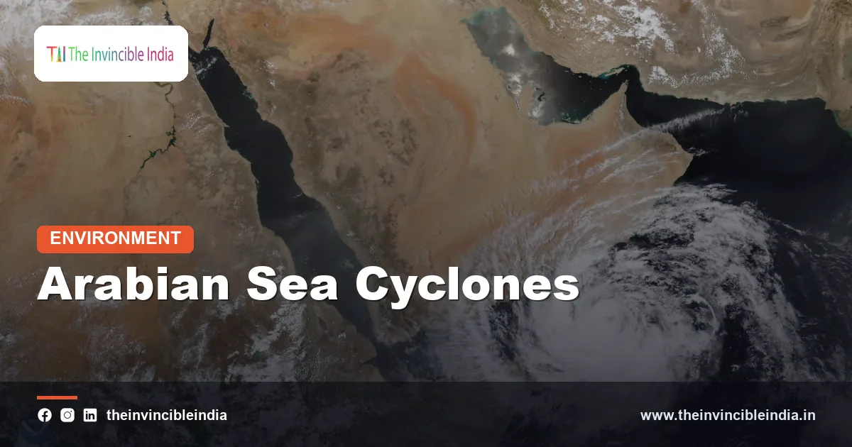
Arabian Sea cyclones are tropical storms that form over the sea off India’s west coast and track towards Gujarat, Maharashtra, Pakistan, Oman or Yemen, and although they were historically fewer and weaker than storms of the Bay of Bengal, they have become stronger and more threatening as the Arabian Sea warms. Storms such as Tauktae in 2021 and Biparjoy in 2023 showed that the west coast, once considered relatively safe from major cyclones, now faces a growing risk of severe landfalls.
The shift matters because India’s west coast holds some of the country’s biggest ports, refineries, industrial hubs and metropolitan areas. Last updated: 30 October 2026. This explainer covers why the Arabian Sea has traditionally produced fewer cyclones, what is changing, which storms illustrate the trend, and how coastal states are responding.
| Attribute | Detail |
|---|---|
| Type of storm | Tropical cyclone forming over the Arabian Sea, part of the North Indian Ocean basin |
| Share of North Indian Ocean storms | Historically about one in five; the rest form over the Bay of Bengal |
| Peak seasons | Pre-monsoon (May to early June) and post-monsoon (October to November) |
| Typical targets | Gujarat, Maharashtra, Goa, Karnataka, Kerala, Lakshadweep, Pakistan, Oman and Yemen |
| Key warming link | Rising sea-surface temperatures and a deeper warm upper layer, supporting stronger storms |
| Official monitoring agency | India Meteorological Department (IMD), New Delhi |
| Recent severe examples | Nisarga (2020), Tauktae (2021), Biparjoy (2023) |
| Most exposed Indian state | Gujarat, which has the longest coastline of any Indian state |
Key Takeaways
- Arabian Sea cyclones make up roughly one in five of all tropical cyclones in the North Indian Ocean, with the Bay of Bengal producing the rest.
- The Arabian Sea has two cyclone seasons, the pre-monsoon months of May and early June and the post-monsoon months of October and November.
- The Arabian Sea has been warming, and studies indicate that the intensity of its cyclones, and especially the number of very severe ones, has been increasing.
- Cyclone Tauktae in May 2021 and Cyclone Biparjoy in June 2023 both threatened Gujarat as very severe cyclonic storms, and Biparjoy was among the longest-lasting Arabian Sea storms on record.
- Gujarat has the longest coastline of any Indian state, and its ports, salt pans and fishing communities are highly exposed to Arabian Sea cyclones.
- Improved forecasting, evacuations and shelters have greatly reduced deaths from recent Arabian Sea storms despite their strength.
What are Arabian Sea cyclones?
Arabian Sea cyclones are tropical cyclones, meaning rotating storm systems powered by warm ocean water, that develop over the Arabian Sea between India’s west coast and the Arabian Peninsula. They are the western arm of the North Indian Ocean cyclone basin and are monitored by the India Meteorological Department (IMD), which acts as the World Meteorological Organization’s Regional Specialised Meteorological Centre for the region.
Like Bay of Bengal storms, they are classified by wind speed, from depression and cyclonic storm up to very severe, extremely severe and super cyclonic storm categories. Storms are named once they reach cyclonic storm strength, using a list contributed by countries around the basin, which explains why the names such as Tauktae (from Myanmar) and Biparjoy (from Bangladesh) can sound unfamiliar to Indian ears.
Many Arabian Sea storms never reach India. A large share curve north or west and hit Oman, Yemen, Somalia or Pakistan. Others weaken at sea, turning into rain-bearing systems. The risk for India comes from those that track north or north-east towards Gujarat and Maharashtra.
Why has the Arabian Sea historically had fewer cyclones than the Bay of Bengal?
The Arabian Sea has historically had fewer cyclones than the Bay of Bengal because its surface waters were cooler on average, its air was drier and its winds were less favourable for storms to organise. The sea receives far less freshwater from rivers than the bay, so it lacks the warm, layered surface that sustains storms there.
Dry continental air from the deserts of Arabia and the Thar region often blows into the Arabian Sea, especially in the pre- and post-monsoon periods, and this dry air can choke a developing storm. The northern Arabian Sea is also subject to strong upper-level winds at times, adding wind shear that tears vortices apart. Added to this, the sea is bounded by land to the north, which limits the space for storms to grow.
The table below contrasts the two basins at a glance.
| Feature | Bay of Bengal | Arabian Sea |
|---|---|---|
| Share of North Indian Ocean storms | Roughly four in five | Roughly one in five |
| Freshwater from rivers | Very large, creating a warm, layered surface | Much smaller |
| Coastal funnel shape | Narrowing northern bay amplifies storm surge | Open coast, though Gujarat’s gulfs also concentrate surges |
| Typical landfall regions | Odisha, Andhra Pradesh, Tamil Nadu, West Bengal, Bangladesh, Myanmar | Gujarat, Maharashtra, Oman, Yemen, Pakistan |
| Historical storm strength | Frequent intense storms | Fewer and generally weaker, but changing |
Are Arabian Sea cyclones becoming more frequent and intense?
Arabian Sea cyclones are becoming more intense, and several studies indicate that very severe cyclones in the basin have become more frequent in recent decades, especially in the post-monsoon season. Research suggests that the sea-surface temperature of the Arabian Sea has risen markedly, and that its upper ocean now holds more heat for longer.
The 2019 season illustrated the change, with an unusually busy run of storms in the Arabian Sea, including the super cyclonic storm Kyarr and the very severe cyclonic storm Maha, along with Vayu in June. Cyclones that do form can also intensify faster than before, because warm water extends deeper and the atmosphere carries more moisture. Scientists caution that records for the Arabian Sea are short and variable from year to year, so the trend is still being refined.
What can be said with reasonable confidence is that the old assumption of a quiet and weak Arabian Sea no longer holds. Planners on the west coast now treat severe cyclones as a realistic hazard.
How does ocean warming strengthen Arabian Sea cyclones?
Ocean warming strengthens Arabian Sea cyclones by supplying more heat and water vapour, the fuel that drives a storm, and by reducing the cooling that normally weakens a cyclone as it moves. A warmer sea surface lets a storm intensify quickly, and a deeper warm layer means the storm does not stir up cold water that would starve it.
- More heat: Higher sea-surface temperatures raise the energy available for convection.
- More moisture: A warmer atmosphere holds more water vapour, increasing the rainfall from each storm.
- Rapid intensification: Storms can jump several categories within about a day under favourable conditions.
- Longer life: Warm water can allow storms to persist for many days over the sea, as Biparjoy did.
- Higher seas: Rising sea level raises the base for storm surge along the coast.
Natural variability still plays a large part. Climate patterns such as El Nino, the Indian Ocean Dipole and the Madden-Julian Oscillation influence which years are busy, so warming adds to these cycles rather than replacing them.
Which recent Arabian Sea cyclones show the trend?
Several recent Arabian Sea cyclones show the trend, either because they were unusually strong, long-lived or close to India’s densely populated west coast. They are best treated as illustrations rather than proof, since a handful of storms cannot establish a trend on their own.
| Cyclone | Year | Area affected | Notable feature |
|---|---|---|---|
| Gujarat cyclone | 1998 | Porbandar and Kandla region, Gujarat | A historic storm that killed more than a thousand people and remains a benchmark for the state |
| Gonu | 2007 | Oman | One of the strongest Arabian Sea storms recorded, which weakened before reaching Oman |
| Ockhi | 2017 | Kerala, Tamil Nadu and Lakshadweep | Caught many fishermen at sea and exposed gaps in warnings for fishing communities |
| Kyarr | 2019 | Arabian Sea, towards Oman | A rare super cyclonic storm during a very active season |
| Nisarga | 2020 | Maharashtra, near Alibag | Rare cyclone landfall near the Mumbai region, which is not usually hit directly |
| Tauktae | 2021 | Kerala to Gujarat | A powerful storm that tracked along the entire west coast and made landfall in Gujarat |
| Biparjoy | 2023 | Gujarat (Kutch) and Pakistan | Lasted for about two weeks, among the longest-lived Arabian Sea cyclones |
What happened during Cyclone Tauktae and Cyclone Biparjoy?
Cyclone Tauktae and Cyclone Biparjoy were two powerful storms that tested Gujarat and Maharashtra’s preparedness, and both saw large pre-landfall evacuations that kept loss of life along the coast lower than their strength might suggest. They are the clearest recent illustrations of the Arabian Sea’s growing threat.
Cyclone Tauktae (May 2021)
Tauktae formed in the Arabian Sea in mid-May 2021, intensified into an extremely severe cyclonic storm and moved up the west coast, bringing heavy rain and gales to Kerala, Karnataka, Goa and Maharashtra before crossing the Gujarat coast near Una and Diu. Offshore, vessels and oil platforms off Mumbai were struck, and the sinking of a barge with many crew members aboard became one of the storm’s most tragic episodes. The storm also caused widespread power outages and damage to crops, especially mango orchards and coastal plantations.
Cyclone Biparjoy (June 2023)
Biparjoy formed in early June 2023 and became one of the longest-lasting cyclones in the Arabian Sea, wandering over the sea for around two weeks before crossing the coast near Jakhau in Kutch, Gujarat, in mid-June. Authorities moved a very large number of people away from the coast beforehand, and the storm caused extensive damage to power lines, trees and homes but relatively few deaths. Its slow path and long life underlined how warm seas can sustain a storm for an unusually long time.
Which parts of India are most at risk from Arabian Sea cyclones?
Gujarat is the Indian state most at risk from Arabian Sea cyclones, followed by Maharashtra, Goa, Karnataka, Kerala and the Lakshadweep islands. Gujarat has the longest coastline of any state and includes the Kutch and Saurashtra regions, the Gulf of Khambhat and the Gulf of Kutch, where shallow water and funnel-like coastlines can magnify surges.
- Ports and industry: Major ports such as Kandla (Deendayal Port) and Mundra, plus refineries and chemical plants on the Gujarat coast, can suffer disruption and damage.
- Salt pans and fisheries: Salt production and fishing, which employ many coastal families, are highly exposed to cyclones and surges.
- Mumbai and the Konkan coast: The country’s financial capital has seldom been hit directly, but a storm such as Nisarga showed the potential for harm.
- Kerala and Lakshadweep: Storms that form near the southern tip of India can affect fishing communities and island populations.
- Agriculture: Orchards, coconut groves, groundnut and cotton fields are vulnerable to wind and salt-laden surges.
How is India preparing for stronger Arabian Sea cyclones?
India is preparing for stronger Arabian Sea cyclones by upgrading forecasting, expanding early warning and evacuation systems and building shelters and coastal protection along the west coast. These steps follow the model developed on the east coast, where Odisha showed that organised preparedness can sharply cut deaths.
The India Meteorological Department tracks storms using satellites, radar and ocean buoys and issues bulletins that specify expected landfall, wind speed and surge. The National Disaster Management Authority (NDMA), the National Disaster Response Force (NDRF) and the Gujarat State Disaster Management Authority coordinate evacuations, rescue and relief. Fishing communities are told to stay ashore, and ports shut operations when a storm approaches.
Longer-term measures include strengthening embankments, restoring mangroves and other natural barriers, improving building standards, and including cyclone risk in coastal planning and industrial siting. Experts stress that the west coast needs the same depth of preparation that east coast states have developed over decades.
Bottom Line
Arabian Sea cyclones used to be a lesser concern, but a warming sea has made them a serious and growing threat to India’s west coast. With strong storms now plausible every few years, Gujarat and Maharashtra are investing in the kind of early warning and evacuation that has proved effective elsewhere in the country.
Frequently Asked Questions
Why are Arabian Sea cyclones increasing in intensity?
Arabian Sea cyclones are increasing in intensity mainly because the sea is warming, giving storms more heat and moisture to draw on. A deeper warm layer also stops storms from cooling themselves by churning up cold water. Natural climate cycles still affect which years are busiest.
Which Arabian Sea cyclones have hit Gujarat recently?
Cyclone Tauktae in May 2021 and Cyclone Biparjoy in June 2023 are the two best-known recent Arabian Sea storms to hit Gujarat. Tauktae crossed the coast near Una and Diu, while Biparjoy made landfall near Jakhau in Kutch. Both caused major damage but relatively few deaths because of early evacuations.
When is the Arabian Sea cyclone season?
The Arabian Sea cyclone season has two peaks: May to early June before the monsoon and October to November after it. Storms are rare during the monsoon months because strong winds aloft prevent them from organising. The pre-monsoon months are the main threat to Gujarat and Maharashtra.
Do Arabian Sea cyclones hit Mumbai?
Arabian Sea cyclones rarely hit Mumbai directly, but they can come close and cause heavy rain and strong winds. Cyclone Nisarga in June 2020 made landfall near Alibag in Maharashtra, relatively close to the city. Other storms, such as Tauktae in 2021, passed offshore and still affected the region.
How many cyclones form in the Arabian Sea compared to the Bay of Bengal?
The Arabian Sea produces far fewer cyclones than the Bay of Bengal, roughly one in five of all North Indian Ocean storms. The bay is warmer, more humid and fed by large rivers, which favours storms. Recent years have seen the Arabian Sea share and intensity rise.
How does the IMD warn people about Arabian Sea cyclones?
The India Meteorological Department warns people about Arabian Sea cyclones through regular bulletins, colour-coded alerts and forecasts of the storm’s track, wind speed and landfall. State disaster authorities then pass these warnings to coastal districts, fishing communities and ports. Alerts are issued days in advance so that evacuations can take place before landfall.
{“@context”:”https://schema.org”,”@graph”:[{“@type”:”FAQPage”,”mainEntity”:[{“@type”:”Question”,”name”:”Why are Arabian Sea cyclones increasing in intensity?”,”acceptedAnswer”:{“@type”:”Answer”,”text”:”Arabian Sea cyclones are increasing in intensity mainly because the sea is warming, giving storms more heat and moisture to draw on. A deeper warm layer also stops storms from cooling themselves by churning up cold water. Natural climate cycles still affect which years are busiest.”}},{“@type”:”Question”,”name”:”Which Arabian Sea cyclones have hit Gujarat recently?”,”acceptedAnswer”:{“@type”:”Answer”,”text”:”Cyclone Tauktae in May 2021 and Cyclone Biparjoy in June 2023 are the two best-known recent Arabian Sea storms to hit Gujarat. Tauktae crossed the coast near Una and Diu, while Biparjoy made landfall near Jakhau in Kutch. Both caused major damage but relatively few deaths because of early evacuations.”}},{“@type”:”Question”,”name”:”When is the Arabian Sea cyclone season?”,”acceptedAnswer”:{“@type”:”Answer”,”text”:”The Arabian Sea cyclone season has two peaks: May to early June before the monsoon and October to November after it. Storms are rare during the monsoon months because strong winds aloft prevent them from organising. The pre-monsoon months are the main threat to Gujarat and Maharashtra.”}},{“@type”:”Question”,”name”:”Do Arabian Sea cyclones hit Mumbai?”,”acceptedAnswer”:{“@type”:”Answer”,”text”:”Arabian Sea cyclones rarely hit Mumbai directly, but they can come close and cause heavy rain and strong winds. Cyclone Nisarga in June 2020 made landfall near Alibag in Maharashtra, relatively close to the city. Other storms, such as Tauktae in 2021, passed offshore and still affected the region.”}},{“@type”:”Question”,”name”:”How many cyclones form in the Arabian Sea compared to the Bay of Bengal?”,”acceptedAnswer”:{“@type”:”Answer”,”text”:”The Arabian Sea produces far fewer cyclones than the Bay of Bengal, roughly one in five of all North Indian Ocean storms. The bay is warmer, more humid and fed by large rivers, which favours storms. Recent years have seen the Arabian Sea share and intensity rise.”}},{“@type”:”Question”,”name”:”How does the IMD warn people about Arabian Sea cyclones?”,”acceptedAnswer”:{“@type”:”Answer”,”text”:”The India Meteorological Department warns people about Arabian Sea cyclones through regular bulletins, colour-coded alerts and forecasts of the storm’s track, wind speed and landfall. State disaster authorities then pass these warnings to coastal districts, fishing communities and ports. Alerts are issued days in advance so that evacuations can take place before landfall.”}}]}]}


